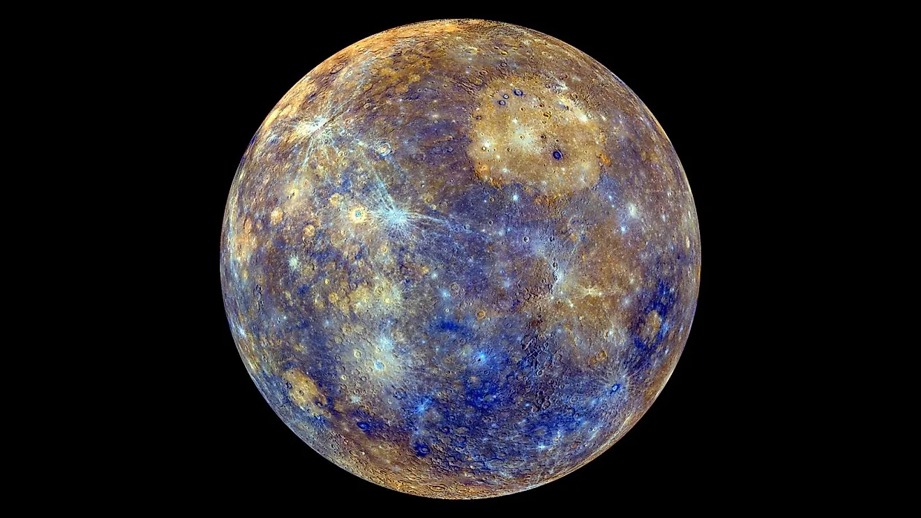
What Is A Lahar?
A lahar is a natural phenomenon that demands the attention of scientists, policy makers, and the public due to their potentially devastating effects on the environment and human settlements. Derived from the Indonesian term for "lava stream," a lahar is a rapidly flowing mixture of rock debris, ash, and water that comes racing down the sides of volcanoes. Proper self-education requires understanding the details of lahars, such as their formation, types, and impacts. Through a public effort to promote education about lahars, it is possible to mitigate some of the dangers related to extreme volcanic events; because at the end of the day, when it comes to natural disasters, saving lives is all that matters.
Definition And Description Of Lahars

A lahar is a complex natural event characterized by a viscous, fast-moving flow of materials, predominantly originating from a volcanic source. They can be classified into two main categories: debris lahars and mudflow lahars. Debris lahars consist of a higher percentage of solid materials, such as volcanic rock fragments, ash, and pyroclastic debris, suspended in a matrix of water. Mudflow lahars, on the other hand, have a higher proportion of water and fine-grained sediment, resulting in a slurry-like consistency.
Lahars can form through various mechanisms, including the rapid melting of snow and ice during a volcanic eruption, intense rainfall on loose volcanic deposits, or the failure of a volcanic edifice. In some cases, the sudden release of water from a crater lake can also trigger a lahar. Lahar generation is highly dependent on the specific characteristics of the volcano, such as its size, composition, and the nature of the eruption. Moreover, the presence of water, either from precipitation or glacial melt, plays a crucial role in the formation of lahars, as it enables the mobilization of loose volcanic materials down the slopes.
As lahars travel down the volcanic slopes and river valleys, they can attain speeds of up to 120 miles per hour and carry vast quantities of debris, posing a significant threat to life, property, and infrastructure. Their capacity to travel great distances from their source and their highly destructive nature mean that preparation and prevention crucial issues for human settlements.
Historical Context
The term "lahar" can be traced back to its origin in the Indonesian language, reflecting the country's long-standing experience with these hazardous volcanic phenomena. The study of lahars has been shaped by numerous significant events throughout history, which have demonstrated their destructive power and far-reaching impacts.

One of the most notable lahar events occurred in 1985, when the eruption of the Nevado del Ruiz volcano in Colombia produced a series of catastrophic lahars. The lahars, generated by the rapid melting of the volcano's ice cap, traveled approximately 62 miles from the summit, devastating the town of Armero and causing the death of more than 20,000 people. This tragic event highlighted the importance of monitoring and understanding lahars to prevent similar disasters in the future.
Another significant lahar event took place in 1991, following the eruption of Mount Pinatubo in the Philippines. The eruption itself caused widespread destruction, but the subsequent lahars, triggered by heavy monsoon rains, exacerbated the damage. Over the course of several years, these lahars buried entire towns, destroyed infrastructure, and displaced hundreds of thousands of people. The Pinatubo lahars demonstrated the long-lasting and far-reaching consequences of these events, necessitating comprehensive hazard assessment and management strategies.
Lahars and Volcanology

The study of lahars is closely intertwined with volcanology, as the two phenomena are inherently connected. Lahars are typically generated during or after volcanic eruptions, when the mobilization of volcanic material is facilitated by various factors.
One of the primary ways volcanoes contribute to lahar formation is through the production of loose volcanic materials, such as ash and pyroclastic debris. These materials can become unstable during an eruption or fall under the influence of external factors, such as heavy rainfall or the release of water from a crater lake. The resulting lahars can be both hot and cold, depending on the temperature of the materials involved and the source of the water.
Another crucial factor in lahar generation is the presence of snow and ice on a volcano's slopes. During an eruption, the rapid melting of snow and ice by the heat of the volcanic materials can produce large volumes of water, which can then mix with the loose debris to create lahars. This process was exemplified by the Nevado del Ruiz eruption (where the sudden release of meltwater generated lahars).
Lahars can also form independently of volcanic eruptions, as long as the necessary conditions are met. For instance, heavy rainfall can saturate loose volcanic deposits, causing them to become unstable and generate lahars in the absence of eruptive activity.
Impact of Lahars

The impacts of lahars are multifaceted, affecting both the physical environment and human communities. At the physical level, lahars can dramatically alter landscapes, eroding soil, destroying vegetation, and depositing large amounts of sediment downstream. This can disrupt river systems, create new lakes, and cause widespread flooding. Infrastructure, such as buildings, bridges, and roads, is also highly susceptible to lahar damage due to the force and speed of these flows.
At the socio-economic level, lahars can have severe impacts on communities and regions. The destruction of homes, agricultural lands, and critical infrastructure can lead to significant financial loss and displacement of populations. For instance, the lahars following the Mount Pinatubo eruption displaced hundreds of thousands of people and caused economic damage estimated at several billion dollars.
In terms of health, lahars can pose immediate and long-term hazards. The fast-moving flows can trap and bury individuals, while the deposition of sediment can contaminate water supplies, leading to potential health issues, such as gastrointestinal illnesses. Additionally, the airborne dust from dry lahar deposits can contribute to respiratory problems.
Lahar Risk Management and Mitigation Strategies
Monitoring and predicting lahars typically involves a range of technologies, including seismographs to detect ground vibrations indicative of lahar movement, acoustic flow monitors to identify the noise of lahars, and radar systems to measure the flow velocity and depth. These tools can provide valuable data to inform early warning systems, which can alert communities of imminent lahar threats.
Physical mitigation measures include the construction of lahar diversion structures, such as dikes and channels, to redirect lahars away from vulnerable areas. However, these structures must be designed to withstand the force and sediment load of lahars, and their effectiveness can vary depending on the size and velocity of the lahar.
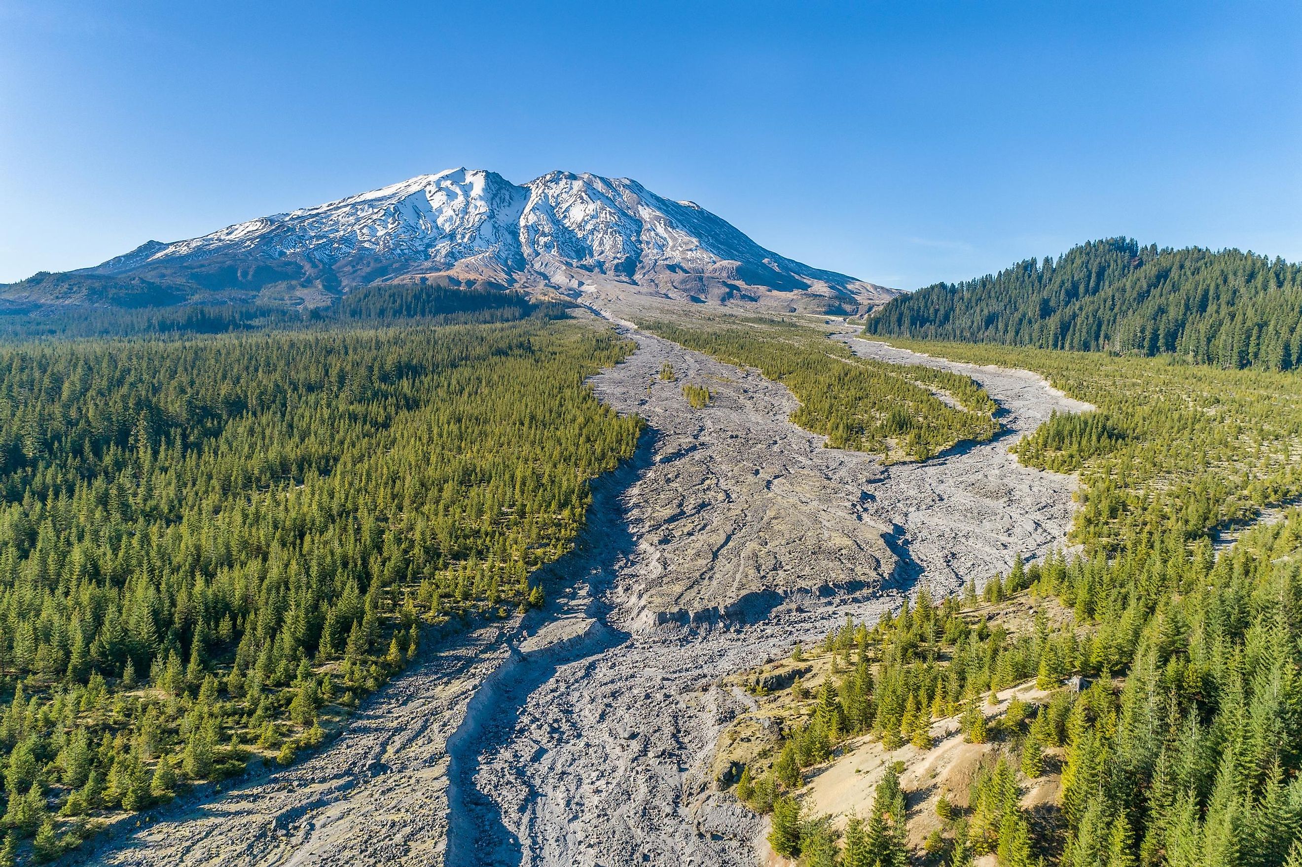
A notable case study of successful lahar mitigation is the town of Orting in Washington State, USA. Located in the lahar-prone Puyallup River valley, downstream from Mount Rainier, Orting has implemented an extensive lahar preparedness program. The program includes regular drills, public education campaigns, and the installation of a lahar warning system. Despite the constant lahar threat, these measures have significantly reduced the risk to the community.
Future Research and Perspectives

Despite considerable advancements in our understanding of lahars, several gaps remain that necessitate further research. Our ability to predict lahars, for instance, is still limited by uncertainties surrounding their initiation processes and the complex interactions between volcanic materials and water. There is also a need for more accurate models to simulate lahar flows and their potential impacts.
Emerging technologies, such as advanced remote sensing and machine learning, offer promising avenues for future research. These technologies could enhance lahar monitoring and prediction capabilities, providing more timely and accurate warnings. Furthermore, interdisciplinary research that integrates geological sciences with social and health sciences could yield valuable insights into the broader impacts of lahars and how best to mitigate them.
Lahars, with their inherent destructive potential, represent a significant natural hazard, particularly for communities situated near volcanoes. The historical context of lahars, such as the events at Nevado del Ruiz and Mount Pinatubo, underscores the deathly consequences of these phenomena. However, through advancements in volcanology and hazard management, communities like Orting have demonstrated that it is possible to live in lahar-prone areas while substantially reducing the risk. Thankfully, future research holds promise for enhancing our understanding of lahars and improving our ability to predict and manage these events.