8 Off-The-Grid Utah Towns To Visit In 2026
The quietest corners of Utah are worth building a whole road trip around. In Hanksville, a gas station sits carved into solid rock at the edge of empty desert. Helper's old coal-mining Main Street is now a strip of art studios and antique shops. Torrey outfitters run horseback and llama treks into the red rock below Capitol Reef. All eight towns sit far enough out for empty trails and skies full of stars.
Helper

Helper grew up as a coal and railroad town on the Price River in Carbon County. Its name comes from the extra locomotives, called helpers, that pushed trains up the steep grade out of town. The Main Street Historic District has since filled with art studios, murals, and antique shops. Listed on the National Register of Historic Places in 1979, the district includes about 110 buildings, 98 of them contributing structures. Most are early-20th-century red brick, built in the company-town style during Helper's mining years. The Western Mining and Railroad Museum sits along the same street. Its exhibits trace the men who worked the underground mines between 1880 and 1950, with model trains, artifact-filled rooms, and views of the working rail line outside.
A paved path, the Price River Parkway, follows the water through the middle of town. Walkers use it for birding, fishing, and access to a riverside fitness area. Above town, a sandstone formation called Balanced Rock caps a short, steep climb. At sunset the rock glows red-orange, a fitting close to a day in Helper.
Hanksville

In 1984, a former uranium miner set off more than 100 cases of dynamite to hollow out a gas station inside a desert hill. That store, Hollow Mountain, still sells fuel, snacks, and souvenirs from rooms carved into solid rock at the edge of Hanksville. The town works as a launch point for some of Utah's most remote desert. Moonscape Overlook, atop Skyline Rim at the edge of Factory Bench, looks out over the gray, cratered ground of the Lower Blue Hills. Photographers make the rough drive for that view.
Factory Butte rises alone from the desert floor, a freestanding wall of gray shale badlands. OHV riders, motorcyclists, and touring cars use the open flats around it. South of town, thousands of mushroom-shaped sandstone hoodoos fill the basin of Goblin Valley State Park, which is why people keep comparing it to Mars. The park allows hiking, camping, mountain biking, and disc golf. Stargazers arrive after dark, since Goblin Valley holds an International Dark Sky Park certification.
Torrey

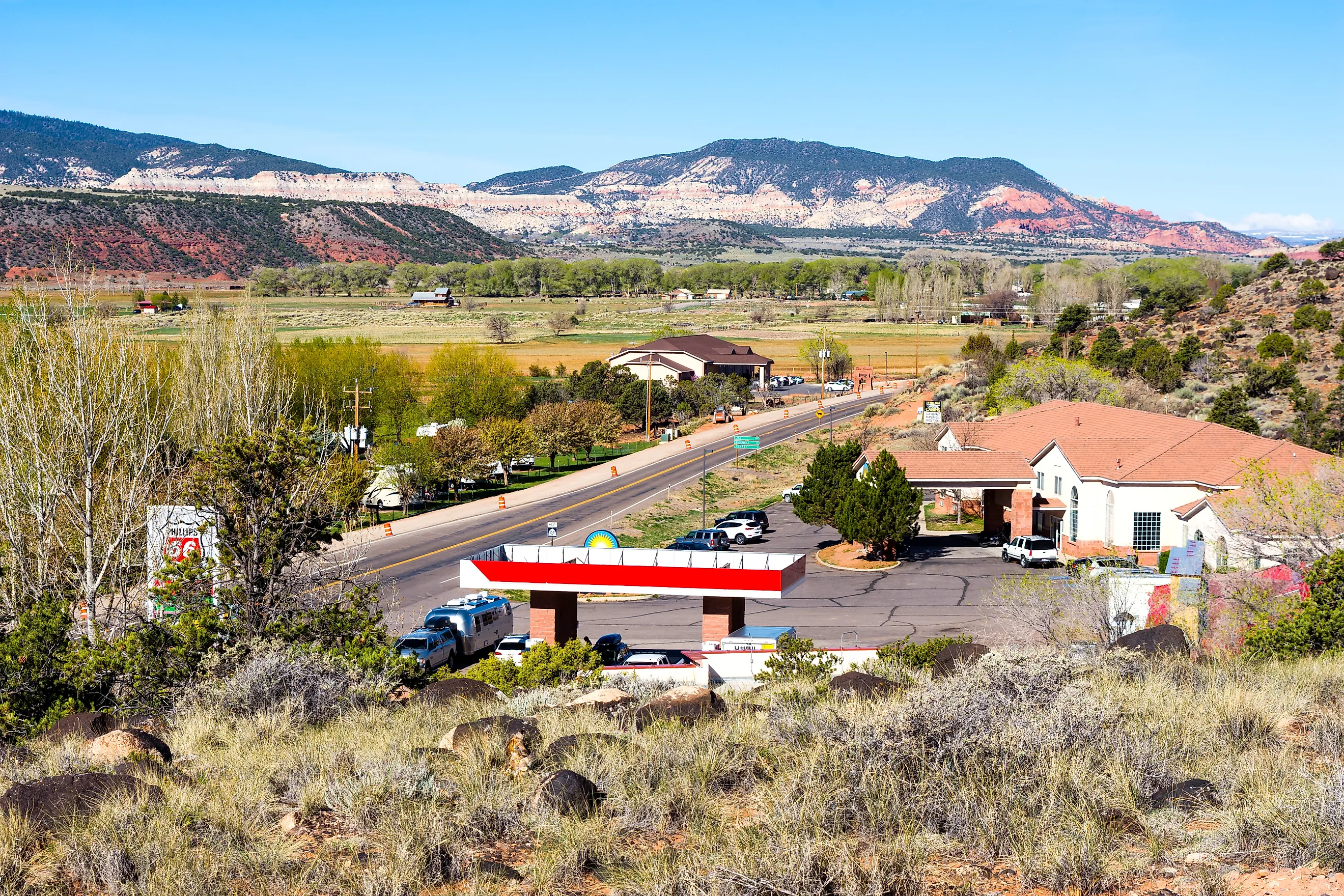
Torrey sits just west of Capitol Reef National Park, at about 6,800 feet, where the nights turn cold and the skies go dark. The park protects the Waterpocket Fold, a 100-mile buckle in the earth's crust lined with cliffs, domes, canyons, and natural bridges. Its scenic drive reaches the Hickman Bridge trailhead and the short walk out to that sandstone arch. The Fruita Historic District, an old Mormon orchard settlement, sits at the green heart of the park.
Local outfitters run guided horseback and llama treks into the red-rock backcountry, some climbing to overlooks above the Waterpocket Fold. Hikers reach similar views on the park's Rim Overlook and Chimney Rock trails. For dinner, the Rim Rock Restaurant serves regional trout and game behind floor-to-ceiling windows that face the reef.
Green River

The town takes its name from the Green River, which splits it in two. The John Wesley Powell River History Museum traces Powell's expeditions down the Green and the Colorado, with displays on local paleontology, historic river craft, and a River Runners Hall of Fame. Each September, growers celebrate the town's watermelons at Melon Days, a weekend of a 5K, a softball tournament, a concert, and a melon-carving contest.
West of town, Crystal Geyser, also called the soda-pop geyser, erupts on no fixed schedule. It is one of the world's few cold-water geysers, driven by carbon dioxide rather than heat, so patient visitors sometimes camp nearby to catch an eruption. Green River State Park runs along the water under old cottonwoods, with a campground, a boat ramp for the Labyrinth and Stillwater canyons, and a nine-hole golf course on the bank.
Boulder

The Anasazi State Park Museum in Boulder preserves the Coombs Village site, a sizable Ancestral Puebloan settlement excavated in the late 1950s. Visitors walk past unearthed pottery and stone tools and tour a life-size replica of a masonry dwelling built on the grounds. Scenic Byway 12 links the town to the rest of the region, running between red cliffs and the forested slopes of Boulder Mountain.
The Burr Trail Scenic Backway heads east out of Boulder, paved for about 30 miles through slickrock canyon and high desert before it reaches the eastern edge of Grand Staircase-Escalante. Between Boulder and Escalante, Scenic Byway 12 crosses The Hogback, a narrow spine of road with thousand-foot drops on both sides. A six-mile round-trip hike from the Calf Creek trailhead ends at Lower Calf Creek Falls, a 126-foot ribbon of water falling into a green pool.
Escalante

Escalante serves as the main base for the slot canyons and backcountry of Grand Staircase-Escalante National Monument. Stop first at the Escalante Interagency Visitor Center for maps, route conditions, and exhibits on the area's geology. Just west of town, Escalante Petrified Forest State Park has trails past deposits of colorful petrified wood and overlooks above Wide Hollow Reservoir, where visitors swim and kayak in summer. Local lore warns that anyone who pockets a piece of the petrified wood carries off bad luck with it.
The monument's slot canyons are the main draw. Guided treks and self-guided routes lead into narrow sandstone corridors like Peek-a-Boo and Spooky Gulch, Zebra Slot, and Willis Creek. Closer to the highway, Devil's Garden is an open scatter of hoodoos, small arches, and sculpted sandstone reached by a short, family-friendly walk. No marked trails cross the area, so visitors wander the formations at will.
Bluff

Bluff sits in Utah's Four Corners country, on the San Juan River near the edge of Bears Ears National Monument. The town's history starts at Bluff Fort, a reconstructed settlement built by the Hole-in-the-Rock pioneers who reached the site in 1880 after a brutal winter crossing. The historic site re-creates pioneer life with gold panning, short films on that journey, and scheduled demonstrations.
A few miles downriver, the Sand Island petroglyph panel holds hundreds of carvings that span roughly 3,000 years of rock art, and it now lies within Bears Ears National Monument. Beyond it, the monument protects cliff dwellings, climbing routes, and long views over the San Juan. Back in town, Twin Rocks Cafe serves Navajo tacos directly beneath the pair of sandstone pillars that give it its name.
Kanab

Hollywood filmed so many Westerns around Kanab that the town picked up the nickname Little Hollywood. The Little Hollywood Movie Museum keeps preserved sets and props from the films and television shows shot in the surrounding canyons. Five miles north, Best Friends Animal Sanctuary spreads across Angel Canyon as the largest no-kill animal sanctuary in the country, open for tours and volunteer days.
Just outside town, a short walk leads through Belly of the Dragon, a drainage tunnel carved under Highway 89 whose ribbed sandstone walls resemble the inside of some enormous animal. Coral Pink Sand Dunes State Park lies southwest, where visitors hike, sandboard, and ride off-highway vehicles across the pink dunes. On the way back, Moqui Cave houses a private collection of Native American artifacts, dinosaur tracks, and fluorescent minerals inside an old sandstone grotto.
The Quieter Side Of Utah
Utah's national parks get the crowds. The towns around them keep much of the same red rock, deep history, and dark sky, with far fewer people in the way. Escalante and Boulder sit at the doorstep of the Grand Staircase and its slot canyons. Helper and Green River still show the mining and river-running roots of the high desert. Kanab and Bluff put old film sets, an animal sanctuary, and thousand-year-old petroglyphs within an easy drive. Any one of these eight towns makes a solid base for a few slow days on Utah's back roads in 2026.