2026's 11 Most Scenic Western Australia Towns
Western Australia does scenery on a spectacular scale. Its small towns sit beside white-sand beaches and some of the country's most famous reefs. In Esperance, kangaroos wander onto the sand at Lucky Bay. Around Pemberton, karri trees tower over the roads, while at Coral Bay, Ningaloo Reef begins almost at the beach. That variety is what makes these towns worth exploring. Each town comes with a different way to experience the landscape around it.
The list begins along Western Australia's southern coast and moves through the forests and vineyards of the south-west before following the coastline north toward the Coral Coast, where reefs and coastal cliffs take over.
Esperance

Esperance is where Western Australia really starts showing off, with beaches, clear turquoise water, and granite headlands along the southern coast. The Great Ocean Drive follows the coast west of town, passing Twilight Beach, the pale salt flats of Pink Lake, and several granite headlands overlooking the ocean. Farther east, Cape Le Grand National Park has walking trails through hills and along the coast, with views over the bays below.
Lucky Bay is the park's best-known beach, with white sand, clear water, and kangaroos often resting on the beach in the morning. Out on the water, the Recherche Archipelago is made up of 105 islands and is home to sea lions, dolphins, and migrating whales from June to October. Between the beaches, rocky headlands, and islands, there is enough coastline to fill several days.
The journey continues toward Denmark, where rocky coastline gives way to sheltered coves, forest, and calm waterways.
Denmark

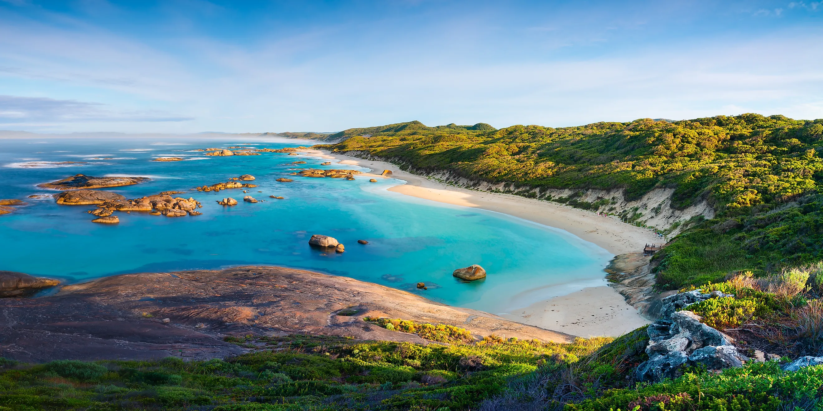
Denmark is surrounded by forest, farmland, and rocky coastline. At Greens Pool in William Bay National Park, granite boulders shelter a small cove from the ocean, leaving clear water between the rocks. Nearby, Elephant Rocks is at the end of a short coastal walk, where rounded granite boulders crowd the shore and resemble elephants standing in the shallows.
Away from the coast, the Mount Shadforth Scenic Drive climbs through farmland and vineyards, opening up views toward the forest and sea. The Denmark River runs through the town before reaching Wilson Inlet, a large, sheltered estuary where the water is calm enough for paddling and walks along the shore.
From Denmark, the journey continues through the south-west, where the forests become much larger and taller around Pemberton.
Pemberton

Pemberton is surrounded by karri forest, with tall trees lining the roads and rising well above the town. The Gloucester Tree shows just how high the forest reaches. It was selected as a fire lookout in 1947, when foresters still climbed trees and towers to watch for smoke across the south-west forests.
The former lookout reopened to climbers in 2026 after a safety upgrade, and iron rungs still lead up the trunk to a new viewing platform among the treetops. At Beedelup Falls, the forest is quieter, with a short walk and swing bridge leading to the waterfall.
The karri forest continues around Big Brook State Forest, where the picnic area is popular in summer. You can also take the Pemberton Tramway through the forest along old timber-milling tracks, giving you a slower view of the trees without having to climb one.
The forest changes again around Walpole, where huge red tingle trees replace the karri.
Walpole

Walpole is surrounded by the Walpole Wilderness, a 3,634-square-kilometre protected zone of karri and red tingle eucalypts. The Valley of the Giants Tree Top Walk, a 600-metre elevated steel walkway, takes people into the canopy, bringing them level with trees known for their enormous girth.
Some of the trees are around 400 years old, and red tingles grow naturally only in this small part of Western Australia. Back on the ground, the 450-metre Ancient Empires Walk winds among the same trees, with some of the huge trunks close enough to touch. Beyond the forest, Walpole Inlet is a quiet place to kayak or walk along the shore.
Mount Frankland rises nearby as a granite dome, with concrete steps and a short ladder leading to views across the surrounding forest. Circular Pool is a popular picnic and lookout spot and is sometimes used for swimming when the river is low in summer. The mix of red tingle forest, granite, and water gives Walpole a very different feel from Pemberton.
Further along, the landscape changes again, with limestone caves, vineyards, and a rugged coastal landscape around Margaret River.
Margaret River

Margaret River's scenery works in layers, starting below ground. Mammoth Cave and Lake Cave, two of the region's limestone systems, run beneath the surrounding farmland. Both are open for guided tours that descend well below the vineyards overhead. On the coast, Surfers Point overlooks the break, where some of Australia's best surfers take on the powerful Southern Ocean swell.
Inland, the limestone country gives way to rolling hills covered with vineyards and cellar doors. South of town, the Boranup Forest Drive winds through hilly terrain and tall karri trees beneath a dense woodland canopy. Few towns this size have such a mix of caves, coast, vineyards, and forest within a short drive.
Further south, the vineyards and caves give way to the forests and coastline around Augusta.
Augusta

Augusta is at the south-western tip of Western Australia, where the Indian and Southern Oceans meet. The Cape Leeuwin Lighthouse stands near this point, with views over the coast and surrounding waters. A short drive inland, Jewel Cave is Western Australia's largest show cave, with three vast chambers filled with stalactites, stalagmites, straws, shawls, and other limestone formations.
The scenery changes again in the Boranup Forest, where walking and driving tracks pass through tall karri trees before reaching the coastal dunes. Flinders Bay has a quieter stretch of sheltered coastline, where migrating humpback and southern right whales can often be seen from June to September. Together, the forest, cave, sheltered bay, and open ocean give Augusta a varied landscape despite its small size.
Farther east, the coast becomes wilder and more remote, with Bremer Bay surrounded by native bushland and long stretches of undeveloped coastline.
Bremer Bay

Bremer Bay is one of the more remote places on this list, with long stretches of natural coastline and very little development. Fitzgerald River National Park is close to town and is known for its wildflowers, with heathland covering much of the landscape. The waters around Bremer Bay are also known for whale watching, with humpback, southern right, and blue whales passing through from May to December.
A short drive from town, the 300-metre Native Dog Beach has a long stretch of sand backed by low coastal scrub and clear turquoise water. At Point Ann, high cliffs overlook the Southern Ocean, and southern right whales can be seen close to shore from June to October when they come to calve.
Farther north, the coastline opens into long sandy beaches, low dunes, limestone reefs, and offshore islands around Jurien Bay.
Jurien Bay

Jurien Bay is known for its clear, calm water and long sandy beaches. The Turquoise Way follows the beachfront, with views across the Indian Ocean and the islands offshore. Close to shore, the water is shallow enough to see the sandy bottom, making the coastline easy to explore on foot or by kayak. Further out, Jurien Bay is home to Australian sea lions. Boat tours take people out to swim and snorkel with them.
The surrounding islands are home to seabirds and other marine life, and the Jurien Bay Marine Park protects the waters along the coast. With its clear water, sandy beaches, and offshore islands, Jurien Bay has a quieter feel than the more rugged coastline farther south.
Farther north, the coast becomes warmer and the reef moves closer to shore, with Coral Bay built right beside Ningaloo Reef.
Coral Bay

Coral Bay is small enough to explore on foot in a few minutes, but the Ningaloo Reef begins almost at the beach. The shallow lagoon makes it possible to wade into the water and snorkel among coral and tropical fish without taking a boat. Bill's Bay is the main stretch of beach, and Paradise Beach Lookout gives a higher view across the bay and reef. Nearby, the Shark Sanctuary protects shallow waters where reef sharks and other marine life can be seen.
Manta rays also live in the area, and swim tours run throughout the year to see them. The reef can also be explored from a glass-bottom boat. Purdy Point, at the southern end of the bay, is a popular place for drift snorkelling. With the reef so close to shore, Coral Bay makes it easy to explore Ningaloo without going far from town.
A little farther north, Exmouth brings the reef together with the rugged limestone landscape of Cape Range.
Exmouth

Exmouth has the Ningaloo Reef on one side and the limestone cliffs of Cape Range National Park on the other. The range rises above the coast, with limestone gorges, canyons, and lookouts spread through the park. Turquoise Bay lies below the range, with clear water and reef close to shore, making it a popular spot for swimming and drift snorkelling.
Inside the park, Yardie Creek Gorge can be seen from a short walking trail or from the water on a boat cruise. The 2-kilometre Yardie Gorge Trail follows the cliffs for wider views of the gorge and coast. From March to August, whale shark tours run from Exmouth, giving people another way to experience the waters around the town.
South of Exmouth, the reef and limestone give way to the red sandstone and deep gorges around Kalbarri.
Kalbarri

Kalbarri lies between two very different landscapes, with the Murchison River gorge and the Indian Ocean coast only a short drive apart. Nature's Window, a natural rock arch above the river, is one of the area's best-known sights. Nearby, the Kalbarri Skywalk extends out over the gorge on two cantilevered platforms, giving views across the red and white sandstone cliffs.
Walking trails follow the gorge through the national park, with the layers of rock showing where the river has cut through the landscape over millions of years. A short drive from the gorge, the coastal side of Kalbarri National Park brings a completely different landscape. Red Bluff Lookout sits high above the ocean, with views along the red cliffs and beaches below. Further along, blowholes open in the coastal rocks as waves push water through the cliffs.
Conclusion
Together, these towns show just how much Western Australia's coast can change. Esperance and Denmark have white beaches and granite, Pemberton and Walpole are surrounded by tall forests, and farther north the landscape opens into reef, limestone, and red sandstone. The towns themselves are small, but each one opens onto a very different part of the state. Between the granite coast of Esperance and the red cliffs of Kalbarri, the scenery keeps changing from one town to the next.