2026's 11 Most Scenic Alberta Towns
Alberta stacks glaciers, badlands and shortgrass prairie inside a single day's drive. The gondola above beautiful Banff gives visitors incredible views of six mountain ranges in about eight minutes. Abraham Lake stuns onlookers as it freezes methane into stacked white discs under clear ice every January. The Red Deer River valley drops 100 metres below the wheat at Drumheller. The eleven towns below all sit in scenery of the highest caliber. Each entry covers the viewpoints, short hikes, and closures worth knowing about this season.
Banff

Six mountain ranges come into view in a full circle from the summit boardwalk on Sulphur Mountain, and the Banff Gondola covers the climb in about eight minutes. A path continues along the ridge to Sanson's Peak and the old weather observatory. Down on the valley floor, Rundle, Cascade and Sulphur close in on three sides of the townsite. This is the most photographed place in the province, and the scale of it still surprises people driving in.
Lake Minnewanka is the largest lake in the park and one of the oldest continuously used sites in it. The Stoney Nakoda call it Minn-waki, Lake of the Spirits, and finds along the shore go back more than 10,000 years. Take the cruise, or walk the lakeshore trail out to Stewart Canyon where the Cascade River cuts in. Parks Canada banned paddling and large inflatables here in spring 2026 to slow aquatic invasive species. Bow Falls sits fifteen minutes below the Fairmont Banff Springs, and the Surprise Corner pullout on the way frames the hotel against Mount Rundle.
Drumheller

The prairie ends without warning and the Red Deer River valley opens up 100 metres below the wheat. The North Dinosaur Trail loops out of Drumheller along the valley rim, and Orkney Viewpoint has the widest panorama of the badlands. Layered rock runs to the horizon in bands of grey and rust. The loop crosses the river on the Bleriot Ferry, a free cable ferry running since 1913, then comes back on the south side.
Southeast of town, the road to Wayne crosses eleven single-lane bridges in about six kilometres. It follows a creek through a narrow coulee to what was a mining town of 2,500 and is now a saloon and a handful of buildings. The Rosedale Suspension Bridge sits on the same route, a swaying pedestrian span that miners once crossed to get to work. Come at either end of the day. Badlands rock shifts colour dramatically as the sun drops, and midday flattens all of it. Calgary is ninety minutes southwest.
Jasper

The July 2024 wildfire took roughly a third of the Jasper townsite, and rebuilding continues two years on. Book early and expect a work in progress. The park came through better, and what people come for is still here. Valley of the Five Lakes is the best short hike in it, a loop of about four and a half kilometres past five small lakes. Each runs a different shade of blue-green depending on depth and mineral content. Give it two hours.
South of town, the Icefields Parkway runs 230 kilometres to Lake Louise, past more glacier-carved terrain than almost any road on the continent. You do not have to drive all of it. The first hour alone covers Athabasca Falls, Sunwapta Falls and the approach to the Columbia Icefield. Jasper is also the second-largest dark sky preserve in the world, so on a clear night with no moon, pull off outside the townsite and look up. Check Parks Canada advisories first. Access roads and trails have been closed or limited since the fire, and the picture keeps changing.
Canmore

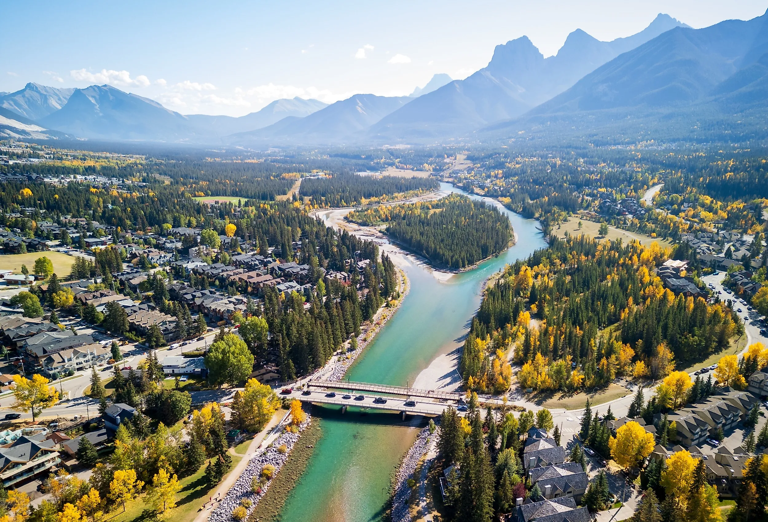
The Three Sisters fill the southern sky, and the Bow River runs through the middle of town. Canmore was a coal town until the last mine closed in 1979 and still has the bones of one. Grotto Canyon heads the other direction, east toward Exshaw, up a dry or frozen creekbed between limestone walls to pictographs painted on the rock centuries ago. Winter is arguably the better season there, with ice formations and easier footing.
Plan the mountainside of a Canmore trip carefully this year. A June rockslide off the East End of Rundle closed Highway 742 between the Grassi Lakes turnoff and Goat Creek. The Grassi Lakes day-use area and its trails went down with it. Crews spent the summer removing unstable rock, and the road was still shut in late August. Ha Ling Peak and Goat Creek remain reachable via the long way around on Highway 40, which turns a ten-minute drive up the hill into roughly two hours. Ha Ling repays the detour for anyone fit enough for 800 metres of gain in under three kilometres of switchbacks. Check Alberta Parks the morning you go.
Waterton Park

Prairie runs flat for hours and then hits a mountain wall, and the townsite sits right at the seam. The Prince of Wales Hotel stands on a bluff above Upper Waterton Lake, and the bluff itself is the single best vantage in the park. The lake carries on south into Montana. Forest cover changed substantially after the 2017 Kenow fire, and much of what you see is early regrowth. It photographs differently than older images suggest.
The Akamina Parkway climbs sixteen kilometres to Cameron Lake, a glacial bowl at the end of the road with rental canoes and a flat shoreline trail. Mountains rise on three sides and the international border runs across the far end. Halfway up that road a short trail leads to Crandell Lake through burned and regenerating forest. At the park entrance off Highway 6, the Bison Paddock loop road puts you inside a fenced range where a small herd grazes with the mountains behind them. You stay in your vehicle. The drive takes fifteen minutes and the road is open spring through fall.
Lake Louise
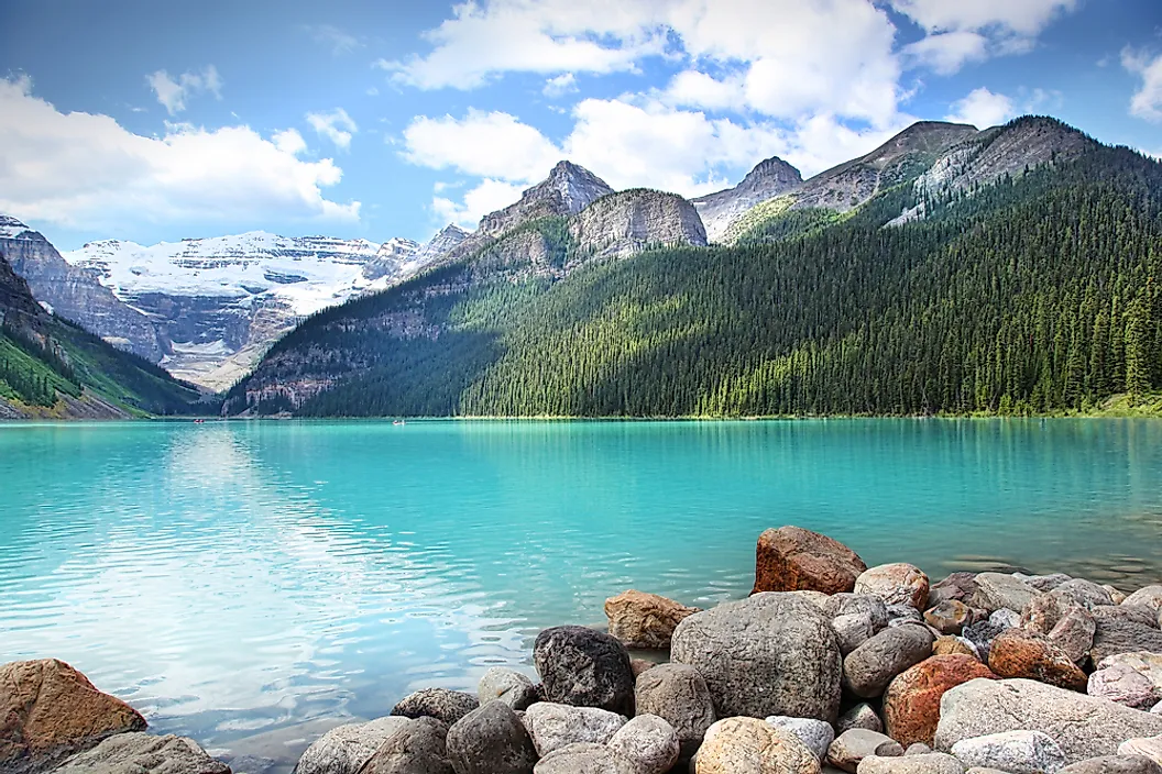
This is the most photographed water in Canada, and the logistics now decide whether the visit works. Private vehicles can no longer drive the road to Moraine Lake, and the Lake Louise lot fills before sunrise in summer. The Parks Canada shuttle from the ski resort park-and-ride serves both lakes and connects them. Reserve ahead. Moraine sits in the Valley of the Ten Peaks, where a five-minute scramble up the Rockpile gives you the view that used to be printed on the twenty-dollar bill.
At the lake itself, the flat lakeshore trail runs two kilometres along the north side to the far end, where the Victoria Glacier comes in. Most visitors photograph from the boathouse and leave, so the half-hour walk empties out considerably. In late September, Larch Valley above Moraine turns gold for about two weeks, and it is the busiest fortnight of the year on that trail for good reason. Canoeing is still permitted on Lake Louise, which is no longer true of every lake in Banff National Park.
Nordegg

Abraham Lake is the reason to make the three-and-a-half-hour drive west of Edmonton. It is a reservoir, and in summer the colour runs glacial blue for 32 kilometres along the highway. Winter does something even more strange. Methane from decomposing plant matter freezes into stacked white discs suspended under the ice, and Preacher's Point is the standard viewpoint. January and February are the window, before snow covers the surface.
The Kootenay Plains west of the lake are a genuine anomaly, a dry grassland valley in the middle of the Rockies held open by chinook winds. The Siffleur Falls trailhead leaves from here across a long suspension bridge over the North Saskatchewan River. Crescent Falls sits west of town off the David Thompson Highway, where the Bighorn River drops through a crescent-shaped canyon in two stages. Park close, or hike the canyon rim, which is the better version. In Nordegg itself, the Brazeau Collieries mine site holds National Historic Site designation, with nearly all its processing buildings standing. Guided tours run in summer out of the Nordegg Heritage Centre.
Elkwater

Southeast Alberta stays flat for a very long time, and then the Cypress Hills rise 600 metres out of it. The hills escaped the last glaciation entirely, which is why lodgepole pine and montane forest grow here in the middle of shortgrass prairie. Elkwater is the only townsite in the park. It holds the beach, the visitor centre and the main services on Elkwater Lake.
Two driving loops cover most of the scenery. The western route passes the Horseshoe Canyon viewpoint, where badlands erosion cuts into the plateau edge, then carries on to Head of the Mountain. That is the high point of the Alberta block, with prairie below in every direction. The eastern loop runs for 60 kilometres, nearly to the Saskatchewan border, and takes in Reesor Lake, managed as a rainbow trout fishery with a dock at the dam. The real draw comes after dark. Cypress Hills Interprovincial Park was designated in 2004 as Alberta's first dark sky preserve, and the mix of elevation, distance and clear summer nights makes it one of the most accessible dark sky sites in North America.
Blairmore

The Crowsnest Pass is five communities strung along Highway 3, and Blairmore is the largest of them. The whole valley runs under Turtle Mountain. At 4:10 on the morning of April 29, 1903, roughly 110 million tonnes of limestone came off the east face and buried three square kilometres of valley floor in about 100 seconds. Around 90 of the town of Frank's 600 residents died, and most were never recovered. The Frank Slide Interpretive Centre sits on a bluff above the rubble field. It handles the geology, the survivor accounts and an award-winning documentary, open daily in the summer season and closed Mondays the rest of the year.
From the same parking lot, the Frank Slide Trail is an easy 1.5-kilometre loop threading between boulders the size of cars. A harder 3.1-kilometre route climbs Turtle Mountain itself, which the Blackfoot and Ktunaxa knew as the mountain that moves. The Bellevue Underground Mine runs hour-long guided tours into a working-era coal seam with headlamps and interpreters, and it stays cold down there year round. In winter, Pass Powderkeg is Blairmore's community ski hill, small and free of lift lines. In summer the same slopes carry mountain bike trails, and a community trail links the five towns for anyone on foot or on a bike.
Bragg Creek

West Bragg Creek is the reason locals come. The trail network backs directly onto the hamlet and covers dozens of named routes through aspen and spruce, groomed for cross-country skiing in winter and shared by hikers and mountain bikers the rest of the year. The Fullerton Loop is the usual introduction, climbing to a ridge with a view down the Elbow valley. The hamlet is a few hundred people, a trading post and a cluster of shops, thirty minutes west of Calgary where aspen replaces wheat.
Elbow Falls is the standard stop, twenty kilometres west on Highway 66, where a paved interpretive trail runs to a lookout over a drop that changes noticeably with how much water the river is carrying. The whole walk is under a kilometre and works for strollers. Bragg Creek Provincial Park is day use only, with picnic sites, easy river access and flat forest trails. CBC filmed parts of North of 60 in the area. One piece of timing to know: Highway 66 west of Elbow Falls closes December 1 and reopens in mid-May, which changes what is reachable in winter.
Longview
A village of under 300 people sits on Highway 22, with the Rockies filling the western horizon and rangeland running the whole way there. Longview is named for exactly what you think. The Cowboy Trail is the main event, roughly 600 kilometres of Highway 22, and the stretch south of the village toward the Crowsnest is the finest section of it. Open range, working ranches, and almost no development. Drive it slowly and pull over often.
South of the village, the Bar U Ranch National Historic Site preserves the headquarters of one of the largest ranching operations in Canadian history. At its peak, it ran 30,000 cattle and a thousand Percheron horses across roughly 157,000 acres. More than 35 original buildings remain, among the largest such collections in the country, and the season runs mid-May through late September with wagon rides and roping demonstrations. Allow half a day. Highway 541 follows the Highwood River west toward the Highwood Pass, the highest paved road in Canada, closed December through mid-June. Then there is the Longview Jerky Shop, open since 1978. Go early. The good varieties sell out.
Access Is The Real Variable
Every town here earns a place on a most scenic list. What separates them in 2026 is what each one asks of a visitor. Banff and Lake Louise run on shuttle reservations, Canmore has lost its road up the hill, and Jasper is still rebuilding two years after the fire. Drumheller and Elkwater want a tank of gas and some daylight. The most scenic stop in the province this year is the one your weekend can actually reach.