2026's 11 Most Scenic Adirondack Mountains Towns
Mirror Lake sits a block behind Lake Placid's Main Street. Scenic towns are a given in New York's Adirondacks, with the Adirondack High Peaks in full view from village sidewalks, public beaches, and the shoulder of Route 73. Wild Walk carries visitors 30 feet into the treetops outside Tupper Lake, while the Essex-Charlotte ferry crosses three miles of Lake Champlain in about 25 minutes. Fort Ticonderoga spans 2,000 acres above that same water. These 11 towns hold their looks in every season.
Lake Placid

Downtown Lake Placid comes with a 128-acre lake in the middle of it. Mirror Lake sits just behind Main Street, where a 2.7-mile path circles the water with the Adirondack High Peaks across the lake. Late September is typically the best bet for peak fall foliage here, and it's also the tail end of a very well-regarded fly fishing season. Whiteface Mountain changes the scale of the town considerably, though the mountain itself stands 13 miles northeast in Wilmington. Its Cloudsplitter Gondola spends about 15 minutes climbing to Little Whiteface, passing streams, exposed rock, and ski trails before reaching a summit view that takes in Lake Placid village and, to the east, Lake Champlain. The gondola shifts to a reduced weekend schedule in the fall before closing for the season in mid-October. Back at lake level, Brewster Peninsula's Lake Shore Trail follows Lake Placid for 0.4 miles, while Heaven Hill's 1.4-mile Old Orchard Loop leaves the woods for an open field facing the mountains.
Saranac Lake

Less than 10 miles from Lake Placid, Saranac Lake squeezes a surprising amount of Adirondack scenery into its small neighborhoods. Baker Mountain starts beside Moody Pond, only half a mile from downtown, then gains nearly 900 feet in less than a mile. Rocky overlooks near the top look across the village, Saranac Lake, Lake Flower, and more than 20 major mountains, including the High Peaks to the east. Stay at ground level, and Moody Pond is only 25 acres, with a flat 1.1-mile paved road around the water beneath Baker and McKenzie Mountains. The Adirondack Rail Trail is even easier to find. Roughly two miles are paved straight through Saranac Lake before the 34-mile route continues through forests and wetlands toward Lake Placid and Tupper Lake. The trail is free and remains open for cross-country skiing and snowshoeing in the winter.
Tupper Lake

The 34-mile Adirondack Rail Trail ends in Tupper Lake after running through Saranac Lake from Lake Placid. The final 8.5 miles of the Rail Trail from Floodwood are among its wildest, cutting past ponds, bogs, and forest before finally reaching town. Nearby, The Wild Center takes visitors 30 feet into the forest canopy on Wild Walk, where bridges, platforms, and a four-story twig treehouse overlook the surrounding woods. Returning in late November, Wild Lights illuminates Wild Walk and a quarter-mile forest trail after dark with thousands of lights on winter evenings. South of town, Bog River Falls is reached via a quick and easy trail, where the Bog River drops beneath a stone bridge immediately before entering Tupper Lake.
Ticonderoga

Fort Ticonderoga covers 2,000 acres along Lake Champlain, with Vermont's Green Mountains visible across the water and the Adirondacks standing tall to the west. The view helps explain why the 18th-century fort was built here in the first place. This narrow stretch of Lake Champlain was part of the water route linking Canada with the Hudson Valley, while Lake George lies only a few miles away. Mount Defiance rises above the fort, providing a direct view down onto its walls, Lake Champlain, and the surrounding mountains. Both run a Tuesday-through-Sunday schedule and close for the season in late October, so check the fort's calendar before making the drive. The La Chute River Walk can be accessed right from downtown Ticonderoga. It follows the three-mile river connecting the two lakes, including six waterfalls along its roughly 220-foot descent.
Lake George

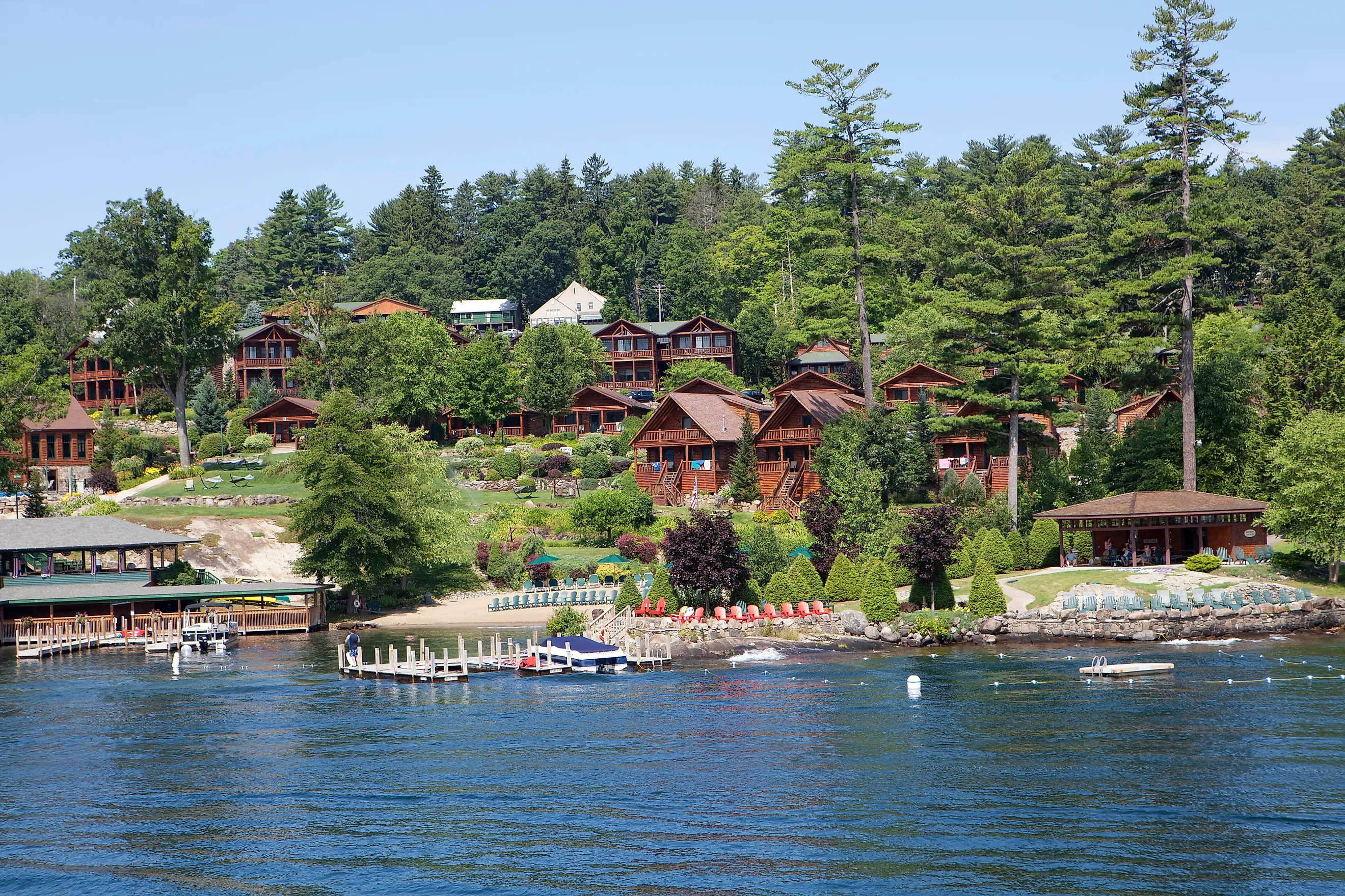
The cozy Adirondack town of Lake George sits right on its 32-mile namesake lake, with Million Dollar Beach giving views of the forested mountains that surround it. Prospect Mountain can be found immediately behind the village, where three roadside overlooks lead toward a summit looking across the lake and a large portion of the Adirondacks. The seasonal Veterans Memorial Highway on Prospect Mountain closes in winter, but the 1.7-mile summit trail remains an option after the road season ends. The eastern shore of Lake George is considerably less developed than the west and south sides. Here, the Shelving Rock area combines a 1.7-mile mountain climb with trails to the 50-foot Shelving Rock Falls and the water's edge of Shelving Rock Bay.
Schroon Lake

Schroon Lake's Main Street is barely a block from the water. Schroon Lake Town Beach sits right in the village, with a sandy shoreline facing north along the nine-mile lake toward the Adirondack mountains. Just south of town, Mount Severance requires considerably more effort to enjoy. The 1.2-mile climb passes beneath Route 9 through a pedestrian tunnel before reaching ledges above Schroon Lake, with the 46,283-acre Pharaoh Lake Wilderness stretching east from the opposite side of the valley. Ten minutes farther south, the geology changes completely. Natural Stone Bridge and Caves follows Trout Brook through Adirondack marble, including waterfalls, a gorge, and what the park bills as the largest marble cave entrance in the East. Its fall trail season continues into mid-October, then closes ahead of winter operations.
Long Lake

Long Lake stretches for nearly 14 miles through the central Adirondacks, which makes the seaplanes leaving from town more than a novelty. Helms Aero Service offers 20-minute flights over the area, where the lake can be seen amid surrounding ponds, mountains, and large stretches of forest. The scenic circuits cover roughly 25 to 30 miles and are flown mainly in July and August. About three miles southwest of town, the Raquette River tumbles over the broad rock ledges of Buttermilk Falls. It's only a 0.1-mile walk from the road, with paths leading alongside the water and several places to watch the river work its way through the exposed rock. Mt. Sabattis sits back in town on a former golf course. Its open hillside overlooks Long Lake and the bridge at its southern end, with Triplet Hill and the Big Brook Hills beyond. Once enough snow falls, the lower slope becomes the town's free sledding hill, with separate lanes cut into the hillside and lights allowing sledding after dark.
Bolton Landing

Ten miles north of Lake George Village, Bolton Landing looks out on a busier stretch of water, where islands begin breaking up the lake beneath the surrounding mountains. Rogers Memorial Park is an easy place to see it, with the Victorian Sagamore Resort sitting offshore on 70-acre Green Island and Sleeping Beauty, Shelving Rock, and the Tongue Mountain Range beyond it. Walking into the park is free, while summer parking carries a modest fee. From The Pinnacle, the resort becomes a small landmark in a much larger view that includes Dome Island and the Narrows. The climb is 1.1 miles with a notable 548 feet of gain. Bradley's Lookout reaches open ground above the lake after just 0.6 miles and 144 feet of climbing. Green Island and the Sagamore sit directly below it, with Dome Island farther out and Black Mountain across Lake George.
Essex

The best view of Essex is the one from the middle of Lake Champlain. The Essex-Charlotte Ferry takes about 25 minutes to reach Vermont, with the Adirondacks and Green Mountains visible across the three-mile crossing. It is the southernmost of the Lake Champlain crossings and runs year-round as weather allows, with a reduced single-boat winter schedule and occasional suspensions when ice or high winds close the lane. Inland, the 1.8-mile Wildway Overlook Trail climbs 520 feet before farm fields, Lake Champlain, and the Green Mountains come into view together. South of Essex, Split Rock Mountain Wild Forest protects 3,700 acres along New York's largest undeveloped stretch of Lake Champlain shoreline, including secluded bays and the 150-foot Lake Champlain Palisades. Entry is free, and the preserve remains open year-round.
Keene

Some of the Adirondacks' biggest mountains are right beside the road in Keene. The 30-mile High Peaks Scenic Byway follows Route 73 through town on its way to Lake Placid, passing the trailheads and cliffs below 4,627-foot Giant Mountain, the 12th-highest of the Adirondack High Peaks. Chapel Pond is found below those cliffs with its small beach just off the highway. A little farther north, Roaring Brook Falls can be seen coming off Giant Mountain from Route 73, or after a mostly flat 0.3-mile walk to its base. North of Keene, the road enters Cascade Pass and runs directly beside Upper and Lower Cascade Lakes. The New York State Department of Transportation even replaced the old concrete barriers along the Cascade Lakes with see-through railings because they blocked views from Route 73.
Blue Mountain Lake

Blue Mountain stands about 3,750 feet above sea level, with a steel fire tower adding another 35 feet to the peak that gives Blue Mountain Lake its name. The Blue Mountain Trail gets there in 2.2 miles, gaining 1,550 feet through increasingly steep and rocky terrain before the surrounding forest finally falls below the tower. Down on the lakeshore, the Adirondack Experience spreads across roughly 120 acres above Blue Mountain Lake, with the water and surrounding mountains visible between its buildings and from several parts of the grounds. The museum, known as the Adirondack Museum until it was renamed in 2017, keeps a four-story climbable fire tower that gets visitors above the treetops without the 1,550-foot ascent, and it closes for the season in mid-October. On the lake's northern shore, the Castle Rock Trail passes beneath a 200-foot cliff, an overhanging rock shelter, and a small cave before reaching exposed ledges above the water.
Adirondack Scenery In Every Season
The scenery in New York's Adirondacks comes with the package year-round. Bradley's Lookout still reaches open ground above Lake George after 144 feet of climbing, and Long Lake turns the lower slope of Mt. Sabattis into a lit sledding hill once enough snow falls. Route 73 carries traffic past Chapel Pond and the Cascade Lakes in Keene all winter, no trailhead required. Across these 11 towns, the view is usually just a few minutes away from wherever the car stops.