2026's 10 Most Scenic Victoria Towns
Poplars along the Ovens River in Bright turn gold every April. In Port Fairy, short-tailed shearwaters return to Griffiths Island each spring by the tens of thousands. Daylesford's bathhouse has drawn bathers to its mineral water since the 1890s. Kangaroos still graze on the sports oval in Halls Gap at dusk. Each of the most scenic Victoria towns for 2026 wraps its streets around a setting that belongs to it alone.
Bright

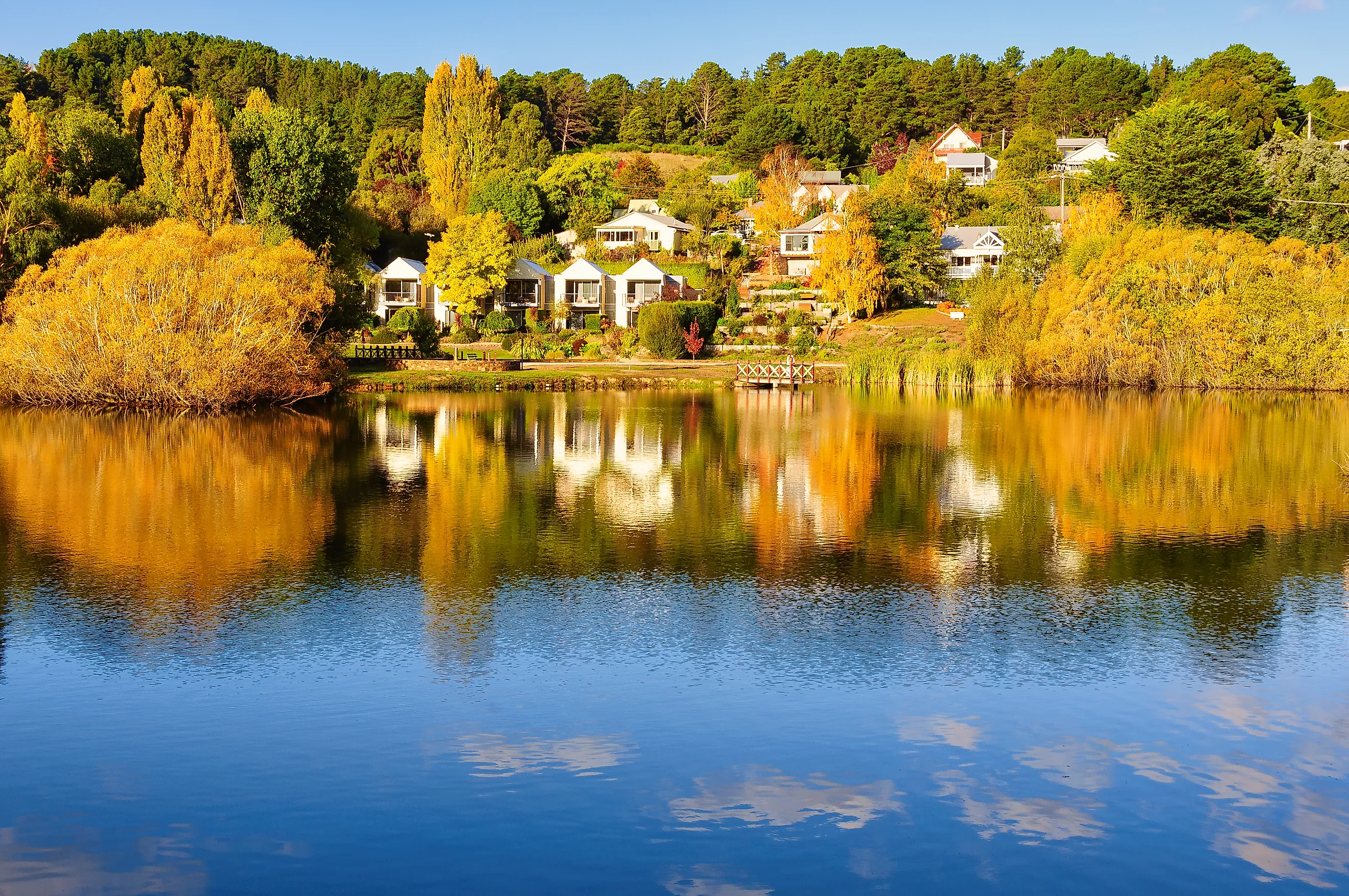
Autumn arrives in Bright as a full-scale color event. Settlers and local tree-planting committees lined the town with exotic deciduous trees in the late 1800s and early 1900s. Each April, those oaks, maples, and poplars turn red and amber below the peaks of the Victorian Alps. The Bright Autumn Festival marks the season across late April and early May with markets, food stalls, and live music.
Spring belongs to the Ovens River, which runs clear past riverside parks where families picnic and swimmers wade in on warm days. Bright Brewery sits on the riverbank and pours beers made in town. Cyclists know Bright as the finishing point of the Murray to Mountains Rail Trail, a paved route that begins in Wangaratta and follows an old railway corridor into the high country. Its gentle grades suit families as well as serious riders.
Port Fairy

Bluestone cottages and old timber shopfronts give Port Fairy one of the best-preserved 19th-century streetscapes on Victoria's southwest coast. Whalers and sealers worked this shore in the 1820s and 1830s, and the town grew up along the Moyne River about 28 kilometers (17 miles) west of Warrnambool. More than 50 of its buildings carry National Trust classification. Fishing boats still tie up along the river wharf.
A causeway leads to Griffiths Island, where an 1859 bluestone lighthouse stands above the rocks. Each year from late September, tens of thousands of short-tailed shearwaters return to the island's burrows after their long migration, and visitors gather at dusk to watch them fly in. Every March, the Port Fairy Folk Festival fills the town for four days with performers from Australia and overseas, as it has since 1977.
Daylesford

Wombat Hill, an extinct volcano, rises in the middle of Daylesford and carries the town's botanic gardens on its slopes. The gardens date to the 1860s, and a lookout tower at the summit looks out over forest and farmland. Lake Daylesford, ringed by a walking track, sits a short stroll from the main street.
Beneath the town and neighboring Hepburn Springs lies Australia's largest concentration of naturally carbonated mineral springs. The Hepburn Bathhouse and Spa, about 4 kilometers (2.5 miles) north of the town center, has welcomed bathers since 1895. On Sundays, the Daylesford Sunday Market spreads around the old railway station on Raglan Street with local produce, crafts, and secondhand goods.
Beechworth

Honey-colored granite gives Beechworth's gold rush streets their warm tone. Ford Street and the blocks around it hold more than 30 buildings classified by the National Trust, most of them built in the 1850s and 1860s, when gold drew thousands of miners to the Ovens district. The Burke Museum, founded in 1857, is one of Australia's oldest regional museums and includes a recreated gold rush streetscape.
In August 1880, Ned Kelly faced his committal hearing at the Beechworth Courthouse before his trial in Melbourne, and the courthouse now forms part of the town's historic precinct. Vineyards around town grow cool-climate wines, and several cellar doors lie a short drive from the center. Beechworth Honey runs a shop and tasting room on Ford Street, where a glass observation hive shows the bees at work.
Maldon

In 1966, the National Trust named Maldon Australia's first Notable Town, recognizing a gold rush streetscape that had changed remarkably little. Verandahed shops and stone buildings line High Street, and film crews often use the town as a period setting.
The Victorian Goldfields Railway runs heritage trains between Maldon Station and Castlemaine. The line first opened in 1884 and closed in 1976. Volunteers restored it in stages until trains reached Castlemaine again in 2004. Mount Tarrangower rises just outside town, and its lookout tower gives long views over the central goldfields. Each November, the Maldon Folk Festival fills local halls and paddocks with musicians over a long weekend.
Lorne

The Otway Ranges come almost to the sand in Lorne, leaving a narrow town between the forest and Loutit Bay on the Great Ocean Road. Its main beach is sheltered enough for families, and a foreshore path leads past cafés toward the pier.
About 10 kilometers (6 miles) inland, in Great Otway National Park, Erskine Falls drops 30 meters (98 feet) into a fern-filled gully. A road leads to a viewing platform, and stairs continue down to the base. Every January, the Pier to Pub swim sends thousands of swimmers across the bay in one of the largest open-water swims in the world. In even-numbered years, the Lorne Sculpture Biennale places large outdoor works along the foreshore.
Queenscliff

Norfolk Island pines and grand Victorian hotels set the tone in Queenscliff, which sits on the Bellarine Peninsula beside the narrow entrance to Port Phillip Bay. Fort Queenscliff guards that entrance. Work began in the 1860s, and the fort was expanded in the 1880s amid fears of a Russian naval attack. It remains one of the best-preserved colonial forts in Australia, and guided tours visit its batteries and the dark bluestone lighthouse inside its walls.
Searoad Ferries carries cars and passengers across the bay to Sorrento in about 40 minutes, and dolphins often trail the boat. Each November, the Queenscliff Music Festival brings Australian and international acts to stages around town.
Apollo Bay

Green hills of the Otway Ranges rise directly behind Apollo Bay, and its small fishing harbor faces the open ocean. Surf beaches give way to rainforest within a short drive. The Great Ocean Walk starts at the edge of town and follows the coast west for about 100 kilometers (62 miles) to the Twelve Apostles, with campsites along the way for multi-day hikers.
West of town, Melba Gully in Great Otway National Park is known as the Jewel of the Otways for its myrtle beech rainforest and tree ferns. After dark, glowworms light the banks along its short walking track. Each May, the Great Ocean Road Running Festival sends runners along the coastal road toward a finish line in Apollo Bay.
Healesville

Mountain ash forest and Yarra Valley vineyards surround Healesville, about an hour's drive east of Melbourne. Healesville Sanctuary opened in 1934 and is now run by Zoos Victoria. It shelters more than 200 species of native animals in a bushland setting, including platypus, koalas, and birds of prey that fly in a daily show.
Badger Weir Park, a short drive out of town, has walking tracks through cool temperate rainforest, and superb lyrebirds often forage in its undergrowth. Cellar doors fill the valley around town, including Domaine Chandon, which makes sparkling wine near Coldstream.
Halls Gap

Kangaroos graze on the Halls Gap sports oval most evenings, a sign of how close the town sits to the wild. It is the only township inside Grampians National Park, which covers about 168,000 hectares (415,000 acres) of sandstone ranges in western Victoria. The Wonderland Range rises above town, and a well-used track climbs through the Grand Canyon, a narrow sandstone gorge, to the Pinnacle lookout. From the top, hikers see Halls Gap, Lake Bellfield, and the Mount William Range.
MacKenzie Falls, about a 30-minute drive away, is among the largest waterfalls in Victoria. Spring brings wildflowers across the ranges, and the park records nearly 1,000 native plant species, about 20 of them found nowhere else.
Where Each Town Keeps Its Own Setting
Daylesford sits on volcanic ground, while Beechworth built its main street from local granite. Bright follows an alpine river valley, and Lorne and Apollo Bay press between forest and sea. Port Fairy and Queenscliff keep their 19th-century seafaring look, and Maldon has barely changed since the gold rush. Halls Gap lives inside a national park. Few places fit this much variety into towns this small.