Why San Francisco Bay Is Disappearing Under Its Own Mud
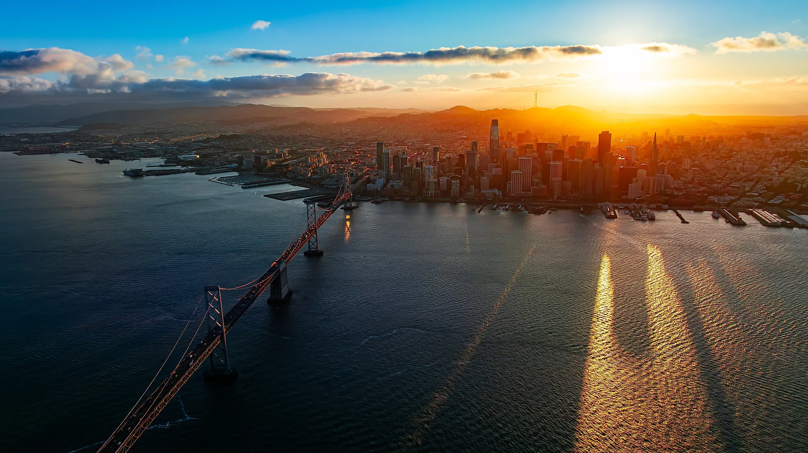
San Francisco Bay is about a third smaller than it was during the Gold Rush. In 1849, it covered 787 square miles. Today it covers about 550. The missing water vanished behind dikes, under dirt, and under mud, and plans drawn up in the late 1950s could have left much of the bay little more than a river.
A lot of that mud traveled more than 150 miles to get there. It still settles under the shoreline, clogs the shipping lanes, and covers the flats where shorebirds feed. Yet today, parts of the bay face the opposite problem. It all began in the Sierra Nevada, when gold miners turned water cannons on the mountains.
Gold Rush Miners Buried the Bay in Sierra Mud

Starting in the 1850s, miners in the Sierra Nevada foothills aimed high-pressure water cannons, called monitors, at whole hillsides to wash out gold-bearing gravel. The Oakland Museum of California puts the total at 1.5 billion cubic yards of soil and rock blasted loose. The Feather, Yuba, Bear, and American rivers drained the biggest diggings and carried the debris down through the Sacramento Valley toward the bay. To catch the fine gold, miners also used mercury, which binds with gold, and mercury-laced sediment from the diggings ended up in the bay as well.
From 1856 to 1887, sediment poured into the bay at nearly ten times its pre-mining rate. About 340 million cubic yards settled in San Pablo Bay, the bay's northern arm, raising its floor by an average of about 3 feet. Its channels filled in, and its intertidal mudflats, the ground exposed at low tide, spread by 60 percent. A federal court ruling in January 1884 stopped the North Bloomfield mine from dumping its tailings into the river, but the debris already in the bay kept moving around it for the next century. Sediment cores pulled from the bay in 1990 still held up to 43 percent mining debris in their top layer, and the Gold Rush mercury still in the bay's mud is one reason California's fish advisory tells people to limit or skip several kinds of bay-caught fish.
Dikes and Fill Shrank the Bay's Muddy Edges by a Third

While the mining debris was making the bay's edges shallower, people were making the bay smaller. Marshes were walled off behind dikes for salt ponds and farmland, and shallow tidelands were filled to make ground for ports and housing. By 1965, fill, diking, reclamation, and siltation had cut the bay to about two-thirds of its 1849 size.
It could have shrunk much further. In December 1959, the Oakland Tribune printed an Army Corps of Engineers map marking parts of the bay as "susceptible to reclamation," and development plans of that era would have filled another 325 square miles, enough to leave much of the bay little more than a river. The map helped start the group now called Save The Bay, and in 1965 California created the Bay Conservation and Development Commission to control filling. Large-scale fill ended, and with marsh restoration since then, the bay has grown slightly larger.
The marshes took most of the loss. About 190,000 acres of tidal marsh once ringed the bay, and by 1999 about 40,000 acres were left. The marshes that survived still need a steady supply of bay mud to stay above the tide.
Land Built on Bay Mud Is Sinking Back Toward the Water
Much of the filled ground sits on young bay mud, a soft, water-saturated clay laid down over the past 10,000 years beneath the bay and its marshes. In parts of San Mateo County, it runs 20 to 40 feet thick. Under weight, bay mud compacts slowly as water is squeezed out of it, and the ground on top settles with it.
Treasure Island was built in the middle of the bay as landfill for the 1939 Golden Gate International Exposition. A 2018 study using satellite radar found its northwest corner sinking half an inch to three-quarters of an inch a year. Along most of the bay's shoreline, the ground sinks less than a tenth of an inch a year, but in some areas over compacting landfill and young bay mud, the rate reaches about 0.4 inch or more.
The bay's older clay sinks too. Downtown San Francisco's Millennium Tower stands on piles that end in sand above Old Bay Clay, an older bay-laid clay deeper underground, and the building's weight squeezed water out of that clay until the tower had settled 17 inches by 2018. A $120 million fix finished in 2023 drilled 18 piles to bedrock along its north and west sides. The tower has stopped sinking at its northwest corner, but its top still leans a little less than 29 inches to the northwest.
Drifting Mud Keeps Filling the Bay's Shipping Channels

San Francisco Bay averages only 12 to 14 feet deep, and the South Bay averages 8.9 feet, even though the channel under the Golden Gate Bridge drops past 300 feet. In water as shallow as most of the bay, wind waves stir mud off the bottom, and tidal currents carry it into deeper water. Stronger winds in spring and summer stir up more, and the USGS describes the bay as a broad, shallow, turbid estuary.
Some of that drifting mud settles in the channels that cargo ships need. About 3 million cubic yards are dredged from the bay in a typical year, around 2 million of it by the Army Corps of Engineers. The Port of Oakland's channels were deepened from 42 to 50 feet in a $433 million project completed in late 2009, and maintenance dredging has to keep up with the natural silting that would make them shallower again. Some of the dredged mud is barged 55 miles past the Golden Gate and dumped in 8,200 to 9,800 feet of water, at the deepest ocean disposal site for dredged material in the United States. Mud dumped there is gone from the bay for good.
Dams Now Hold Back the Mud the Bay Needs

The mining mud that buried San Pablo Bay eventually ran out. Over the 20th century, dams built across the watershed trapped sediment upstream, and rock armor called riprap came to cover more than half the banks of the lower Sacramento River. Around 1999, after a very wet 1998, the amount of sediment suspended in the bay's water dropped 36 percent in a single step. The Gold Rush sediment that had washed back and forth around the bay for more than a century had finally flushed out to sea. San Pablo Bay had already begun to erode by then. About 30 million cubic yards of sediment washed out of it between 1951 and 1983, and it lost roughly half its tidal flats between the late 1800s and the 1980s. With less sediment coming down the rivers, USGS researchers expect it to keep eroding in the near term.
Without More Mud, the Bay's Marshes Could Drown

A tidal marsh stays above the water by catching mud. High tides spread sediment-laden water across the marsh, some of the sediment settles, and the surface builds up a little at a time. As long as mud arrives faster than the sea rises, the marsh holds its height. A 2021 regional study found the bay's current supply adequate, but as sea level rise speeds up, its tidal marshes and tidal flats will need more than 450 million cubic yards of sediment between now and 2100. That is a tall order for a bay that takes in about 2 million cubic yards of sediment a year, only a fraction of which settles on its wetlands and mudflats.
The mudflats, exposed at low tide, are where the bay's shorebirds feed. More than 1 million shorebirds use the bay each year, including over 300,000 in winter, and western sandpipers and dunlins, the two most numerous species in a November 2008 count, numbered about 100,000 each. The Western Hemisphere Shorebird Reserve Network ranks San Francisco Bay as a site of hemispheric importance, and it holds a larger share of the Pacific coast's wintering and migrating shorebirds than any other U.S. wetland.
Sunken Baylands Need Dredged Mud to Become Marsh Again

Behind the dikes, the old baylands kept sinking. At Hamilton, a former Army airfield in Novato, the diked ground sank about 6.5 feet over the past century, too low for a marsh to form if the bay were let back in. Between 2008 and 2013, the Army Corps of Engineers placed 5.9 million cubic yards of dredged material there, much of it from the Port of Oakland's deepening project, to raise the ground for about 900 acres of tidal and seasonal wetlands. Mud that had to come out of Oakland's channels went back to the bay's edge.
The Montezuma Wetlands project in Solano County is raising another subsided site the same way, and it had taken in about 10 million cubic yards of dredged sediment by late 2023. In the South Bay, 15,100 acres of diked salt ponds, bought from Cargill in 2003, are being restored in the largest tidal wetland restoration project on the West Coast.
For most of a century after the Gold Rush, San Francisco Bay took in more mud than it could hold, and people shrank it further with dikes and fill laid over soft clay that is still settling at Treasure Island. That surplus is gone. The bay's marshes and mudflats need more than 450 million cubic yards of sediment by 2100, and the rivers bring in about 2 million cubic yards a year, only part of which reaches them. San Pablo Bay is expected to keep eroding, and shoreline ground over young bay mud will keep sinking, in places by 0.4 inch or more a year. Where the dredges send their loads now matters to the marshes. Mud barged 55 miles past the Golden Gate is lost to the bay, while mud spread on a site like Hamilton stays where a marsh can use it to build up against the rising tide.