The American Towns Built On Filled-In Wetland
Some American towns did not find their land. They made it. These five stand on ground that was once salt marsh, mangrove forest, or swamp. Each got there the same blunt way, by dredging sand and mud from somewhere wetter and piling it onto the wetland until it could hold a house. The results include a Jazz Age resort and a postwar planned suburb, driven by real estate ambition or a plain need for space. What they share is a foundation younger than many of the buildings on it, and a relationship with water that never quite went away.
Foster City, California

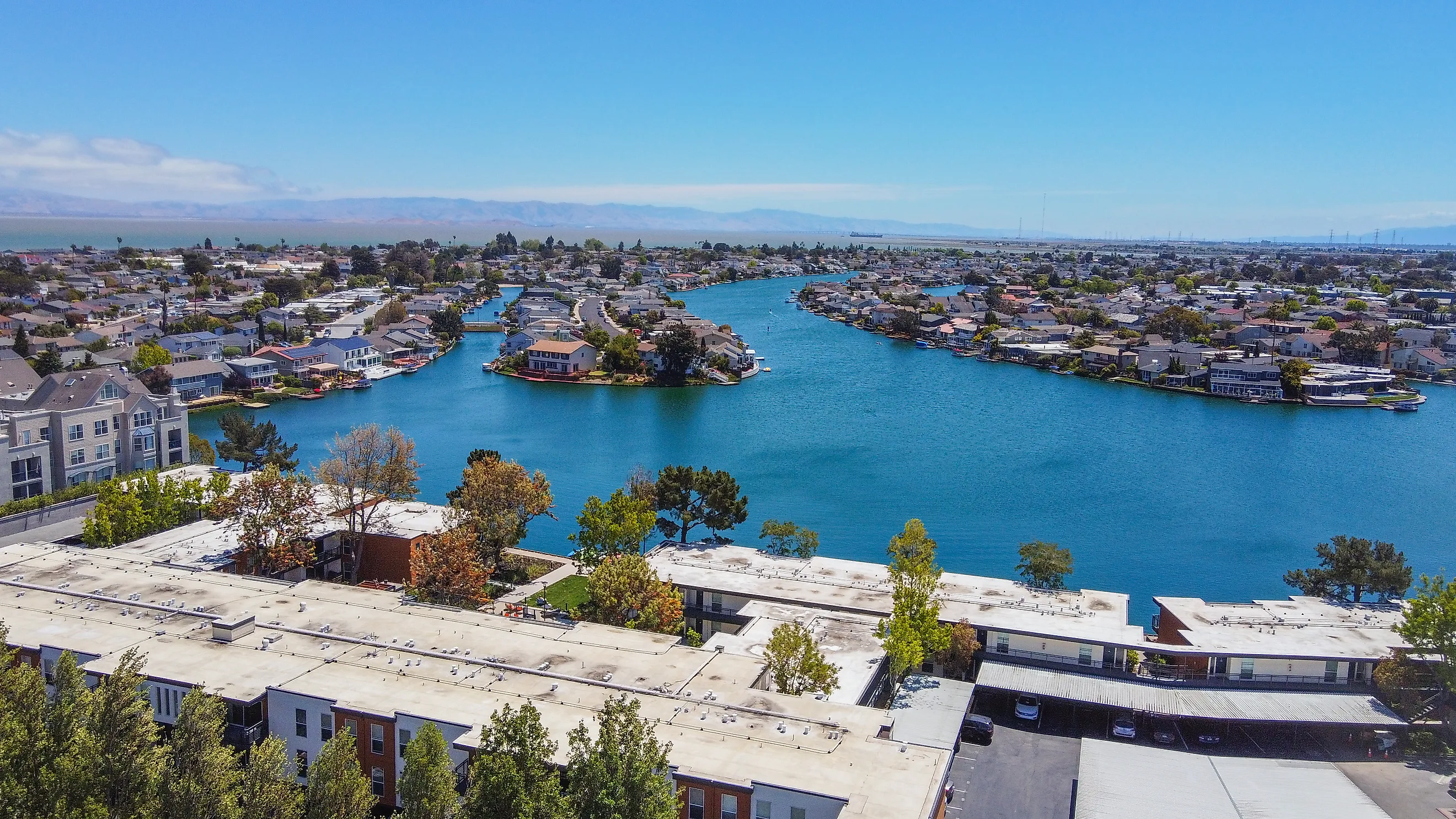
It took roughly 18 million cubic yards of sand to turn Brewer Island, about 2,600 acres of tidal marsh on the edge of San Francisco Bay, into a city. A farmer named Frank Brewer had diked the marsh around 1900 to grow hay and graze dairy cattle, but the ground stayed low, flat, and soft. In 1958, developer T. Jack Foster took an option on the land, and by 1961 he had drawn up a master plan for a self-contained community of homes, schools, and parks.
The engineering was the hard part. Sand was dredged from the bay, barged to the island, and pumped across it to raise the ground an average of about 4.5 feet. Instead of burying the whole island deeper, engineers carved a winding lagoon through the middle, which handled drainage and reduced the fill needed. That lagoon still defines the place. Houses back onto the water, residents keep sailboats and kayaks at their docks, and the city manages the lagoon's water level to handle storm runoff. The project also landed in history at an awkward moment. The group Save the Bay formed in 1961 to stop exactly this kind of bay fill, and projects on Foster City's scale soon became far harder to approve.
Miami Beach, Florida

In the summer of 1913, new land began rising out of Biscayne Bay. Carl Fisher, an Indiana industrialist who had made his fortune in automobile headlights, had looked at the barrier island across from Miami and seen a resort where there was mostly mangrove swamp. According to historian Polly Redford, Fisher and his partners spent $600,000 replacing about 1,000 acres of mangroves with six million cubic yards of fill. Crews of Black laborers cleared the forest by hand with saws and axes before the dredges moved in.
Fisher did not stop at the shoreline. His dredges pulled sand from the bay bottom to build entirely new islands, and today Star, Palm, and Hibiscus Islands, the Sunset Islands, and most of the Venetian Islands are human-made ground. The new land filled with hotels, golf courses, and polo fields, and Lincoln Road, now a pedestrian shopping street, was first sketched by Fisher in the damp sand of a freshly cleared swamp. The city that grew from it sits only a few feet above sea level, and its streets are now among the most closely watched in the country for tidal flooding.
Hoboken, New Jersey
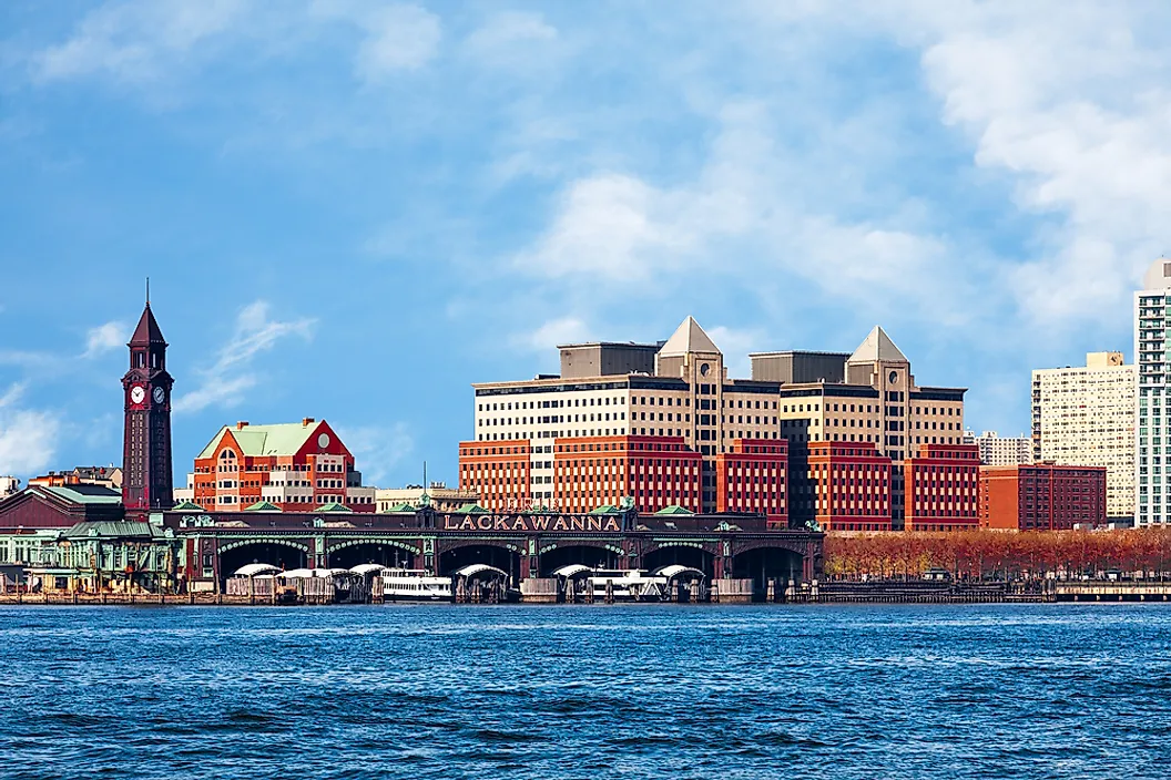
Hoboken started as an island. The rocky high ground around Castle Point made up only about a quarter of the city's present land area, according to the Hoboken Historical Museum, and the rest was a salt marsh known as the Hoboken Meadows. After Colonel John Stevens bought the land, he had a surveyor lay out a street grid in 1804, and the marsh was gradually filled to make room for it. By the mid-1800s, the western wetlands had been drained and covered with roads, houses, schools, and churches, many of which are still standing.
The old marsh never stopped behaving like one. Much of western Hoboken sits less than five feet above average high tide, and heavy rain routinely pools there. During Hurricane Sandy in 2012, the low western side filled with water, and an estimated 20,000 residents were cut off by flooding. The city has since built a flood-control plan around the shape of the former wetland, with a floodwall along the river and new parks on the west side designed to hold millions of gallons of stormwater underground.
Cape Coral, Florida

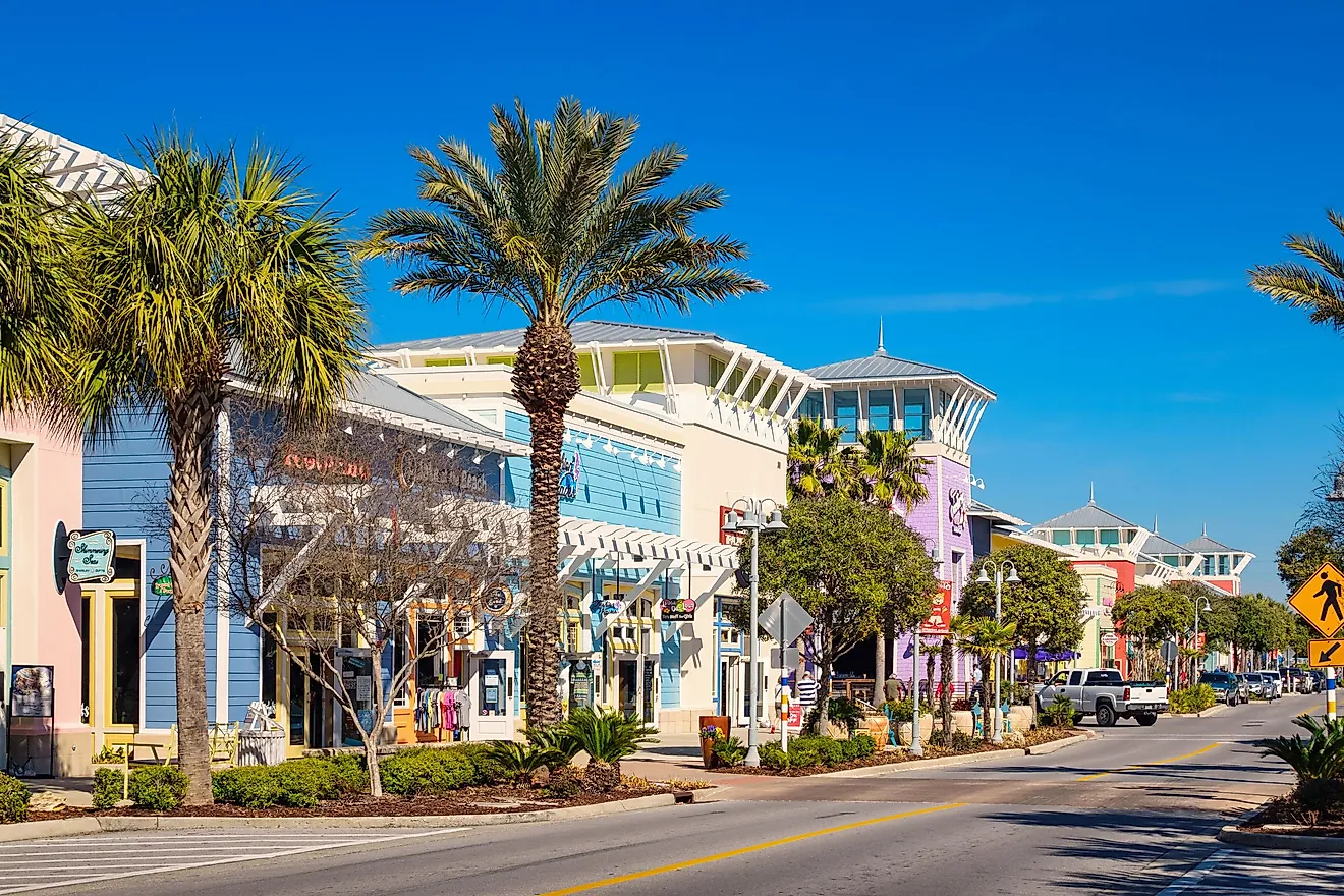
Leonard and Jack Rosen sold shampoo and hair tonic by mail before they sold Florida. In 1957, the Baltimore brothers bought a low-lying stretch of swamp and pine timberland across the Caloosahatchee River from Fort Myers, formed the Gulf American Land Corporation, and set out to dredge and fill it into tens of thousands of home sites. The method was simple and enormous in scale. Crews dug a canal, piled the spoil on either side, and sold the raised lots as waterfront property.
The result is a city laced with more than 400 miles of canals, most of them dug for marketing rather than navigation. Gulf American flew prospective buyers in on its own airline and sold lots by mail across the country until a 1967 Wall Street Journal investigation exposed deceptive sales practices. The city incorporated in 1970 and has since grown into one of Florida's largest. Its residents inherited both the canals and their upkeep, including regular dredging and the constant repair of seawalls holding the filled land in place.
Secaucus, New Jersey

Before the shopping centers, there were pigs. In the first half of the 20th century, Secaucus was known for dozens of pig farms that supplied meat to Newark and New York, along with rendering plants and junkyards, all surrounded by the Hackensack Meadowlands. That vast complex of tidal and freshwater marsh once covered more than 42 square miles of northeastern New Jersey, and by the late 1960s much of it had been diked, drained, dumped on, or filled.
Secaucus changed fastest after the New Jersey Turnpike put an interchange at Route 3, turning a farm town into a hub for shopping, warehouses, and offices. Marsh around the town was filled for commercial districts such as Harmon Meadow and Harmon Cove, now home to malls, hotels, and riverfront towers. In 1968, the state created the Hackensack Meadowlands Development Commission to plan what was left, and the town now sits beside some of the restored wetlands that survived, including Mill Creek Marsh, where walking paths lead past egrets a short distance from the outlet stores.
Land Made, Not Found
Every one of these places was built by people who saw a wetland as unfinished land. In most cases the fill worked well enough to support entire communities for a century or more, but it did not erase what the ground used to be. Low elevations, soft soils, and water that collects where the marsh once drained still shape how these towns build, pay for upkeep, and plan for storms. The wetland is gone from the map, yet it keeps showing up in the budget.