Sahel Of Africa
- The Sahel is a band of territory in Africa that stretches the length of the continent, from the Atlantic coast of Senegal and Mauritania to the Red Sea coast of Eritrea.
- The Sahel acts like a buffer or transition zone between the Sahara Desert to the north and the fertile savannahs to the south.
- The Sahel was once home to several indigenous African kingdoms.
- The Sahel literally means "edge" or "border" in Arabic.
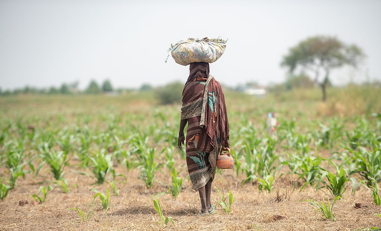
The Sahel region is a large swathe of territory in the northern part of Africa that stretches from the Atlantic coast of the continent to the Red Sea coast. The word “Sahel” literally means “edge” or “border” in Arabic. Indeed, the region represents a physical and cultural border between the Sahara Desert to its north and the more fertile savannah region to its south. Since the region is very long and wide, it also acts as a buffer or a zone of transition between the Sahara and the southern savannahs. The Sahel is generally rocky, semi-arid, and barren, though the geographic conditions can vary. The region passes through several countries. It was once home to several indigenous African kingdoms and is now home to a myriad of ethnic groups.
Geography and Climate

The Sahel is approximately 5,900 km long. Its width differs depending on location, though its average width is 300 km. The total land area of the Sahel is 3,053,200 sq. km. In terms of topography, the Sahel tends to be quite flat. Elevations in the region average between 200 and 400 meters above sea level. The region is home to isolated plateaus and mountain ranges. The highest peak in the Sahel is known as Koel, and is located in Burkina Faso. It is not much of a peak, as it only stands at 448 meters above sea level. Plant life in the Sahel consists of semi-arid grasslands, savanna, and thorn shrub lands.
Some geographers divide the Sahel into northern and southern zones, with the northern zone being dryer and the southern zone being wetter. Though most of the Sahel is semi-arid, the region does contain fertile lands that border the delta region of the Niger River, one of the longest rivers in Africa. These fertile lands, however, are becoming increasingly infertile because of drought, deforestation, and intense agriculture. In effect, the Sahara Desert is slowly expanding into the Sahel.
The Sahel has a tropical climate. Summers are very hot. The maximum mean temperature in the summer can range from 33°C to 36°C. Lows in the region’s temperature average between 18°C and 21°C. The amount of rainfall in the Sahelian south is different from the north. In the southern zone of the Sahel, rainfall can average 600mm per year. In contrast, average rainfall in the north is just 200mm per year. The Sahel also has a rainy season and a dry season. The former lasts from May to September, while the latter lasts six to eight months afterwards. The amount of rainfall in the Sahel is effected by what is known as the Intertropical Convergence Zone, which is a belt of low pressure surrounding the Earth at the Equator. Whenever this zone is far to the north, it creates a long rainy season, but when it does not, rainfall is limited.
Countries of the Sahel

The Sahel passes through 10 African countries. It begins on the Atlantic coasts of Senegal and Mauritania, and passes east through the central parts of Mali, Niger, Chad, and Sudan into northwestern Eritrea, ending at Eritrea’s Red Sea coast. Part of the Sahel also reaches into the extreme northern parts of Burkina Faso and Nigeria, and the extreme south of Algeria. Nigeria is the most populous of the Sahelian countries, with a population of more than 212 million, which also makes it the most populous country in all of Africa, though only a minority portion of that population lies in the Sahelian zone. In fact, most of the Sahel is sparsely populated. There are, however, a few large cities that are situated in the Sahel, including the Mauritanian capital, Nouakchott; the Nigerien capital, Niamey; the Chadian capital, N’Djamena, the Sudanese capital, Khartoum, and the Eritrean capital, Asmara.
African Kingdoms of the Sahel

The Sahel can be a harsh region to live in. Nevertheless, several African kingdoms have prospered in the region. The first large state to materialize in the Sahel was the empire of Ghana, not to be confused with the modern-day country of Ghana in Western Africa, for which it is named. Actually, modern-day Ghana is nowhere near the area that was home to the ancient empire of Ghana. The empire of Ghana was centered in what is now Senegal and Mauritania. It dominated the region between 750 and 1078 CE. The empire of Ghana eventually fell to an invasion by people known as the Almoravids. In the 13th century, however, another empire, known as the Mali Empire, would emerge to dominate the region, reaching its peak in the 1350s. The modern-day country of Mali is named after this once-vast empire. In the mid-15th century, another empire, the Songhai Empire, began expanding rapidly. At its peak, the Songhai Empire stretched from Cameroon to the Maghreb, making it the largest state in African history.
Far towards the east, in the vicinity of Lake Chad, the state of Kanem-Bornu was founded. It would emerge to become a prominent power in the central Sahel region. To the west of Kanem-Bornu were city-states controlled by the Hausa ethnic group. These Hausa were subsequently conquered by the Fulani Empire in the early 19th century. Kanem-Bornu and the Fulani Empire endured until the arrival of Europeans.
People of the Sahel

The Sahel is home to several people and cultures. The most northerly ethnic group of the Sahel region are the Tuareg, a people of Berber origin, whose Sahelian people live in northern Mali and northern Niger. Further to the west are the Soninke, the ethnic group that founded the Ghana Empire. The modern-day Soninke live near Bakel, on the Senegal River, and in countries neighboring Senegal. Not too far from the Soninke are the Malinke, who founded the Mali Empire. They now live in the Senegalese and Malian parts of the Sahel region. The Songhai, who founded the empire of the same name, live in the southern parts of the Sahel, mainly in western and southern Niger, eastern Burkina Faso, and along the Niger River in Mali. The Hausa and Fulani, who are strongly tied to each other, live mainly in northwestern Nigeria, and southern Niger. Arabs are the dominant population in the Sahelian countries of Sudan and Mauritania. Other notable ethnic groups in the Sahel include the Kanuri in the vicinity of Lake Chad, the Wolof in northwestern Senegal, and the Fur of western Sudan.