Which Countries Border Uganda?
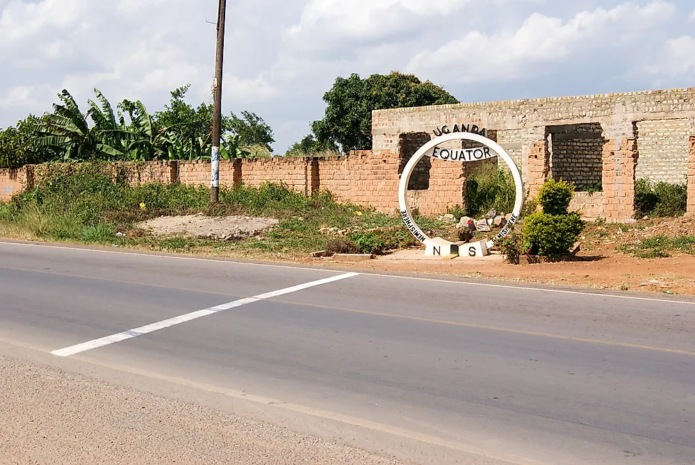
Uganda’s land border spans 1,696 miles in length and separates the country from the five neighbors. Uganda borders Rwanda, Kenya, the DRC, Tanzania, and South Sudan. The Uganda-South Sudan border is the youngest of Uganda’s international borders as it was established in 2011 when South Sudan became an independent country. The shortest of Uganda’s international borders is its border with Rwanda which is 107 miles long, while the DRC-Uganda border is Uganda’s longest international border as it stretches 545 miles in length. All of Uganda’s borders were demarcated in the late 19th Century by European colonial authorities during the Scramble for Africa, and Uganda maintained the demarcation after it gained independence from Britain.
The DRC
The Democratic Republic of Congo is situated west of Uganda. The two countries share a long land border which starts at the DRC-Uganda-South Sudan tripoint and ends at the Uganda-DRC-Rwanda tripoint. Two lakes straddle the international border, and these are Lake Edward and Lake Albert. The border separating the two nations is Uganda’s longest international border, stretching 545 miles in length. Like all of Uganda’s border, the DRC-Uganda border was first demarcated during the Scramble for Africa and establishment of European colonies in Africa which took place in the late 19th Century, and the two countries retained the colonial definition of the border after gaining independence in the 20th Century. Security patrols along the border are insufficient to control the rampant smuggling of people and commodities across the border.
Refugees from the DRC
The two countries have had a violent past and gone through numerous civil wars. As a result, the border has experienced crossings by refugees as people fled their home countries. A recent example is an ethnic conflict between the Hema and Lendu, two tribes in the DRC who have been at war against each other over land. The ethnic strife has seen thousands of people fleeing into neighboring Uganda. However, the journey is dangerous with the 2,046-square-mile Lake Albert standing between the refugees and the refuge they seek in Uganda. Uganda has established refugee camps in the town of Sebaguru where the refugees can receive humanitarian assistance.
Tanzania
Tanzania is Uganda’s southern bordering nation, and two countries share a 243-mile long land border. The land border starts at the tripoint connecting Rwanda, Uganda, and Tanzania, and moves east following a straight line until it meets Lake Victoria. The border was first demarcated in 1894 when Uganda became a British Protectorate during the infamous "Scramble of Africa" when European powers of the 19th Century divided the continent of Africa amongst themselves. The border’s demarcation would undergo numerous adjustments in subsequent years. Tanzania, which gained independence earlier than Uganda, decided to retain the border as it stood in the colonial era, a decision which was upheld by Uganda after it gained independence.
Cross-Border Relations
The Uganda-Tanzania border is porous, with illegal crossings and smugglings being rife on many sections of the border. The Mutuluka border post is the primary border crossing point on the Uganda-Tanzania border. The two countries have established a one-stop border post at Mutuluka aimed at hastening the movement of goods across the border. In 2018, Tanzania started remarking its border with Uganda, replacing old beacons along the border. The tight diplomatic ties shared by the two countries is evident in the bilateral trade and development agreements Tanzania and Uganda have signed in recent years. A lack of electricity connectivity is a problem that had been faced by villages along the Tanzania-Uganda border, a problem the governments of the bordering nation have decided to resolve. The cross-border electrification project is estimated to cost about $0.8 million is financed by the governments of Tanzania and Uganda.
Kenya
Uganda is bound to the east by Kenya, and the two countries share a long land border. The tripoint connecting the two countries to South Sudan marks the start of the Kenya-Uganda border, and moves south to the shores of Lake Victoria, covering a distance of 506 miles. Mount Elgon, a towering extinct volcano, is a dominant geological feature found on the border. Like all of Uganda’s borders, the Kenya-Uganda border was demarcated when the British were establishing the East African colony. There are two main border crossings on the Kenya-Uganda border; the Busia crossing point and the Malaba crossing point. Cross-border movement at the two crossing points is managed by custom and immigration officials drawn from the two countries.
Border Incidents
During the demarcation of the border, the British made no consideration of the cultural impact of the border. The border cut out people of the Luo tribe who inhabit the region around the border. In past years, pastoralist tribes would cross the border to steal cattle from tribes on opposite sides of the border. This tradition of cattle rustling which had been practiced for generations among the Karamojong tribe in Uganda and Pokot in Kenya often resulted in numerous deaths. However, both countries have improved security along the border, and the number of these incidents have decreased in recent years. The border witnessed a surge in cross-border movement in early 2008 as thousands of Kenyans fled from the violence that had engulfed the country since late 2007, settling as refugees in Uganda. Uganda received the refugees and provided humanitarian aid assisted by UN agencies.
Migingo Island
Lake Victoria is home to numerous islands, and one of the tiniest ones is Migingo Island. Despite being less than 0.5 acres in size, the island is home to over 130 people. The interest in the small island is due to its proximity to waters of the lake rich in Nile Perch. This densely populated island has been the center of an ongoing territorial dispute between Uganda and Kenya. Kenya’s claim to the island stems from the provisions of an Order of Council from the British Colonial Administration written in 1926 which defined the island as part of Kenyan territory. However, Uganda has its police force stationed in the island and requires residents to possess Ugandan work licenses. In 2009, senior government officials from two countries reached an agreement which allowed citizens from Uganda and Kenya to reside on the island without government interference.