The Most Extreme Points of North America
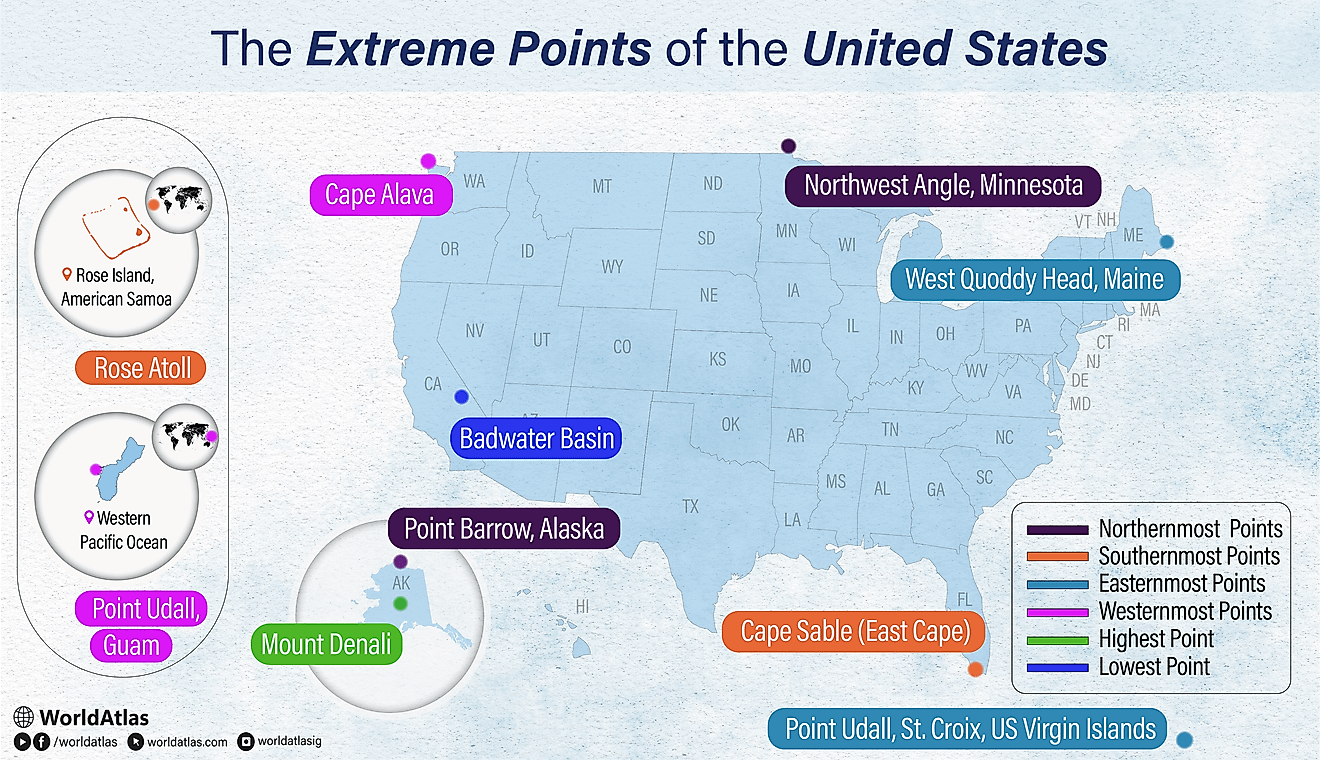
Covering a staggering 9.5 million square miles, North America is a colossal piece of land representing a significant portion of Earth's overall landmass. On that landmass, seven peculiar points of interest reside: Kaffeklubben Island, Cocos Island, Attu Island, Nordostrundingen, Denali, Badwater Basin, and Rugby. At first glance, it might seem that these fringe locations share nothing in common. However, each location marks an extreme point on this massive continent. Brace yourself for a voyage across the continent to uncover North America's seven most-remarkable extremes.
The Locations of North America's Most Extreme Points
| Extreme Point | Location |
|---|---|
|
Kaffeklubben Island, Greenland |
|
|
Cocos Island, Costa Rica |
|
|
Nordostrundingen, Greenland |
|
|
Attu Island, Alaska, USA |
|
|
20,310 feet: Denali (Mt. McKinley), Alaska, USA |
|
|
-282 feet: Badwater Basin, California, USA |
|
|
Rugby, North Dakota, USA |
Northernmost Point — Kaffeklubben Island, Greenland
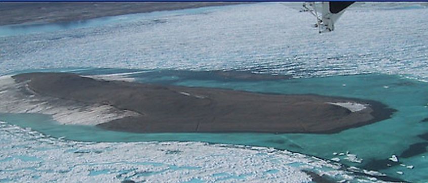
Located 23 miles (37 kilometers) north of Cape Morris Jesup, Greenland, Kaffeklubben Island is not only the northernmost point in North America but also the northernmost point on Earth. The island spans approximately 2,300 feet (700 meters) long and 980 feet (300 meters) wide.
The American Arctic explorer Robert E. Peary discovered the island in 1900. A Danish explorer, Lauge Koch, later visited the island in 1921 and named it "Kaffeklubben," meaning Coffee Club in Danish. The island is not inhabited, as it is essentially a polar desert with summers that only last approximately 30 days. While researchers have occasionally found gravel banks further north, Kaffeklubben Island is still considered the northernmost point, as the gravel banks are not permanent land masses.
Southernmost Point — Cocos Island, Costa Rica
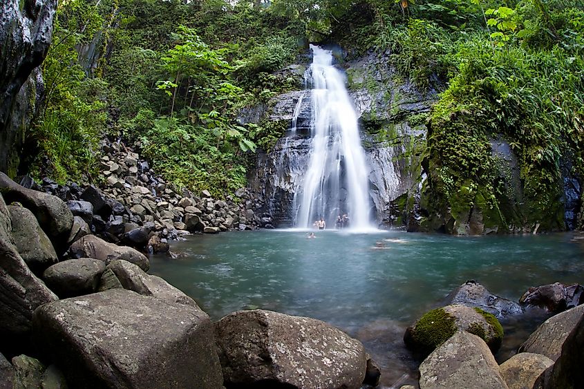
Cocos Island, Costa Rica, is located in the Eastern Tropical Pacific and is approximately 342 miles (550 kilometers) from the Pacific coast of Costa Rica. It has a surface area of only 9.3 square miles (24 square kilometers). The marine conservation network, Eastern Tropical Pacific Marine Corridor, owns the territory, and due to its remote location and efforts by conservationists, Cocos Island is one of the best-preserved tropical waters in the world. Because of this preservation, divers from around the world visit it to see highly diverse coral reefs that contain a variety of aquatic species, including dolphins, sharks, rays, and tunas.
Additionally, Cocos Island is the only island with a Tropical Rainforest in the Eastern Tropical Pacific. UNESCO declared the island a national park in 1997 because of this rich and unique biodiversity. Tourists can visit the island by boat from the Port of Puntarenas in Costa Rica, but the boat ride takes approximately 36 hours.
Easternmost Point — Nordostrundingen, Greenland
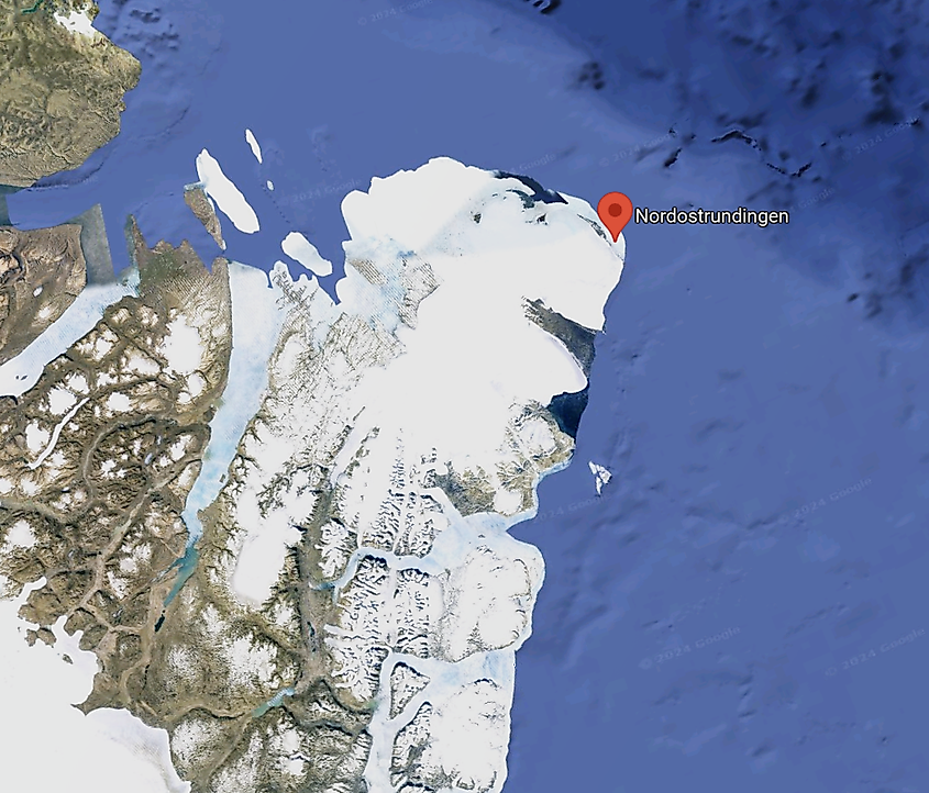
Nordostrundingen, meaning Northeastern Rounding in English, is a point in the northeastern part of Greenland where an ice slope meets the sea. The land is under the administration of The Northeast Greenland National Park. A group of Danish voyagers gave Nordostrundingen its name during an expedition between 1906 and 1908. Coastal Greenland has a polar tundra climate, with winters being below freezing and summers ranging between 32 to 50 degrees Fahrenheit (0 to 10 degrees Celcius). To visit Greenland, one must take a flight from Iceland or Denmark. Air Greenland and Iceland Air are the only two airlines that currently offer flights to the country.
Westernmost Point - Attu Island, Alaska USA
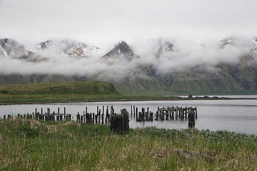
Attu Island, Alaska, is approximately 1,100 miles (1,700 kilometers) from mainland Alaska. It spans 20 by 35 miles (32 by 56 kilometers) and is even further west than the Hawaiian Islands. Even during the summer, much of the island is blanketed by snow. It is frequently rainy, cloudy, and foggy, and sunny days are few and far between.
Prior to World War II, the Aleuts, an indigenous group of the Aleutian islands in Alaska, resided on the land. In 1942, amid the war, the Japanese invaded the island, with the American military recapturing it about a year later due to fears that the Japanese would use it as a foothold to launch attacks against mainland North America. Today, the only residents on the island are US Coast Guard personnel.
Highest Point — Denali, Alaska USA
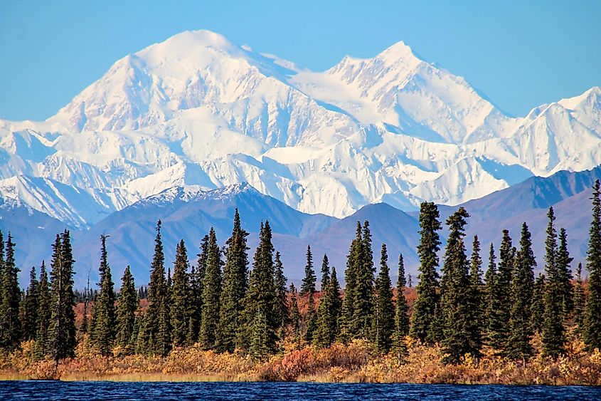
Located in Alaska, Denali (formerly named Mount McKinley) is the tallest mountain in North America at 20,310 feet (6,190 meters). Denali is approximately 130 miles (210 kilometers) northwest of Anchorage, Alaska, and is part of Denali National Park. The name "Denali" originates from the traditional Alaskan language, Koyukon, and means "the tall one." In 1917, Congress approved an official name change to Mount McKinley following the assassination of President William McKinley, despite the fact that President McKinley had never visited Alaska. President Barack Obama and Secretary of the Interior Sally Jewel officially changed the name to Denali again in 2015 following a movement led by Native Alaskans to honor the original name and local language.
Denali is a highly challenging mountain to climb due to harsh weather conditions and steep inclinations. Harry Karstens, Hudson Stuck, and their climbing team were the first recorded climbers in 1913 to reach the summit. While the National Park Service does not require a guided service to climb the mountain, they do recommend that only seasoned climbers who have successfully climbed other glaciated peaks attempt the trek, as it can otherwise be a dangerous endeavor.
Lowest Point — Badwater Basin, California USA
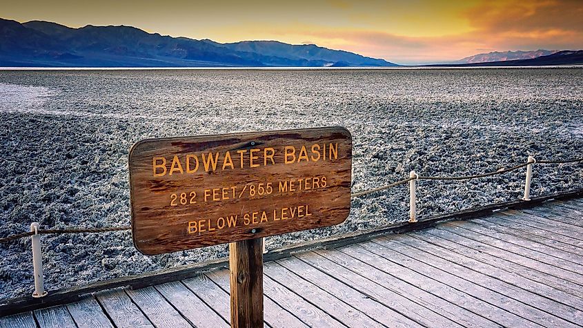
Badwater Basin, at 282 feet below sea level, is the lowest point in North America. Two hundred square miles (518 square kilometers) of salt flats cover the basin. The salt flats are composed mainly of sodium chloride (table salt), calcite, borax, and gypsum. Thousands of years ago, Badwater Basin was a large lake that has since evaporated, leaving behind the salt deposits. Tourists can visit Badwater Basin in Death Valley National Park, although the park does not advise hiking in the summer after 10 am due to the scorching temperatures in the area.
Geographic Central Point — Rugby, North Dakota USA
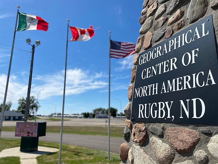
The United States Geological Survey (USGS) defines the Geographic Central point as the center of gravity of a given surface. In other words, it is a surface's most centric-point. While geographers debate the actual geographic central point of North America, the USGS determined Rugby, North Dakota, to be the geographic center in 1931. Visitors can find a 15-foot monument recognizing this point at the intersection between US Highway 2 and North Dakota Highway 3.
In 2015, however, Peter Robinson, a geography professor from the University of Buffalo, invented a new method to determine geographic centers. Using his calculation, he found the North American geographic center to be 145 miles southwest in a town called Center in Oliver County, North Dakota. This claim, however, has not been confirmed by the USGS.
Final Thoughts
While geographers still occasionally debate the locations of these extreme points in North America, the ones outlined above stand as the most widely acknowledged. The fact that almost every location above possesses a unique climate and ecosystem demonstrates how diverse North America is as a region and reminds us of the importance of travel and exploration.
