Salt Flats of the World
Salt pans are large flat grounds covered with salt and other minerals. They are common in deserts and shine under the sun. Salt flats are formed by the evaporation of water bodies such as lakes or ponds, especially in places where the rate of evaporation is considerably higher than the rate of precipitation such as in deserts. Water that cannot be infiltrated into the ground often evaporates, living behind minerals and salt particles. The salts and minerals form on the surface over several years creating a salt pan. Salt pans can be dangerous if they conceal mud beneath it. The concealed mud can engulf a truck.
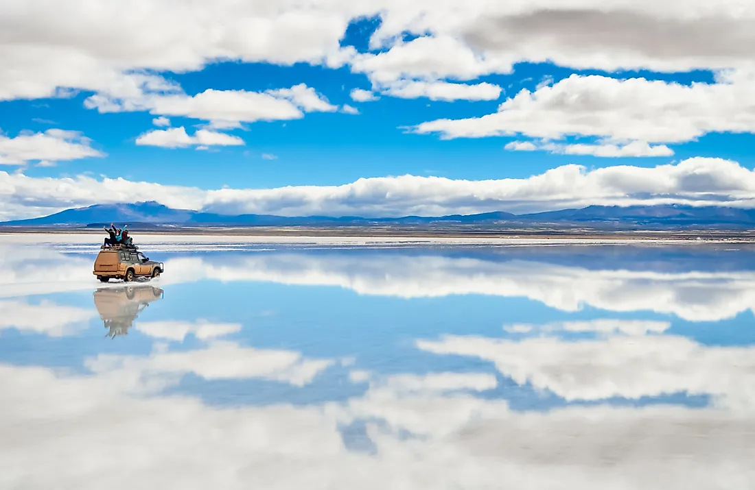
5. Salar de Uyuni
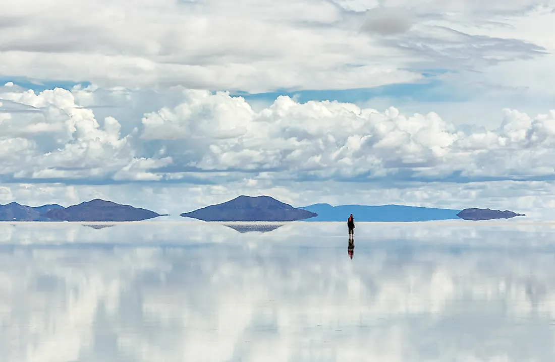
Salar de Uyuni covers an area of about 4,085 square miles. The salt flat is found in Bolivia next to the area around the Andes in Daniel Campos Province. It resulted from the transformation of several prehistoric lakes that dates between 30,000 and 40,000 years ago. Lake Minchin transformed into Paleo Lake Tauca whose depth was about 459 feet. When the lake completely dried, two other lakes were left behind with two salt flats, Salar de Coipasa and the Salar de Uyuni, also formed. The latter is covered with a thick crust of salt which is a major source of salt. The crust also accounts for about 60% of the known lithium deposit in the world.
4. Bonneville Salt Flats
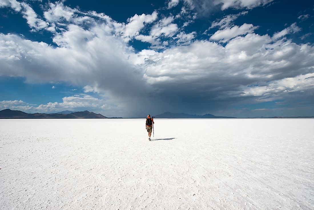
Bonneville Salt Flats covers parts of the Tooele County, Utah. It is one of the several salt pans covering the western parts of the Great Salt Lake. The area covered by the salt pan was once the site for Lake Bonneville. The salt flats are about 12 miles long and cover an area of about 45 square miles. The depth of the crust increases towards the center of the flat, reaching about 5 feet at the thickest point. Bonneville Salt Flats is under the management of the Bureau of Land Management and it is opened to the public. The salt flat has hosted motorcar racing since 1914 with the racing taking place at Bonneville Speedway.
3. Etosha Pan
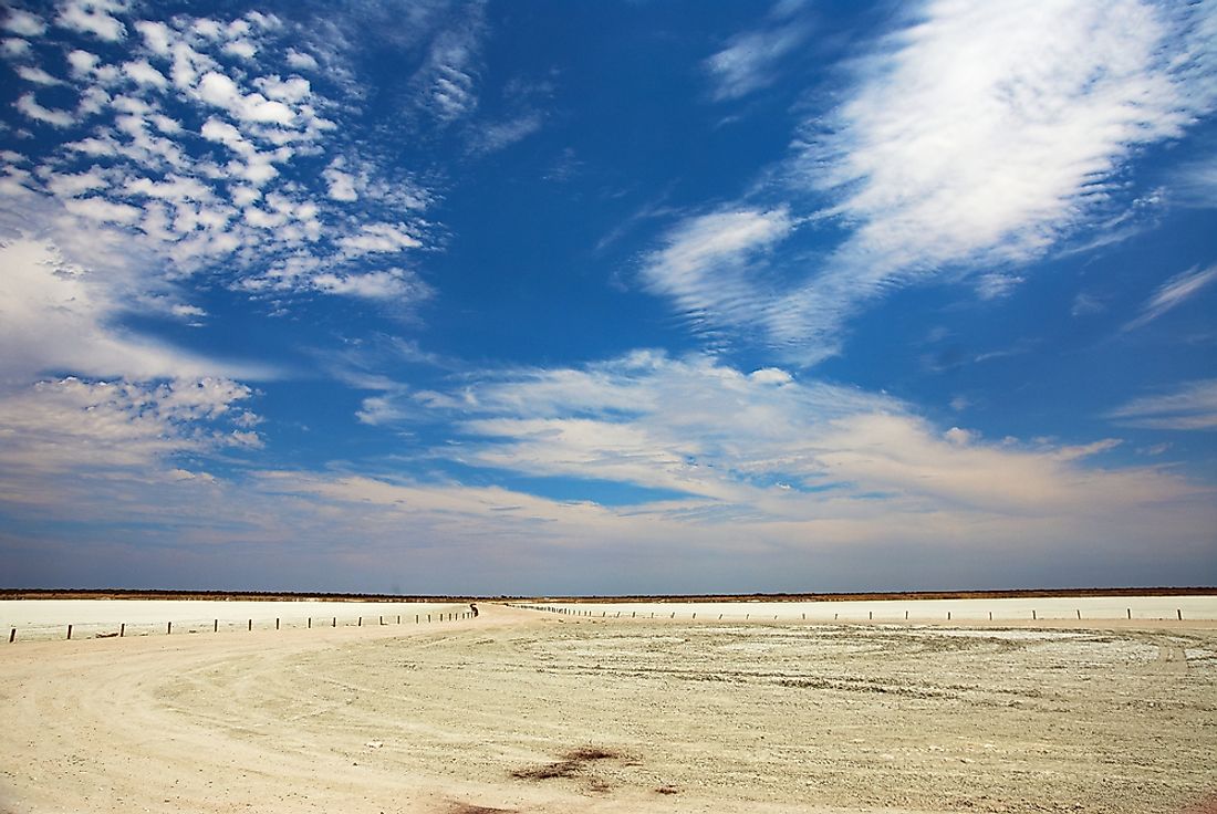
Etosha Pan is part of the Kalahari Basin located in northern Namibia. It measures 75 miles long and is protected by the Etosha National Park. The pan is often dry but the heavy rains form a thin layer of heavily salted water. The salt flat is characterized by white and greenish surface spreading over 1,850 square miles. The salt pan was developed over 10 million years ago through a tectonic plate activity.
2. Cono de Arita
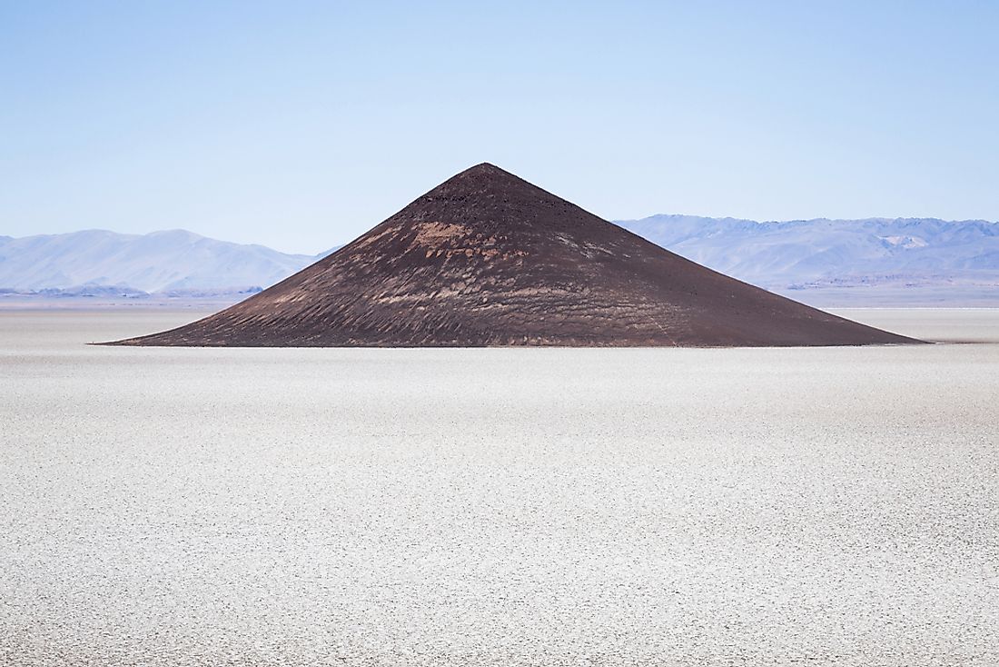
Salar de Arizaro is the sixth largest salt flat in the world and the second largest in Argentina. The salt flat is situated in Los Andes Department, Salta Province. It covers an area of approximately 618 square miles. The salt pan is an important mine for metallic and non-metallic minerals including salt, copper, iron, and marble. An outstanding feature on Salar de Arizaro is the conical hill known as Cono de Arita, a small volcano that lacked the strength to burst through the crust so it never developed crater.
1. Devil's golf course
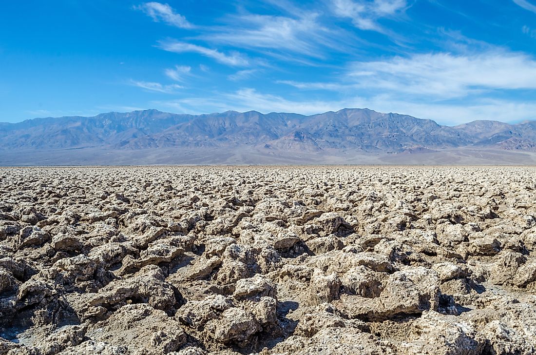
Devil's golf course covers the surface of the Mojave Desert which is within the Death Valley National Park. The valley was initially covered by Lake Manly to a depth of about 30 feet. However, the lake’s water evaporated with time leaving behind the salt flat containing minerals that were part of the lake’s water. The Devil's golf course is located several feet above the valley floor causing it to remain dry most of the time and allowing the weathering process to disintegrate salt into complex formations.


