Maps of Taiwan

Taiwan is an island country located at the western edge of the Pacific Ocean. The main island of the country covers an area of 35,808 sq. km.
About two-thirds of Taiwan is a rugged mountain landscape. As observed on the physical map of Taiwan, the Chung-yang Shan range (central) dominates the island. It has over 200 peaks exceeding 3,000 m in elevation.
The upright yellow triangle on the map represents the highest point of Taiwan. It is the 3,952 m tall Yu Shan located in the central mountain region.
West of the central mountain range the land is covered by rolling hills that descend gently into a somewhat flat region, north to south.
Taiwan is a geologically active island; earthquakes are frequent and the island is punctuated by numerous steam vents and hot sulfur springs. In fact, Taiwan experiences as much as 15,000 to 18,000 earthquakes each year; 800 to 1,000 of which are noticed by people.
Taiwan is a geologically active island; earthquakes are frequent and the island is punctuated by numerous steam vents and hot sulfur springs. In fact, Taiwan experiences as much as 15,000 to 18,000 earthquakes each year; 800 to 1,000 of which are noticed by people.
The largest body of water in Taiwan is Sun Moon Lake; as well, there are over 150 rivers and large streams rising in the central mountains, with the most significant rivers including the Choshui and Kaoping.
It claims numerous (small) islands within its immediate territories and off the coast of China, including the islands of Quemoy, Matsu and Wuchiu.
The South China Sea is the lowest point of Taiwan at 0 m.
Counties of Taiwan Map

The country includes the main island of Taiwan plus smaller islands nearby and off coast of China's Fujian Province.
Taiwan is divided into 13 counties, 3 cities, and 6 special municipalities directly under the jurisdiction of the Executive Yuan.
The 13 counties are: Changhua, Chiayi, Hsinchu, Hualien, Kinmen, Lienchiang, Miaoli, Nantou, Penghu, Pingtung, Taitung, Yilan, Yunlin.
The 3 cities are: Chiayi, Hsinchu, Keelung.
The 6 special municipalities are: Kaohsiung (city), New Taipei (city), Taichung (city), Tainan (city), Taipei (city), Taoyuan (city).
Taipei city located in northern Taiwan serves as the country's capital city.
Where is Taiwan?

Taiwan (Republic of China) is located about 160 km off the Southeast coast of the continent of Asia, at the western edge of the Pacific Ocean between Japan and the Philippines. It is located in the Northern and Eastern hemispheres of the Earth. It is bounded by the East China Sea in the north and the Ryukyu Islands in the northeast. The vast Pacific Ocean lies to the east of Taiwan, and the Bashi Channel to the south. The Formosa or Taiwan Strait separates it from mainland China.
Regional Maps: Map of Asia
Outline Map of Taiwan


Key Facts
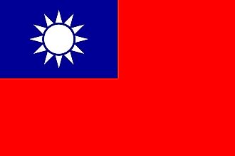
| Legal Name | Taiwan |
|---|---|
| Flag |
|
| Capital City | Taipei |
| 25 02 N, 121 31 E | |
| Total Area | 35,980.00 km2 |
| Land Area | 32,260.00 km2 |
| Water Area | 3,720.00 km2 |
| Population | 23,545,963 |
| Major Cities |
|
| Currency | New Taiwan dollars (TWD) |
This page was last updated on February 24, 2021