The World's Most Famous Valleys
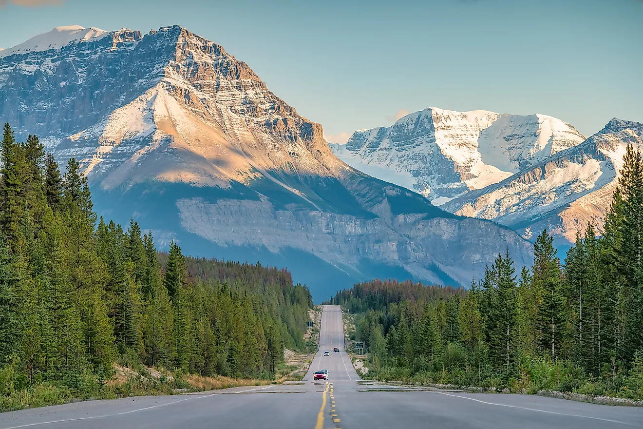
- The Valley of the Ten Peaks is such an iconic representation of Canadian wilderness that it used to feature on the back of their twenty dollar bill.
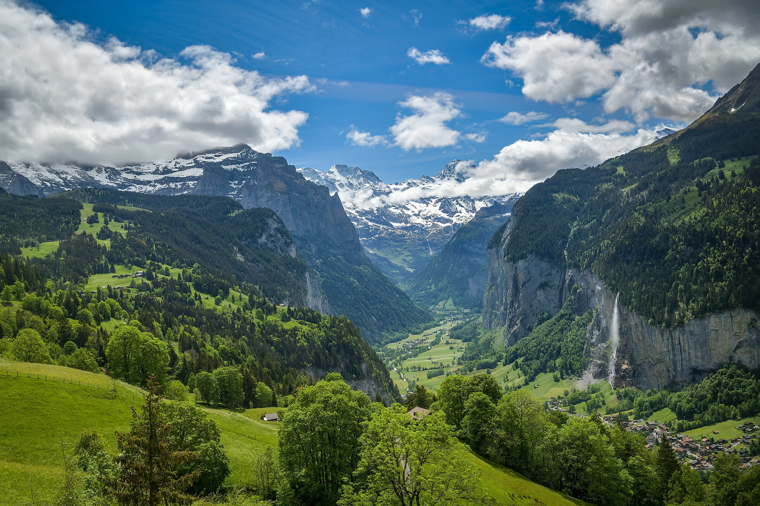
- Lauterbrunnen Valley in Switzerland is so picturesque that Lord of the Rings author J.R.R. Tolkien modeled the Elven kingdom of Rivendell after it.
- Nepal's Barun Valley is such a mystical-looking paradise that it is known in Buddhist folklore as a place where no one ages.
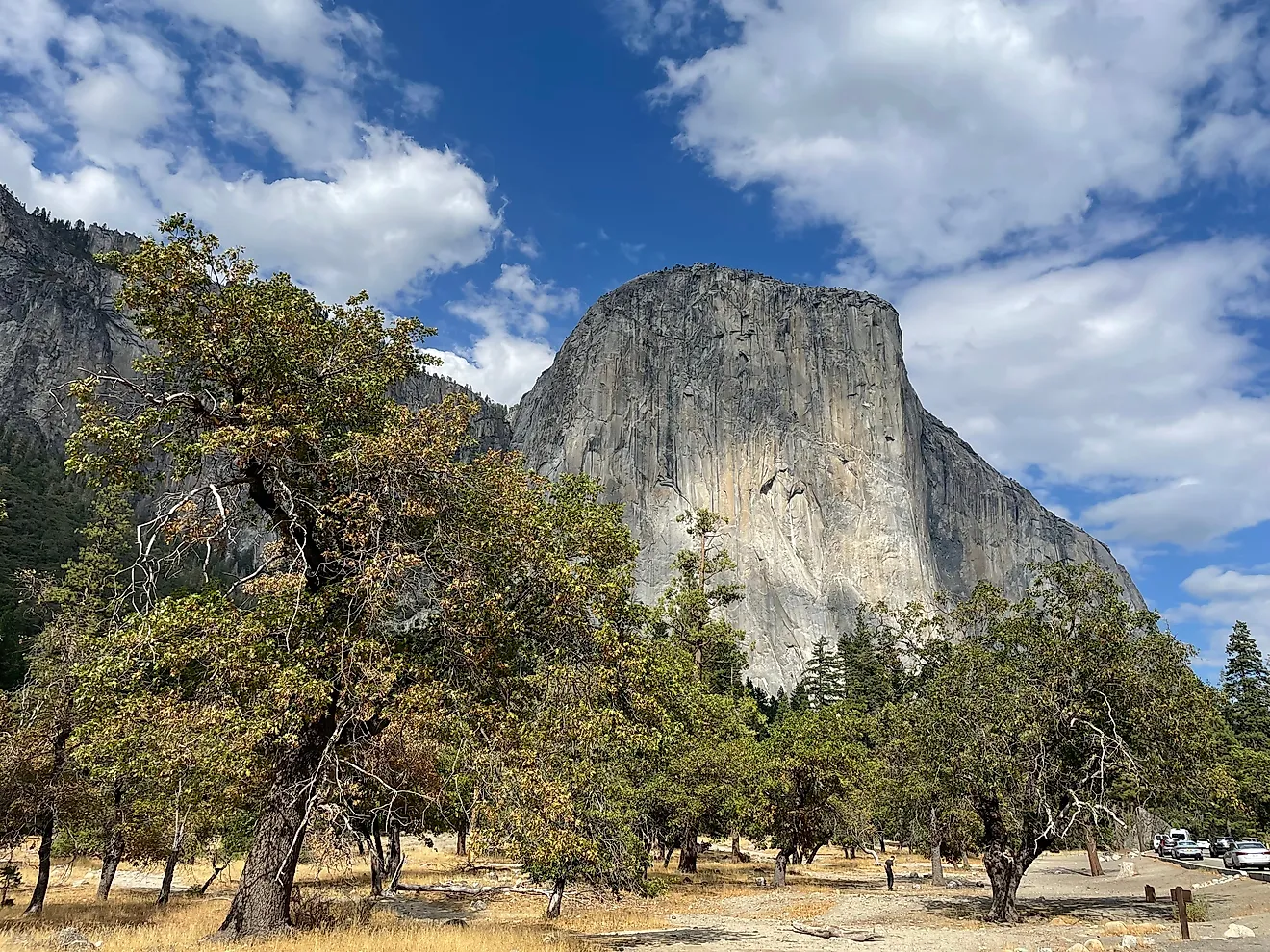
The Valley of the Ten Peaks rode the back of the Canadian twenty-dollar bill from 1969 to 1979. Yosemite Valley's El Capitan became the most-watched single rock climb in history when Alex Honnold soloed the 3,000-foot face without a rope on June 3, 2017. Lauterbrunnen Valley is the landscape J.R.R. Tolkien used as the model for Rivendell after walking it as a 19-year-old in the summer of 1911. The ten valleys below each earned their fame the long way: one specific landscape feature or human encounter that the rest of the world has not been able to ignore.
Valley of the Ten Peaks, Canada

The Valley of the Ten Peaks sits inside Banff National Park in southwestern Alberta and earned its place on Canadian currency for what tourists call the Twenty Dollar View: Moraine Lake's brilliantly turquoise water (the color comes from suspended glacial rock flour) backed by the ten snow-capped Wenkchemna Peaks (the Stoney Nakoda word for "ten"). The composition appeared on the back of the Canadian twenty-dollar note in two consecutive series, the Scenes of Canada (1969-1979) and the Birds of Canada (1986-1996, briefly, on the special $20 commemorative). Deltaform Mountain at 3,424 meters (11,234 feet) is the tallest of the ten peaks. Access to the lake closes seasonally from mid-October through late May because the access road is not plowed; in summer, private vehicle traffic is now restricted to a Parks Canada shuttle system due to overcrowding.
Yosemite Valley, United States

Yosemite Valley is a seven-mile glacial trough in the central Sierra Nevada that became the first land in United States history protected by the federal government for public use. President Abraham Lincoln signed the Yosemite Grant on June 30, 1864, deeding Yosemite Valley and the Mariposa Grove of giant sequoias to the State of California for "public use, resort, and recreation," eight years before Yellowstone became the first national park. Half Dome (8,839 feet) and El Capitan (the 3,000-foot vertical granite face that Alex Honnold soloed without a rope on June 3, 2017, in the climb documented in the Oscar-winning film Free Solo) anchor the valley's signature views. Yosemite Falls, the tallest waterfall in North America at 2,425 feet across three drops, runs full-flow in spring and dries to a trickle by late summer. Ansel Adams photographed the valley for more than 60 years, and the visual vocabulary of American landscape photography is largely his Yosemite work.
Kalalau Valley, United States

Kalalau Valley sits on Kauai's Na Pali Coast and is the largest of the seven hanging valleys carved into the island's northern shoreline by 5 million years of rainfall erosion against volcanic basalt. Access is by the 11-mile Kalalau Trail (regularly cited as one of the most dangerous day hikes in the United States; the National Park Service requires permits for overnight camping and limits the route to 60 backcountry permits per night), by sea kayak from Haena, or by helicopter. The vertical cliffs of the Na Pali Coast rise to about 4,000 feet directly out of the Pacific, and the valley's seclusion has made it the location for filming sequences in Jurassic Park (1993), King Kong (1976 and 2005), Six Days Seven Nights, and the opening credits of Fantasy Island. The Hawaiian state park designation now prohibits permanent residence in the valley, though a long-standing community of off-grid campers continues.
Valle de la Luna, Chile

Valle de la Luna sits inside Los Flamencos National Reserve in northern Chile's Atacama Desert and is famous for two things: the wind- and salt-carved rock formations that resemble the surface of the Moon, and the fact that NASA and the European Space Agency have repeatedly used the surrounding Atacama as the closest terrestrial analog to Mars. Engineers tested prototypes of the Mars Exploration Rover and the ExoMars rover in the area because the Atacama soil chemistry, ultraviolet exposure, and aridity most closely match Martian surface conditions. The Atacama is the driest non-polar desert on Earth, with some weather stations recording no measurable rainfall in their entire operating history. The valley's salt formations expand and contract with the daily temperature swing, producing audible cracking sounds at sunset that draw cyclists to the salt-crystal viewpoint for the show.
Lauterbrunnen Valley, Switzerland

Lauterbrunnen Valley is the U-shaped glacial trough in the Bernese Oberland of Switzerland that J.R.R. Tolkien walked through in the summer of 1911 at age 19, on the Brookes-Smith family hiking trip from Interlaken across the Bernese Alps. The valley's name translates as "many fountains" and refers to its 72 waterfalls, the most famous being Staubbach Falls at 297 meters (974 feet), one of the highest free-falling waterfalls in Europe. Tolkien confirmed the connection in an August 1967 letter to his son Michael, recalling that Bilbo's journey through the Misty Mountains in The Hobbit was based on his own 1911 trek through the Lauterbrunnen Alps. The visual evidence of his Rivendell sketches places the model here. Goethe wrote his 1779 poem "Gesang der Geister über den Wassern" (Song of the Spirits Over the Waters) at Staubbach Falls, predating Tolkien by 132 years.
Valley of Flowers, India

The Valley of Flowers is a high-altitude meadow in the western Himalayas of Uttarakhand state, India, that British mountaineer Frank Smythe stumbled into in 1931 after a successful summit of Kamet (7,756 meters). His 1938 book The Valley of Flowers brought the place to international attention, and the Indian government designated it a national park in 1982 and added it to the UNESCO World Heritage List in 2005 as an extension of the Nanda Devi World Heritage Site. The valley sits at elevations between 3,200 and 3,600 meters and is open to visitors only from June through October; the monsoon-fed alpine bloom of more than 600 wildflower species peaks from mid-July through mid-August in a riot of color across roughly 87.5 square kilometers. The endangered species roster includes the snow leopard, Asiatic black bear, Himalayan brown bear, and the Himalayan blue sheep (bharal).
Barun Valley, Nepal

The Barun Valley sits at the base of Mount Makalu (8,485 meters), the fifth-highest mountain in the world, and is the central drainage of Makalu-Barun National Park, established jointly with the Qomolangma National Nature Preserve across the Tibetan border in 1992. The combined cross-border protected area covers more than 24,000 square kilometers and protects a vertical gradient from 435-meter subtropical valleys to the 8,485-meter Makalu summit, one of the largest altitudinal ranges in any protected area on Earth. The valley is famous in Tibetan Buddhist tradition as one of the seven sacred beyul, the hidden valleys identified by the eighth-century Indian Buddhist master Padmasambhava (Guru Rinpoche) as refuges where the dharma would survive periods of crisis in the outside world. The wildlife inventory includes the endangered snow leopard, red panda, musk deer, and Himalayan tahr.
Jiuzhaigou Valley, China

Jiuzhaigou Valley sits in the Min Mountains of northern Sichuan Province and was added to the UNESCO World Heritage List in 1992 for its 100-plus terraced lakes, multi-tiered waterfalls, and travertine pools. The lakes' distinctive turquoise color comes from dissolved calcium carbonate from the surrounding limestone karst, the same chemistry that produces the colored pools at Pamukkale, Turkey, and Mammoth Hot Springs at Yellowstone. The August 8, 2017 Jiuzhaigou earthquake (magnitude 7.0) damaged several of the park's most famous features, including the partial collapse of Sparkling Lake's underwater dam and the Nuorilang waterfall, and the park closed for partial restoration through 2018-2019 before fully reopening. The Tibetan name Jiuzhaigou ("Valley of Nine Villages") references the nine Amdo Tibetan villages that historically inhabited the valley.
Danum Valley, Borneo

The Danum Valley Conservation Area in Sabah, Malaysian Borneo, protects 438 square kilometers of primary lowland dipterocarp rainforest, one of the largest remaining tracts of completely undisturbed lowland tropical rainforest in Southeast Asia (most Bornean lowland forest was logged or converted to oil palm in the 20th century). The British Royal Society Southeast Asian Rainforest Research Programme has run a continuous scientific research base at the Danum Valley Field Centre since 1986, producing one of the longest unbroken biodiversity-monitoring datasets in the tropics. The valley's wildlife includes the Bornean orangutan, the Bornean pygmy elephant (the world's smallest elephant subspecies), the clouded leopard, the proboscis monkey, and more than 300 bird species. The Borneo Rainforest Lodge, accessible by 2.5-hour drive from Lahad Datu, is the only tourist accommodation inside the conservation area.
Valley of Geysers, Russia

The Valley of Geysers in the Kronotsky Nature Reserve on the Kamchatka Peninsula was unknown to outsiders until April 14, 1941, when the Soviet geologist Tatyana Ustinova and her local Itelmen guide Anisifor Krupenin discovered the geyser field on a winter survey of the Shumnaya River. The basin contains the second-largest concentration of geysers in the world after Yellowstone, with about 90 geysers and pulsating thermal springs along a 3.7-mile stretch of river canyon. The June 3, 2007 mudflow buried approximately one-third of the valley including some major geysers under sediment up to 60 meters thick; some buried geysers have since reactivated, and a new lake formed by the slide drains and refills periodically. The valley is part of the Volcanoes of Kamchatka UNESCO World Heritage Site and is accessible only by helicopter from Petropavlovsk-Kamchatsky, about 100 miles south.
How Each One Made The Map
What makes a valley famous tends to be one thing the rest of the world cannot replicate or look away from. Lauterbrunnen had Tolkien's pen. Yosemite had Lincoln's signature in 1864 and Alex Honnold's rope-free climb in 2017. Valle de la Luna had NASA testing Mars rovers in its salt formations. The Valley of the Ten Peaks rode the back of a national currency for a decade. The Valley of Geysers had the only major geyser field on Earth outside Yellowstone, plus a 2007 landslide that rewrote the geography in a single afternoon. Each of the ten earned its place the long way.