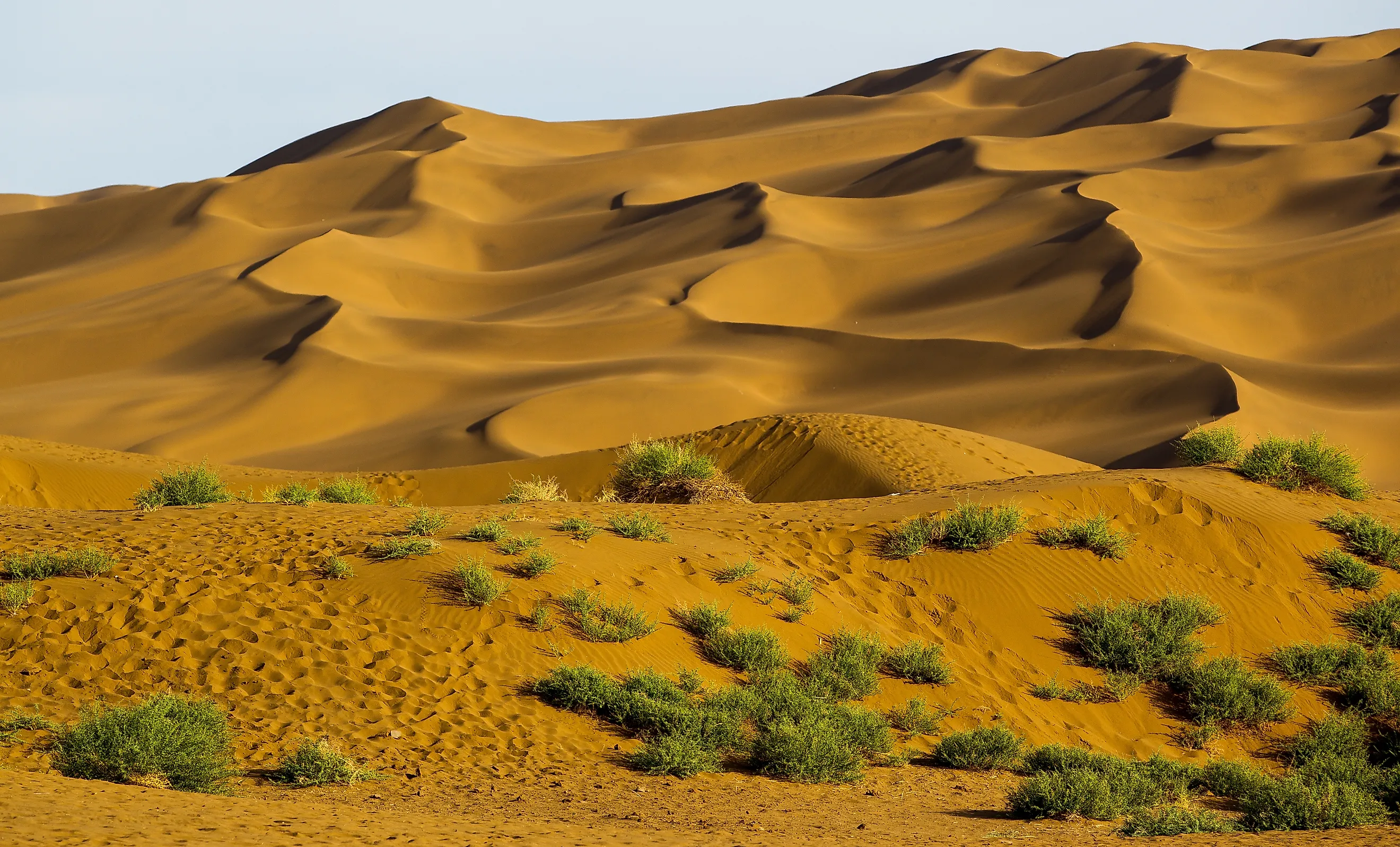
The Deserts Of Asia
Asia holds the largest concentration of true (non-polar) deserts on Earth. The continent's arid lands stretch in an almost continuous belt from the Mediterranean coast of the Arabian Peninsula through the Iranian Plateau, across Central Asia, and into the Tarim and Gobi basins of western China and Mongolia, broken only by the Caspian-Black Sea corridor and a few wetter mountain ranges. The deserts arise from a combination of subtropical high-pressure dynamics (in the Arabian Desert and the Thar), continental interior dryness in the heart of Eurasia (Karakum, Kyzylkum, Gobi), rain shadow effects from the Tibetan Plateau and Pamir-Hindu Kush ranges (Taklamakan, Lop, Dasht-e Kavir), and tectonic basin formation (the salt-floored Iranian basin deserts). Their physical character ranges from the sand seas of the Empty Quarter to the rocky gobis of Mongolia, the salt kavirs of central Iran, and the gravel reg of southern Afghanistan. The eighteen deserts described below cover roughly six million square kilometres of Asian territory and are listed by area, largest first.
1. Arabian Desert - 2,330,000 km²

The Arabian Desert covers most of the Arabian Peninsula and is the largest desert in Asia, the largest in the world south of the polar deserts after the Sahara, and the fifth-largest desert overall by most rankings. It extends across Saudi Arabia, Yemen, Oman, the United Arab Emirates, Qatar, Kuwait, and parts of Iraq and Jordan, covering approximately 2,330,000 square kilometres. The desert is geologically composed of two principal sand seas: the Rub' al Khali ("Empty Quarter") in the south, which is the largest contiguous sand desert on Earth at about 650,000 square kilometres, and the An-Nafud in the north, joined by the long Ad-Dahna sand corridor.
Summer surface temperatures reach 50°C and winter nights can drop below freezing in the higher elevations. Annual precipitation across most of the desert is below 100 mm and below 35 mm in the Rub' al Khali. The desert's fauna is sparse but specialised, including the Arabian oryx (Oryx leucoryx, reintroduced after near-extinction in the 1970s), the Arabian sand cat (Felis margarita harrisoni), the sand gazelle (Gazella marica), and the Arabian wolf (Canis lupus arabs). The Arabian Desert sits atop some of the world's largest proven petroleum reserves, particularly the Ghawar Field in Saudi Arabia, the largest conventional oil field ever discovered.
2. Gobi Desert - 1,295,000 km²
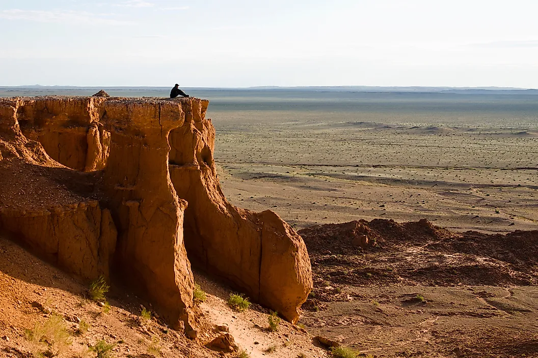
The Gobi Desert covers approximately 1,295,000 square kilometres across southern Mongolia and northern China, making it Asia's second-largest desert. It is a cold-winter desert formed by the rain shadow of the Tibetan Plateau, which blocks Indian Ocean moisture, and the great continental distance from any sea. Annual precipitation ranges from 50 to 200 mm across the desert, and summer temperatures reach 40°C while winter lows drop to minus 40°C, one of the broadest temperature ranges of any desert in the world.
Only about five per cent of the Gobi is covered in sand dunes; the remaining ninety-five per cent is rocky steppe, gravel plain, and exposed sedimentary basement, much of it sediments dating to the Mesozoic Era 252 to 66 million years ago. The desert is the most important dinosaur fossil bed in the world: the first scientifically recognised dinosaur eggs were discovered at Bayanzag (the Flaming Cliffs) in 1923 by Roy Chapman Andrews's American Museum of Natural History expeditions. Modern wildlife includes the Bactrian camel (Camelus bactrianus), the Gobi bear (Ursus arctos gobiensis, with only about 40 individuals remaining), the Asiatic wild ass (Equus hemionus), and the snow leopard (Panthera uncia) in the surrounding Altai mountains. Population density across the Gobi averages about one person per square kilometre.
3. Karakum Desert - 350,000 km²

The Karakum Desert ("Black Sands") occupies about 350,000 square kilometres and covers roughly seventy per cent of Turkmenistan, making it the largest desert in Central Asia after the Gobi. The desert lies in a broad basin between the Caspian Sea to the west, the Amu Darya River to the east, and the Kopet Dag mountains marking the Iranian border to the south. It is one of the most sparsely populated deserts on Earth, with permanent settlement essentially limited to the oases at Mary, Tejen, and along the 1,375-kilometre Karakum Canal, which diverts Amu Darya water across the desert to irrigate cotton fields.
The Karakum is best known internationally for the Darvaza gas crater (the "Door to Hell"), a 70-metre-wide, 20-metre-deep collapsed sinkhole in the central Karakum that has been continuously burning since at least the early 1970s. The popular attribution is that Soviet geologists ignited the escaping methane in 1971 to prevent gas dispersal, though documentary evidence for that specific origin is thin and some Turkmen geologists place the ignition later. The Karakum also conceals significant oil and natural gas reserves; Turkmenistan holds the world's fourth-largest proven natural gas reserves, with most of them located beneath the desert.
4. Taklamakan Desert - 337,000 km²
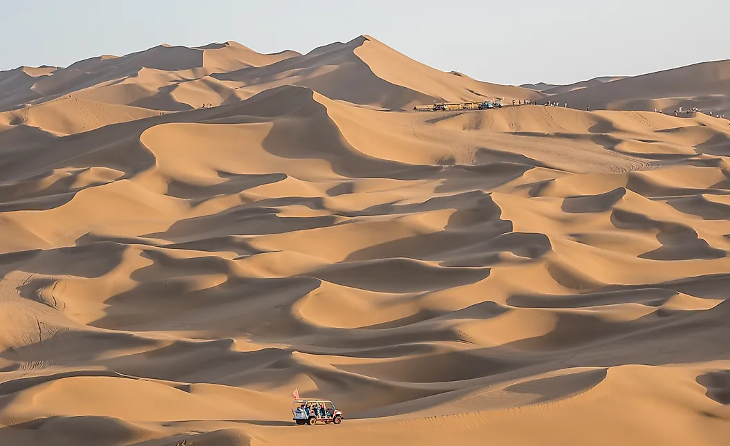
The Taklamakan Desert sits in the Tarim Basin of the Xinjiang Uyghur Autonomous Region of northwestern China and covers about 337,000 square kilometres, almost the size of Germany. It is the world's second-largest shifting-sand desert after the Rub' al Khali, with about 85 per cent of its surface composed of crescent dunes, longitudinal sand ridges, and other mobile dune forms reaching up to 200 metres in height. The desert is bounded by the Tian Shan range to the north, the Kunlun and Pamir ranges to the south and west, and the Gobi Desert to the east.
The name "Taklamakan" is commonly translated as "place of no return," reflecting its lethal reputation among Silk Road travellers. The desert was a key obstacle on the southern branches of the Silk Road, which routed around its northern and southern margins through oasis cities such as Kashgar, Khotan, and Loulan. Tarim mummies discovered along the desert margins since the early 20th century, including the 3,800-year-old "Beauty of Loulan," exhibit features suggesting Bronze Age migrations of European-related populations into Central Asia, and recent DNA analyses (2021) have linked them to an ancient North Eurasian Pleistocene population. Two cross-desert highways, completed in 1995 and 2007, now traverse the Taklamakan on north-south alignments.
5. Kyzylkum Desert - 298,000 km²

The Kyzylkum Desert ("Red Sands") covers approximately 298,000 square kilometres across Uzbekistan, Kazakhstan, and Turkmenistan in the doab between the Amu Darya and Syr Darya rivers. It is the 16th-largest desert in the world. The terrain is a mix of dune fields, takir clay plains, salt flats, and a few low mountain outliers (the Bukantau and Tamdytau ranges), with elevations ranging from 53 metres above sea level to a peak of 922 metres at Aktau.
The Kyzylkum is one of Central Asia's most economically important deserts due to its mineral wealth. The Muruntau gold mine in the central Kyzylkum is the largest open-pit gold mine in the world by output and has produced more than 5,300 tonnes of gold since operations began in 1967. The desert also holds significant uranium reserves (Uzbekistan is among the world's top five producers), as well as copper, silver, and natural gas. Notable wildlife includes the saiga antelope (Saiga tatarica, critically endangered), the goitered gazelle (Gazella subgutturosa), the Bukhara deer (Cervus hanglu bactrianus, also critically endangered), and the Russian tortoise (Testudo horsfieldii). Cretaceous-era fossils from sites such as Bissekty have contributed to scholarly understanding of the evolution of dinosaurs and early mammals.
6. Thar Desert - 200,000 km²

The Thar Desert (also called the Great Indian Desert) covers about 200,000 square kilometres across the northwestern Indian subcontinent, with approximately 85 per cent of its area in India (mostly in Rajasthan) and 15 per cent in eastern Pakistan (mostly in Sindh). It is the world's most densely populated desert, with an average population density of about 83 people per square kilometre, orders of magnitude greater than the Gobi or Arabian deserts. The high population is sustained by traditional water-harvesting infrastructure, particularly the johad and tanka rainwater systems, and more recently by the Indira Gandhi Canal, which has brought Punjab river water into northern Rajasthan since 1958.
The Thar is comparatively biodiverse for a desert. It supports 23 mammal species and 141 bird species (including the critically endangered great Indian bustard, Ardeotis nigriceps, with fewer than 150 individuals remaining as of 2024). The Indian wolf (Canis lupus pallipes), blackbuck (Antilope cervicapra), chinkara (Gazella bennettii), desert fox (Vulpes vulpes pusilla), and caracal (Caracal caracal) all live here. Protected areas include the Desert National Park (3,162 square kilometres in Rajasthan), the Tal Chhapar Sanctuary (a major blackbuck reserve), and the Rann of Kutch Wildlife Sanctuary across the desert's southern boundary.
7. Dasht-e Margo - 150,000 km²
![By Kmusser - Own work, Elevation data from SRTM, drainage basin from GTOPO [1], all other features from Vector Map. [2] and [3] and the Rand McNally "New International Atlas" (1993) used as references., CC BY-SA 3.0, https://commons.wikimedia.org/w/index.php?curid=10323588](https://www.worldatlas.com/r/w960-q80/upload/44/b9/f1/helmandrivermap-s3cdn.png)
The Dasht-e Margo ("Desert of Death") covers approximately 150,000 square kilometres in southwestern Afghanistan, primarily across Helmand and Nimruz provinces. The terrain alternates between rocky-clay plains and isolated dune fields, with elevations averaging 500 to 700 metres above sea level. The desert is bounded on the north by the Helmand River, which forms the Sistan Basin marshlands at the Iranian border, and on the south by the Chagai Hills along the Pakistani border.
The Dasht-e Margo receives less than 50 mm of rainfall annually and experiences summer temperatures regularly exceeding 45°C. The population is sparse and historically nomadic, with Pashtun and Baloch groups grazing herds along the desert margins. The Sistan Basin at the desert's northwestern edge was once a fertile agricultural region in antiquity but has experienced severe drought and desertification since the 1990s, with the Hamun-e Helmand wetlands largely dry by 2001. The region is currently one of the most drought-stressed areas in Asia.
8. Ordos Desert - 90,650 km²

The Ordos Desert covers about 90,650 square kilometres across the Inner Mongolia Autonomous Region of China and consists of two distinct sand seas: the Hobq (or Kubuqi) Desert in the north along the Yellow River, and the Mu Us Desert in the south, separated by the Ordos Plateau. The region is enclosed on three sides by the Great Bend of the Yellow River (the Ordos Loop) and on the south by the Great Wall of China. Vegetation is dominated by montane grasslands and shrublands, including extensive stands of Artemisia ordosica (a sage species characteristic of the region).
Wildlife of the Ordos region includes the Mongolian gazelle (Procapra gutturosa), the corsac fox (Vulpes corsac), various jerboa species, and golden eagles (Aquila chrysaetos); the Przewalski's horse, snow leopard, and wild Bactrian camel sometimes attributed to the Ordos are actually found in other Central Asian regions (the Mongolian Gobi, the Altai mountains, and the Lop Nur basin respectively). The Ordos region is one of China's most economically significant desert areas: it sits atop the Ordos Basin coal field (one of the country's largest), the Sulige natural gas field (China's largest), and substantial soda ash and salt deposits. The city of Ordos, founded in 2003 as a planned modern centre, became infamous as one of China's "ghost cities" after a real-estate bust in 2010.
9. Dasht-e Kavir - 77,600 km²

The Dasht-e Kavir ("Great Salt Desert") occupies approximately 77,600 square kilometres of the central Iranian Plateau, making it the 23rd-largest desert in the world and the largest in Iran. The desert is an enclosed endorheic basin: mountain runoff from the Alborz range to the north and the Zagros to the southwest flows into the basin without an outlet, depositing salts as the water evaporates. The result is a landscape dominated by the Daryacheh-ye Namak ("Salt Lake"), a 1,800-square-kilometre salt pan, plus numerous smaller kavirs (salt-encrusted playas) and seasonal marshes.
Rainfall in the Dasht-e Kavir averages less than 75 mm per year, and most of that evaporates immediately. Vegetation is dominated by salt-tolerant halophytes, particularly mugwort (Artemisia sieberi) and various Salsola species. Mammalian wildlife includes the Persian gazelle (Gazella subgutturosa), the wild goat (Capra aegagrus), the caracal, and the critically endangered Asiatic cheetah (Acinonyx jubatus venaticus), of which fewer than 30 individuals are estimated to remain in Iran as of 2024. Human population is negligible; the few settlements cluster along the desert margins at oases such as Khur and Mesr. Kavir National Park, established in 1964, protects 4,200 square kilometres of the desert's central reaches.
10. Dasht-e Loot - 51,800 km²

The Dasht-e Loot (or Loot Desert) lies in southeastern Iran, covering about 51,800 square kilometres of Kerman, Sistan-Baluchestan, and South Khorasan provinces. It is the 25th-largest desert in the world and was inscribed as a UNESCO World Heritage Site in 2016 in recognition of its exceptional geological features. NASA's Aqua satellite recorded a land surface temperature of 80.8°C (177.4°F) at the Dasht-e Loot in 2018, the hottest land surface temperature ever measured on Earth, edging the desert's own 70.7°C reading from 2005. (Air temperatures, measured at standard 2-metre height, are lower.)
The Loot's landscape is exceptionally diverse for a desert. Its yardangs (wind-carved ridges in the western Loot known as the Shahdad Kalut) reach heights of 80 metres and are among the most dramatic aeolian landforms in the world. The Rig-e Yalan sand sea in the eastern Loot contains some of the tallest sand dunes on Earth, with measurements up to 480 metres in vertical relief from dune base. Nebkhas (vegetation-stabilised sand mounds), salt-water lakes, and basalt plateaus add to the diversity. Life is minimal across the central Loot, but the desert margins support populations of the houbara bustard, sand cat, and Persian gazelle.
11. Lop Desert - 50,000 km²

The Lop Desert lies in eastern Xinjiang, China, between the Taklamakan to the west and the Hexi Corridor to the east. It is often described as a depression rather than a distinct desert, centred on the now-dry Lop Nur salt lake at the eastern end of the Tarim River drainage. The desert is virtually flat, with no significant elevation variation, and biodiversity is sparse: only about 36 plant species, 23 mammal species, 91 bird species, seven reptile species, and one amphibian have been documented in the region.
The Lop Desert is one of the last refuges of the wild Bactrian camel (Camelus ferus), recognised as a distinct species from the domesticated Bactrian camel and listed as critically endangered by the IUCN with an estimated 600 to 950 individuals worldwide. The Lop Nur Wild Camel National Nature Reserve, jointly proposed by the Wild Camel Protection Foundation and the State Environment Protection Administration of China, was formally established in 2001 and upgraded to national reserve status in 2003. The reserve covers approximately 155,000 square kilometres, including parts of both the Lop and the eastern Taklamakan, making it one of the largest protected areas in Asia. The Lop region was also the site of China's atmospheric nuclear weapons tests between 1964 and 1980; the wild camel population reportedly survived 43 such tests largely undisturbed.
12. Registan Desert - 40,000 km²
The Registan Desert ("Land of Sand") covers approximately 40,000 square kilometres of southwestern Afghanistan, primarily across Kandahar and Helmand provinces. The terrain consists of mobile dune fields, rocky scarps, and clay-floored plains, with the Helmand River forming its northern boundary. The desert sits at elevations of 600 to 900 metres above sea level and receives less than 50 mm of annual precipitation, much of it in winter and spring.
The desert has been inhabited by Baloch and Pashtun nomadic groups for centuries, who use it as transitional grazing land between higher-elevation summer pastures and the Helmand valley wintering areas. Desertification has accelerated since the 1970s, with the dune field expanding westward into the Margow region and northward into former agricultural land in Helmand at a rate of roughly 0.5 to 1 kilometre per year, displacing villages and accelerating rural-to-urban migration to Kandahar and Lashkar Gah.
13. Cholistan Desert - 26,300 km²

The Cholistan Desert (locally called Rohi) covers about 26,300 square kilometres across the Bahawalpur Division of Punjab, Pakistan, and is contiguous with the Thar Desert across the Pakistan-India border. The desert contains the dry bed of the Hakra River, an extinct watercourse that flowed through this region in antiquity and is widely identified with the Vedic Sarasvati River; the now-dry channels of the Hakra are lined with hundreds of Indus Valley Civilisation sites including the major centre of Ganweriwala (third millennium BCE).
Cholistan is inhabited by semi-nomadic groups, primarily the Cholistanis, who migrate seasonally with cattle, camels, and goats between rain-water tanks (tobas) and oases. The Cholistan Desert Jeep Rally, the largest motorsport event in Pakistan, has been held annually in February since 2005 and runs from the Derawar Fort area. The desert's most prominent historic landmark is Derawar Fort, a rectangular sandstone fortress originally built in the ninth century and rebuilt in the 18th century by the Nawabs of Bahawalpur.
14. Thal Desert - 20,000 km²

The Thal Desert spans approximately 20,000 square kilometres in Punjab, Pakistan, between the Jhelum and Indus rivers and south of the Pothohar Plateau. It is a sandy desert with elongated longitudinal dunes oriented roughly north-south, separated by low gravel-clay corridors. The terrain is more accessible than most Pakistani deserts and has historically supported larger settled populations along the rivers.
Agriculture has expanded into the Thal Desert since the completion of the Thal Canal in 1947, which diverts Indus River water through the desert and has converted significant portions of formerly arid land into irrigated cropland for wheat, gram, and cotton. Outside the canal-irrigated zone, the desert remains sparsely populated, with small herding communities and oases providing the only permanent water sources. Average annual rainfall is 100 to 200 mm, considerably higher than the western Pakistani deserts.
15. Kharan Desert - 20,000 km²
The Kharan Desert covers approximately 20,000 square kilometres in Balochistan, southwestern Pakistan, in a broad basin surrounded by the Chagai Hills to the north, the Ras Koh range to the east, and the Siahan range to the south. The desert is unusual in being a mountainous sandy desert: the sand fields are interspersed with rocky outcrops and isolated mountain ranges rising several hundred metres above the basin floor.
The Kharan Desert is internationally known as the site of the Chagai-II nuclear test, Pakistan's sixth nuclear weapons test, conducted on May 30, 1998, two days after the five-test Chagai-I device array detonated at the nearby Ras Koh Hills. The Kharan test was a sub-kiloton plutonium device. Population in the Kharan is concentrated in a few oasis towns (Kharan itself has about 30,000 residents); traditional economic activities include carpet weaving, with Baloch knotted carpets recognised regionally for their geometric patterns.
16. Indus Valley Desert - 19,500 km²
The Indus Valley Desert covers about 19,501 square kilometres in northwestern Punjab, Pakistan, on the right bank of the Indus River. The terrain is a mix of low sandy plains and rocky outcrops, with elevation ranging from 200 to 600 metres above sea level. The climate is highly seasonal: summer temperatures exceed 45°C while winter temperatures can fall to freezing, an unusual range for a low-elevation desert at this latitude.
The Indus Valley Desert hosts notable mammalian fauna including the striped hyena (Hyaena hyaena), the caracal, the urial wild sheep (Ovis vignei), the Indian leopard (Panthera pardus fusca), and the Indian wolf. The region is poorly protected, however, and hunting, habitat loss to expanding agriculture, and overgrazing have reduced many of these populations to small remnant groups. Agricultural and pastoral use is limited; the desert remains one of the least developed regions in Pakistan.
17. Maranjab Desert
The Maranjab Desert in Aran va Bidgol County of Isfahan Province, Iran, is a small sand and salt desert area at the northeastern edge of the Dasht-e Kavir basin. It is best known as one of Iran's most popular off-road and ecotourism destinations, with the historic Maranjab Caravanserai (built in 1603 during the Safavid period under Shah Abbas I) serving as the principal staging point for desert tours. The surrounding salt lake (Namak Lake) lies just to the west of the dune field.
Despite its small size, the Maranjab Desert hosts a range of arid-adapted species, including the grey wolf (Canis lupus), the striped hyena, the Asiatic caracal, sand cats, monitor lizards, chameleons, golden eagles, and various viper species. The desert's accessibility (about 60 kilometres north of Kashan) and the preservation of its Safavid-era infrastructure have made it one of the most-visited Iranian deserts for both domestic and international tourists.
18. Polond Desert
The Polond Desert (also called the Mozaffari Desert) lies in South Khorasan Province in eastern Iran and forms part of the larger Mozaffari Protected Area. The desert is geologically distinctive for its combination of dune fields, sand hills, and surrounding rocky mountains, creating a layered landscape that has made it a focus for Iranian landscape photographers. The Cheetah's Tail, a long curving sand dune resembling its namesake, is the most photographed feature.
The Polond region also contains the Ferdows Hole-in-the-Rock, a natural rock arch carved by long-term aeolian erosion of a sandstone outcrop. Wildlife in the protected area includes the Persian gazelle, the wild goat, the houbara bustard, and (historically) the Asiatic cheetah; the protected area was originally designated in part to protect the latter, though no confirmed sightings have been reported in the area for more than a decade.
Why So Many Deserts in Asia?
The geographic concentration of deserts across Asia reflects three overlapping climatic systems. The Arabian and Thar deserts sit within the global subtropical high-pressure belt that produces the world's most arid latitudes (roughly 15 to 30 degrees north of the equator), the same zone that gave rise to the Sahara. The Iranian, Central Asian, and Chinese deserts (Karakum, Kyzylkum, Taklamakan, Lop, Gobi, Ordos) are continental-interior deserts, lying so far from the open ocean that the available atmospheric moisture is exhausted before it reaches them. Many of these continental deserts are further isolated by rain shadow effects from the Himalayas, Tibetan Plateau, Pamir, and Hindu Kush, which strip moisture from the southwest monsoon long before it can reach Central Asia. The Iranian basin deserts (Dasht-e Kavir, Dasht-e Loot) are endorheic basins, meaning that what little water falls drains inward to evaporate, concentrating salts and creating the characteristic kavir surface.
The desert belt is geologically active. The Karakum, Kyzylkum, and Iranian deserts overlie major petroleum and natural gas fields. The Ordos sits atop China's largest coal and natural gas reserves. The Kyzylkum hosts the world's largest open-pit gold mine. The combination of fossil fuel and mineral extraction, climate-driven aridification, and growing populations along desert margins has made management of Asia's drylands a major focus of contemporary environmental and economic policy. The Gobi alone is estimated to expand by 3,600 square kilometres per year through desertification at its southern edge in Inner Mongolia, the highest rate of any desert in the world.
The Eighteen Deserts of Asia by Area
| Rank | Desert | Country/Countries | Area (km²) |
|---|---|---|---|
| 1 | Arabian | Saudi Arabia, Yemen, Oman, UAE, Qatar, Kuwait, Iraq, Jordan | 2,330,000 |
| 2 | Gobi | China, Mongolia | 1,295,000 |
| 3 | Karakum | Turkmenistan | 350,000 |
| 4 | Taklamakan | China (Xinjiang) | 337,000 |
| 5 | Kyzylkum | Uzbekistan, Kazakhstan, Turkmenistan | 298,000 |
| 6 | Thar | India, Pakistan | 200,000 |
| 7 | Dasht-e Margo | Afghanistan | 150,000 |
| 8 | Ordos | China (Inner Mongolia) | 90,650 |
| 9 | Dasht-e Kavir | Iran | 77,600 |
| 10 | Dasht-e Loot | Iran | 51,800 |
| 11 | Lop | China (Xinjiang) | 50,000 |
| 12 | Registan | Afghanistan | 40,000 |
| 13 | Cholistan | Pakistan | 26,300 |
| 14 | Thal | Pakistan | 20,000 |
| 15 | Kharan | Pakistan | 20,000 |
| 16 | Indus Valley | Pakistan | 19,501 |
| 17 | Maranjab | Iran | Small (sub-regional) |
| 18 | Polond | Iran | Small (sub-regional) |