The Lake Superior Circle Tour Towns Worth Stopping In
From the top of Brockway Mountain Drive, all of Copper Harbor, the northernmost town in Michigan, fits in one view, with its harbor below and Lake Superior stretching to the horizon.
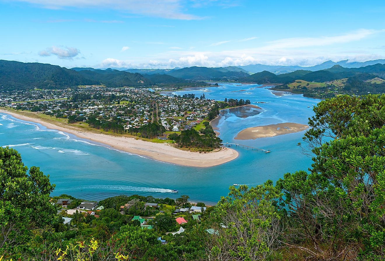
The towns around the lake, on both the American and Canadian shores, tend to look like that. They are small, they sit right on the water, and the land behind them rises into forest or orchards. Above Bayfield, Wisconsin, the orchards look out on the Apostle Islands, and off one Ontario village, a lighthouse stands on an island that only a boat or a paddle can reach.
The Lake Superior Circle Tour links these towns on a signed loop of about 1,300 miles that runs through Minnesota, Michigan, and Wisconsin in the United States and crosses into Ontario, Canada, for more than a third of the drive. The stops worth making are where the road meets a harbor. In Munising, cruise boats leave the city dock for two- to three-hour trips along the lakeshore cliffs.
Duluth, Minnesota

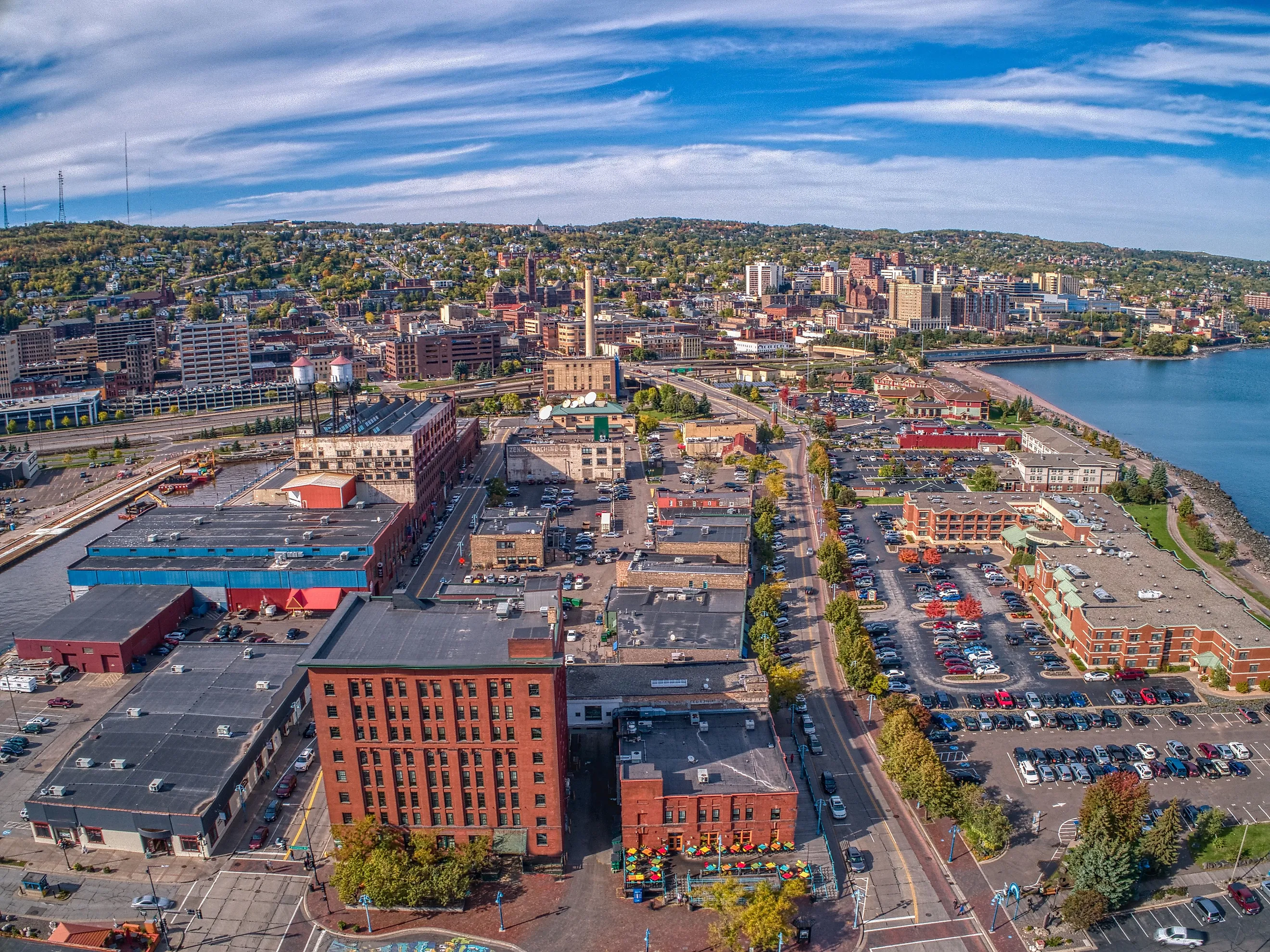
Duluth sits at the western tip of Lake Superior, and the loop starts on its waterfront at Canal Park, where the Lakewalk runs along the shore. Bikes and four-wheeled quadricycles can be rented in Canal Park to ride it, and Grandma's Saloon & Grill has a rooftop deck beside the Aerial Lift Bridge.
In Enger Park, next to the Japanese Peace Bell Garden, Enger Tower is a five-story climb to views over Lake Superior. Ely's Peak is a 1.8-mile hike to the high ground over the city, and the trails near Lester Park lead to waterfalls.
Two Harbors, Minnesota

Heading northeast out of Duluth, the loop has a choice of two highways, and Scenic 61, the one that follows the shore, is the road to take to Two Harbors. In town, ships load taconite at the ore docks close enough to watch from shore, and Betty's Pies, on Highway 61, is known for its cream and fruit pies. About a dozen miles northeast of Two Harbors, Gooseberry Falls State Park has Upper, Middle, and Lower falls, and a paved path about a tenth of a mile long runs from the visitor center to the most photographed of them, so the stop costs the drive very little time. Farther up the shore, Split Rock Lighthouse runs a Keeper's Tour, $25 this season, that goes inside the tower and the keeper's living quarters.
Grand Marais, Minnesota

The best-known stop in Grand Marais, a harbor town up Highway 61 toward the Canadian border, is World's Best Donuts on East Wisconsin Street, and it rewards an early start, because the shop closes in the early afternoon or sooner if the doughnuts sell out. In 2026 it opened at 7 a.m. and stayed shut on Tuesdays and Wednesdays, and it is now closed until next season. The walk out to the lighthouse from downtown is short and one of the most popular things to do in town. By lunch, Angry Trout Cafe, on the edge of Grand Marais Harbor, is serving fresh Lake Superior fish, from May to mid-October.
The Gunflint Trail heads inland from town, and at mile 29.5 the Honeymoon Bluff trail climbs wooden stairs on a 1.5-mile round trip to a view over Hungry Jack and Bearskin Lakes. In July, the Grand Marais Art Colony holds the Grand Marais Arts Festival.
Thunder Bay, Ontario

Past Grand Marais, Highway 61 crosses the Pigeon River into Canada, and the first city on the Ontario side is Thunder Bay, home of a pastry called the Persian. A cross between a cinnamon bun and a doughnut under pink icing, it is found only in this city, and The Persian Man sells them on Tungsten Street. Clocks move ahead an hour on the way in, because Thunder Bay runs on Eastern time, and Canada's border agency recommends that U.S. citizens carry a valid passport.
Kakabeka Falls, about 19 miles west of the city on Highway 17, falls roughly 130 feet into a gorge and is the second-highest waterfall in Ontario. A boardwalk wraps around the top of the falls, and the viewing stays open all year. Across the bay east of the city, Sleeping Giant Provincial Park has more than 60 miles of trails, and the hike to the Top of the Giant, about 13.5 miles round trip from the parking lot, takes most hikers 6 to 10 hours and ends with views over Lake Superior. Back in the city on Saturday mornings, the indoor Thunder Bay Country Market sells pierogies, cheese, and pies.
Rossport, Ontario

Rossport is a small village on a short turnoff from Highway 17, about 116 miles east of Thunder Bay, and it faces a cluster of islands. Battle Island Lighthouse stands among them, about 6 miles from Rossport Marina, and it can be reached only by boat or by paddle. Sail Superior runs boat trips out to it. The grounds are open to visitors who land, although the lighthouse itself typically is not. Such a Nice Day Adventures leads a two-hour sunset kayak tour around the harbor, and on foot, the Rossport Coastal Trail follows the shore for just under a mile each way, past merganser ducks and patches of wild blueberries. Serendipity Gardens Cafe, with a garden patio facing the water, serves locally caught lake trout.
Wawa, Ontario

Wawa is where the Circle Tour turns south toward Sault Ste. Marie, and the turn is marked by a 28-foot goose statue at the junction of Highway 17 and Highway 101, beside the town's visitor information center. Minutes from downtown, Magpie High Falls spills across a face of rock about 125 feet wide, and a trail continues from it to Silver Falls.
Lake Superior Provincial Park begins about 20 minutes south of town, and parking anywhere in it requires an Ontario Parks day pass. Inside the park, Old Woman Bay has a long sandy beach scattered with driftwood, and the Nokomis Trail starts at the day-use area and climbs on a round trip of about 3 miles to lookouts above the bay.
The Agawa Rock Pictographs, deeper into the park, are reached by a 0.3-mile loop through the woods that ends at a steep rock staircase and a ledge just above the lake. A chain is bolted to the cliff there, and a posted warning says death and injury have occurred when unpredictable waves washed visitors off the ledge.
Sault Ste. Marie, Michigan

South of the provincial park, the loop reaches Sault Ste. Marie, Ontario, where the International Bridge crosses the St. Marys River into its Michigan namesake and back into the United States. For U.S. citizens, a passport, passport card, or Enhanced Driver's License covers the crossing. On the Michigan side, Soo Locks Park has an observation platform beside the locks, open from 9 a.m. to 9 p.m. The free Soo Locks Visitor Center shows a 30-minute film, and a phone line, (906) 202-1333, gives the time of the next ship, so the wait for a freighter can be spent on the Tower of History, which has 292 stairs, or an elevator, to its observation deck. The Museum Ship Valley Camp, a retired Great Lakes freighter, can be boarded and explored.
The same locks look different from the deck of a tour boat. Soo Locks Boat Tours take passengers through the locks themselves, the same lift the freighters make, on 90-minute trips that continue along the St. Marys River waterfront. Two companies run them, and the boats operate from mid-May to mid-October.
Munising, Michigan

Boat trips to the cliffs of Pictured Rocks National Lakeshore leave from the city dock in Munising, on M-28 west of the Soo. Pictured Rocks Cruises run from May into October on trips of two to three hours, passing Miners Castle and the Caves of All Colors, and the Spray Falls Cruise is the company's most popular route. For a closer look, Pictured Rocks Kayaking runs a 3-hour paddle to Miners Castle and a 5-hour tour that reaches Grand Portal Point and Chapel Rock.
On shore, Muldoons Pasties fills its Cornish pasties with potato, ground beef, onion, rutabaga, and carrot, and it also makes vegetarian and apple versions. Munising Falls is inside the city limits, easy to reach and at its best in spring after the snowmelt.
Marquette, Michigan

On weekend mornings in Marquette, the Upper Peninsula's largest city and the next stop west along the lake, walkers and cyclists get part of the road around Presque Isle Park to themselves. The 2-mile loop circles a 323-acre forested headland at the edge of town, and from 7 to 10 a.m. on Saturdays and Sundays, while the road is open for the season, motor vehicles are barred from its back portion. Black Rocks, on the park's shore, is a well-known cliff-jumping spot. At 9 a.m. on Saturdays, the Saturday Morning Market opens at Marquette Commons downtown, running until 1 p.m. from mid-May to the end of November. In the afternoon, Sugarloaf Mountain, on County Road 550 north of downtown, is a 30- to 60-minute hike to the top.
Copper Harbor, Michigan

Copper Harbor is where US-41 ends, at the tip of the Keweenaw Peninsula north of Marquette, and the last stretch into town is worth taking the long way, over Brockway Mountain Drive. The drive leaves M-26 west of town, across from the Copper Harbor Marina, and runs roughly nine miles to a peak 720 feet above Lake Superior. From mid-March through mid-June, the Brockway Mountain Hawk Watch runs on the mountain during the spring hawk migration.
In town, more than 37 miles of singletrack mountain bike trails run through the woods around Copper Harbor, and Copper Harbor Trails Fest is held on Labor Day weekend. Jamsen's Fish Market & Bakery, on the waterfront, sells thimbleberry doughnuts, and it shares its stretch of water with the Isle Royale Queen IV, which sails for Isle Royale on a crossing of about 3 hours and 45 minutes, with 2026 round-trip fares of $175 for adults.
Bayfield, Wisconsin

Coming down off the Keweenaw, the loop crosses into Wisconsin and reaches Bayfield, a small town on the hills above its harbor. On most summer nights between June and September, Big Top Chautauqua puts on a show under its blue canvas tent on Ski Hill Road at Mt. Ashwabay, just south of Bayfield, with folk, blues, rock, comedy, or spoken word on the bill. The hills above town are orchard country, and at Hauser's Superior View Farm, where apples are pick-your-own in late summer and fall, the view from the old Sears mail-order barn takes in Lake Superior and the Apostle Islands.
Down at the shore, Bodin Fisheries sells fresh and smoked Lake Superior trout and whitefish from the south commercial fish docks, where the catch comes in daily. The Apostle Islands National Lakeshore visitor center is in the Old County Courthouse on Washington Avenue, and the lakeshore's mainland sea caves are a drive west on Highway 13 at Meyers Beach, where parking costs $5 a day. From the beach, the Lakeshore Trail starts on a boardwalk and runs along red sandstone cliffs high above the lake, and the overlooks of the sea caves begin a little under 2 miles out. Duluth is 80 miles away.
By November, most of these stops are done for the year. Day use in Lake Superior Provincial Park ended on October 25, the tour boats at the Soo and the cruise boats at Munising are tied up, and Angry Trout and World's Best Donuts in Grand Marais have closed for the season, which leaves a late-fall Circle Tour as mostly a drive. A handful of stops keep going. Freighters keep moving through the Soo Locks until the locks close for repairs on January 15, and the Saturday market in Marquette runs through the end of November. Kakabeka Falls stays open to viewing all winter, when much of its water freezes. Split Rock Lighthouse is open Thursday through Monday this winter, and on November 10 it lights its beacon for its annual ceremony.