The State Parks Where You Can See Glacial Erratics
The ice sheets that covered the northern United States dragged rock hundreds of miles before melting out from under it, and the boulders they abandoned rarely match the ground they sit on today. Geologists call these rocks glacial erratics. A block of Conway Granite resting on Concord Granite, or a slab of argillite stranded in a valley that produces nothing like it, marks the route the ice traveled. Madison Boulder in New Hampshire weighs more than 5,000 tons and was moved less than two miles to reach the clearing it occupies, while the 90-ton boulder at Erratic Rock State Natural Site floated over 500 miles inside an iceberg during the Ice Age floods. Along the Connecticut shoreline, the surf has stripped the finer sediment from a glacial moraine, leaving the boulders standing on the beach. These six sites all belong to state park systems, and at each, the evidence is within a short walk of a parking area.
Erratic Rock State Natural Site, Oregon

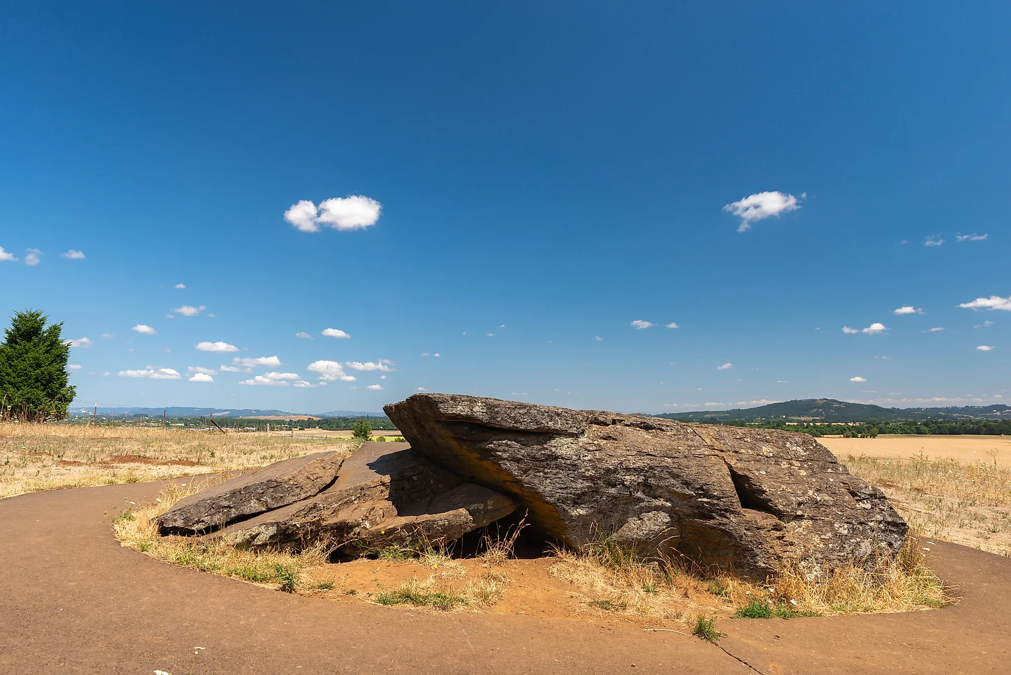
A 90-ton boulder on a hillside above Oregon's Willamette Valley traveled more than 500 miles before it came to rest. Oregon State Parks records that the rock at Erratic Rock State Natural Site floated in from the Northern Rocky Mountains on an iceberg, carried down the Columbia River between 12,000 and 17,000 years ago, and dropped when the ice melted. The agency identifies it as the largest glacial erratic in the Willamette Valley.
The site is small and built around the boulder itself. The Oregon Parks and Recreation Department has owned and maintained the 4.4 acres since 1956, when the property was known as the Erratic Rock Wayside. Its state natural site designation marks a category within Oregon's state park system rather than a different kind of ownership. The same agency and the same day-use rules apply here as at any Oregon state park. A short, paved path leads uphill to the rock, with views across the surrounding valley along the way. The boulder is banded argillite, a metamorphic rock that does not occur naturally in Oregon, which is what gives away its distant origin. The site also connects directly to the larger story of the Missoula Floods. Floodwaters repeatedly surged through the Columbia River Gorge after glacial Lake Missoula's ice dam failed, sending water into the Willamette Valley and carrying sediment-filled ice along with it.
Madison Boulder, New Hampshire

Madison Boulder is difficult to miss. The granite erratic measures about 83 feet long, 37 feet wide, and 23 feet high above the ground. New Hampshire State Parks estimates that the enormous rock weighs more than 5,000 tons, making it one of the largest known glacial erratics in North America. The state acquired the 17-acre site in 1946, and the boulder was designated a National Natural Landmark in 1970.
The boulder was deposited here roughly 14,000 years ago as the last continental glacier retreated across New England. Unlike the bedrock beneath it, which is Concord Granite, Madison Boulder is made of Conway Granite. Geologists trace it to Whitten Ledge, less than two miles northwest, where rock sampling matched the boulder's granite to the ledge. An alternative account points to Mount Willard, 24 miles northwest in Crawford Notch. The New Hampshire Division of Parks and Recreation administers the property as a natural area, one of the designations the state park system uses for undeveloped holdings, and the visit amounts to a short walk from the parking area and a loop around the boulder's base.
Hammonasset Beach State Park, Connecticut

The large boulders at Meigs Point are part of the Hammonasset-Ledyard-Queens River Moraine, a glacial deposit that stretches eastward from Connecticut toward Rhode Island. The ice front stalled here for a time and then withdrew, leaving a mixture of sediment and rock hauled in from farther north. Hammonasset has no exposed bedrock anywhere in the park. Glacial till and sand cover it instead, so every stone on this beach arrived inside the ice.
At Meigs Point, the surf has gradually carried off the finer material, leaving the larger rocks that waves cannot move. Shoreline, marsh, and dune rather than solid bedrock make Hammonasset an unusual place to read glacial deposits. Connecticut's Department of Energy and Environmental Protection maintains an EarthCache on the site devoted to the question of why the boulders are there at all.
Rockefeller State Park Preserve, New York

The largest glacial erratic in Rockefeller State Park Preserve sits in a hardwood clearing in Westchester County, dropped where the ice gave it up. The preserve's New York State Parks trail map marks the Pleasantville Glacial Erratic as a landmark. The preserve has another erratic named Spook Rock, farther along the trail network. The Pleasantville Glacial Erratic rises about 20 feet above ground and measures 65 feet around, although how much rock lies buried is unknown. The boulder is gneiss, estimated at more than 600 million years old, plucked from the peaks of the Hudson Highlands and carried south by the Late Wisconsin continental glacier. Forty-five miles of crushed-stone carriage roads laid out by the Rockefeller family thread the preserve, and a short woodland path called Nature's Way reaches the boulder from the main parking area.
Fort Townsend Historical State Park, Washington

Fort Townsend Historical State Park contains two large boulders that were left behind during the last glaciation. The Puget lobe of the Cordilleran Ice Sheet pushed south through the region, carrying rock down from the north before it stalled and melted away. Both erratics are signed along the park's wooded trails. The easier one to find sits on the Historic Walk Trail, about 300 feet south of the parade grounds. That light-colored, granitic boulder originated in the Coast Mountains of British Columbia. A second erratic, dark gray, and made of fine-grained basaltic rock, sits along the Madrona Trail.
The beaches at Fort Townsend show the same material in cross-section. The bluffs expose layers of sand, gravel, and cobbles laid down by glacial activity. The park's geology guide points out smaller erratics scattered along the shore. Douglas fir, western hemlock, and cedar cover the 6.5 miles of trail between the parade grounds and the rocky shoreline.
Dighton Rock State Park, Massachusetts

Dighton Rock weighs about 40 tons and no longer sits where the ice left it. The gray-brown crystalline sandstone boulder measures roughly 11 feet long, 9.5 feet wide, and 5 feet high. For centuries, it lay in the bed of the Taunton River in southeastern Massachusetts, submerged for most of each tidal cycle. One of its six faces bears petroglyphs of uncertain age, and the debate over who carved them has continued since the 1680s. The mainstream archaeological reading credits the indigenous peoples of the region, though the meaning and the date remain unsettled.
State officials lifted the rock out of the riverbed in 1963 during construction of a coffer dam and installed it inside a small museum building in the park. That makes Dighton Rock the one entry here that a visitor meets indoors rather than outdoors. The Massachusetts Department of Conservation and Recreation manages the 85-acre park on the eastern shore of the river in Berkley, which the state acquired in 1955. Picnic grounds, boat access, and shoreline trails fill out the rest of the site. As of 2026, the museum is open by appointment only, so seeing the carvings requires a phone call before the drive.
The Ice Sheet's Record in US State Parks
The ice sheets that covered the northern United States left few monuments other than those they dropped by accident. A block of gneiss, more than 600 million years old, came down from the Hudson Highlands and stopped in a Westchester County wood. Two boulders on the Olympic Peninsula began in British Columbia and rode the Puget lobe south, and a sandstone slab that spent centuries in the bed of the Taunton River now sits indoors with its carvings intact.