The Most Dangerous State Parks In America
The same thing that makes these parks worth the drive is the thing that can hurt you. The view from a canyon rim is the reason to come, and the depth behind that view is a long way to fall. The best coastal trails are the ones cut into the cliffs, which is exactly what puts the ocean a few hundred feet below your boots. A wetland is worth visiting for the birds, and it is full of birds because it is also full of alligators. Across the country, the most dangerous state parks are dangerous for the exact reasons people love them, and the smart visitor treats the beauty and the risk as one and the same. Here are eight where that bargain is especially clear.
Napali Coast State Wilderness Park, Hawaii

On the northwest shore of Kauai, cliffs rise as high as 4,000 feet straight out of the Pacific, cut by wind and rain into fluted green walls that have stood in for prehistoric wilderness in half a dozen movies. The only way in on foot is the Kalalau Trail, 11 miles one way, and it is regularly listed among the most dangerous day hikes in the country. The first two miles to Hanakapiai Beach make a popular out-and-back. After that the exposure begins, and the trail crosses stream beds that can rise fast in a mountain downpour and narrow to a ledge with the ocean a few hundred feet below. The stretch hikers dread is called Crawler's Ledge, just past the seven-mile mark, where the footing shrinks and there is nothing on the downhill side but air and water. People have died here, and a fall at the wrong spot is not survivable. Anyone going the full distance needs at least two nights and a camping permit arranged well in advance, because the state caps how many people sleep out on the coast.
Waimea Canyon State Park, Hawaii

Stay on Kauai and drive to its west side and you reach Waimea Canyon, nicknamed the Grand Canyon of the Pacific, more than 3,000 feet deep and 14 miles long, carved by the Waimea River over roughly four million years. Most people see it from the paved lookouts along the rim, where the biggest hazard is a chilly breeze, since the air at the canyon rim sits about 20 degrees cooler than in the beach town below. The danger is on the trails that drop off that rim. They run along cliff edges and narrow ridgetops, and in winter, which is the wet season here, they turn to slick mud where a loose rock or a bad step means a twisted ankle at best. Fog rolls in and cuts visibility, and the lower reaches flood suddenly when the rain comes hard upcountry. The park still logs a handful of rescues a year. The classic route is the Canyon Trail to Waipoo Falls, a few miles round trip along a ridge, past two canyons, and across a stream to an 800-foot waterfall, and it is worth doing with dry weather and good boots.
Chugach State Park, Alaska

Chugach begins about seven miles from downtown Anchorage and runs back nearly 500,000 acres into the mountains, which makes it the third-largest state park in the country and larger than the entire city of Los Angeles. It is also genuinely wild in a way most parks near a city are not, with knife-edged ridges, ice fields, fast glacial rivers, and a full complement of big animals. There are 280 miles of trails, lakes and rivers for paddling, and three campgrounds, and there are also brown bears that can top 1,000 pounds and moose that stand taller than a person and outweigh the bears. Both have attacked visitors over the years, and for the record the moose put more people in the hospital than the bears do. Avalanches run from winter into spring, high country stays cold and windy even in July, and the park is big enough that getting lost is a real problem, since a search covering that much ground takes time the weather does not always allow.
Smith Rock State Park, Oregon

Smith Rock is only 641 acres, but those acres are stacked vertically. The park's welded tuff and basalt spires rise straight out of the high desert above a bend in the Crooked River, and they are widely credited as the birthplace of modern American sport climbing, which is why climbers fly in from around the world to hang off them. The signature hike is the Misery Ridge Loop, and the name is not marketing. It climbs steeply to a summit near 3,360 feet along narrow paths with real drops, then rewards you with a view of the river, the spires, and climbers working the rock face, plus the odd golden eagle or mule deer. Summer temperatures push past 100 degrees, which stacks heat exhaustion on top of the fall risk. Rescues happen every year, split fairly evenly between climbers stranded on a ledge partway up and hikers who slipped, fell, or overheated on the way to the top.
Lost Dutchman State Park, Arizona

The danger at Lost Dutchman is simpler and, if anything, easier to underestimate: it gets extremely hot and there is almost nowhere to hide from it. The park sits in the Sonoran Desert beneath the Superstition Mountains, all rock formations and open ground, and summer highs run past 100 degrees day after day with next to no natural shade. That combination turns an ordinary hike into a heat emergency faster than people expect. The trails are mostly short, which helps, and the popular Treasure Loop covers a couple of miles past desert plants and rock with the Superstitions as a backdrop. The park's own advice for June, July, and August is blunt: go early in the morning or late in the evening and skip the middle of the day entirely. It also has cabins and more than 130 campsites for people who want to stay and catch the desert at the hours when it is not trying to cook them.
Valley of Fire State Park, Nevada

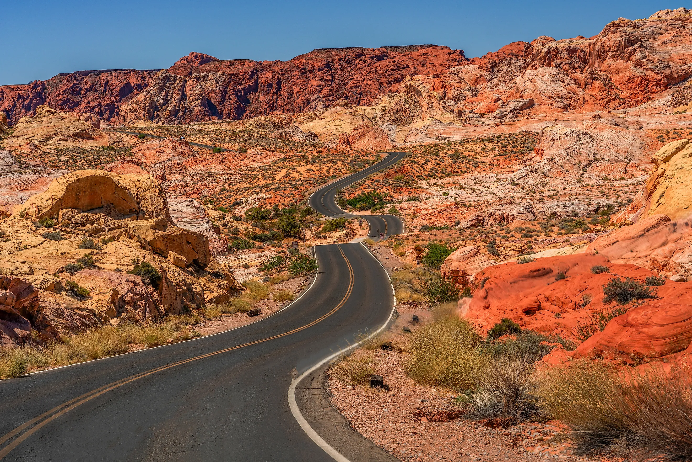
An hour northeast of Las Vegas, Valley of Fire earns its name from red Aztec sandstone that formed more than a hundred million years ago, set among petroglyphs and petrified wood. It earns its place on this list from heat that is worse than Lost Dutchman's. Summer temperatures in the park reach 115 to 120 degrees, and the bare sandstone radiates it back at you, so the air and the ground both work against a hiker at once. On July 22, 2023, two women who set out on the trails in the morning did not come back; both were found dead, and the park later said they had run out of water in 118-degree heat. Rangers tell people to avoid midday hiking in high summer and to carry more water than seems reasonable, some of it just to pour over your head. The park closes some of its most popular trails during the hottest stretches, including the Fire Wave, a short walk out to sandstone banded like a frozen ocean swell, so it is worth checking what is open before you drive out.
Myakka River State Park, Florida

Florida's danger is not heat or heights. It has teeth. Myakka River State Park spreads across 37,000 acres of wetlands and pine woods east of Sarasota, and it holds one of the densest American alligator populations in the state, with hundreds of them living along the Myakka River, Florida's first designated wild and scenic river. There is a spot in the park called Deep Hole, a sinkhole 295 feet across, where more than a hundred alligators have been counted gathered at once during the dry months. Experienced paddlers can take the river when the water is high, keeping their distance and staying out of the water entirely, and the park's rules are the sensible ones: don't feed the alligators, don't crowd them, and keep pets well back from the bank. Beyond the gators there is good fishing and a long trail system for hiking, biking, and horseback riding, with a supporting cast of wild hogs, bobcats, otters, birds, and venomous snakes like the pygmy rattlesnake. There are cabins and about 90 campsites for anyone who wants more than a day of it.
Devil's Lake State Park, Wisconsin

Devil's Lake is the largest state park in Wisconsin at 9,217 acres, and also its busiest, which turns out to be part of the problem: it records some of the highest numbers of visitor accidents and rescues of any state park in the country, and most years someone dies here, usually in a fall. The 360-acre lake sits in a gap in the Baraboo Range, ringed by 500-foot quartzite bluffs whose rock is roughly 1.6 billion years old, among the oldest exposed anywhere in North America. Nearly 30 miles of trails run through the park, some of them right along the edge, with poison ivy and wild parsnip growing beside the path. The route that gets people in trouble is Devil's Doorway, off the East Bluff Trail, a set of steep, uneven, sometimes slick stone steps that lead to the arch formation the trail is named for and a long look down at the lake. In winter, ice makes the whole thing worse. On a good day the park has two swimming beaches, paddling, climbing, biking, and more than a hundred bird species, best in spring and fall.
Reading The Risk Before You Go
What connects these eight is that none of them is dangerous by accident. Chugach is wild because it is enormous and full of animals with their own agendas. Valley of Fire and Lost Dutchman are punishing because the desert does not care how far you walked in. Devil's Lake and Smith Rock draw people to the edge of very old, very hard rock, and the Napali cliffs and Waimea's canyon walls draw crowds for the same reason they are unforgiving. The risk is not a flaw in these places; it is the source of the scenery. That is also the good news, because it means the danger is predictable. Check the forecast, carry the water, respect the permit rules and the wildlife, turn around when the weather turns, and the same forces that make these parks intimidating are the ones that make them worth the trip.