Where Is The Canadian Shield?
The Canadian Shield, also known as the Laurentian Plateau, is an extended area of exposed metamorphic and Precambrian igneous rocks that form the geological core of North America. The Canadian Shield is made up of the oldest known rocks some of which date back to the formation of the planet. It covers half of Canada from the Arctic Ocean to the Great Lakes and extends southwards into the northern regions of the United States. The Canadian Shield is covered by a thin blanket of earth making it less useful in some economic activities such as manufacturing and farming but useful for logging, hydroelectric generation, and mining.
Formation
The U-shaped Shield is estimated to be 3.96 billion years old. It was once characterized by tall jagged peaks but years of erosion degraded the mountains to rolling hills. The Canadian Shield was the first part of the North American continent to be elevated above the sea level and managed to survive the encroachment of the sea. Today, the region lies between 980 and 2,000 ft above sea level. Vast continental ice sheets deformed the land surface during the Pleistocene Epoch resulting in the formation of the Hudson Bay.
Geographic Extent
The Canadian Shield covers five physiographic regions that include the Laurentian Upland, Davis, Hudson and James Bays, and the Kazan Region. It extends into the northern United States as the Superior Uplands and the Adirondack Mountains.
When Greenland is included, the Shield forms a circular shape that extends over much of Labrador, Greenland, north of the Saint Lawrence River, Ontario, the Adirondack Mountains, upper and lower Michigan, northeastern Minnesota, northern Wisconsin, northern Saskatchewan, and parts of northeastern Alberta. The entire Canadian Shield covers an estimated 3.1 million square miles, but the greater shield extends from the Appalachian Mountains in the east, the Western Cordillera in the West, and southwards into Texas.
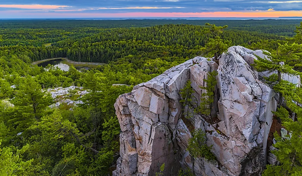
Physical Features
Notable physical features in the Canadian Shield include the rolling hills, a shallow layer of soil, and hundreds of small lakes formed during the last glacial erosion. Other features from the glacial period include striations and drumlins. In addition to small lakes, the shield borders large lakes and waterways including Lake Winnipeg, Lake Athabasca, Great Slave Lake, Great Bear Lake, Lake Superior, Lake Huron, Lake of the Woods, and the Saint Lawrence River.
Natural Resources
The Laurentian Plateau is rich in natural resources including minerals, native forests, and freshwater. In the mid-19th century, the discovery and mining of gold, copper, uranium, nickel, zinc, silver, and diamonds contributed significantly to the development of the Canadian economy. The largest concentration of operational mines on the Shield is found in Sudbury, Ontario, where gold, palladium, nickel, and copper are mined.


