This United States Scenic Byway Is The Road Trip Of A Lifetime
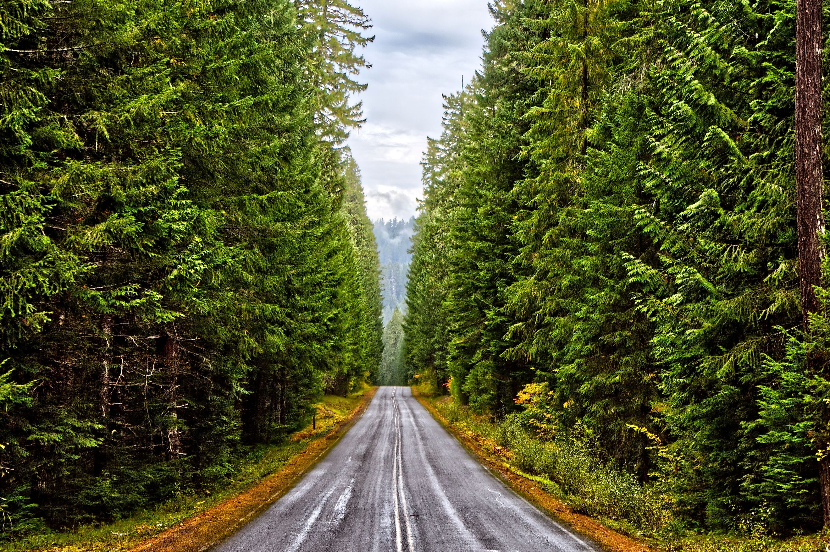
For sightseers on a mission, the West Cascades Scenic Byway is the road trip of a lifetime. Designated a National Scenic Byway in 2000, the route threads Oregon's western Cascade Range for 220 miles, with memorable sights at every stop. Remote and wild for miles, this mountain road runs high and low, passing snowcapped peaks and river valleys. In the fall, rust-colored trees frame the route. In the spring, rivers and waterfalls surge, and summer snowmelt feeds the byway's 2 national forests and alpine lakes.
Where To Start This Scenic Drive

The West Cascades Scenic Byway runs north to south through western Oregon, following the west slope of the Cascades along the eastern edge of the Willamette Valley. The northernmost starting point is southeast of Portland, in the historic logging city of Estacada. For a southern entry, rural Westfir is the starting point, just before the city of Oakridge. Several highways cross the route along the way, among them OR 22 at Detroit and OR 126 in the McKenzie corridor, so drivers can sample shorter sections instead of committing to the whole thing. This road trip guide will navigate north to south, but the route can easily be reversed.
Know Before You Go

It takes about 8 hours to drive the West Cascades Scenic Byway, though many road trippers split the drive into a multi-day trip. Campsites and resorts are scattered across the Oregon road. Even so, it's best to book in advance to guarantee your overnight stay, especially during the peak summer months. Many of the parks and recreation areas are also day-use friendly, but require paid passes.
It's also important to note that gas stations and convenience stores are sparse along portions of the West Cascades Scenic Byway, particularly in middle forested stretches. Multi-hour gaps are not uncommon, and cellphone service can become patchy or disappear altogether. For these reasons, road trippers must fill up gas tanks and buy ample provisions before departing. A map or plan detailing service stations and rest stops is also recommended.
Fire recovery continues to shape access along the northern half of the route. As of an August 2026 Forest Service order covering the Austin and Mitchell fires, Forest Road 46 is closed between Forest Roads 63 and 4660, and Bagby Hot Springs and several Clackamas River campgrounds are closed with it. Anyone planning the full drive should confirm the current status through the Mt. Hood National Forest alerts page before setting out, since closures on this corridor can shift week to week.
The Best Time To Take This Drive

The best time to drive this byway mainly depends on personal preference, but it's worth knowing about seasonal closures. Forest Roads 19 and 46 are the two high-elevation segments to watch. Neither is maintained for snow and ice, and both generally close between mid-November and late April. Sections can be impassable even when no gate is down. For real-time information on road closures and conditions, road trippers can call ranger stations such as the Detroit Ranger District.
Autumn is a more popular time to take this drive, as much of the byway travels through Willamette National Forest and Mt. Hood National Forest. Oregon's fall foliage generally peaks in mid-to late-October, although higher mountain segments will see leaves change as early as late September. Road trippers can check for foliage forecasts ahead of time using online trackers. Spring and summer come with their own byway charms. Spring rainfall and snowmelt rejuvenate greenery and feed waterfalls to peak flow. The warm summer months are also ideal for enjoying the byway's parks and outdoor recreation. The area's alpine lakes are chilly year-round, making sunny summer days the prime time to take a dip.
Top Stops Along The Byway
Clackamas River

Departing from the byway's northern point, the Clackamas River is the first exciting sight. A tributary of the Willamette, this "Wild and Scenic" river parallels the byway for several miles, with countless pullouts along the way. About seven miles from Estacada, North Fork Reservoir opens up the first real water view. Boat ramps, bank fishing, and day-use access sit right off Highway 224. Farther upstream, the Clackamas Watershed Viewpoint is the classic photo stop, looking out over the waterway and the forested river canyon.
Olallie Lake Scenic Area

Another 2 hours in, a short detour leads to Olallie Lake, a scenic spot to stretch your legs, sightsee, and spend the night. The Olallie Lake Scenic Area covers over 14,000 acres in the southern tip of Mt. Hood National Forest. The centerpiece lake is backed by Mount Jefferson, with plenty of ways to breathe in its views.
The Olallie Lake Day Use Area is best for short visits. The site is open from sunrise to sunset, with vault restrooms and picnic tables. For a longer layover, the neighboring Olallie Lake Resort is a great place to spend the night in a cabin, yurt, or campsite. Rowboats, kayaks, and canoes are available to rent, and swimming is allowed at nearby Head Lake rather than in Olallie itself. Due to its remoteness, the resort has no cell phone service and takes cash or check only, so guests should plan accordingly. Also, bear in mind that this high-elevation Scenic Area closes in the winter due to snow.
Detroit Lake State Recreation Area

For a direct byway drive, Detroit Lake State Recreation Area sits right on the road. Much like Olallie Lake, it has a day-use area along with campsites framed by Mount Jefferson. Detroit Lake, the area's reservoir, is 9 miles long and surrounded by forested hills. The Mongold Day-Use Area spotlights the landscape from a grass "beach," and it holds the only public boat launch on the lake. Here, guests can stroll the lakefront, swim, and use the picnic facilities and restrooms.
Camping at the recreation area is seasonal, and summer weekends book out well ahead. In addition to swimming and boating, hiking is an awesome way to see the lake from a different perspective. A roughly three-mile trail loops through the campground and along the shoreline, an easy walk suited to families and posted with interpretive signs. For something steeper, the Tumble Ridge Trail climbs from a trailhead just off Highway 22 toward Dome Rock, trading forest switchbacks for views over the lake and Mount Jefferson. One more piece of timing to note: the Army Corps of Engineers plans a deep drawdown of the reservoir after November 1, 2026, which will drop water levels well below their summer mark.
Sahalie & Koosah Falls

Continuing through Willamette National Forest, Sahalie and Koosah Falls are easy to reach and well worth the stop. The McKenzie River connects the waterfalls, both of which flow year-round. Sahalie Falls comes first, dropping about 75 feet over a lava dam before tumbling on in smaller cascades. Its wheelchair accessible observation deck sits a short walk from the parking area along a paved pathway.
A Waterfalls Loop Trail connects Sahalie to Koosah Falls. Unfortunately, Koosah Falls is not wheelchair accessible due to stairs and uneven terrain. The roughly 65-foot cascade spills into a deep pool, surrounded by a thick cover of forest. Spring rain and mountain snowmelt bring both waterfalls to peak water volume, making this a popular time to visit. Winter is the least congested time to stop by, though parking lots are unmaintained and highway parking is strongly discouraged due to unsafe conditions.
Belknap Springs
Belknap Springs is a McKenzie River mineral spa first developed in 1869 and open to the public almost continuously since the 1870s. Just 15 minutes south of Koosah Falls, the hot spring is a relaxing place to pause from this epic drive. Today, the spring is owned and operated by Belknap Hot Springs, Lodge and Gardens, offering 2 mineral pools in a botanical setting. Lodge guests receive unlimited access to both, and day visitors can buy lower-pool passes for a 1-hour soak. Whether spending the night or stopping in for a quick spa break, this is a great way to loosen sore driving muscles.
Cougar Reservoir Area

Another 20 miles in, the Cougar Reservoir Area lets byway travelers recharge with lake recreation. In the summertime, people flock here to boat, swim, and fish. The 1,280-acre lake holds stocked rainbow trout and landlocked Chinook salmon, along with naturally reproducing cutthroat. Water levels drop sharply from late summer into spring, though, and boat launches often become unusable. Three developed campgrounds sit nearby for overnight stays: Sunnyside, Cougar Crossing, and Slide Creek. Close to all 3, campers and day guests alike can unwind in the Terwilliger Hot Springs, a day-use site with a fee collected at the trailhead. These clothing-optional mineral springs are spread across 4 separate soaking pools, spaced apart by rock walls. The lowest sits near 85°F, and the uppermost reaches about 112°F.
Historic Office Covered Bridge

The Office Covered Bridge is located in Westfir, marking the end of this scenic drive. Built in 1944 by the Westfir Lumber Company, the red structure spans the North Fork of the Middle Fork of the Willamette River. At 180 feet long, this historic bridge is also the longest covered bridge in Oregon. The bridge originally linked the Lumber Company's main office to its mill site. While the mill was lost to a fire in 1979, the office has since been converted into the Westfir Lodge and Mountain Market. The quaint bed and breakfast doubles as a market and gathering spot, selling baked goods, drinks, and local artisan crafts. The bridge also carries the only separate covered pedestrian walkway of any covered bridge west of the Mississippi, which makes crossing on foot the better way to finish the drive.
The Drive Worth Every Mile
The West Cascades Scenic Byway asks more of a driver than most designated routes. Fuel and cell service thin out through the middle stretches, two segments close under snow for roughly half the year, and fire recovery still dictates which campgrounds and side roads open in any given season. What the byway returns for that planning is a rare kind of continuity. Its 220 miles stay inside two national forests for nearly the whole distance, with the Clackamas, the Breitenbush, and the McKenzie handing the route from one drainage to the next. Faster ways across the Cascades exist, and none of them slow down long enough to show this much of the range.



.jpg)
