This Iowa Scenic Byway Is The Road Trip Of A Lifetime
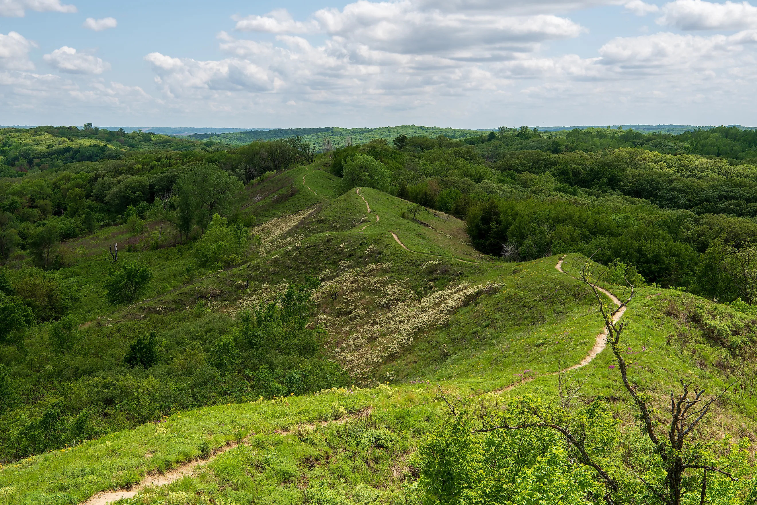
At the end of the last ice age, glaciers ground rock into a powder finer than flour, and the winds picked it up and dropped it in drifts along the eastern bank of the Missouri River. Those drifts hardened into steep, wave-shaped bluffs called loess, a landform this deep and this extensive that geologists can point to only one comparable stretch on Earth, in the Shaanxi province of China. The Loess Hills National Scenic Byway follows the spine of that formation for 220 paved miles down the western edge of Iowa, from Akron in the north to the Missouri state line in the south. Along the way the road passes bison prairie, abolitionist safe houses, and the ground Lewis and Clark crossed, which makes this less a scenic drive than a route through the whole story of how the middle of the country was settled. Winter brings ice and snow to these grades, so most travelers save the trip for the warmer months.
Day 1: Sioux City to Council Bluffs

The Broken Kettle Grasslands Preserve, just off State Highway 12 north of Sioux City, is the largest remaining tract of native prairie in Iowa and home to a bison herd that now numbers more than 200 animals. The Nature Conservancy manages the land, and the herd grazes it much the way bison shaped this prairie for thousands of years before the plow arrived. From the preserve, the highway bends along the Big Sioux River and reaches Sioux City in about 25 minutes, where the Sergeant Floyd River Museum and Welcome Center sits along the water. Next door, the Lewis and Clark Interpretive Center covers the 1804 expedition, the Missouri River corridor it followed, and the Sioux people who lived here long before Meriwether Lewis and William Clark passed through.
An hour south lies Preparation Canyon State Park, 344 acres of hike-in campsites and ridgetop views in the Loess Hills near Pisgah. The name is a leftover from the 1850s, when a breakaway group of Mormons under Charles Thompson settled a town here called Preparation. Thompson eventually fled the state after a property dispute reached the Iowa Supreme Court, the town emptied out by 1900, and the state acquired the land decades later. Another hour on, past the farm towns of Logan and Missouri Valley, the Hitchcock Nature Center rises above Honey Creek, its 45-foot observation tower looking out over the hills and the Missouri River Valley. Hungry travelers can stop at The Aeroplane Inn nearby for a sandwich or cheese curds before the climb.

Roughly 25 minutes farther brings you to the Union Pacific Railroad Museum in Council Bluffs, five minutes from the Nebraska line. Its exhibits cover how the railroad pushed west out of this valley toward the Pacific, and the interactive displays give families with restless kids a reason to linger. Council Bluffs makes a good overnight stop, with chain hotels like the Fairfield Inn and Suites and local kitchens like Boxer Barbeque a few blocks from the museum for anyone craving smoked meat before the second leg.
Day 2: Council Bluffs to the End of the Line

The Wabash Trace Nature Trail begins in Council Bluffs and runs 63 miles southeast to the Missouri border along a former Wabash Railroad grade, its crushed-limestone path shaded by hardwoods that turn gold in fall. Cyclists and hikers can pick it up right in town, and a short drive along Wabash Avenue connects to the wider road south. About 35 minutes on sits Tabor, a town founded in the 1850s by graduates of Ohio's Oberlin College who carried that school's abolitionist convictions west with them. The Todd House on Park Street, the third building raised in Tabor, was the home of Reverend John Todd and his wife Martha, and it became one of the most important Underground Railroad stops in western Iowa. John Brown sheltered here between his raids into Kansas, and the basement once held rifles for the fight over slavery in the territories. For a meal in town, Casey's does pizza and Yeya's Scratch Kitchen does a sit-down family spread.
Half an hour south, Waubonsie State Park spreads across some of the most rugged loess terrain on the route, with wild prairie, turkey and deer in the brush, and eight cabins for anyone who wants to stay the night among the bluffs rather than push on. Roadside restrooms make the stretch easy on families. From there the byway runs its final miles to the Missouri state line, where the loess bluffs give way and the road crosses into the southern reach of the Midwest.
Where the Road Leads Next
The Missouri border is a natural place to keep going. Heritage Highway 136 runs east and west across northern Missouri through small farm towns, while the Great River Road follows the Mississippi for some 3,000 miles across ten states, with St. Louis and other river cities strung along it. Where the Loess Hills byway traces a single strange landform born of ice-age wind, those routes open onto the wider farm country and the great rivers that carried people and goods across the interior. A traveler who finishes the loess bluffs at the Missouri line has driven the length of one of the rarest landscapes in North America, and the rest of the continent's road trips wait just past it.