The US Highway That Never Touches A Town
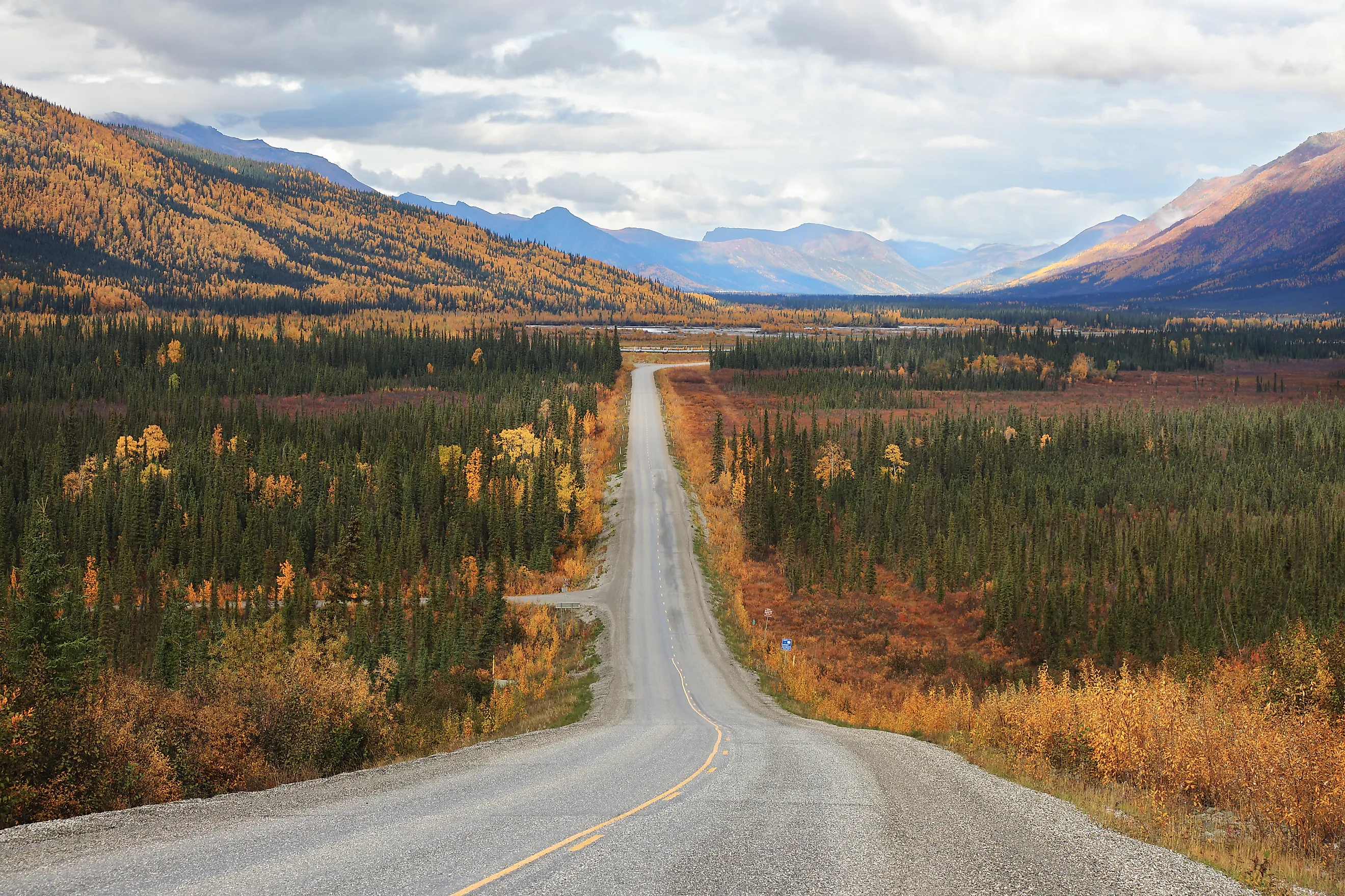
The Dalton Highway in Alaska is the cleanest fit for a US highway that never touches a town, as long as "town" means an incorporated municipality. The 414-mile road runs from the Livengood area to Deadhorse without entering an incorporated city. There are named communities along the route, so calling it completely uninhabited would be wrong. The US Census classifies Livengood and Coldfoot as census-designated places, while Alaska records the Deadhorse and Prudhoe Bay area as unincorporated. Alaska DOT describes services on the Dalton as extremely limited. Coldfoot, around mile 175, is the main service point before the highway continues through the Brooks Range and across the North Slope to Deadhorse at mile 414. The road was originally built to support construction of the Trans-Alaska Pipeline, and commercial trucks hauling equipment and supplies remain a major part of its traffic.
Denali Highway, Alaska

The Denali Highway gives Alaska another long road without an incorporated municipality in the middle. Alaska DOT measures it at 135 miles between Paxson and Cantwell and says it opened in 1957 as the original road access to Denali National Park. Most of the route is gravel, its advisory speed is 35 mph, and cell service is unreliable. Only four lodges operate along the highway.
Winter makes the road's separation from nearby population centers especially clear. The highway closes each year, and in May 2026, Alaska DOT crews worked toward one another from Paxson and Cantwell to remove snow and thaw culverts before reopening it. During summer, the road crosses open tundra and glacial valleys with the Alaska Range frequently visible beyond them. Drivers get 135 miles of state highway and scattered roadside lodging, but no incorporated town appears between the two ends.
U.S. Route 6 Between Ely And Tonopah, Nevada

U.S. Route 6 between Ely and Tonopah is one of the strongest Lower 48 examples. A highway sign west of Ely warns, "Next Gas 167 Miles on US 6," a message Travel Nevada still uses when describing this part of the state. The route crosses central Nevada through a sequence of broad basins and mountain passes. Railroad Valley brings oil wells and service roads into view, while Warm Springs at the State Route 375 junction is an abandoned settlement with only a handful of surviving structures. Neither supplies the kind of town center found at Ely or Tonopah. Nevada Magazine has repeatedly included this section among the state's sparsest highways, with historical traffic counts showing only a few hundred vehicles a day. For roughly 167 miles, the road has pavement, junctions, ranch access, and oil activity without passing through an active town.
State Route 95, Utah

Utah State Route 95 heads southeast from Hanksville into a section of the state that Visit Utah describes as one of Utah's most remote highway stretches. The Bicentennial Highway covers roughly 120 miles before reaching the U.S. 191 side of the route near Blanding. Hanksville provides the clear population center at the northern end.
After Hanksville, addresses quickly give way to named pieces of geography. SR 95 runs through the White Canyon area, crosses the Colorado River near Hite, and passes the access road for Natural Bridges National Monument. The highway also crosses land within Bears Ears National Monument. There is no incorporated town lined up along the middle of that drive.
This part of Utah is not empty. There are recreation sites, side roads, trailheads, ranch access, and occasional buildings. They are spread across a large area with no continuous settlement around the highway. That distinction makes SR 95 a better example than routes that are called remote simply because the towns happen to be small.
Extraterrestrial Highway, Nevada

Nevada State Route 375 has hard numbers behind its reputation. Nevada DOT says the 98-mile road between Crystal Springs and Warm Springs received the Extraterrestrial Highway name in 1996. Much of it crosses south-central Nevada beside large tracts of federal and military land. Travel Nevada reports that the highway often sees fewer than 200 vehicles per day and warns that mobile service can range from spotty to nonexistent.
Rachel is the principal inhabited community along the route, and it is tiny. The US Census classifies Rachel as a census-designated place and counted 48 residents in 2020. Its Little A'Le'Inn, alien signs, and Area 51 associations make the settlement unusually recognizable for its size. Outside Rachel, SR 375 crosses long sections of Tikaboo Valley and surrounding desert without another comparable population center. The UFO theme may bring visitors out here, but the highway's low traffic and single very small community are measurable facts.
Taylor Highway, Alaska

The Taylor Highway does reach Eagle at its northern end, but there is little settlement across the 160 miles before it. Alaska DOT says Route 5 was built between 1947 and 1951 to provide access to the Fortymile Mining District. The first 60 miles are paved, much of the remaining road is gravel, and reliable cell coverage is not expected. Chicken is the best-known inhabited stop. The 2020 Census counted just 12 residents and classifies it as a census-designated place. Farther north, Jack Wade survives as a historic mining settlement, and Jack Wade Junction connects the Taylor with the Top of the World Highway toward Canada. Mines and scattered properties remain part of the Fortymile landscape, so this is not untouched wilderness. What is missing is a chain of towns. Chicken's population of 12 shows just how small the settlements can become before the highway finally reaches Eagle.
U.S. Route 50 Across Central Nevada

U.S. Route 50 proves that a highway does not need to avoid every town to spend most of its mileage away from them. The central Nevada section acquired the "Loneliest Road in America" label after a 1986 Life magazine article portrayed the route as exceptionally empty. Nevada later adopted the name as part of its official tourism campaign.
The communities are real and far apart. Travel Nevada's route across the state passes Fallon before reaching Austin, Eureka, and Ely. Between those places, U.S. 50 crosses successive Great Basin valleys and mountain ranges. Nevada DOT notes that the bicycle route following U.S. 50 across the state crosses 12 summits higher than 6,000 feet.
Highway 50 therefore sits in a different category from the Dalton. Towns do appear, and several have fuel, food, lodging, and historic main streets. The distances separating them are the interesting part. Travel Nevada describes the central run as almost 300 miles with only a few towns spread across it, leaving long sections where the next population center is still on the other side of another basin and mountain pass.