Denali National Park And Preserve
Although Alaska is the US’ largest state, spanning approximately 1.7 million square kilometers, it is the third least-populated state. Much of the land is protected as preserves, national parks, national historic parks, and monuments. The state accounts for about 30% of the US wilderness areas, with more than the country’s national park land area located there. Alaska hosts six of the US’ seven largest national parks, with only the Death Valley (5th largest national park) located outside the state. Denali National Park and Preserve is the state and country’s third-largest national park, after Wrangell-St. Elias and Gates of the Arctic (both located in Alaska).
Location

The Denali National Park and Preserve are located in Alaska’s central region, also known as Interior Alaska. Its main attraction is the Denali, North America’s highest peak, at 6,190 meters above sea level. The national park and the surrounding protected areas cover approximately 24,464 square kilometers, slightly larger than West Virginia and nine other US states. It contains the Denali Wilderness area, which stretches 8,687 square kilometers. The national park covers about 19,186 square kilometers, with the preserve covering the rest.
Naming
For years, the Koyukon Athabaskans referred to the mountain as “Denali” or “Dinale” for “tall” or “high.” However, the Russians referred to it as “Bolshaya Gora” for “big mountain.” In 1896, President William McKinley’s supporter and a gold prospector, William A Dickey, named it McKinley Mountain. The state officially adopted the name when President McKinley assented to an Act establishing the Mount McKinley National Park in 1917. However, Denali National Monument was combined with the national park and the combined unit named” Denali National Park and Preserve.” Alaska’s Board of Geographic Names also changed the mountain’s name to Denali.
Geography And Wildlife

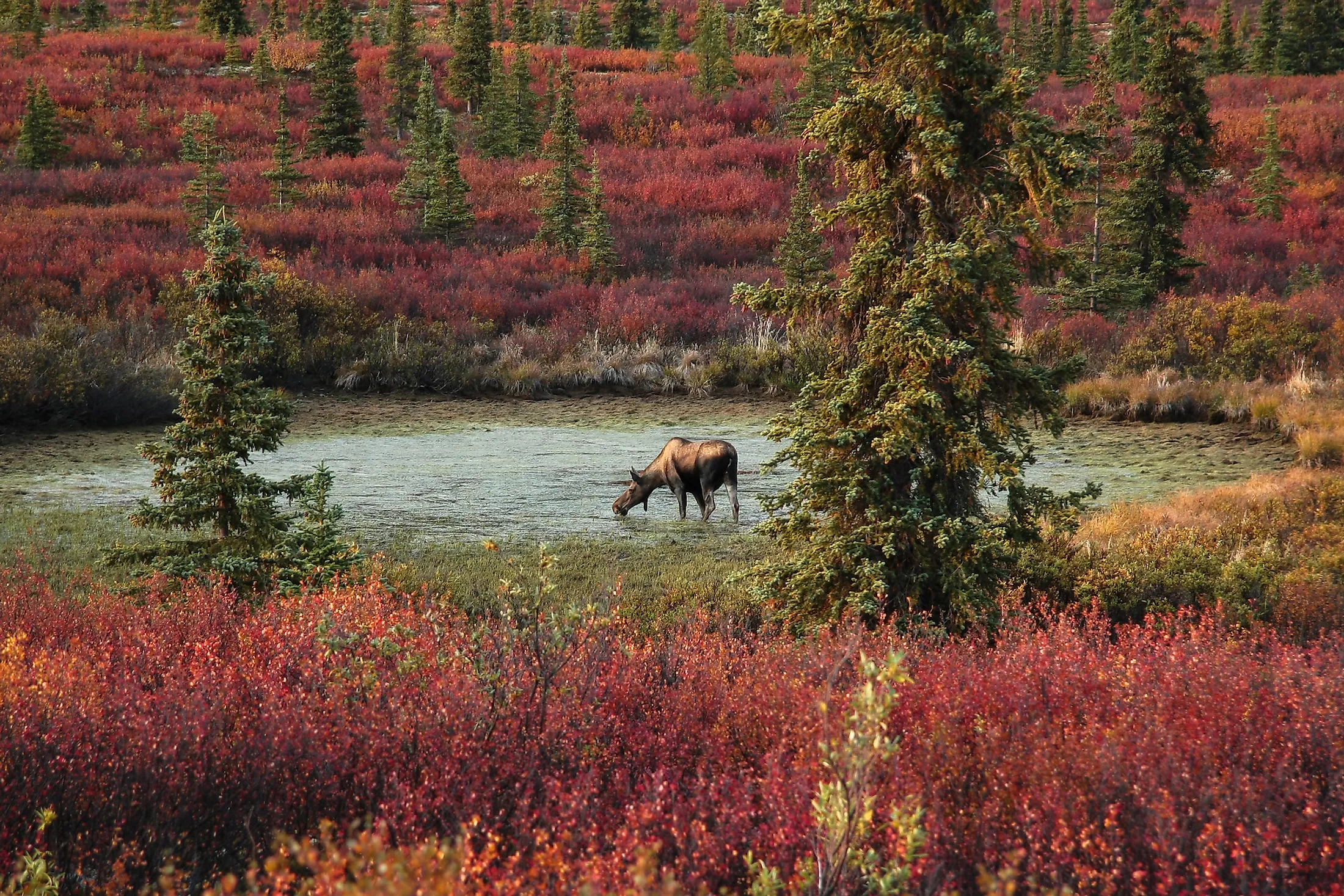
The national park and preserve straddle Matanuska-Susitna and Denali Boroughs. The park is approximately 400 kilometers north of Anchorage (Alaska’s largest city) and 1,350 kilometers off Juneau’s northwest. Denali National Park and Preserve is not only famous for its high peak. It also hosts numerous plants and animal species and offers numerous fun activities, including rafting, biking, camping, fishing, and hiking. It is home to 37 mammal species, including marmots, lynx, foxes, snowshoes hares, and Arctic ground squirrels. About 450,000 people visit the national park and preserve annually, especially between May and September.

The Denali National Park and Preserve encompass Alaska Range’s central, highest section and the glacial valleys on the south. On the north, the park and preserve include the Foraker, Toklat, and McKinley river valleys and Wyoming and Kantishna Hills. The park’s entrance is 18 kilometers off Healy’s south, with the park’s headquarters and visitors center located inside the entrance. The Preserve borders the park on the west side and comprises two parcels of land. The first parcel covers areas like Muddy River and Highpower Creek, while the second parcel covers areas around Mount Dall.
Brief History And Establishment

The Denali Region was inhabited as early as over 11,000 years BP, with archaeological evidence dating back 8,000 years BP. Teklenika River site is the park’s oldest site, dating back to 7130 BC. The Athabaskan people have inhabited the area since 1,500 years BP or even earlier, with prominent groups including Tanana, Koyukon, and Dena’ina people.

In the early 20th century, Charles Alexander Sheldon came up with the idea of creating a national park to preserve the Denali Region. In 1906, he presented the plan to the fellow Boone and Crockett Club members, who thought that Congress would not take any action as the political climate was unfavorable at the time. In October 1915, the matter was presented to the Boone and Crockett Club’s Game Committee, where it was endorsed. The committee presented the plan to James Wickersham, Alaska’s delegate, on December 15, 1915, for approval. Finally, the Club approved the plan and presented it to the Interior’s Assistant Secretary, Stephen Mather, who also gave his approval. Wickersham introduced the bill in the House in April 1916, while Key Pittman (Nevada Senator) introduced it in the Senate. The bill was passed on February 19, 1917, and signed into law on February 26 by President Woodrow Wilson, effectively establishing Mount McKinley National Park.
Geology

Denali National Park and Preserve covers the central portion of Alaska Range, a 650-km long mountain range in southcentral Alaska that runs between Lake Clark (US) and the White River (Canada). Denali, the range’s main geologic feature, is North America’s highest mountain, at 6,190 meters above sea level. However, its base-to-peak height (vertical relief) is 5,500 meters, the world’s highest. Denali gains 1 mm annually due to the Pacific and North American plates convergence and has retained much of its height because of the granite composition.

The park also contains some old rocks, most of which originated from the Pacific Ocean as sediment deposits over 400 million years ago. The oldest rocks belong to the Yukon-Tanana terrane, while the next oldest rocks are part of Farewell terrane, dating back 250-300 years ago. Other terranes include Chulitna, McKinley, and Pingston. The park’s youngest rocks are part of the Kahiltna terrane, deposited during the mountain formation’s early stages.
Approximately 16% of the park and preserve’s total area is under a glacier, with the range’s southeastern portion having more snow than other places. Some of the largest glaciers on the south are Ruth, Tokositna, Kahiltna, and Yentna. Ruth Glacier is about 1,200 meters thick. However, Muldrow, located on the north, is the park’s largest glacier, measuring 51 kilometers long.