From Graveyard of the Atlantic to America's First National Seashore
Once, sailors called it the 'Graveyard of the Atlantic.' The grim nickname came from the multitude of shripwrecks that lie entombed in the water off North Carolina's Cape Hatteras. Today, that same coast is America's first national seashore, authorized in 1937 to protect the barrier islands that so many sailors never reached.
The ecosystem of the barrier islands along the Atlantic coast in North Carolina would probably not have survived nearly a hundred years if not for the Cape Hatteras National Seashore. From sinking pirate ships to today's conservation efforts, here is (nearly) everything you need to know about Cape Hatteras National Seashore.
Was The Cape Hatteras National Seashore Really The First?

The federal government defines and manages public land. Before stepping in in 1937, federal parks were mostly inland spots (think Yellowstone, etc.) People could visit and provide beach resorts or city parks within these federal parks. Cape Hatteras was the first stretch of ocean coastline that Congress protected with the aim of keeping an ecosystem intact. At the same time, the coastline stayed open to the public under National Park Service management. According to this definition, Cape Hatteras became the very first national seashore in the country.
Under different superlatives, other national natural areas deserve a mention too. Acadia National Park in Maine gained federal protection in 1919. It was called Lafayette National Park at the time, and its designation as a national park still helps protect the headlands of the Atlantic coastline. But since it was set up as a national park and not a national seashore, it does not take the top spot in this article. North Carolina is also home to the Pea Island National Wildlife Refuge that was set up in 1938. The bird sanctuary sits inside the borders of Cape Hatteras, but is run by the U.S. Fish and Wildlife Service as a habitat reserve. This makes it fall under a different legal definition from the seashore.
The Storied History Of The Cape Hatteras National Seashore

Cape Hatteras once provided a home for Algoquian-speaking peoples, including the Poteskeet, Showanog, and Croatan tribes. They lived off the fish in the water and the animals on land, while growing their own crops. It is believed that the first Europeans to find Cape Hatteras were the Spanish. The English were there first to attempt a permanent settlement in the area during the 16th century and became part of a centuries-long mystery.
The lost colony of Roanoke left clues behind when they vanished, including the word CROATOAN carved into a post and the letters CRO carved into a tree. Some researchers believe that the colonists moved to the nearby Croatoan Island, now known as Hatteras Island. Others are convinced that the Roanoke colonists assimilated into the local tribal culture.

After the Roanoke incident, pirate activity began increasing around Cape Hatteras. Blackbeard used the shallow waters and coves of the Pamlico Sound and Ocracoke Island to anchor and rest. He was eventually killed in a ferocious battle off Ocracoke Island in 1718. Before and after the pirates, the Diamond Shoals and terrible storms wrecked more than 1,000 ships in the Cape Hatteras area. The loot from these ships ensured an income for local settlers. The Cape Hatteras Lighthouse was constructed in 1870 to help seafarers navigate the sea. The lighthouse still stands and is the highest brick lighthouse in the country.
Private development in the early 20th century saw the privatization of sections of the Atlantic coastline. Conservationist Frank Stick lived on the Outer Banks and did not want to see the coastline destroyed. He proposed creating a coastal national park to help preserve the barrier islands. He collaborated with U.S. Representative Lindsay C. Warren to realize this goal. President Franklin D. Roosevelt signed Public Law 75-303 in 1937, officially authorizing the creation of Cape Hatteras National Seashore Recreational Area. The caveat was that no federal funds could be used to purchase the land. The acreage had to be donated by either the state of North Carolina or private philanthropists.

During the Great Depression, the Outer Banks landscape was stabilized by the Civilian Conservation Corps and the Works Progress Administration. Hundreds of workers put up over 3,000,000 feet of sand fencing. They also planted millions of culms of beach grass. It was an incredible project to build a sand dune line along the shore to protect coastal communities and State Road 12 from erosion and storm surges. Land acquisition efforts, however, were interrupted by World War II. The waters off Cape Hatteras became a battleground where German U-boats attacked Allied merchant shipping. The battles were so fierce that the area was eventually called Torpedo Alley.
After the war, land purchases resumed. Funds were provided by the state and the A.W. Mellon Educational and Charitable Trust. The Old Dominion Foundation also provided funds. By late 1952, the state of North Carolina had acquired and transferred more than 12,000 acres to the federal government. In January 1953, Cape Hatteras National Seashore was established as the country's first national seashore. The dedication ceremony was held in 1958. Now administered by the National Park Service, the Cape Hatteras National Seashore includes more than 70 miles of beach stretching from Nags Head to Ocracoke. Two million people visit the seashore annually on the Outer Banks, flanked by the Atlantic and Pamlico Sound.
Things To Do At The Cape Hatteras National Seashore Today

These visitors can walk the 70 miles of beach, swim, fly kites, pick up shells, and picnic on the sand. Beach fires are allowed park-wide between November and April, while from May to November, fires are restricted to specific beaches to protect nesting sea turtles. There are also seashore ramps for off-road vehicles, but rides require a permit.
Those who want to fish during the spring and fall can find a spot from the surf or the piers. There are also charter fishing trips available. Hikers will find designated hiking trails within the seashore that are open 24 hours a day. For a real challenge, the Mountains to Sea Trail stretches from Great Smoky Mountains National Park to Jockey's Ridge State Park. On the seashore, the trail enters via ferry on Ocracoke Island. It runs along the beach to the northern border of Nags Head.
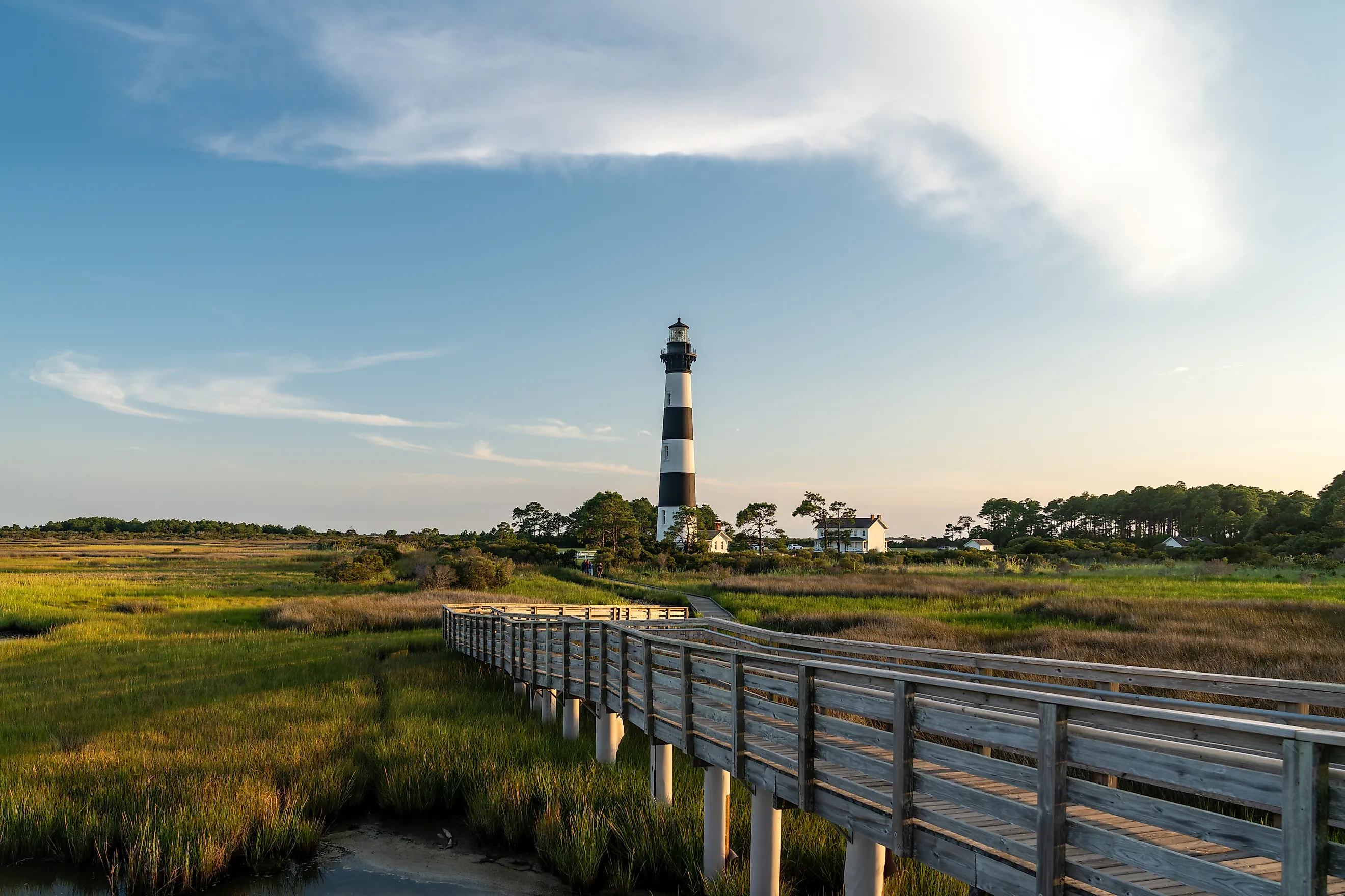
Visitors can also climb the Bodie Island Lighthouse in 2026. Usually, visitors can also climb the Cape Hatteras Lighthouse, but it is closed in 2026 for restoration. The Bodie Island Lighthouse is open seasonally, while the Ocracoke Island Lighthouse is not open for climbing but the base is open periodically for viewing. The seashore is a massive draw for birdwatchers too, being home to more than 400 species. And, at night, the area transforms into a gorgeous dark sky destination for stargazing.
Other Contenders Transformed Into National Seashores

There are some other national seashore contenders, under different definitions. The Cape Cod National Seashore in Massachusetts was the first national seashore created through local land acquisition and not public domain transfer. It was established by President John F. Kennedy (who famously used 22 pens) in 1961, is built on glacial landforms, and boasts some of the highest oceanfront dunes on the Atlantic coast.
The Point Reyes National Seashore in California is the first and only national seashore on the West Coast. It is also the windiest place on the Pacific and the second foggiest place in the country. The seashore sits on the San Andreas Fault Line and is more than twice the size of Cape Hatteras.
The Padre Island National Seashore in Texas is one of the largest national seashores in the U.S. and the longest undeveloped barrier island in the world. At 130,434 acres, it is more than four times the size of Cape Hatteras.

At 19,579 acres, the Fire Island National Seashore in New York is smaller than Cape Hatteras and also part of the only federally designated wilderness area in the state (Otis Pike Fire Island High Dune Wilderness). It is the closest national seashore to a major U.S. city and is car-free across most of the area.
Maryland and Virginia's Assateague Island National Seashore is part of the largest continuous salt marsh barrier island sanctuary in the Mid-Atlantic. It features the Chincoteague ponies and is roughly half the size of Cape Hatteras National Seashore.
Cape Hatteras Conservation Challenges

Cape Hatteras still faces several conservation challenges despite strict protection measures. Rising sea levels and storms continue to erode the beaches, threatening wildlife habitats. Erosion in areas like Rodanthe and Buxton has already caused houses and septic systems to collapse into the ocean. The collapses cause debris to contaminate the seawater, potentially harming marine life. Storms cause flooding on North Carolina Highway 12 and disrupt ferry services, which cuts off access to some parts of the Outer Banks. And there is a constant balancing effort between allowing off-road vehicles and protecting fragile bird and turtle nesting zones.
Protecting The Cape Hatteras National Seashore

Technicians and wildlife rangers inspect beaches regularly to help shield sea turtle and shorebird nests. Habitats are managed for protected species such as colonial terns, sea turtles, oystercatchers, and more. Sand replenishment programs are ongoing to fight erosion and sea-level rise, and barrier island shifting is part of ecological planning. The hope is that these measures will help protect the Cape Hatteras National Seashore for many decades to come.