The Foggiest National Park In The United States
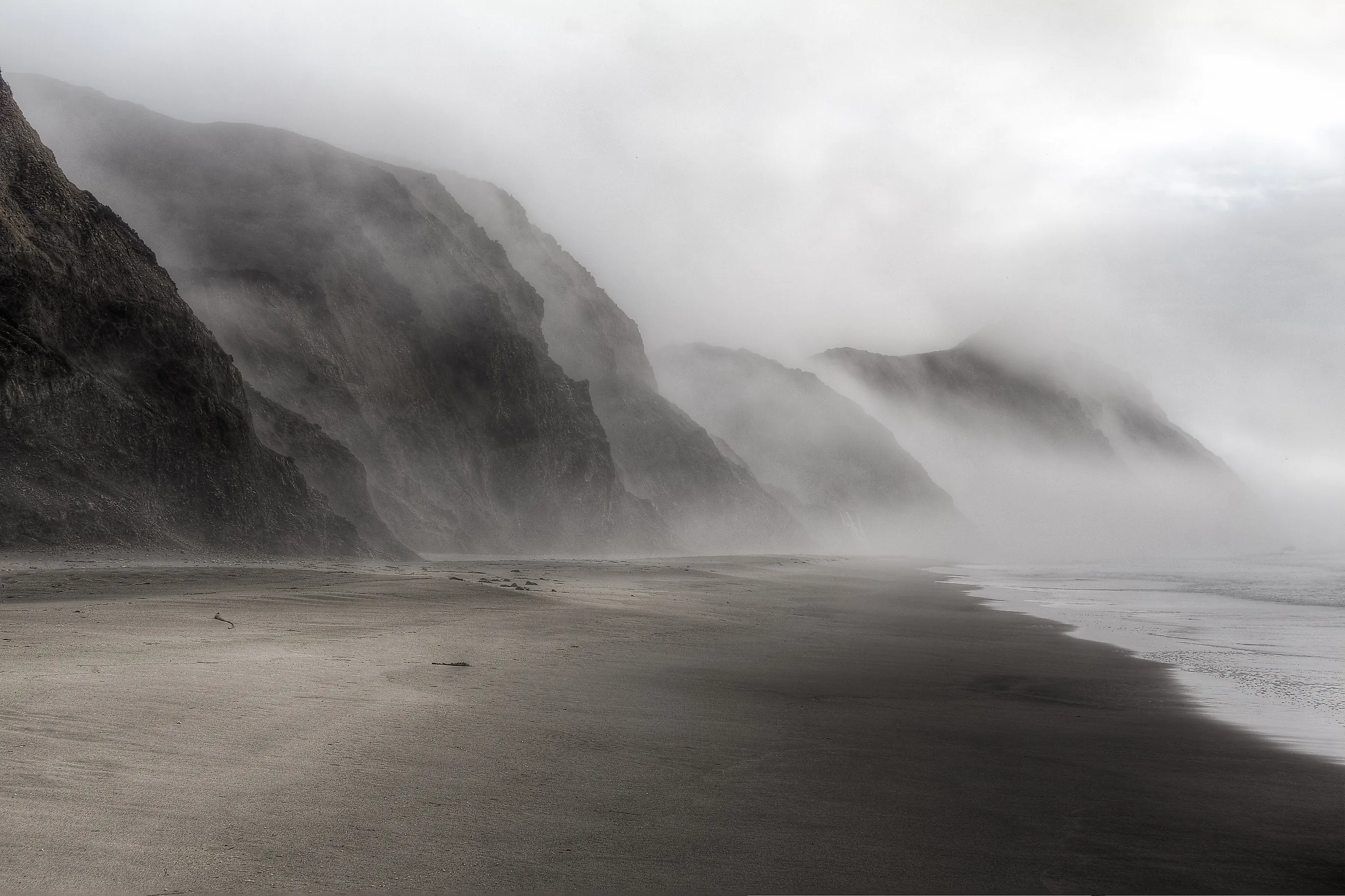
Point Reyes National Seashore has a very well-earned reputation for fogginess, and the numbers support it, as the Californian peninsula on which it sits experiences fog on roughly 200 days annually. Cold Pacific waters, coastal upwelling, and its exposed position create ideal conditions for thick, persistent marine fog, particularly during the summer months. This weather pattern has subsequently shaped the landscape and influenced its maritime history, from the Point Reyes Lighthouse to the modern park amenities millions come to use every year. Yet fog is only part of what makes this seashore notable. Its beaches, cliffs, wildlife, historic ranches, and more provide plenty to see beyond the often gray skies.
Why is there so Much Fog in Point Reyes?

Point Reyes sits directly in the path of cool, moisture-laden marine air moving inland from the Pacific Ocean. The peninsula is surrounded by ocean on three sides, while the California Current carries cold water southward along the coast, and during summer, persistent northwesterly winds drive coastal upwelling, bringing even colder water to the surface.
When warmer air passes over this cold water, it cools to its saturation point, causing water vapor to condense into tiny droplets and form fog. A temperature inversion then traps the cool, foggy marine layer near the surface, allowing it to persist along the coast. Point Reyes' exposed position also makes it susceptible to incoming marine air of all kinds, making it quite a windy spot, too.
The fog is most common in July, August, and September, when it can better remain over the outer coast throughout the day, extending more than 50 miles (80 km) offshore at times.
How Did Such a Gloomy Place Become a National Seashore?

Designated a national seashore in 1962, Point Reyes officially opened as a parkland a decade later in 1972 after long debate over how to protect the peninsula from development. Ranching had been part of the local economy since the Spanish and Mexican periods of control dating back hundreds of years, and dairy and beef operations continued functioning across the peninsula after California became part of the United States.
By the mid-20th century, the region faced growing pressure from suburban expansion and recreation development as the San Francisco Bay Area grew. Conservationists argued that its beaches, coastal grasslands, forests, and other wildlife habitat needed federal protection in order to go on relatively undisturbed. President John F. Kennedy then signed legislation establishing Point Reyes National Seashore on September 13, 1962.
Today, Point Reyes National Seashore remains unusual among National Park Service sites because active ranching continues within the protected landscape alongside extensive wildlife habitat and recreational areas. The Service did, after all, acquire much of the land while many existing ranches continued operating under leases. However, the designation still protects more than 71,000 acres of coastal lands to varying degrees.
The Best Sights and Sounds in and Around Point Reyes National Seashore

Whether you're simply looking to escape the busy streets of San Francisco for an afternoon or want a cool stop along the Pacific Coast Highway, here are some attractions in the park that we highly suggest you check out.
Point Reyes Lighthouse

Precariously perched on a rocky headland at the western edge of the peninsula, Point Reyes Lighthouse is probably the park's most recognizable landmark. Built in 1870, the structure helped guide ships through a stretch of coastline notorious for, of course, heavy fog, but also strong winds and generally rough seas.
Reaching it on foot requires a walk of about 0.45 miles (0.7 km) from the parking area, including over 300 steps down to the lighthouse itself. The descent is steep, and the staircase can close during severe weather, but the view at the end could be worth it. When conditions permit, you can also explore the surrounding historic lighthouse area and look for migrating gray whales offshore during winter and spring.
Drakes Beach

Drakes Beach occupies a broad stretch of sand along the eastern, inner side of the Point Reyes Peninsula. The beach is named for Sir Francis Drake, whose 1579 voyage along the Pacific coast is now deeply associated with this area, although the exact location of his landing remains debated. A visitor center near the beach provides more information about the peninsula's maritime history and natural environment.
For nature lovers, the winter season often brings in northern elephant seals, which can sometimes be seen along nearby beaches, while harbor seals regularly haul out along the coast. Drakes Beach is also notable for its interesting geology, including numerous exposed sandstone formations along the shoreline and backing cliffs.
Cypress Tree Tunnel

The Cypress Tree Tunnel makes for a short, atmospheric walk leading to the historic KPH radio station near the northern end of Point Reyes. Monterey cypress trees densely line both sides of the road, forming a tunnel-like canopy that has become one of the region's most photographed spots, especially around sunset time.
The trees were planted in the 1930s when the coastal radio station was established to provide maritime communication services. At the end of the tunnel, you can still see the former RCA receiving station and its distinctive Art Deco-style radio building.
Thankfully, the area is particularly striking in the fog, when the dense canopy and muted light emphasize Point Reyes' distinctive landscape.
See the Roaming Tule Elk

Point Reyes has a collection of wildlife-viewing areas that protect a herd of tule elk, a subspecies native to California. The elk were reintroduced to the peninsula in the late 1970s after being absent from the region since the 1850s, with several hundred now inhabiting the northern part of the seashore, typically around Tomales Point and Pierce Ranch.
The Tomales Point Trail provides the main route through the reserve, following old ranch roads across grasslands and coastal scrub toward the tip of the peninsula. Note that local elk are very commonly visible from the trail, usually in the morning and late afternoon, and that a safe distance of at least 50 feet should always be maintained.
The hike also provides advantageous views across Tomales Bay and the Pacific Ocean, making it a must-visit for anyone looking to get a real taste of the space on foot.
Check Out this Surprisingly Interesting Slice of California's Pacific Coast Today
Come and explore Point Reyes today, where you can experience a number of worthwhile attractions while hiking through its varied coastal scenery. If you plan on staying for more than a day, overnight accommodations include a few campgrounds within the nationally protected seashore, while nearby communities such as Point Reyes Station, Inverness, and Mill Valley boast a more robust selection of inns, hotels, and vacation rentals. Staying nearby also makes it easier to explore the park early, when wildlife activity is high, and the picturesque fog often blankets the coast at its heaviest.