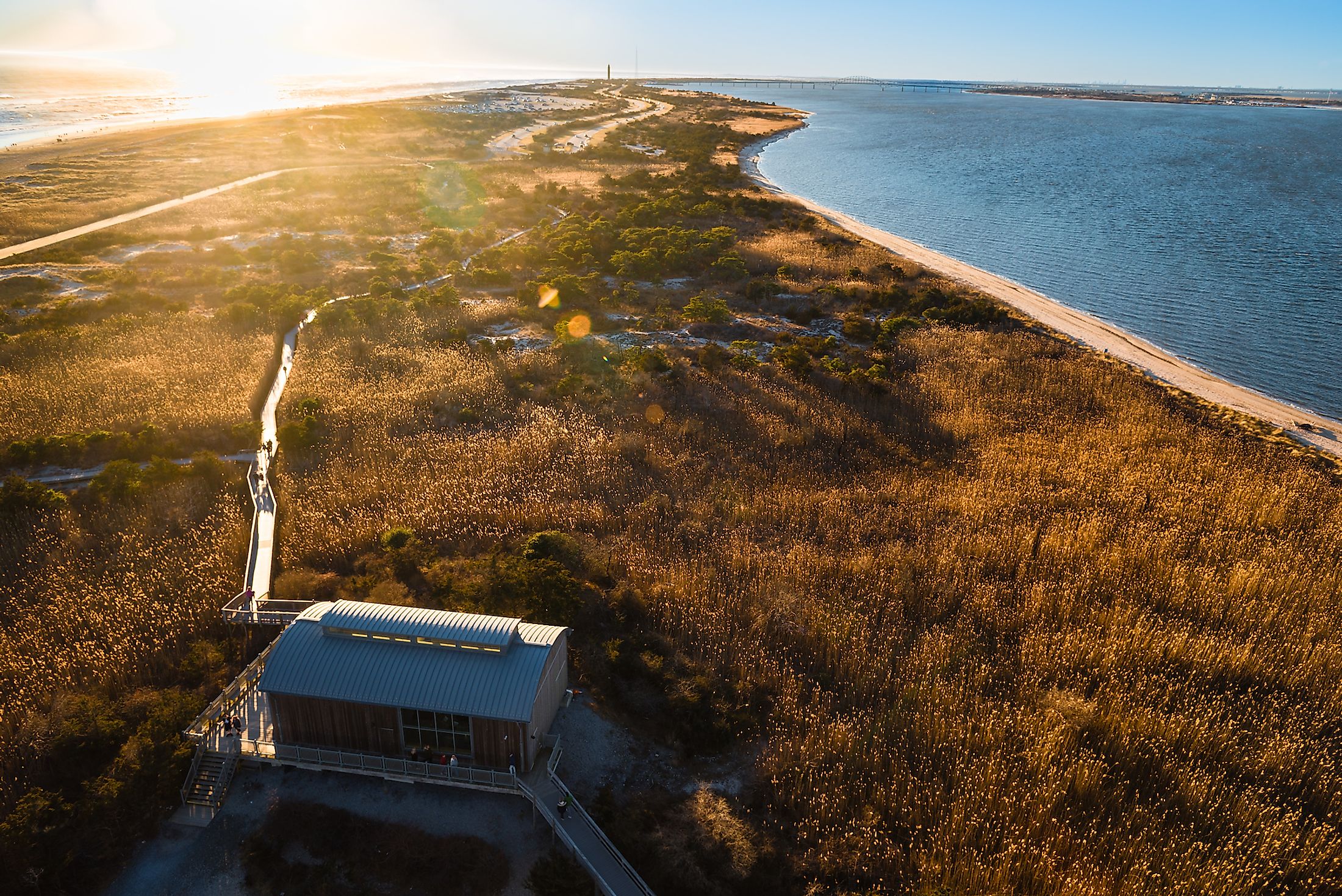
Fire Island
Fire Island is one of the outer barrier islands that runs parallel to the south shore of Long Island, New York. It is the larger one in the center of other barrier islands, Long Beach Barrier Island, Barnum Island, Jones Beach Island, and Westhampton Island. Together these run for around 121 km from the Rockaway Peninsula in New York City to the east end of Shinnecock Bay in Suffolk County.
In 2012, Hurricane Sandy readjusted the waterways and sand barriers in the region and split Fire Island into two landmasses. Collectively, Fire Island measures 50 kilometers, and the islands are between 160 and 400 meters across. The islands combine for a land area of 25 square kilometers.
Geography Of Fire Island

Fire Island sits roughly 6.2 km away from Long Island's south shore but almost touches it at the eastern end. Great South Bay lies between it and Long Island and Patchogue Bay, Bellport Bay, Narrow Bay, and Moriches Bay. The Fire Island is reachable via boat, seaplane, and several ferries from Bay Shore, Sayville, or Patchogue to various landings on the opposite shore. Road connections include the Robert Moses Causeway in the west, and William Floyd Parkway in the eastern end, though motor vehicles are restricted to essential services.
History Of Fire Island
The first known people to have lived on the island were indigenous Native American peoples. They were thought to be two main groups on the island, speculated to be most closely related to Algonquian people, though records are not overly detailed. Europeans were first recorded having a presence on the island in 1664, but this was more of a political act as European settlers on the mainland appointed their choice of indigenous leader over the island. Jeremiah Smith was the first to build a large home on the island in 1795, and small settlements grew from there. In the 19th Century, slave stockades were common on the island, especially in the area near Fire Island Inlet. During this time, Fire Island Lighthouse was built. It was first constructed in 1825 and was later updated in 1858. The Surf Hotel was built in 1855 when David S.S. Sammis bought half a square kilometer of land near the lighthouse. The Hotel operated until 1892 and was converted into a state park in 1908, becoming the first state park on Long Island.

1880 saw the construction of a second hotel on land owned by Archer and Elizabeth Perkinson. In 1867, the Coast Guard built 11 stations on the island, and Ocean Beach opened in 1908, with Saltaire following in 1910. Duffy's Hotel eventually added to the hotels in 1930. In 1938, a large hurricane ripped through the region and wiped out much of the infrastructure there. Aside from the damage, the hurricane did PR damage in that it deterred many people from visiting or moving to the seemingly dangerous island. Eventually, though, the Captree Causeway was constructed in 1964 led by Robert Moses, and Fire Island National Seashore was established the same year. The popularity of the island - especially during warmer summer months, began to increase.
Effect Of Hurricane Sandy On Fire Island
In 2012 the island was hit by Hurricane Sandy. The primary issue was the high tides and destructive waves caused by the hurricane, which breached the island. The largest of these breaches was located at Old Inlet, in the Otis Pike Wilderness Area. The breach grew massively after the storm but was essentially left to itself, as the breach allowed Great South Bay to be flushed, which improved the water quality there. Some 80% of homes in the area were flooded, and almost 100 homes were destroyed. A large portion of the dunes and coastline were also lost to the storm surges. This later inspired a dune replenishment program.
Gay Influence And Culture On The Fire Island

It is thought that Duffy's Hotel was one of the initial meeting areas for the gay population, including Christopher Isherwood and W. H. Auden. Such meetings continued into the 1960s when John B. Whyte, a known male model of the times, created Fire Island Pines, a gay dominant community on the island. Both the hamlets of Fire Island Pines and Cherry Grove are known for being popular resort areas for gay men. In the 1970s especially, free-living, drugs, and parties were common in the area, especially at the Grove Hotel (then known as the Botel). The Botel was very gay-friendly and hosted tea dances frequently. As such, Cherry Grove is the self-proclaimed "First Gay and Lesbian Town" in America. Grove Hotel continues to be a cultural icon in the gay community and is the only Hotel in the state of New York that is strictly 21 and over due to the fact its entrance and main floor are a bar.
The island continues to have an active tourist and recreational industry. Though roughly 300 residents live on the island permanently, thousands visit during the warmer months. From beachgoers to fishers, outdoor enthusiasts, resort lovers, and anglers, there are a variety of activities for the visitors to Fire Island to enjoy.