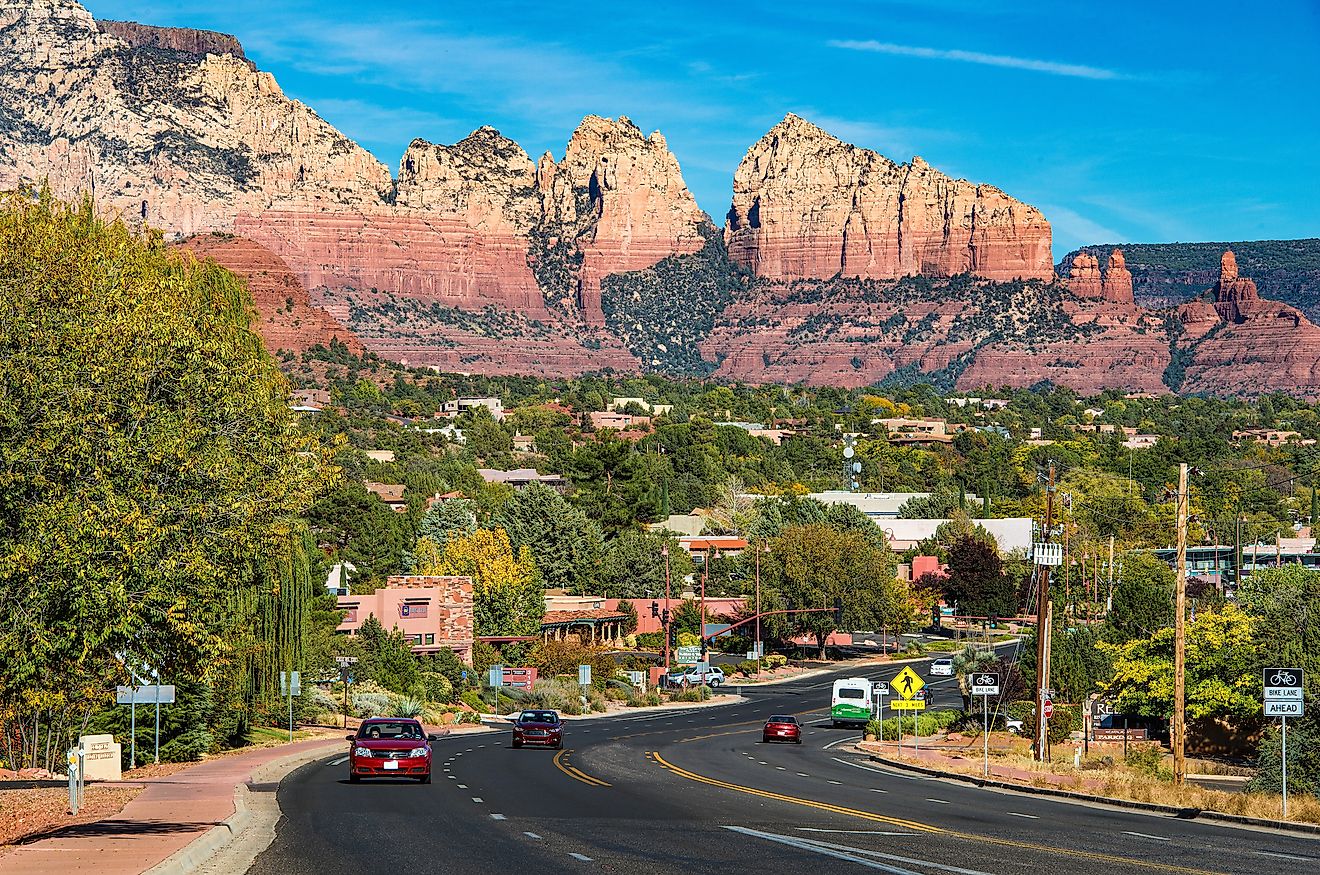
9 of the Most Scenic Road Trips to Take on the Pacific Coast
The Pacific Coast saves its best scenery for the road, with a different drive every hundred miles or so. Highway 1 hangs off the Big Sur cliffs above open ocean. The Avenue of the Giants slips under redwoods older than the country. Oregon made all 363 miles of its shoreline public in 1967. Washington adds the Olympic Peninsula, one loop around a park of rainforest and glaciers. Some of these drives take a weekend. One takes a month and earns it.
Pacific Coast Highway: San Francisco to San Diego

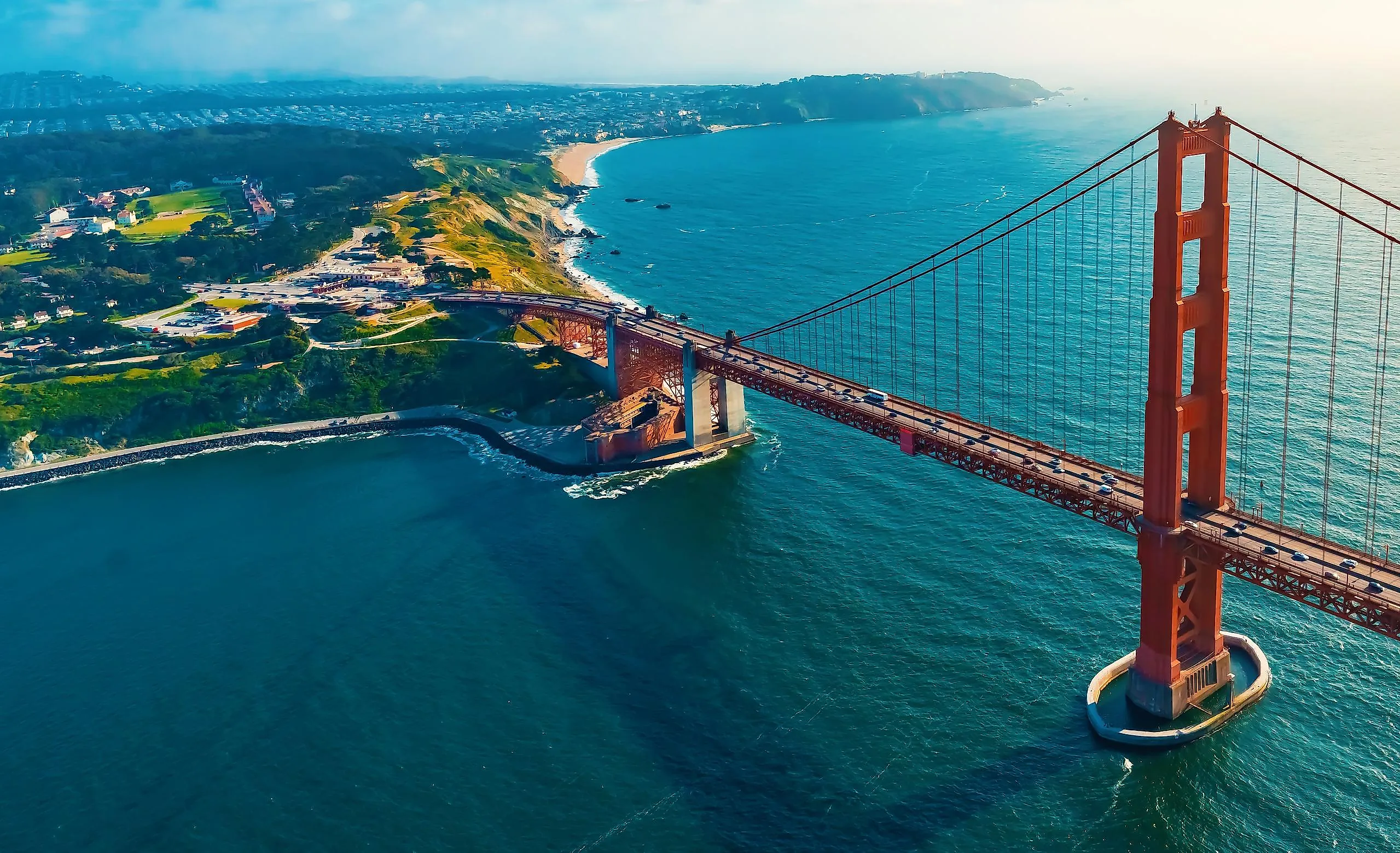
The San Francisco to San Diego run covers about 615 miles of coast. Plan on a full week. Leave the Golden Gate behind and the road serves up Muir Woods and the Land's End Trail. Then it dips south through Half Moon Bay and Santa Cruz.
Past Monterey, Highway 1 climbs into the Big Sur cliffs. The road tops out hundreds of feet above the surf. McWay Falls, in Julia Pfeiffer Burns State Park, drops 80 feet toward the beach below. The route then threads San Simeon and Cambria into Santa Barbara, Malibu, and the Santa Monica Pier. The home stretch rolls through Long Beach, Huntington Beach, and Laguna Beach to La Jolla. It ends at Ocean Beach in San Diego.
Big Sur

The 90 miles between Carmel and San Simeon make a trip on their own. The Bixby Creek Bridge is the obvious place to stop. It opened in 1932 and arcs 714 feet across the canyon, 280 feet above the creek bed. Hurricane Point Vista, just up the road, looks straight back at it.
Point Sur Lighthouse perches on a volcanic rock 361 feet above the water. It opens for guided tours on weekends. A little south, McWay Falls is one of only two tidefalls in the state. It drops 80 feet to its cove and reaches open ocean at high tide. Cap the day at the Henry Miller Memorial Library, with its evening readings under the trees, or at Nepenthe. The restaurant perches 800 feet above the surf on land Orson Welles bought in 1944. Give the stretch a full day, with an overnight in Carmel or Cambria.
Avenue of the Giants

Some redwoods along this 31-mile detour were already centuries old when the Roman Empire fell. The Avenue of the Giants parallels Highway 101 and the South Fork Eel River through Humboldt Redwoods State Park. The park's 53,000 acres hold the largest unbroken stand of old-growth coast redwoods left anywhere. Founders Grove is the headline stop. The 346-foot Founders Tree still stands. Nearby, the Dyerville Giant lies where it fell in 1991, a 362-foot trunk you can walk the length of.
The drive-thru trees are pure roadside kitsch. They have outlasted plenty of fancier attractions. The Shrine Drive-Thru Tree in Myers Flat and the Chandelier Tree in Leggett were both carved into living trunks in the 1930s. Stop at the Humboldt Redwoods Visitor Center in Weott for trail maps. The road takes about an hour without stops. Founders Grove and the Rockefeller Loop alone can take half a day.
California's Lost Coast

This is the piece of California coast the highway engineers gave up on. For 80 miles the King Range climbs too steep and crumbly for any road to hold. So Highway 1 quits the shoreline and bends inland through Humboldt and Mendocino counties. The drive opens in Eureka. The Carson Mansion and the Old Town district set the tone. South of there, Ferndale's Victorian Main Street has stood in for small-town America in more than one film.
Out of Ferndale, Mattole Road is the only paved way back to the water. It dead-ends at Black Sands Beach. The Punta Gorda Lighthouse waits at the end of a three-mile beach walk from the Mattole Beach trailhead. Shelter Cove is the lone town with services out here, down to a tiny airport and a few coastal inns. Humboldt Redwoods State Park makes an easy side trip on the way back to 101.
Oregon Coast: Astoria to Brookings

Oregon settled the beach question in 1967. The Beach Bill made the whole shoreline public, and Highway 101 traces all 363 miles of it. Astoria opens the route at the top. Fort Clatsop here marks where the Lewis and Clark Expedition wintered. Down the road, Cannon Beach has Haystack Rock, a 235-foot sea stack ringed with tide pools. Tillamook hands out self-guided tours of the creamery behind the cheese on every grocery shelf in the region.
South of Tillamook, the Three Capes Scenic Loop ducks off 101 onto the headlands. The Oregon Coast Aquarium in Newport, the Sea Lion Caves near Florence, and the Oregon Dunes all line up along this stretch. Near the southern end, Bandon and Gold Beach put you in whale-watching range during the migrations. Give the whole coast about a week with stops.
Three Capes Scenic Loop

This 40-mile loop peels off Highway 101 between Tillamook and Pacific City. It trades the main road for three headlands jutting into the Pacific. Cape Meares opens it at the north end with two oddities side by side. The Octopus Tree is a Sitka spruce that grew sideways into a candelabra. Cape Meares Lighthouse, at 38 feet, is the shortest on the Oregon coast. It first lit in 1890 and looks almost toy-sized next to its headland.
Cape Lookout State Park covers the middle. Its headland reaches two miles out to sea, with a campground set among the dunes. At the south end, Cape Kiwanda's sandstone bluffs draw the dory fleet that launches off the beach in front of Pelican Brewing. Save room for the Tillamook Air Museum near the start of the loop. It occupies one of the largest wooden buildings ever raised.
Portland to Seattle: The Coastal Route

Skip the freeway and the coastal version of Portland to Seattle becomes 250 miles of the wildest country in the Northwest. Head west out of Portland on Highway 26 to the coast. Then go north on Highway 101 over the Astoria-Megler Bridge across the Columbia River. At 4.1 miles, it is the longest continuous truss bridge in North America. Crossing it feels like driving out over open water.
On the Washington side, Long Beach fronts a sandbar it bills as the longest beach in the country, some 28 miles of it. Highway 101 carries on through the Willapa National Wildlife Refuge. Then come Aberdeen and Hoquiam, the working towns that open the door to the Olympic Peninsula. From there the route crosses the Chehalis on Highway 12 and picks up Route 8 to Olympia. The final 60 miles to Seattle run on Interstate 5.
Seattle and the Olympic Peninsula

The Olympic Peninsula Loop circles a national park for about 330 miles on Highway 101. It starts with a boat. Catch the Bainbridge Island ferry out of Seattle across Puget Sound, then head north. Port Townsend, on the eastern shore, preserved its early-1900s Victorian downtown so well it feels staged. Sequim, in the rain shadow of the Olympic Mountains, gets about 16 inches of rain a year. That makes it the driest spot west of the Cascades, where half the retired Coast Guard seems to garden.
Port Angeles puts you at the foot of the Hurricane Ridge road into Olympic National Park. Lake Crescent, carved by glaciers, drops to 624 feet and glows an unreal blue on a clear day. Deeper in the park, Sol Duc Hot Springs Resort soaks visitors in mineral pools fed by sulfur springs. Neah Bay, at Cape Flattery, is as far northwest as anyone can drive in the Lower 48. The southern arc through Quinault, Aberdeen, and Olympia closes the loop toward Seattle.
The Full Pacific Coast Highway

The complete Pacific Coast Highway covers 1,675 miles between Olympia and San Diego. Drive it southbound to ride the ocean side the whole way. Two to three weeks is the honest estimate with stops. Plenty of drivers stretch it to a month for Big Sur, the Oregon Coast, and the Olympic Peninsula. March through May is the sweet spot, after the rain and before the heat. Gray whales pass close to shore in spring. Elephant seals haul out by the thousands at Piedras Blancas through the winter.
Pick Your Stretch of the Pacific
You don't have to drive all of it at once. A free Saturday covers the Big Sur cliffs or the Three Capes headlands. A week buys the whole Oregon shoreline or the Olympic Peninsula loop. The redwood detour and the Lost Coast reward anyone who leaves the obvious highway. Pick any piece. The Pacific does the rest, holding the horizon off your right shoulder for nearly every mile.