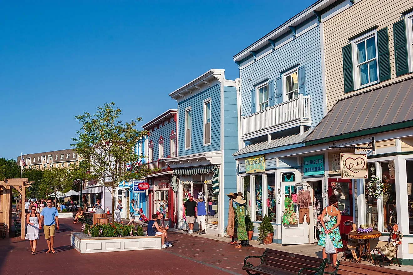
9 Most Scenic Drives in Florida
In Florida, sprawling beaches and crystal clear waters make it the perfect destination for fun drives. In the south, the Tamiami Trail runs past Everglades sawgrass, where alligators and wading birds are often part of the view. Around Ormond Beach, the road follows the Tomoka River beneath palmettos and live oaks before the Atlantic comes into sight. And in the Keys, US 1 carries drivers across open water for miles at a time. Taken together, these nine drives trace a very different side of Florida from one region to the next.
Ormond Scenic Loop

This National Scenic Byway passes through some of the most beautiful scenery on the Atlantic coast of central Florida. Just off I-95, the 34-mile double-loop road offers easy access to the ocean, undeveloped natural beauty, and over 300 years of history. The loop can be traveled in any direction and passes by several historic sites, including a WWII submarine watchtower in Ormond Beach, the ruins of the Dummett Sugar Mill, and The Casements, the former waterfront winter home of John D. Rockefeller.
Starting from Pine Tree Drive, traveling clockwise will take you through the hardwood hammock of Tomoka State Park with scenic views of both the Tomoka River and Tomoka Basin, where West Indian manatees can be spotted in the water. For more river views, you can take the John Anderson Drive route, which follows the Halifax River up to North Peninsula State Park. If you prefer the ocean, drive along the Atlantic on Ocean Shore Drive. The beaches along the latter route host nesting turtles from May to September and offer opportunities to spot migrating right whales in winter. To return to your starting point, you’ll cross over the Knox Memorial Bridge, one of only three remaining drawbridges spanning the Intracoastal Waterway in Volusia County, and pass through Bulow Creek State Park, which contains the Fairchild Oak, one of the largest live oak trees in the south
Florida Black Bear Scenic Byway

The Florida Black Bear Scenic Byway is a 60-mile network of several different scenic roads between the towns of Silver Springs and Ormond Beach. Most of the byway follows Florida State Road 40 but also includes portions of SR-19 and County Road 445, connecting many of the recreation areas and natural springs in Ocala National Forest. As the name suggests, this area has the highest population density of Florida black bears, and it is not uncommon to see them meandering along the roadway.
Traveling east from Ocala takes you past Silver Springs State Park, home to one of the country’s largest springs and a historic tourist attraction, where glass-bottom boat rides reveal the underwater life in its clear waters. The route then passes right through the heart of the Big Scrub, the largest continuous pine scrub ecosystem in the world. The area is full of white sand dunes, long leaf pine, and is home to endangered species, including sand skinks and Florida scrub jays. At the intersection with State Road 19, you can drive north along the shores of Lake George to Salt Springs Recreation Area, home to another beautiful mineral spring and great opportunities for swimming, snorkeling, and paddling. Driving south will take you to the Lake Dorr Recreation Area, a great bass fishing destination in the shade of a dense oak hammock. Continuing along State Road 40 will take you along the edge of Tiger Bay State Forest before ending in the small coastal town of Ormond Beach.
Green Mountain Scenic Byway

Florida probably isn’t the first place that springs to mind when you think of rolling hills, but this scenic drive just outside of Orlando might change your perception of the country’s flattest state. Known for its rural charm, gorgeous lake views, and access to the highest point on the Florida Peninsula, the 45-mile Green Mountain Scenic Byway is a fantastic way to explore this unique area of central Florida.
Starting in Winter Garden, the route closely follows the southwestern shores of Lake Apopka, passing through the small towns of Oakland, Montverde, and Ferndale. Just outside of Ferndale, the Green Mountain Scenic Overlook provides great views of the hilly terrain and a trailhead that connects to the Lake Apopka Loop Trail. A short turn off the route leads to the 312-foot summit of Sugarloaf Mountain, the highest point on the Florida Peninsula and the most prominent peak in the state. Wildlife enthusiasts should check out the Lake Apopka Wildlife Drive, an 11-mile stretch home to distinctive birds like snowy egrets and snowy herons. The byway then passes by a trio of smaller lakes, Carlton, Ola, and Beauclaire, before ending in the town of Mount Dora, home to the Modernism Museum and a 35-foot faux-lighthouse at Grantham Point Park overlooking Lake Dora.
Ocean Islands Trail

The Ocean Islands Trail is a 40-mile stretch of Florida State Road A1A that runs from just south of the Georgia state line to Jacksonville Beach along the Atlantic coast. This region of beaches, barrier islands, and maritime forests is known as Florida’s First Coast, home to the oldest permanent European settlement in the country.
The route begins on Amelia Island, passing through the historic streets of Fernandina Beach. The historic seaport village is home to hundreds of historical sites, such as the Amelia Island Lighthouse and Fort Clinch, as well as a 50-block historic district full of distinctive Victorian-style houses. From there, the highway follows the coast down the length of the island to American Beach, where visitors can climb to the top of Nana Dune, the tallest sand dune in Florida, before crossing the Nassau Sound Bridge onto Big Talbot Island. This state park and nature preserve is full of distinctive geology, tidal pools, and ample opportunities for hiking and birdwatching, and the road passes right by two of its most famous attractions: Boneyard Beach, which is covered in the skeletons of live oak and cedar trees, and Blackrock Beach, a stretch of eroded cliffsides and unique spodosol formations. After passing through the maritime forests on Little Talbot Island and Fort George Island, the Mayport Ferry takes you across the St. Johns River before returning to the ocean for the last leg and ending in the coastal town of Jacksonville Beach.
Big Bend Scenic Byway Coastal Trail

One of the longer scenic road networks in the state, the Big Bend Scenic Byway covers 220 miles of roadway in the Florida Panhandle between Tallahassee and Apalachicola. The byway is split into two main sections, the Forest Trail and the Coastal Trail, and the latter offers travelers the chance to explore some of the state's most pristine and least developed shoreline.
Driving south from Tallahassee, the route passes Edward Ball Wakulla Springs State Park, home to one of the largest and deepest freshwater springs in the world, where manatees and alligators can often be seen in the clear waters. From there, you will wind your way through the 86,000-acre St. Mark’s National Wildlife Refuge, passing coastal marshes, tidal creeks, and estuaries that provide a winter habitat for hundreds of species of migratory birds. Stop at the historic St. Mark’s Lighthouse at the mouth of the St. Mark’s River for gorgeous views of the Apalachee Bay. Continuing west along US Highway 98, the byway follows the Gulf Coast for approximately 60 miles, with access to places such as Bald Point State Park and Tate’s Hell State Forest before reaching Apalachicola. This welcoming port town is a great place to stop for fresh seafood or to explore the area’s rich history at the Orman House Historic State Park.
Tamiami Trail (Miami to Naples)

When construction on the Tamiami Trail was completed in 1928, it was the only paved road connecting the cities of Tampa and Miami. Nowadays, thanks to the interstate highway system, there are faster routes across the swamps of south-central Florida, but few that are as scenic for travelers who don’t mind a slightly longer trip. Today, the most scenic and memorable stretch for many travelers is the segment between Miami and Naples, which takes less than three hours to drive without stops.
Driving west from Miami, the Tamiami Trail enters the heart of the Everglades, where alligators and other wildlife are often visible in the roadside canals. Along the route, the Miccosukee Indian Village highlights the history and culture of the native tribes that call the area home. This attraction offers a living history museum, alligator demonstrations, and airboat rides through the vast river of grass, one of the best ways to explore the area’s unique ecology. If you prefer to stay on relatively dry land, the Shark Valley Visitor Center offers tram tours that stop at the Shark Valley Observation Tower, a great spot for birdwatching and panoramic views of the wetlands. At roughly the halfway point on the drive, you will enter Big Cypress National Preserve and can stop at the Oasis Visitor Center to learn about the natural and cultural history of the region and try to spot wildlife from the boardwalk. Also worth a stop is Clyde Butcher’s Big Cypress Gallery, where you can view some of his landscape photography or go on a guided swamp walk. The route also features several quirkier man-made attractions, such as the Skunk Ape Research Headquarters and the country’s smallest Post Office.
Old Florida Heritage Highway

The Old Florida Heritage Highway is a 45-mile network of roads through some of north central Florida’s most beautiful rural and pastoral landscapes. Just south of the college town of Gainesville, this Florida State Scenic Highway can be driven in about 2 hours and offers one of the best glimpses of what traveling through the state was like before the interstate highway system.
After leaving Gainesville on US Highway 441, you will pass through Paynes Prairie Preserve State Park, the first state preserve in Florida, which is home to several animals you might not expect to see in Florida, like herds of wild-roaming horses and bison. The park’s observation tower, right next to the visitor center, provides a great vantage point for birdwatching or taking in the diverse terrain of grassland and wetland. After skirting the shores of Lake Wauburg, the road leads right through the historic town of Micanopy, the oldest inland town in Florida. The Micanopy Historical Society Museum provides exhibits about the town’s 200-year history, and the Historic District is packed with antique stores and boutique shops. Take County Road 346 over the Cross Creek Bridge to visit the historic homestead of one of Florida’s most important literary figures, Marjorie Kinnan Rawlings. This National Historic Landmark, where Rawlings wrote her Pulitzer Prize-winning novel The Yearling, provides a well-preserved window into farm life in early 20th-century Florida.
Main Park Road (Everglades National Park)

This 38-mile stretch is the only paved road through Everglades National Park. This scenic drive connects the Ernest F. Coe Visitor Center near Florida City to the Guy Bradley Visitor Center in Flamingo and takes about an hour to drive without stops, though it can easily fill a full day in the park.
The drive will take you through several different ecosystems, from the pinelands and hardwood hammocks farther inland to cypress swamps and mangrove forests in the marshier coastal areas. The road provides access to some of the park's most popular trails, including the Anhinga Trail, a 0.8-mile boardwalk over a sawgrass marsh known for its abundance of wildlife, and the Gumbo Limbo Trail, a paved, shady walk through jungle-like stands of gumbo limbo trees and royal palms. The Pah-hay-Okee Overlook is another great stop, providing panoramic views of the vastness of the Everglades, and the wheelchair accessible Mahogany Hammock Trail, just a few miles further down the road, allows visitors to see the largest living mahogany tree in the country. Flamingo, the road’s southern terminus, is a great place for spotting American crocodiles and West Indian manatees or grabbing a bite to eat at the Flamingo Restaurant before heading back up the road.
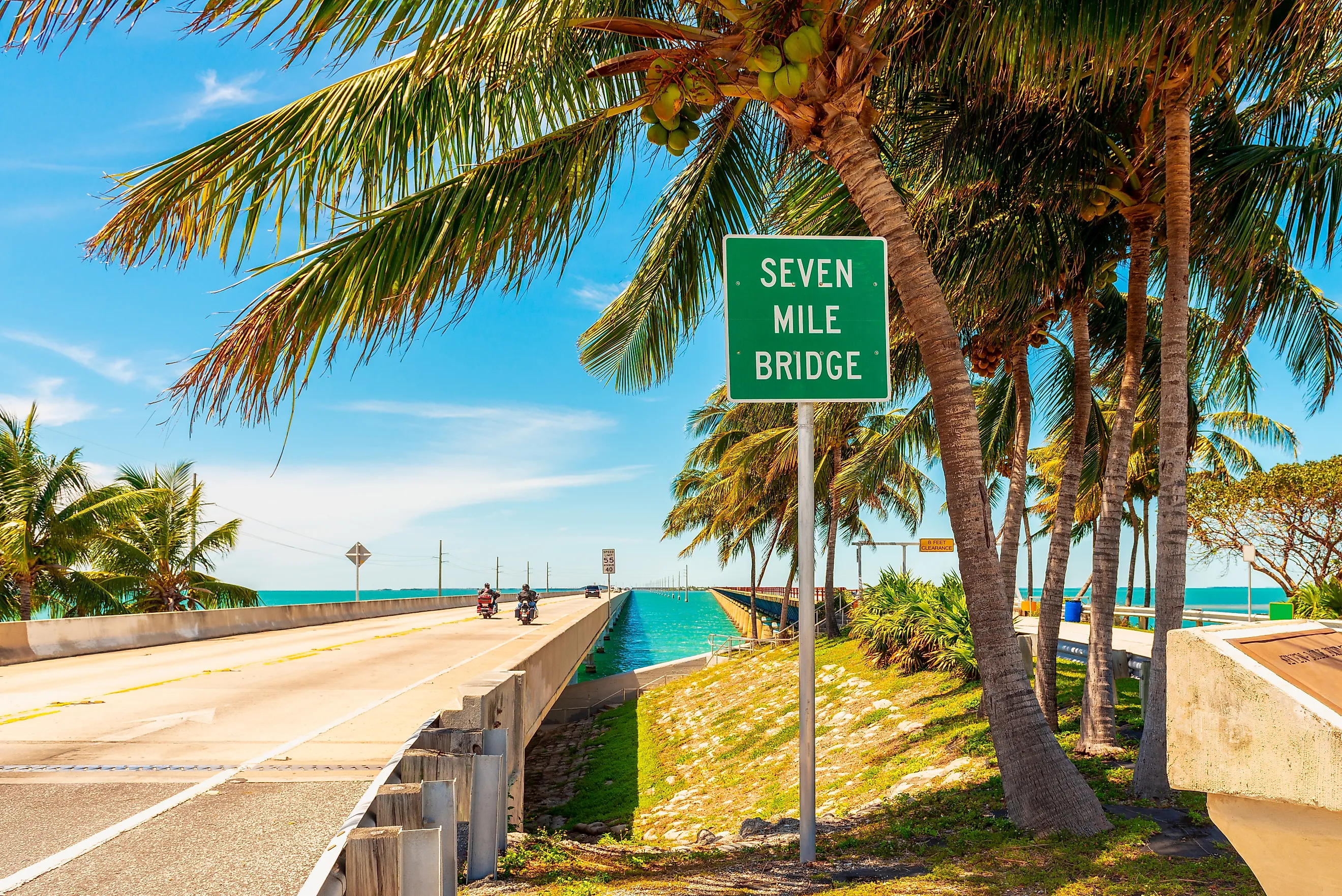
Florida Keys Scenic Highway

One of the state’s most iconic drives, the Florida Keys Scenic Highway is a 113-mile stretch of US Route 1 that connects mainland Florida to Key West. This system of 42 bridges is an engineering marvel, island-hopping across the scattered Florida Keys, providing incredible ocean views as it traverses the open ocean.
Driving south from Key Largo, you’ll pass right by John Pennekamp Coral Reef State Park, the first undersea park in the country, which can be explored on glass-bottom boat tours or snorkeling. The History of Diving Museum on Islamorada is a great place to stop to learn about the history of SCUBA diving through its vast collection of artifacts, exhibits, and historic dive equipment. At Bahia Honda State Park, you can enjoy beautiful white sand beaches and crystal-clear waters, as well as the historic railroad bridge, a remnant of Henry Flagler’s ambitious plan to open the Florida Keys to rail travel in the early 20th Century. The highlight of the drive is the Seven Mile Bridge, the longest in the Keys, which offers travelers the opportunity to pull over and enjoy sweeping views of the water and see the old Seven Mile Bridge, now a perch for pelicans, herons, and other seabirds. If you can time it right, the bridge is one of the best spots to watch the sunset in the entire state.
A Road Trip View of Florida’s Landscapes
Diverse ecosystems, unique wildlife, and miles of gorgeous coastline make Florida an excellent road trip destination. From experiencing what life was like in the early days of Florida on the Old Florida Heritage Highway to memorable wildlife encounters along the Main Park Road in Everglades National Park, these scenic drives allow you to explore the vast array of landscapes, historical attractions, and pristine waterways that Florida has to offer.