8 Great Road Trips to Take in Washington
The Pacific Northwest goes on full display along Washington's highways and byways. Natural backdrops like the Olympic Peninsula and Puget Sound set the scene for road trips with sweeping views and small-town pit stops. The Hidden Coast Scenic Byway winds along the Pacific Ocean past sandy beaches, coastal towns, and dramatic bluffs. If you're short on time, Deception Pass delivers breathtaking water views and a dramatic bridge crossing in under an hour. Each of these eight routes packs its own visual reward from beginning to end.
West Highway 2

The Bavarian-themed village of Leavenworth is a year-round Washington destination, but the 100-mile drive along West Highway 2 between Everett and Leavenworth is as memorable as the destination. The route starts right off Interstate 5 near the Salish Sea and passes through Snohomish and Monroe (where the Highway 2 Fusion Diner handles the Mexican-American pit-stop). Highway 2 becomes Stevens Pass Greenway as it climbs into the Cascade Mountains. Check weather and fill up on gas; the pass can be icy any time between fall and spring.

The route runs along the Skykomish River. Alpine Adventures in Gold Bar (named for its original identity as a gold prospecting camp) handles whitewater rafting. The nearby Woody Trail is a 5.6-mile loop to the multi-tiered Wallace Falls. Other stops include Bridal Veil Falls, Heybrook Lookout, and Deception Falls. Railway enthusiasts should stop at the Great Northern and Cascade Railway and the Iron Goat Hike, a section of preserved former Great Northern Railway grade that climbed over Stevens Pass before the tunnel bypass.
Hidden Coast Scenic Byway

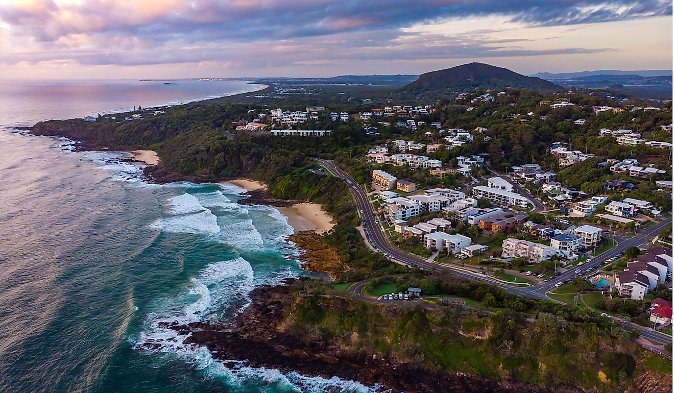
Where Highway 109 meets the Pacific Ocean and curves north at Hogan's Corner, one of the most scenic stretches of road in the United States begins. The Hidden Coast Scenic Byway starts in Hoquiam and winds through Ocean City, known for wide, flat sandy beaches. As the route heads north, the Olympic Rainforest rises to the east while the Pacific stretches west.

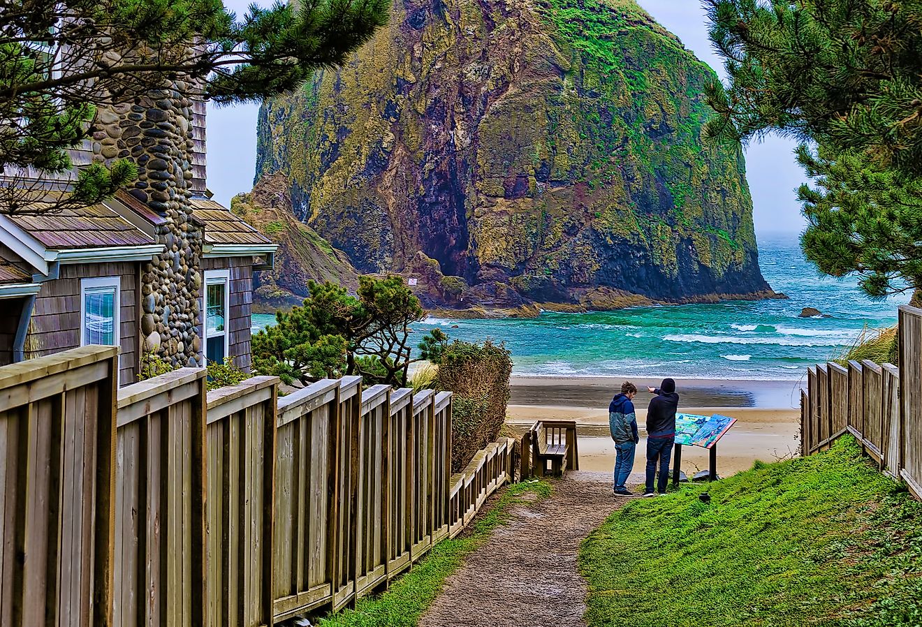
Just north of Ocean City, Roosevelt Beach allows vehicles directly onto the sand (no Discover Pass required). Further along, Seabrook has independent shops like Joie Des Livres bookstore and Frontager's Pizza Company. Beyond Seabrook, Pacific Beach sits on one of the westernmost main streets in the contiguous US. The route continues past the dramatic bluffs of Moclips and ends at Taholah on the Quinault Reservation.
Olympic Peninsula Loop

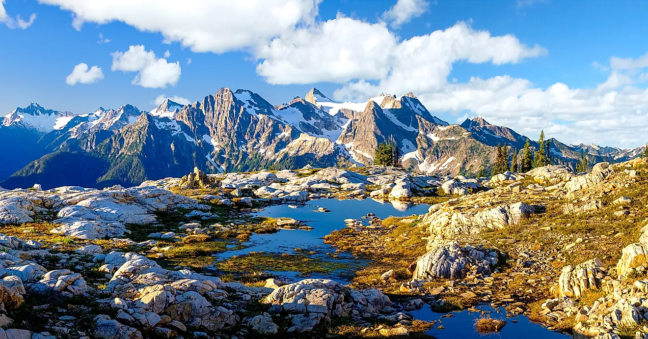
This loop runs roughly 300 miles around the Olympic Peninsula along Highway 101, best taken over a few days to absorb the changing landscapes. Starting near Olympia, the route heads north toward the Strait of Juan de Fuca. The drive to Port Angeles is 120 miles and transitions from inland forests to open-water views. Port Angeles makes a convenient mid-route stop with a walkable waterfront.
To visit the Hoh Rainforest, drive 13 miles south of Forks on Highway 101, then turn onto Upper Hoh Road for about 18 miles into one of the most lush temperate rainforests in the country. Highway 101 then hugs the northern edge of Olympic National Park west to Lake Crescent, following the shoreline of this clear, glacially-carved lake before continuing deeper into the peninsula's dense forests.

South of Forks, the drive opens into dramatic stretches of coastline with sea stacks and driftwood-strewn beaches. The route curves inland again through the Quinault rainforest region before the final leg south toward Hoquiam and Grays Harbor. Highways 12 and 8 then bring you back toward Olympia to complete the loop.
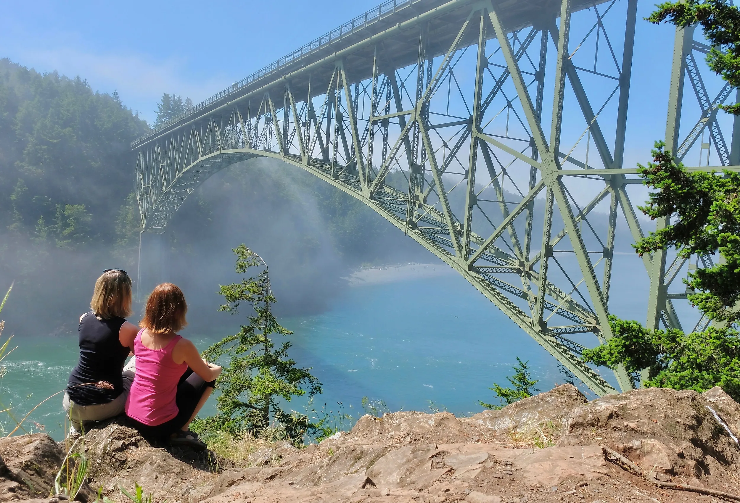
Deception Pass

This 20-mile drive begins in Oak Harbor and follows State Route 20 north toward the tip of Whidbey Island. Deception Pass State Park (Discover Pass required) holds ocean cliffs, beaches, and a freshwater lake. The highlight is the Deception Pass Bridge, a 1935 steel-arch pair spanning the narrow strait separating Whidbey and Fidalgo Islands, with water moving visibly through the channel below at each tide change. On the north side, SR-20 continues past Pass Lake, Lake Campbell, and the Fidalgo Bay Aquatic Reserve to Anacortes, where ferries and whale-watching tours head out onto the Salish Sea.
Point Defiance To Gig Harbor Via The Narrows Bridge

Point Defiance is known for its views, and this short trip is full of them on clear days. Start at Dune Peninsula for Mount Rainier in the distance, then head for the Five Mile Drive, the scenic loop through Point Defiance Park. Viewpoints along the loop offer views of Puget Sound and the Tacoma Narrows Bridge.

After completing Five Mile Drive, head to State Route 16 and cross the Tacoma Narrows Bridge (the current twin spans opened 1950 and 2007; the original 1940 "Galloping Gertie" collapsed spectacularly in wind four months after opening, a classic engineering case study). Take Olympic Drive Northwest to downtown Gig Harbor, or Soundview Drive for the waterfront approach. Downtown Gig Harbor combines boutiques, art galleries, and cafes.
Poulsbo To Seattle Via Bainbridge Island Ferry

This trip starts in the Viking-themed town of Poulsbo, founded in 1908 by Norwegian immigrants. Liberty Bay Waterfront Park overlooks the harbour in the walkable downtown, which has shops, galleries, pubs, and eateries (Sluys Poulsbo Bakery has been a town institution since 1966 for its Norwegian pastries). Front Street becomes Northeast Hostmark Street and connects to Highway 305, then runs about 20 miles across the Agate Pass Bridge onto Bainbridge Island and to the ferry terminal.

Stretch your legs around the terminal before boarding the ferry to Seattle. The 35-minute crossing is part of the experience; step out on deck for Puget Sound views and (on clear days) glimpses of the Seattle skyline including the Space Needle and Seattle Great Wheel. You'll arrive at Coleman Dock, within walking distance of Pike Place Market.
Palouse Scenic Byway

The Palouse region is known for rolling fields of wheat and lentils, a landscape unlike anywhere else in the country (the distinctive dune-like hills are formed from windblown loess soil). This trip starts in Pullman, home to Washington State University, and heads north through the heart of this farm country. On the way to Colfax, the road winds through the region's signature hills. Colfax is home to the Codger Pole, a 65-foot chainsaw-carved memorial to a 1938 high school football team.

The route ends at Palouse Falls State Park. The Palouse River plunges 198 feet over a basalt cliff into a deep canyon, with the Columbia flood basalts surrounding the drop making the geology especially interesting. The cascade is part of the Ice Age Floods National Geologic Trail (the falls and canyon were carved by the Missoula Floods around 15,000 years ago) and is Washington's official state waterfall.
East State Route 106

Where Highway 101 passes through the Skokomish area near Olympic National Forest, State Route 106 begins. This 20-mile stretch starts in forest with glimpses of the Skokomish River through the trees. The river opens into an estuary where it meets Hood Canal (one of the four fjord-like arms of Puget Sound). SR-106 then follows the Hood Canal shoreline through Union and past Alderbrook Resort. Twanoh State Park partway along offers a good stopping point with a beach for oyster watching (Hood Canal is one of the most productive oyster-growing regions in the US). The route ends in Belfair at State Route 3.
Eight Drives, One State
From coastal highways and ferry crossings to mountain passes and rolling farmland, Washington's scenic drives cover a wide range of landscapes. Each route reveals a different side of the state: Pacific beaches on the Hidden Coast Byway, old-growth rainforest on the Olympic Peninsula Loop, dramatic ocean channels at Deception Pass, city-ferry views from Poulsbo, wheat country on the Palouse Byway, and quiet fjord shoreline on SR-106. Take your time, pull over, and let the scenery do the work.