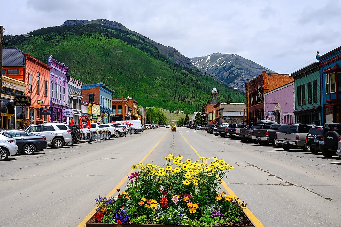
10 Great Road Trips to Take in Oregon
In Oregon, a morning can start with damp air on Marine Drive in Portland. Afterwards, you can head east on I-84, where firs line the road near Corbett and Multnomah Falls, then the gorge opens around Rooster Rock. By the time you reach The Dalles, the air feels drier, and wheat fields start taking over the slopes above town. Another day begins at the Astoria Column, then crosses the Youngs Bay Bridge onto U.S. 101. The Pacific stays within reach through Cannon Beach, with Haystack Rock just offshore. These are familiar Oregon drives. The ten trips below focus on what it feels like to move through Oregon by road, from weather and terrain to the way the view changes between towns.
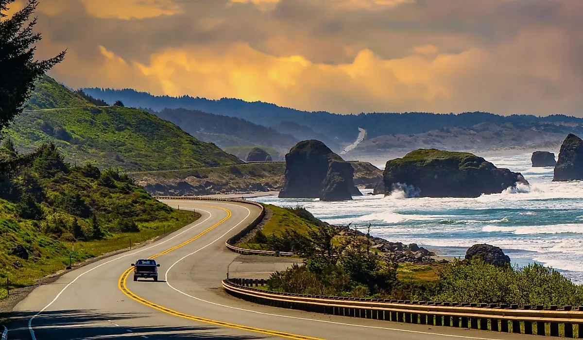
Highway 101: Astoria to Brookings

From the moment you leave Astoria at the mouth of the Columbia River, most of the drive on U.S. 101 runs close to the Pacific, rarely straying far from the shoreline. For nearly the entire 338-mile run to Brookings, the road clings to bluffs, dips into small beach towns, and repeatedly comes close enough to the surf that spray can hit the shoulder on stormy days. Southbound, Haystack Rock rises beside the road at Cannon Beach before 101 bends around Tillamook Bay and threads toward Cape Lookout State Park.
Farther along, the route passes Cape Perpetua and then drops into Florence, where a bridge crosses the Siuslaw River beside working marinas. The final hours toward Brookings run past Cape Arago and Shore Acres, two viewpoints where waves pound the cliffs even in calm weather. Late in the day, the light turns the cliffs gold near Brookings, and the sound of the ocean carries inland.
Columbia River Gorge: Portland to Hood River

East of Portland, I-84 hugs the Columbia River so tightly that the freeway almost feels like part of the canyon wall. Waterfalls spill down basalt cliffs within sight of your windshield, and the first few exits feel more like scenic overlooks than highway ramps. Only after you have settled into the rhythm of the gorge do you realize this 63-mile stretch to Hood River is over far too quickly.
Water tumbles down canyon faces that sit close to the road, making it one of Oregon’s most concentrated stretches of waterfalls. Quick exits lead to Multnomah and Latourell Falls, but even the miles between stops deliver sweeping river views and sheer cliffs. As you get closer to Hood River, windsurfing sails cluster on the water, and Mount Hood often comes into view on clear days. If you want quiet, go early, because by midday in summer, the waterfall exits can back up fast.
Santiam Pass to Bend

Heading out of Salem on OR 22, you do not immediately feel like you are beginning a long trip, just a steady climb along the Santiam River into the Cascades. Dense forest lines both sides of the road, snow lingers late into spring, and the route gradually tightens as you approach Santiam Pass. It is only later, once you are deep in the mountains, that you notice how much ground you have covered on this roughly 160-mile journey toward Bend.
Near Santiam Pass, lava fields and alpine lakes appear beside the pavement, and mountain views start to dominate the windshield. Once over the pass, U.S. 20 drops you abruptly into the high desert. Trees thin out, sagebrush takes over, and the sky opens wide. Pull-offs near Clear Lake and Lava Camp Lake break up the drive before the highway straightens across volcanic terrain toward Bend. The last stretch levels out, though dark volcanic ridges on either side remind you that you are still crossing wild ground.
Bend to Crater Lake

South of Bend, U.S. 97 carries you out of town and into open, dry country almost immediately. The desert gives way to ponderosa pine forests near La Pine, and the air cools as the road begins to climb. By the time you turn onto OR 62 toward Crater Lake, you have already traveled a surprising amount of the roughly 90 miles that separate Bend from the park.
OR 62 then winds through dense woods toward the rim of Crater Lake. The approach does not reveal everything at once. You pass small lakes, patches of lava rock, and long forested stretches before the water suddenly appears from the rim. Multiple pull-offs line Rim Drive, and even the access roads feel remote and quiet. If clouds roll in, you might miss the first view completely and have to circle the rim again later.
Klamath Falls to Lakeview

In about two hours, OR 140 takes you from the settled feel of Klamath Falls into some of the emptiest country in southern Oregon. The first miles east are dominated by sagebrush and scattered juniper, with ranch gates appearing occasionally along the shoulder and services thinning out fast. You settle into the drive long before you realize you are already halfway to Lakeview.
Near Upper Klamath Lake, the land flattens briefly, then begins to roll again as you climb toward the Fremont-Winema National Forest. The transition is gradual, with patches of woodland appearing between stretches of desert. Several small turnouts offer views across broad volcanic plateaus toward distant ridgelines that hover on the horizon. Fill your tank in Klamath Falls, because there is very little between here and Lakeview.
Eugene to Florence along the Siuslaw

OR 126 follows the Siuslaw River west from Eugene in a gradual, steady descent. Farmland gradually gives way to thicker forest, and for long stretches the river disappears into deep bends below the road before flashing back into view through breaks in the trees. The 61-mile run to Florence unfolds so gradually that you barely notice the miles passing.
Traffic can be steady in summer, especially near popular trailheads and riverside picnic areas, which gives the route a practical, everyday feel rather than a purely scenic one. As you get closer to Florence, the air begins to smell faintly salty, and the vegetation softens. The highway crosses the Siuslaw on a high bridge beside working marinas, where fishing boats and recreational craft share the water. From the bridge, you can usually spot seals hauled out near the docks before you even reach the beach.
Mount Hood Loop: Hood River to Government Camp

Leaving Hood River on OR 35, the orchards drop away quickly, and Mount Hood’s lower slopes take over the view. The road twists upward through darker forest in steady switchbacks, and you feel the elevation gain in both temperature and vegetation. Timberline Lodge eventually appears high on the mountain before the loop carries you toward Government Camp along roughly 105 miles of varied terrain.
From Timberline, U.S. 26 bends east through open meadows and dense pine stands. Ski areas, pullouts, and seasonal parking lots appear in clusters, which can slow traffic but also break up the drive. Snow can linger well into spring near Timberline and Mount Hood Meadows, making this feel like an alpine corridor even in early summer. If you hit this loop on a powder day in winter, expect delays, along with clear views of the upper mountain.
Pendleton to Baker City

From Pendleton, U.S. 30 heads toward Umatilla, where it meets the Columbia River, skirting bluffs where trains rumble below, and barges move slowly upstream. After several miles, the highway turns inland toward the Blue Mountains, opening into rolling farmland with long sightlines across fields. From there, the road gradually carries you toward Baker City over about 95 miles of changing landscape.
As the route climbs toward Meacham, trees thicken, and the temperature drops noticeably. Weather can change fast in this stretch, with fog or light snow appearing even when Pendleton is clear. Beyond Meacham, the road settles into smooth, sweeping curves that make the descent toward Baker City feel effortless. Several informal turnouts offer wide valley views and glimpses of distant peaks rather than formal scenic overlooks. Stop in Meacham if you need coffee, because services are sparse until Baker City.
Klamath Falls to Medford

Westbound from Klamath Falls, OR 140 eases you into the Cascade foothills rather than throwing you straight into the mountains. Forest alternates with open grazing meadows as the road climbs steadily toward the Rogue-Umpqua Divide, where winter snow is common. Only later, as you drop toward Medford, do you realize you have covered most of the 80 miles that separate the two cities.
Past the divide, the scenery softens as you descend on OR 140 into river valleys, orchards, and small farm properties that feel more settled and developed. The Rogue River appears intermittently beside the highway, sometimes right next to the shoulder, sometimes tucked behind trees and gravel bars. Traffic increases as you near Medford, giving the final miles a more urban feel compared with the quiet mountain stretch earlier in the trip. On clear evenings, the last few miles glow orange with orchard light before you reach town.
Ontario to Burns

Starting near the Idaho border, U.S. 20 stretches west across a vast, open desert where towns are few and services are spaced far apart. Buttes rise from the flat horizon, and ranchland runs in long, uninterrupted lines. The road invites a steady cruising pace, and it is easy to lose track of time as you roll toward Burns over roughly 130 miles of high desert.
Moving west, the terrain becomes more rolling, and volcanic features begin to appear beside the highway, including old lava flows and low basalt ridges. Wildlife sightings are common, especially at dawn or dusk, when pronghorn or deer sometimes appear near the shoulder. As Burns approaches, sagebrush plains dominate again, but with more texture and variation in the land. Cell service fades in long stretches, and traffic thins to almost nothing across the open desert.
Why Oregon’s Roads Feel So Varied
These ten routes show how different Oregon can feel depending on which highway you choose and how far you’re willing to drive. The state’s coast, river corridors, mountain passes, and high desert are connected by roads that change character as quickly as the landscape around them. Some trips keep you close to towns and services, while others carry you through long stretches with few stops, making planning and timing part of the experience. Whether you’re following the Pacific on Highway 101, tracing the Columbia River Gorge, or crossing open country between Ontario and Burns, each route connects the distinct regions into one continuous stretch. Most of these trips can be completed in a day, but each one rewards you more if you allow time for pull-offs and changing weather.