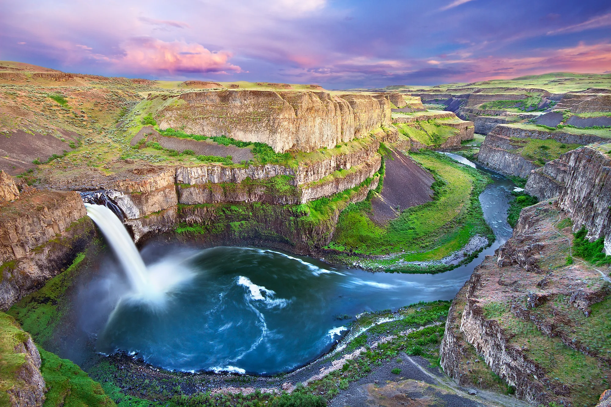
Palouse Falls
The Palouse Falls is a 61-meter-high waterfall located in Palouse Falls State Park in Washington, United States. The waterfall flows into the Palouse River, about 6 kilometers upstream of the river’s confluence with the Snake River in the southeastern part of Washington. Residing in the flood-carved Palouse River Canyon, Palouse Falls is a key destination along the Ice Age Floods National Geologic Trail. Palouse Falls holds a lot of cultural and historical significance, given the region’s unique geology and its historical ties to Native American tribes. The waterfall’s unique characteristics and history led it to become the official state waterfall in Washington and is now a natural touristic attraction for campers, bird watchers and picnic-lovers. Palouse Falls State Park has been established to protect the falls and the unique area surrounding it.

Structure & Geology
Two massive volcanic events that followed each other millions of years ago created the basalt columns. The first volcanic event occurred between 17 and 14 million years ago while the second coincided with the first, occurring between 14 and 6 million years ago. Nevertheless, the outcome of both events was the formation of basalt columns and varied terraced layers that line the canyon walls.
Palouse Falls was created by the Ice Age floods from glacial Lake Missoula about 13,000 years ago. In fact, this waterfall is one of few active waterfalls left along this massive glacial flood path. During the Pleistocene epoch, great Missoula floods swept periodically across eastern Washington and across the Columbia River Plateau, creating a 115-meter-deep canyon, which the waterfall flows into. The canyon is an important feature of the channeled scablands that the floods created. The ancestral Palouse River flowed through the currently dry Washtucna Coulee to the Columbia River. When the Missoula floods overtopped the south valley wall of the ancestral Palouse River, the Palouse Falls and canyon were created. This also diverted the river's current course to the Snake River after a new channel was formed by erosion. The flood also led to the formation of many interconnected and hanging coulees, cataracts, plunge pools, kolk-created potholes, rock benches, buttes and pinnacles typical of scablands.
History
Palouse Falls was discovered by the Wilkes Expedition in 1841. The waterfall has always been a location used by Native American tribes, particularly the Palouse Indians. The Palouse Indians first called the waterfall ‘Aputapat’, which stands for “falling water”. It was later renamed as Palouse Falls to commemorate the Palouse Indian culture.
Tourism

Being designated as a state waterfall, Palouse Falls is a natural touristic attraction and a hotspot for hikers and campers. For daytime visitors, hiking and fishing are the top two activities. At the top of the plateau, a half-mile loop trail leads to the wide Upper Falls and another short trail switchbacks down to the river’ edge. The secluded pool at the base of the waterfall is a typical spot for fishermen to carry on their favorite activity.