10 Great Road Trips to Take in Alabama
Alabama's road networks connect more than scenery. They link Civil Rights landmarks with national forests, historic river towns like Florence with protected wetlands, and serene waterfronts of the Gulf with the state's oldest city. Within a few hours' drive, Appalachian ridges, Black Belt farmland, the Tennessee River Valley, and the Gulf Coast all unfold along highways and scenic byways.
These road trips span the state with day-trip and weekend-friendly distances, and offer direct access to national forests and state parks, museums, historic districts, notable landmarks and architecture, and cultural destinations.
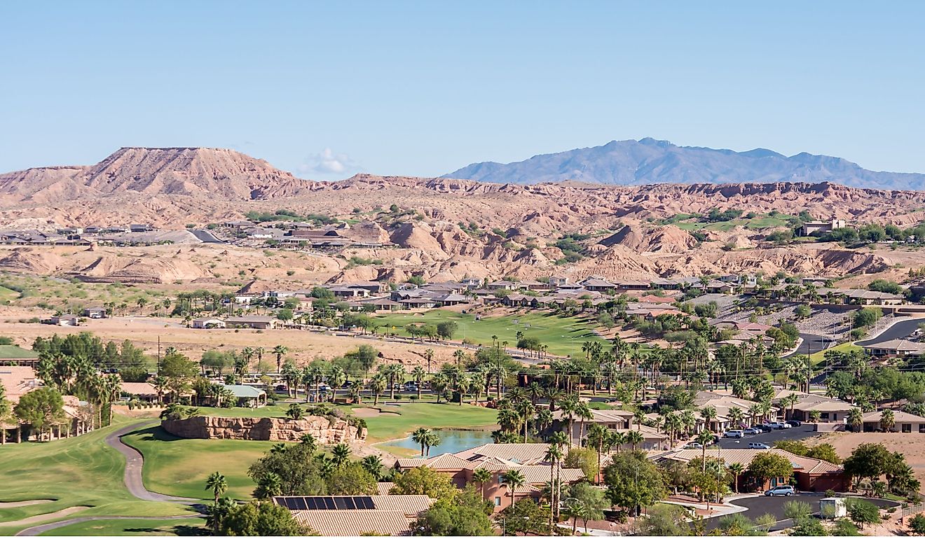
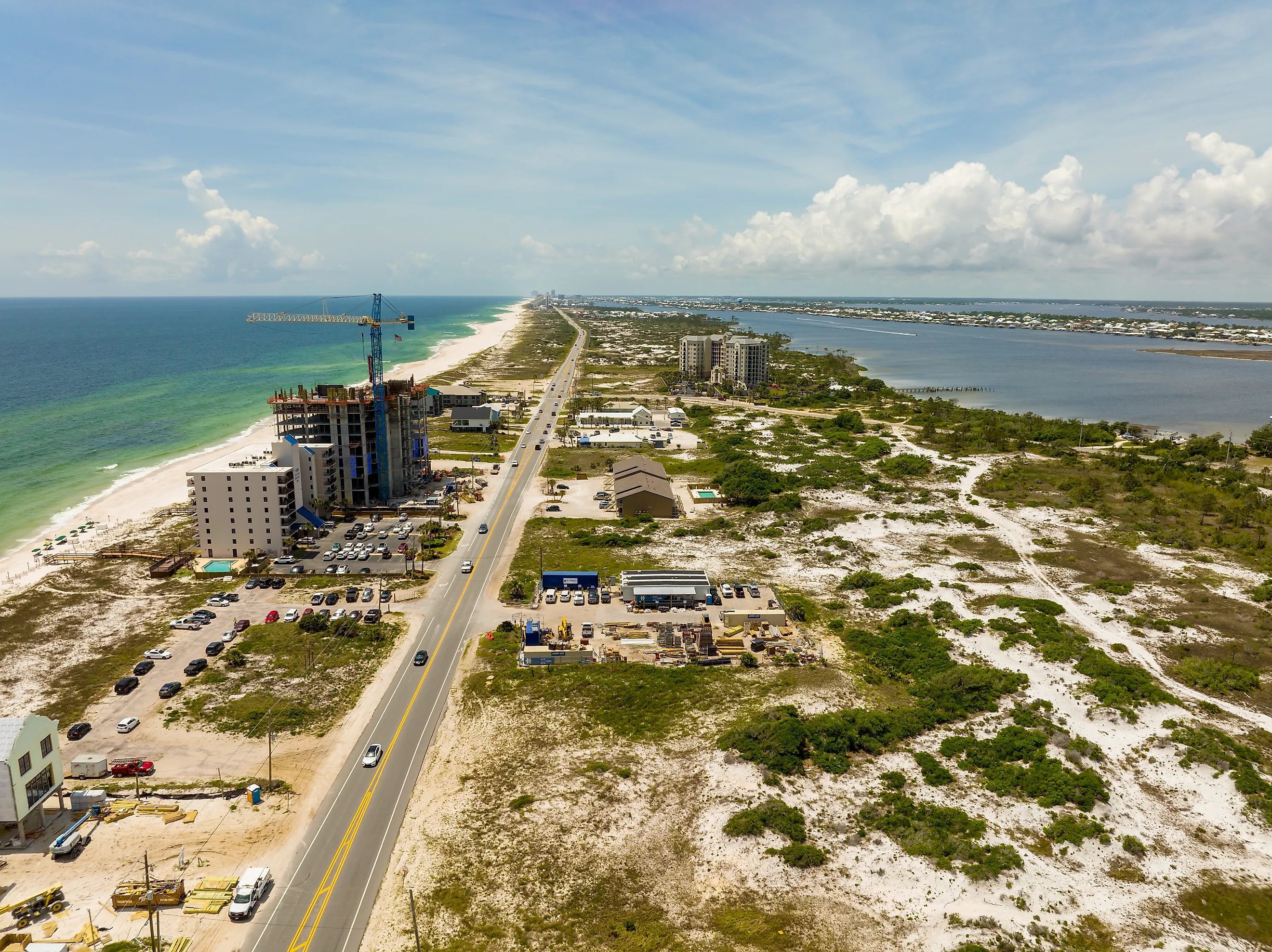
Mobile to Gulf Shores

Start in Mobile, Alabama's oldest city, and end this ~87-mile journey in the natural wonderland of Gulf Shores. In Mobile, the Mobile Carnival Museum and the National Maritime Museum of the Gulf reflect the city's maritime and cultural history. The oak-lined streets of the historic district further embody the timeless character of the deep south.
Heading south on the western shores of Mobile Bay, coastal views unfold. The Heron Bay Wetlands is a gorgeous area to stop and take in the scenery. From Heron Bay, take a delicious detour 10 miles west on the Alabama Coastal Connection to Bayou La Batre, the Seafood Capital of Alabama. Next, catch the vehicle-friendly Mobile Bay Ferry on a 40-minute trip from Dauphin Island to Fort Morgan. The Bon Secour National Wildlife Refuge and Fort Morgan Peninsula beaches are highlights of the route's western coastal stretch. In Gulf Shores, the tranquil Branyon Beach and the hiking trails of Gulf State Park conclude the journey.
Gadsden to Cheaha State Park

This 55-mile trip begins in the small town of Gadsden, into Anniston, and finally winds into the mountains of the Talladega National Forest, ending at the summit of Mount Cheaha.
In Gadsden, start the adventure at Noccalula Falls, home to a 90-foot waterfall. Trails trace Black Creek Gorge past caves, an Indigenous fort site, an abandoned dam, a pioneer homestead, and Civil War carvings, with a botanical garden and more. Head south into Anniston to for the Berman Museum and Anniston Museum of Natural History.
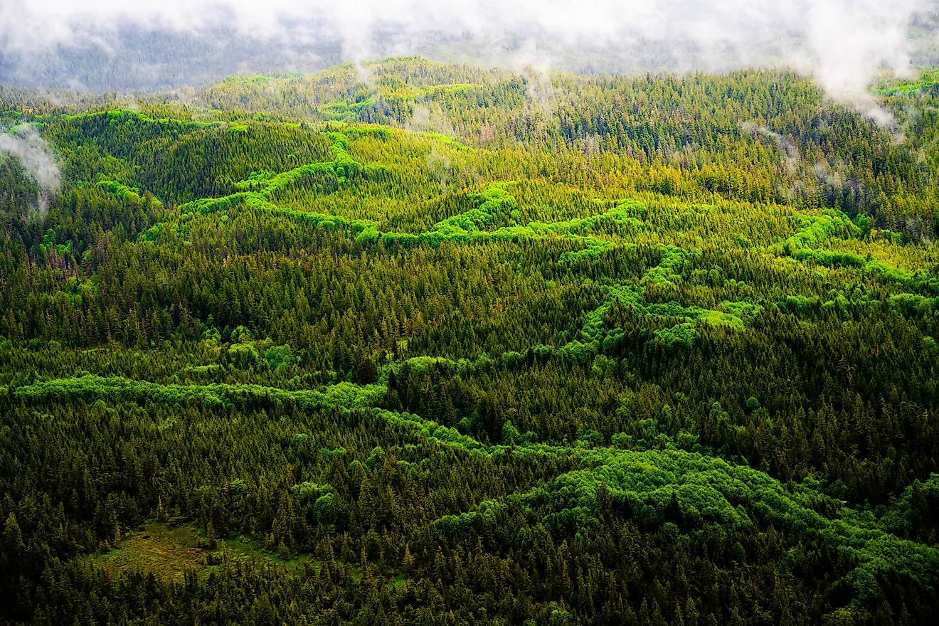
Continuing south through the Talladega Scenic Drive, the winding road ascends amongst dense forest, revealing several overlooks with sweeping views from Alabama's highest elevations. End the journey at 2,407 feet above sea level, on the ridge of Cheaha Mountain at Alabama's highest point.
Dismals Canyon to The Natchez Trace

For a northern Alabama roadtrip full of natural beauty and history, take an 80-mile ride from the Dismals Canyon to the Natchez Trace Parkway. The Alabama section of the 444-mile historic Natchez Trace Parkway is 33 miles of gently curving road that passes through the northwest corner of the state.
Start at Dismals Canyon in Phil Campbell, where moss-covered boulders, waterfalls, stone corridors, and a natural stone bridge create one of Alabama's most magical landscapes. Next, drive northwest through the forested foothills of the Appalachian Plateau towards Russellville, passing quiet farmland, green hills, and weathered barns. Briefly pass through a section of Mississippi before connecting with the Natchez Trace Parkway. It features Rock Spring Nature Trail, the Wichahpi Commemorative Stone Wall, and the sweeping views of Freedom Hills Overlook.
Selma to Montgomery National Historic Trail

The Selma to Montgomery National Historic Trail commemorates the history of Black people struggling for voting and civil rights in the southern US. The route traces the momentous 54-mile 1965 Voting Rights March path led by Dr. Martin Luther King Jr. From the Brown Chapel A.M.E. Church in Selma, this historic trail crosses the Edmund Pettus Bridge and traverses US Highway 80 across Dallas, Lowndes, and Montgomery counties where it terminates at the Alabama State Capitol in Montgomery.
In Selma, the National Voting Rights Museum & Institute is located near the Edmund Pettus Bridge. Midway through the route is the Lowndes Interpretive Center. In Montgomery, folks often wrap up their trip at the Civil Rights Memorial Center.
Little River Canyon National Preserve to DeSoto State Park

Begin at Little River Canyon National Preserve in northeast Alabama, often called the "Grand Canyon of the East". Take the 11-mile Little River Canyon Rim Parkway on Highway 176 and soak in the views of eight dramatic overlooks, waterfalls like Little River Falls, rock formations, and sandstone cliffs.
A short, picturesque drive through Lookout Mountain leads to DeSoto State Park. The park features the Talmadge Butler Boardwalk above Azalea Cascade, trails like the Laurel Falls & Lost Falls Loop, rustic cabins, and sweeping views of forested highlands. The most popular seasons are the fall for the spectacularly colored leaves and the spring for the high flow rate at the waterfalls.
Huntsville to The Shoals

Start this approximately 75-mile road trip in Huntsville and end in the Shoals region. In Huntsville, the US Space & Rocket Center commemorates the city's role in space exploration. Drive south across the Tennessee River and head west on Highway 72 through quiet farmland and small communities toward the neighboring towns of the Shoals.
The Shoals is home to the legendary Fame Recording Studios and Muscle Shoals Sound Studio. In Tuscumbia, stop by Helen Keller's birthplace and the Alabama Music Hall of Fame. Just south of the Tennessee River, the TVA Muscle Shoals Trails Complex expands across miles of walking and biking trails. Nearby, water cascades over the historic dam at the Wilson Dam Waterfall. Ending in Florence, points of interest include the Florence Indian Mound Museum and the original homesite of the "Father of the Blues", W.C. Handy.
Three Covered Bridges of Blount County

For a relaxed 19-mile day trip, explore the covered bridges of Blount County and nearby waterfalls. Blount County, Alabama is home to three picturesque covered bridges, Swann, Easley, and Horton Mill Bridges. After checking out the bridges, head a few miles north via US Route 231 to take in the views at King's Bend Scenic Overlook Park, and continue onto SR 79 to Mardis Mill Falls.
Start at Swann Covered Bridge over Locust Fork Creek. Then drive toward Cleveland, passing farmland, open pastures, and wooded hollows. Small creeks meander by the roadside as you approach the Easley Covered Bridge, where a classic wooden truss spans a stream. Continue northeast towards the Horton Mill Bridge near Oneonta. To celebrate these historic bridge, Blount County hosts the Covered Bridge Festival annualy in October.
Town of Spectre to Prattville

For a short but unique day trip, check out the ficticous town of Spectre to Prattville route. Spectre is a movie set village located on the privately-owned Jackson Lake Island in Millbrook. The town is the filming location for Tim Burton's Big Fish and is open for daily exploration of the site's whimsical structures, as well as overnight camping.
From the Spectre town in Millbrook, drive about 8 miles west before reaching Prattville. The Autauga Creek Canoe Trail and Heritage Park provide views of waterfalls and historic downtown. The Bamboo Forest at Wilderness Park is only 2 miles from downtown, where towering, 60-foot tall bamboo culms create an otherworldly atmosphere among shaded walking trails.
Ave Maria Grotto to Cathedral Caverns

Within a 56-mile drive of each other in northeast Alabama are the Ave Maria Grotto and Cathedral Caverns State Park. Ave Maria Grotto, In Cullman, is a famous 4-acre park on the grounds of St. Bernard Abbey, where Brother Joseph Zoettl spent nearly 50 years meticulously crafting 125 incredible miniature replicas of famous historical and religious structures.
Head toward Guntersville on winding back roads with long views of the lake and surrounding hills. In town, stop at the Guntersville Museum, Guntersville City Harbor, or the Sunset Drive Walking Trail.
Drive another 18 miles northeast to reach the Cathedral Caverns State Park. The park offers guided, 90-minute cave tours showcasing the jaw-dropping beauty of the cave's formations.
Bankhead National Forest to Decatur

This ~50-mile scenic drive winds through the forested hills of Bankhead National Forest before descending into the Tennessee River Valley and ending in Decatur.
Driving north on AL-33 from Bankhead National Forest to Decatur shifts from forested hills, canyons, and waterfalls to flatter farmland and town streets. The route passes rural communities and runs near Oakville Indian Mounds Park.
After exiting Bankhead National Forest, the road opens into spacious farmland and river valleys. Arriving in Decatur along the banks of the Tennessee River, the Cook Museum of Natural Science and the Carnegie Visual Arts Center highlight the city's cultural offerings. From Rhodes Ferry Park, you can see Decatur Harbor and the old railroad bridge.
Alabama Awaits: Scenic Roads and Timeless Views
Alabama is a land of contrasts, where ridges and plateaus give way to river valleys and coastal wetlands. Roads wind through farmland and small towns, passing waterfalls, canyons, beaches, and overlooks. Along the way are historic sites, local gathering spots, and cultural centers that tell the state’s story. These 10 road trips span everything from Gulf fishing towns and music museums to canyon drives in Appalachian forests, showing how Alabama’s landscapes and communities connect.