Why The East Has Far Fewer National Parks Than The West
Line up the national parks on a map and the West looks blessed with scenery the East was somehow denied. The real explanation is a property ledger, not a landscape. Roughly 1.29 billion acres of public land passed out of federal ownership between 1781 and 2013, and about 97% of the transfers to private buyers were finished before 1940. The federal government once owned the country between the Appalachians and the Mississippi, then sold most of it before the selling reached the far West. Parks beyond the Mississippi were carved from ground the government had never let go. Parks behind that line had to be bought back, parcel by parcel, with state bonds and private fortunes.
The Government Already Owned The West

Roughly 46% of the 11 coterminous western states belongs to the federal government, against about 4% in every other state. The disparity was settled long before anyone drew a park boundary.
Yellowstone cost nothing to assemble. Congress passed the Act of March 1, 1872, drew a line around territory the government controlled, and the world's first national park existed. No landowner had to be paid. The land changed status from public domain to protected, and the Army was sent to guard it, because the Park Service would not exist for another 44 years.
Western states also entered the Union on terms the original 13 never faced. Congressional researchers trace the concentration of federal acreage to early treaties and settlement patterns. They also point to the admission laws, which required new states to surrender any claim to federal land inside their borders. Nevada is roughly 85% federally owned. Connecticut, Iowa, and New York sit under 0.3%.
The East Was Federal Once, And Congress Sold It

The original "western lands" were not western at all. They were the tracts between the Appalachian Mountains and the Mississippi River, claimed by the original colonies and ceded, reluctantly, to a new central government. Ohio, Indiana, and Illinois all began as public domain.
Then the government gave it away. Roughly 1.29 billion acres left federal ownership between 1781 and 2013: about 816 million acres to private owners including railroads, another 328 million to the states. Some 97% of the transfers into private hands were finished before 1940.
Timing decided everything. The disposal machinery ran hardest through the 19th century, under the Homestead Act of 1862 and the Desert Lands Entry Act of 1877. Homestead entries did not peak until 1910, when 18.3 million acres passed out of federal hands in a single year. By the time anyone proposed protecting eastern scenery, the eastern public domain had largely gone. The West still had acreage left because the giveaway there had not finished.
Settlement Failed On Land Nobody Could Farm

A homestead claim was written for a 160-acre farm in Ohio, and 160 acres of Great Basin sagebrush will not feed anyone. The rules that emptied the eastern public domain worked poorly on the dry plains, where that acreage could not sustain a farm.
Land that could not be farmed was not claimed. Land that went unclaimed was never patented, and land never patented never left the public domain. Congress kept adjusting the terms, offering larger parcels under later statutes, and the adjustments never fully took. Homestead entries fell below 200,000 acres a year after 1935, and the program ended in 1986.
Roughly 90% of federal land today is public domain, ground retained continuously since the government acquired it, and only about 10% was bought or donated back.
Congress Refused To Buy Parkland

The Park Service has no general authority to acquire land to create new park units. The Bureau of Land Management holds broad acquisition powers, the Fish and Wildlife Service has several, and the Defense Department has its own. The agency whose entire purpose is parks has none.
The consequence showed up geographically. In the West, where the government was already the landowner, the missing authority cost nothing at all. In the East, where nearly every candidate landscape was already titled, it was close to fatal.
Federal money did eventually appear, though never as a park-buying budget. Appropriations from the Land and Water Conservation Fund became the main mechanism for acquiring land across all four federal land agencies. Condemnation stayed technically available and almost never used. Neither arrangement reached the eastern park campaigns of the 1920s, which had to raise their own money and deliver finished acreage before the government would accept it.
The Antiquities Act Reached Only Land The Government Held

The statute is explicit. A president may proclaim national monuments on "lands owned or controlled by the Government of the United States," and Theodore Roosevelt signed it on June 8, 1906. Within six months he had proclaimed Devils Tower, El Morro, Montezuma Castle, and Petrified Forest.
For the West this was a shortcut with no equal. Grand Canyon National Monument was proclaimed in January 1908 on ground that was federal already. Mount Olympus followed in March 1909 by the same route, and became Olympic National Park in 1938. A president could protect a landscape overnight, provided the title was federal.
Past the edge of the public domain no such shortcut existed, so somebody had to hand over the ground first. George B. Dorr and the Hancock County Trustees of Public Reservations spent 15 years assembling parcels on Mount Desert Island. By 1913 they held more than 5,000 acres. Woodrow Wilson proclaimed Sieur de Monts National Monument on July 8, 1916, the first federal protection granted to land east of the Mississippi for its natural and scenic value.
Two Bills, One Pen, February 26, 1919

Dorr went to Washington in 1914 wanting a national park and was told the politics were against him. He took a national monument instead, then spent three more years working toward the title he had wanted all along.
By 1919 Dorr had bills moving through both chambers to create Lafayette National Park. A second bill sat waiting for the same signature, this one converting Grand Canyon from a monument into a national park. Dorr bought two fountain pens, filled them, and carried both bills to the executive chambers. Wilson signed on February 26, 1919, and the two pens survive in the two parks' collections.
The pairing is the clearest illustration in the whole story. One park had been gathered acre by acre out of private hands over 15 years, by a group that raised the money privately. The other was lifted whole out of a national forest the country had owned for decades. Acadia, as Lafayette was renamed in 1929, and Grand Canyon entered the system in the same hour by opposite routes.
The East Bought Its Own Parks

Tennessee and North Carolina purchased Great Smoky Mountains National Park and handed the finished park to the government. About 85% of the acreage came from 18 logging companies. The rest came from roughly 1,200 individual owners, some of whom kept lifetime leases on ground no longer theirs.
The money came from everywhere. Both legislatures committed $2 million in bonds in 1927. Schoolchildren gave pennies. John D. Rockefeller Jr. supplied the final $5 million in 1928 through the Laura Spelman Rockefeller Memorial, named for his mother. Calvin Coolidge had signed the enabling act on May 22, 1926, promising federal administration once the states delivered the acreage. The same bill declared that no federal money would buy the land. Delivering it was their problem.
Virginia faced the same bill for Shenandoah and answered differently. Rather than negotiate thousands of separate purchases, the Commonwealth passed the Public Park Condemnation Act in 1928, allowing a single condemnation suit in each affected county. The park was pieced together from more than 3,000 tracts, more than 450 families gave up homes inside the boundary, and Virginia deeded about 190,000 acres to the government. The park opened in July 1936.
The Railroads Chose Some Of The Sites

The Great Northern Railway helped promote the legislation that established Glacier National Park in 1910. The company then built the hotels, chalets, and trails that made the park reachable. James J. Hill had already strung an empire of towns and ranches along the line from St. Paul to Seattle, a route still called the Empire Builder.
His son Louis worked the demand side. The Great Northern marketed Glacier to wealthy Americans who would otherwise have toured Europe, under the slogan "See America First." The railroad remained the park's main concessionaire and developer of visitor facilities from 1910 until after the Second World War.
A railroad had reason to want a park where its track already ran. Western track crossed country the government still owned, so such campaigns rarely ran into a private owner. Eastern lines had no comparable opening, because a route toward a scenic valley there would generally have found it subdivided and titled.
The East Is Short Of One Label, Not Of Parkland

The Park Service manages 433 units under at least 19 naming designations, and only 63 of them are national parks. The rest carry titles such as national monument, national historic site, national battlefield, and national seashore.
Congress assigns those titles, and it does so freely. Congressional researchers state that no definitive criteria exist for naming a park unit, and that a bill may specify any title at all, including one never used before. The General Authorities Act of 1970 confirmed that every unit holds equal legal standing on resource protection inside a single unified system. A title is not what protects the ground beneath it.
Some differences are genuine. Congress has never authorized sport hunting in a national park, and permits it in certain preserves, seashores, and recreation areas. But the eastern share of the system is enormous once that one word stops being the measure. The battlefield family alone runs to 25 units marking the Revolution and the Civil War. The Forest Service, meanwhile, manages more than half of all federal land in the East.
The Newest Eastern Parks Are Relabeled, Not New

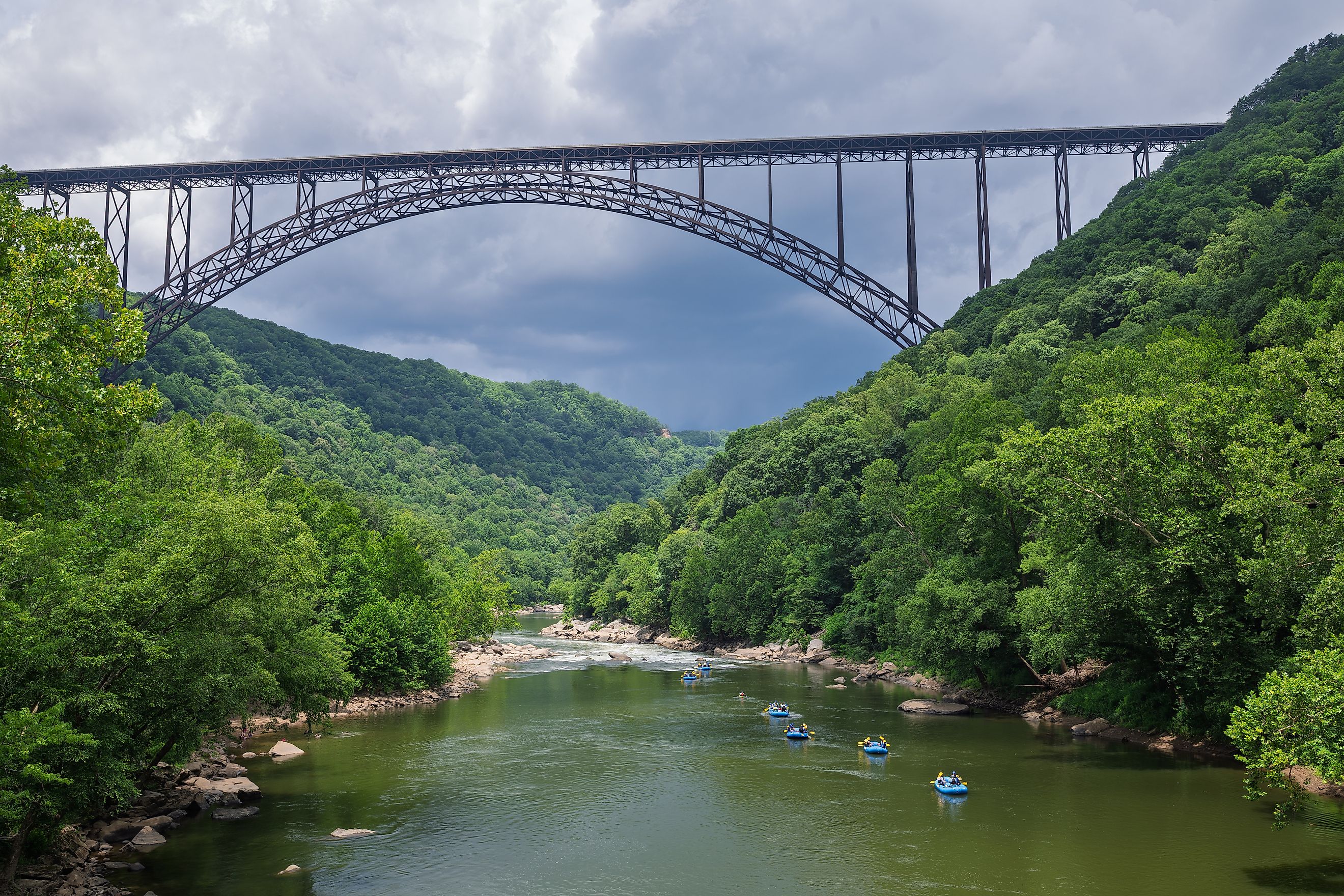
New River Gorge became a national park on December 27, 2020, and the government did not buy an acre to make it happen. The land had been federal since 1978, protected as the New River Gorge National River, and Public Law 116-260 changed what the sign said.
Every recent eastern addition works the same way. Congaree was a national monument until 2003. Indiana Dunes was a national lakeshore until 2019. Each sat inside the system already, protected already, staffed already, before the newer title arrived.
The motive is usually economic, and the Park Service does not always agree with it. Testifying in 2017, the agency argued that the Jefferson National Expansion Memorial was too small and too limited in the resources it protects to be called a national park. Congress redesignated its 193 acres as Gateway Arch National Park the following year. One study of eight such redesignations found visits rose an average of 21% in the five years afterward, though visits fell at three of the eight.
What The Map Is Actually Showing

The distribution of national parks is a map of who owned American ground when the idea of a park arrived. Past the Mississippi the government was still holding territory it had never managed to give away. Behind that line the giveaway had finished, so parks had to be bought back one tract at a time with state bonds, private fortunes, and condemnation suits. The scenery was never the variable.