Maps of Mauritius

Mauritius occupies a total area of 2,040 sq. km. One of the smallest countries in the world, this island nation can be found just east of Madagascar in the middle of the Indian Ocean. It is made up of the main island of Mauritius and several outlying islands like Ambre Island, Est Island, Cerfs Island, Benitiers Island, etc., as marked on the map. Off the coast of mainland Mauritius, there are nearly a hundred islets and rocks without any human habitation.
The island of Mauritius is a volcanic island formed by volcanic activity around 8 million years ago. However, no volcanic activity has been recorded on the island for over 100,000 years. Much of the island is made up of low-lying grasslands surrounded by towering mountains and rolling hills. The volcanic history of this island has resulted in some truly unique landscapes and environments.
Coral reefs surround the island protecting the land from storms and high waves. The spectacular white sand beaches of Mauritius Island give way to a broken ring of coastal mountain ranges. A plain covers the northern part of Mauritius gradually giving way to a central plateau with elevations ranging from 270 to 730 m. The highest peak in Mauritius, the 828 m tall Mount Piton, is located in the southwest of the plateau.
Lake Vacoas, marked on the map, is the primary source of water for the islanders. Most water for day-to-day life comes from this lake or from one of the three major rivers that flow through the island. Important rivers include the Grand River South East and the Black River.
Districts of Mauritius Map

Mauritius is composed of nine districts. In alphabetical order, these are Black River, Flacq, Grand Port, Moka, Pamplemousses, Plaines Wilhems, Port Louis, Riviere du Rempart, and Savanne.
The country also has three dependencies. These are Cargados Carajos Shoals, Rodrigues, and Agalega Islands. The districts of Mauritius are further subdivided into one city, four towns, and 130 villages. Port Louis is the capital of the country. With an area of 297.9 sq. km, Flacq is the largest district in Mauritius while Plaines Wilhelms is the largest by population.
Where is Mauritius?

The island country of Mauritius is located off the southeast coast of Africa in the Indian Ocean. It is separated from mainland Africa by a distance of about 2,000 km. It is located in the Southern and Eastern Hemispheres of the Earth.
Regional Maps: Map of Africa
Outline Map of Mauritius

The outline map above represents the main island of the island country of Mauritius. The above map can be downloaded for free and used for educational purpose or coloring.

The above map represents the main island of Mauritius. The country also encompasses several smaller islands within its territory.
Key Facts
| Legal Name | Republic of Mauritius |
|---|---|
| Flag |
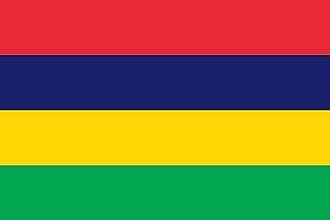
|
| Capital City | Port Louis |
| 20 09 S, 57 29 E | |
| Total Area | 2,040.00 km2 |
| Land Area | 2,030.00 km2 |
| Water Area | 10.00 km2 |
| Population | 1,265,711 |
| Currency | Mauritian rupees (MUR) |
| GDP | $14.18 Billion |
| GDP Per Capita | $11,203.54 |
This page was last updated on December 7, 2023