The Largest Crater Lakes in the World
Lake Toba in Indonesia is the largest crater lake in the world. It covers nearly twice the area of New Zealand's Lake Taupō. The other nine lakes are spread across Ethiopia, the Philippines, Guatemala, Italy, Japan, New Zealand, and Indonesia. Some border cities, villages, and farmland. Others occupy remote volcanic basins marked by active faults and geothermal springs. This ranking counts natural volcanic crater and caldera lakes by surface area. It leaves out meteorite-impact lakes, reservoirs, and calderas flooded by seawater.
1. Lake Toba - Sumatra, Indonesia

Lake Toba belongs in a different size class from every other lake in the ranking. It covers approximately 425 mi² (1,100 km²), almost twice the area of Lake Taupō. Its maximum depth is approximately 1,657 feet (505 meters), and its water drains through the Asahan River toward the Strait of Malacca.
The surrounding caldera measures roughly 62 miles (100 kilometers) end to end. It developed through several enormous eruptions rather than a single event. The most recent caldera-forming eruption produced the Young Toba Tuff about 74,000 years ago. It was among the largest eruptions of the Quaternary Period and spread ash across a vast section of Asia.
Samosir Island is what the collapse left behind. Magma moving beneath the caldera gradually pushed part of its floor upward, producing a resurgent dome that rose by at least 3,600 feet (1.1 kilometers). Erosion and changing water levels later exposed much of that uplifted block. The Batak people now live on Samosir and across the surrounding highlands, placing one of Earth's largest volcanic scars within a working cultural landscape.
2. Lake Taupō - North Island, New Zealand
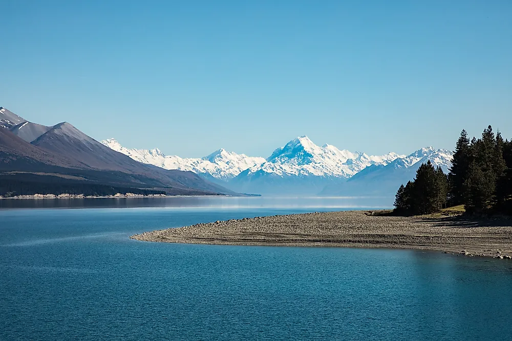
Lake Taupō is nearly twice the size of Lake Shala. Its surface covers approximately 238 mi² (616 km²), making it New Zealand's largest lake. Around 30 rivers and streams flow into it, but only the Waikato River carries water out. The lake is therefore a central part of both the country's volcanic landscape and its largest river system.
Much of the present basin formed during the Ōruanui eruption about 25,500 years ago. That event expelled hundreds of cubic kilometers of material and collapsed a vast section of the volcanic system. The volcano stayed active after the lake appeared. Another extremely powerful eruption occurred roughly 1,800 years ago. Taupō is still an active volcanic system, and scientists monitor it for earthquakes, deformation and shifts in geothermal activity beneath the lake.
3. Lake Shala - Ethiopia

Lake Shala is the most complicated inclusion in the ranking. The lake covers much of the O'a-Shala Caldera, which collapsed approximately 240,000 years ago. It also lies within the actively extending Main Ethiopian Rift. Fault movement, crustal stretching and volcanic collapse have all influenced the shape of the modern basin. Shala is therefore best described as a composite rift-caldera lake.
Using its commonly reported area of approximately 127 mi² (329 km²), Shala ranks third. It reaches a maximum depth of about 873 feet (266 meters), making it the deepest of Ethiopia's Rift Valley lakes. The lake has no surface outlet. Evaporation concentrates dissolved minerals and produces alkaline water. Hot springs occur around the basin, while islands and isolated shoreline areas give pelicans, flamingos and other waterbirds a place to nest.
4. Taal Lake - Luzon, Philippines

At Taal, the main lake is only the outermost part of a much more complicated volcanic system. Taal Lake covers approximately 90.4 mi² (234.2 km²) and reaches about 564 feet (172 meters) deep. Volcano Island stands within the older flooded caldera, and that island holds numerous vents and craters of its own.
Large eruptions created the surrounding caldera over thousands of years, while later activity shifted toward Volcano Island. The system is still active, as the disruptive eruption of January 2020 showed. Taal also supports extensive fisheries and densely populated communities around its shores. This combination makes it more than a geological curiosity. Changes in volcanic gas, lake circulation or eruptive activity can threaten both the lake ecosystem and hundreds of thousands of nearby residents.
5. Lake Atitlán - Guatemala

Only a few km² separate Lake Atitlán from Lake Ranau in the ranking. Depending on the shoreline survey, Atitlán covers approximately 50 to 51 mi² (130 to 132 km²). It is much deeper, however, descending to an estimated 1,115 feet (340 meters). That makes it the deepest lake in Central America.
The lake fills the northern half of the Atitlán III Caldera, formed about 84,000 years ago during the Los Chocoyos eruption. Ash from that event spread across the Guatemalan highlands and has turned up in distant marine sediments. Later eruptions built the San Pedro, Tolimán and Atitlán volcanoes along the southern side of the basin. Atitlán has no major visible surface outlet, so much of its water is thought to escape through evaporation and underground drainage.
6. Lake Ranau - Sumatra, Indonesia

Lake Ranau lacks the rounded outline normally associated with a volcanic crater. Its basin is noticeably rectangular because the Sumatran Fault helped control the direction of the collapse. The lake occupies a caldera approximately 8.7 miles (14 kilometers) long and 5 miles (8 kilometers) wide in southern Sumatra.
Reported surface measurements place Ranau at approximately 49 mi² (127 km²), with a maximum depth near 751 feet (229 meters). Mount Seminung rose along the southeastern edge after the caldera-forming eruption, partly reshaping the original basin. Hot springs at the volcano's base mark continuing geothermal activity. Ranau has also seen unexplained fish deaths, which makes its deep-water chemistry and volcanic gas system a subject of scientific interest.
7. Lake Bolsena - Lazio, Italy

Lake Bolsena is the only European lake in the top ten. It covers approximately 43.8 mi² (113.5 km²) in Italy's Vulsini volcanic district. The lake reaches about 495 feet (151 meters) at its deepest point, while the Marta River provides its only surface outlet to the Tyrrhenian Sea.
Bolsena did not form as one simple summit crater. Geological evidence points to a complex period of subsidence and caldera development between roughly 600,000 and 200,000 years ago. Later eruptions produced features within the collapsed basin, including the volcanic islands of Bisentina and Martana. Those islands record continued activity after the main depression had already formed. The result is a lake shaped by several stages of eruption, collapse and rebuilding.
8. Lake Maninjau - Sumatra, Indonesia

A road with 44 numbered hairpin bends drops down the wall of the Maninjau Caldera toward a lake covering approximately 38.4 mi² (99.5 km²). The steep descent shows the scale of the collapse more clearly than a distant view. Lake Maninjau reaches a maximum depth of about 541 feet (165 meters), and little level ground separates the water from the forested rim.
The caldera formed during a major eruption approximately 52,000 years ago. Today, villages, rice fields and fruit gardens occupy its narrow lower slopes. Floating fish cages have also become a major part of the local economy. Nutrient buildup and periods of low oxygen have contributed to repeated mass fish deaths. Maninjau therefore shows how the enclosed shape of a caldera can affect both livelihoods and water quality.
9. Lake Rotorua - North Island, New Zealand

Lake Rotorua is broad rather than deep. Its 30.9 mi² (80 km²) surface is only slightly larger than Kussharo's, but its average depth is approximately 36 feet (11 meters). Even its deepest point reaches only about 147 feet (44.8 meters). That shallow profile sets Rotorua apart from the steep-sided volcanic lakes elsewhere in the ranking.
The lake occupies much of the Rotorua Caldera, which formed about 220,000 years ago during the eruption of the Mamaku Ignimbrite. That eruption discharged more than 340 cubic kilometers of volcanic material. Later activity created lava domes, including Mokoia Island near the lake's center. The city of Rotorua now extends along the southern shore and across an active geothermal landscape of hot springs, steaming ground and mud pools.
10. Lake Kussharo - Hokkaido, Japan

Winter shows the two opposing forces at work beneath Lake Kussharo. Much of the lake freezes, but geothermal water holds sections of the shoreline open. Whooper swans gather in these warmer pockets as steam rises around them. The same underground heat feeds springs at Sunayu, where visitors can reach hot water by digging into the lakeside sand.
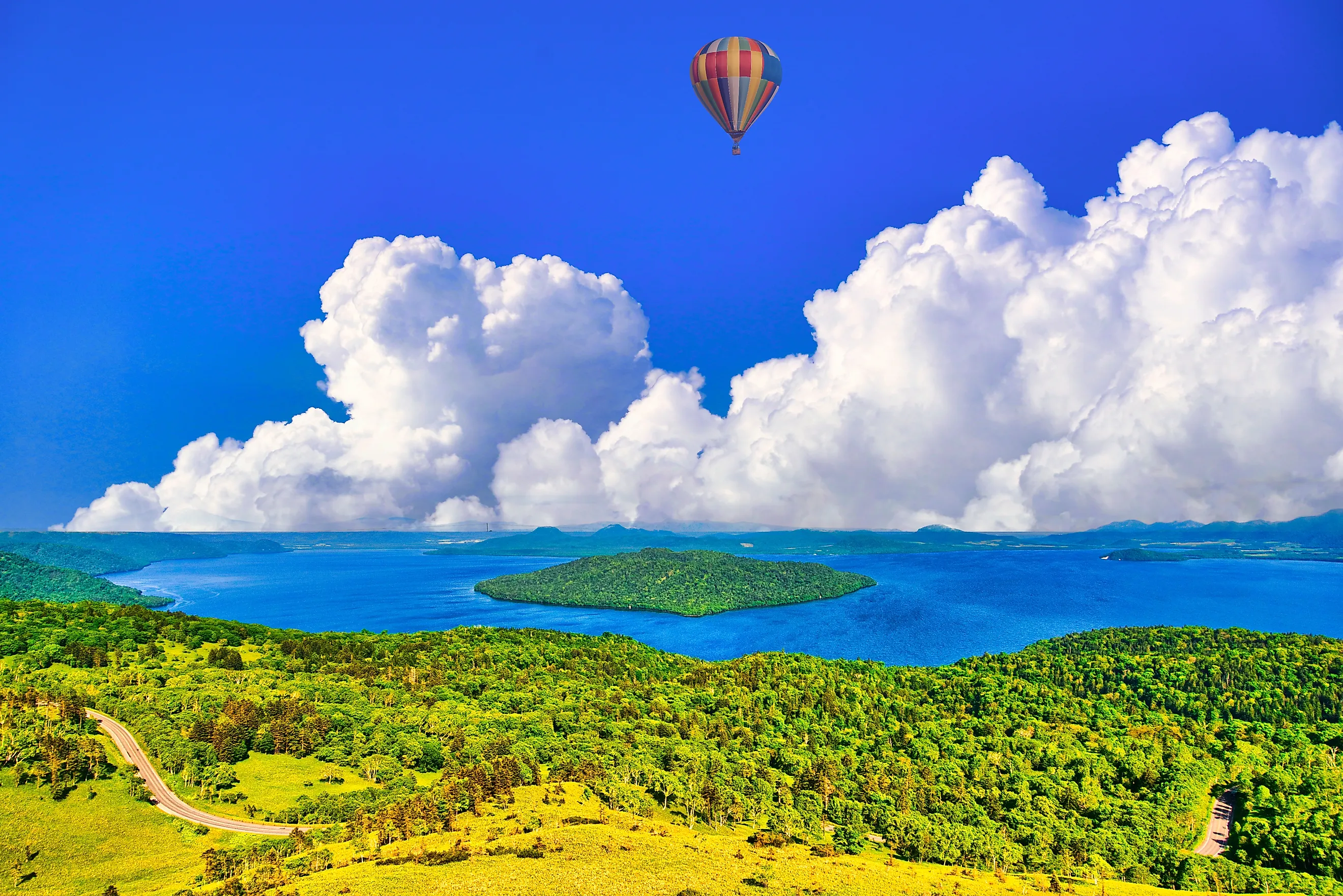
Kussharo covers approximately 30.6 mi² (79.3 km²), making it Japan's largest caldera lake by surface area. It reaches a maximum depth of roughly 386 feet (117.5 meters). Nakajima, a volcanic island built by activity after the main caldera collapse, occupies part of the lake. Nearby sulfur vents and hot-spring areas show that the region's volcanic heat has not disappeared.
Crater Lakes in the US and Canada

Neither the United States nor Canada contributes a lake to the global top ten. The best-known US example is Oregon's Crater Lake, which covers approximately 20.5 mi² (53.2 km²). It formed when Mount Mazama collapsed following a major eruption about 7,700 years ago. Although comparatively small in surface area, its depth reaches 1,943 feet (592 meters), making it the deepest lake in the United States. Rain and snow provide nearly all of its water because no rivers flow into the caldera.
Yellowstone Lake is much larger, but it does not qualify as a complete caldera lake. Only its northern half lies within the Yellowstone Caldera. The southern half extends beyond the caldera and was shaped by glaciers and other geological processes. Yellowstone's West Thumb is volcanic, however, occupying a smaller caldera created by an eruption approximately 174,000 years ago.
Other US examples include Paulina Lake and East Lake, which occupy the Newberry Caldera in central Oregon. Paulina covers approximately 2.3 mi² (6 km²), while East Lake covers about 1.5 mi² (4 km²). Both receive water from precipitation, snowmelt, groundwater, and geothermal springs. Their small sizes keep them far below the global ranking, but their hot springs reveal that an active magmatic system remains beneath Newberry Volcano.
Canada has crater lakes, but many of its prominent examples formed through meteorite impacts rather than volcanic collapse. Western Clearwater Lake in northern Quebec, for example, occupies an impact structure that planetary geologists study as an analogue for craters elsewhere in the solar system. Such lakes fall outside this ranking because the article is limited to lakes created by volcanic craters and calderas.
What the Largest Crater Lakes Reveal
The ten largest crater lakes are not enlarged versions of Oregon's Crater Lake. Most occupy complex calderas shaped by collapse, faulting, renewed eruptions and later uplift. Several volcanoes kept erupting after their lakes formed, building islands, lava domes and new cones inside the original depressions.
The lakes also keep changing without erupting. Sediment accumulates, outlets erode, shorelines shift and deep water can lose oxygen. At Shala and Ranau, tectonic faults remain part of the story. At Maninjau and Taal, volcanic basin conditions directly affect fisheries and nearby communities. Their enormous surfaces may look permanent, but each lake represents a temporary stage in the continuing development of an active or formerly active volcanic system.