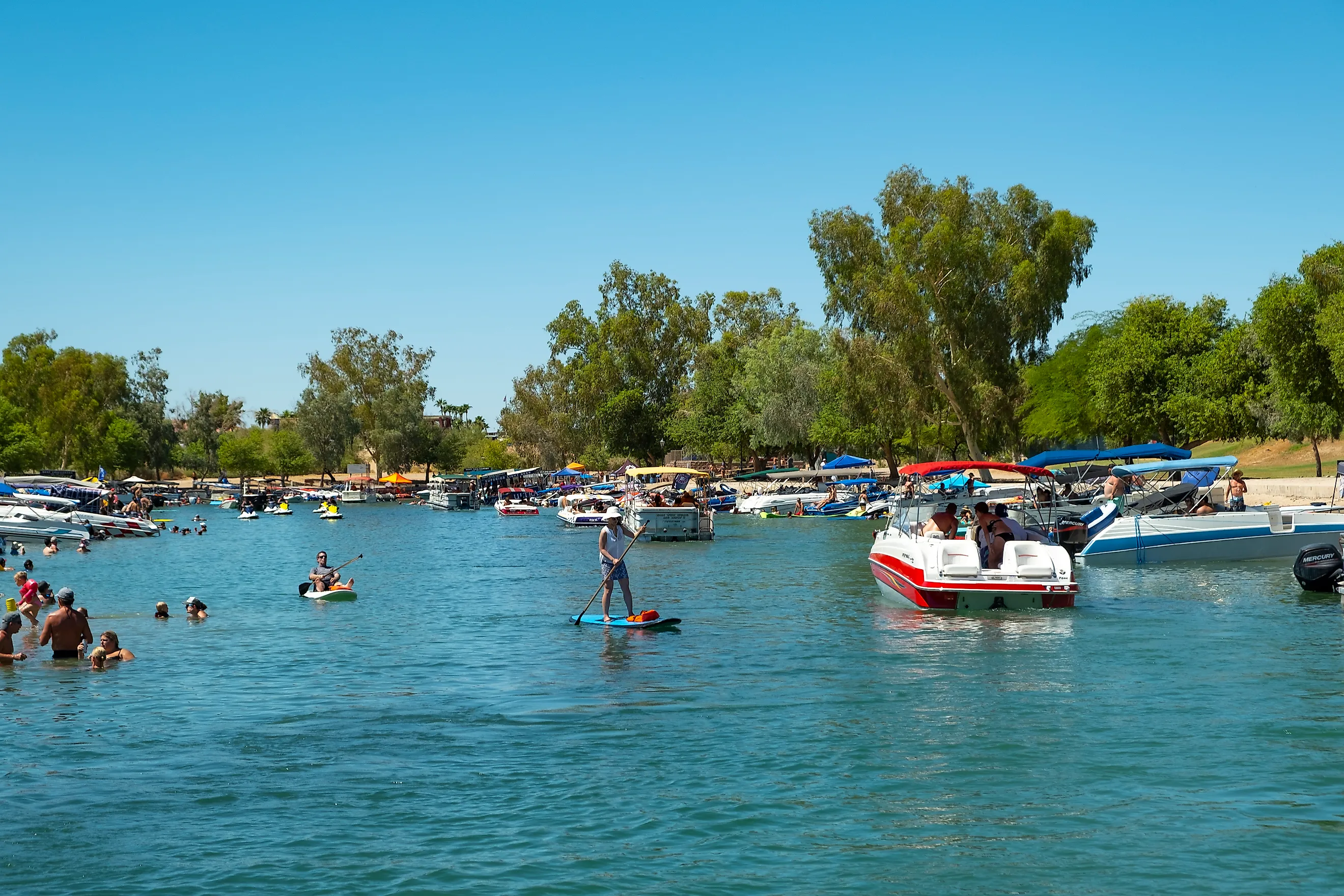
Which State Has The Warmest Lakes For Swimming?
Arizona has a strong claim as the state with the warmest lakes for swimming. Its low-elevation reservoirs soak up weeks of desert sun. By late summer, surface temperatures at the hottest of them climb well past what swimmers feel at most mountain lakes. Lake Havasu records the highest readings, though warm water reaches well beyond the Colorado River. Patagonia Lake, down in the greener south, stands as a softer counterpart to the desert basins farther north. A swim here can mean saguaro-lined shallows, water hemmed by sheer rock, or a red-rock cove below Glen Canyon.
Lake Havasu

By August, the surface at Lake Havasu averages roughly 87°F, which puts this Colorado River reservoir in a league of its own for anyone who dislikes cold water. July runs only slightly cooler at around 83°F. At Lake Havasu State Park, a sandy shore runs beside picnic areas and waterfront campsites, so a swimmer can step from the beach into the shade in a few paces. Paddlers take kayaks and paddleboards beyond a simple swim, and the 1.75-mile Mohave Sunset Trail runs through low desert vegetation close to the water. A few minutes away, the London Bridge crosses Bridgewater Channel in the center of Lake Havasu City, where pedestrian paths, docks, and restaurants line a busy waterfront. Boaters stay on the channel after sunset, when cooler evening air brings more people out and lights begin reflecting off the water beneath the bridge.
Lake Pleasant

A swim away from Phoenix does not require a mountain road or an all-day drive. Less than an hour from much of the metropolitan area, Lake Pleasant sits in a broad Sonoran Desert basin with room enough for swimmers to find quieter coves beyond the busiest boating lanes. Scorpion Bay Marina works as one of the main activity centers, with watercraft rentals and food beside the reservoir. Hiking routes climb above the shore to wide views of saguaros, rocky ridges, and open water. In spring, wildflowers color the surrounding hills before hotter weather dries the landscape and the shallows begin to warm. The western and northern arms feel far removed from suburban Phoenix despite the short distance to the city. By midsummer, long hours of direct sun heat the sheltered edges, and swimmers, paddleboarders, and kayakers spend the afternoon there, away from the marina traffic.
Roosevelt Lake

More than 100 miles of shoreline wrap Theodore Roosevelt Lake, the largest reservoir lying entirely within Arizona. Its many access points let a visitor launch a kayak, fish from shore, camp beside the water, or wade in for a swim without depending on one developed beach. Water levels rise and fall through the year, exposing broad banks around the recreation areas and shifting the shape of familiar access points. Roosevelt Dam stands nearby as a major historical landmark. Completed in 1911, the dam reshaped water management along the Salt River, and it remains an imposing sight below the lake. State Route 188 runs through Tonto National Forest, with long views opening between the desert hills. Boat ramps and campgrounds ring different portions of the reservoir, and anglers work the same broad arms for bass and crappie that paddlers come to explore.
Saguaro Lake

Butcher Jones Beach is the place to start at Saguaro Lake. Its no-wake zone stays calmer than the main boating channels, and mesquite trees near the shore throw valuable shade during hot afternoons. Beyond the beach, giant saguaros stand on the rocky slopes, and several parts of the reservoir narrow between steep canyon walls, giving the scenery an unmistakably central-Arizona character. The Butcher Jones Trail leaves from the same recreation area and traces the water through cactus-covered terrain, opening new angles across the lake at each turn. Anyone who would rather explore by boat can board the Desert Belle, which cruises into sections lined by cliffs and small inlets. Mountains block much of the reservoir from any view of metropolitan Phoenix, even though the city is surprisingly close. Weekend parking around Butcher Jones fills quickly during peak summer, so early arrivals reach the beach most easily.
Canyon Lake

Few swimming trips begin with a drive as dramatic as the one to Canyon Lake. The road twists through the Superstition Mountains, past volcanic cliffs and steep ravines, before the reservoir appears between rugged walls of rock. At the Acacia Day Use Area, a gently sloping beach and picnic facilities close to shore make the water easy to reach. Farther east, the lake narrows into tight passages, and kayakers and paddleboarders push past the developed recreation areas to reach them. Bighorn sheep turn up on the slopes above the water, most often in the quieter sections. The Dolly Steamboat runs a scenic route through the canyon and reaches formations that are hard to see on foot. Parts of the Apache Trail also open onto overlooks above the reservoir. At Acacia, shaded tables sit close enough to the beach that swimmers can duck out of the midday sun without leaving the lakeside.
Bartlett Lake

A shaded ramada at Rattlesnake Cove is a good base for an entire summer afternoon at Bartlett Lake. The recreation area sits close to the water, with grills and picnic facilities beside an accessible stretch of shore where swimmers cool off between meals. Away from the cove, paddleboarders and kayakers find several ways onto the lake along the rocky banks and occasional sandy patches. Yellow Cliffs is one of Bartlett's most recognizable features, its pale stone standing sharply against the darker desert hills behind. Anglers come for bass, crappie, and catfish, and boaters gas up at the marina before heading into the less-developed portions of the reservoir. The drive north from Scottsdale trades neighborhoods for open Sonoran Desert, with saguaros growing more prominent along the road. Picnic areas on the western shore sit close enough to the water for repeated swims through the hottest hours.
Lake Powell

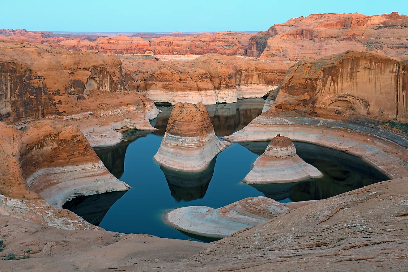
Slip into Lake Powell in late summer and orange sandstone rises straight from water warmer than 80°F. The Arizona portion of this immense reservoir centers on Page, where Wahweap has marina services, lodging, and convenient access for longer stays. Anyone after a less developed entry can head to The Chains, where bare slickrock slopes toward the water instead of a conventional sandy beach. Boats and paddlecraft reach side canyons and protected bays walled in Navajo sandstone, though swimmers should stay clear of launch ramps and busy vessel routes. Glen Canyon Dam stands just upstream, and Horseshoe Bend is close enough to fit into the same trip. Late-day light changes the cliffs dramatically, deepening their red and orange tones. The reflections turn especially striking in protected coves, where steep rock blocks the wind and the surface stays relatively calm.
Lake Mohave

The cold water near Hoover Dam can mislead anyone who judges Lake Mohave as a single swimming destination. Releases from Lake Mead keep the northern reaches chilly, but farther south around Katherine Landing the water has far more time to warm under the Mojave sun. The short Fisherman's Trail leads to Turkey Cove, which ends at a sandy shoreline suited to swimming and picnics. Arizona Telephone Cove gives another way into the lake away from the main marina. Katherine Landing is the developed hub, with camping, boat services, and food beside the reservoir, and Bullhead City lies nearby for more lodging and supplies. The country here is noticeably barer than the cactus-covered land around Phoenix, its brown ridges dropping toward startlingly blue water. Numerous small inlets break up the shoreline around Katherine Landing, leaving sheltered places to swim.
Apache Lake

Getting to Apache Lake is part of the adventure. The reservoir lies deep in Tonto National Forest, cut off from metropolitan Phoenix by rugged terrain and stretches of the historic Apache Trail. Upper Burnt Corral is one of the useful spots to settle beside the water, its campsites close enough that swimmers walk straight down to the lake. Horse Mesa Dam created the reservoir in the 1920s, backing the Salt River into a steep mountain corridor. High points along the surrounding road open onto broad views over blue water and rocky canyon country, though travelers should check current road conditions, since storms and flood damage can close access. Development stays limited compared with Lake Pleasant or Saguaro Lake, so fewer busy marina zones crowd the shore. Early mornings at Upper Burnt Corral are the easiest time for swimming, fishing, and paddling, before the strongest afternoon heat sets in.
Patagonia Lake

Green hills, riparian growth, and an established swimming beach set Patagonia Lake apart from Arizona's harsher desert reservoirs. The 265-acre lake sits inside Patagonia Lake State Park in the south of the state, where the designated beach is an uncomplicated way into the water for families and casual swimmers. More than 100 campsites make an overnight stay practical, and visitors take rental kayaks and other watercraft beyond the swimming area. Birding is another major draw. The trails reach habitat used by hummingbirds, flycatchers, herons, and seasonal migrants, and more riparian country is protected next door in the Sonoita Creek State Natural Area. Sitting higher than Lake Havasu or the lowest desert reservoirs, Patagonia stays somewhat fresher in summer, a difference that feels especially welcome on a hot southern-Arizona afternoon. Shaded picnic areas, camping loops, trails, and the beach all cluster within a relatively compact section of the state park.
Other States With Warm Lakes For Swimming

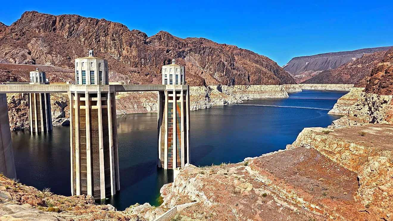
Arizona is not the only place to find bathwater-warm swimming. In central Texas, Lake Austin runs near 89°F to 90°F at the surface in summer, and the hottest days push toward the low 90s. Unlike the Arizona reservoirs, releases from Lake Travis keep it at a nearly constant level, so the shoreline and boat ramps stay usable all summer instead of stranding on exposed mud during a drawdown. Florida has the longest warm-water season of all. Lake Okeechobee, the state's largest lake, averages only about nine feet deep, so the whole water column heats fast and stays swimmable far earlier and later in the year than deeper lakes manage. Marinas and boat ramps at Clewiston and Pahokee ring its southern shore, though swimmers should mind alligators and check local advisories, since the shallow water also drives seasonal algae. Back in the desert, Lake Mead spans the Nevada-Arizona line behind Hoover Dam, where the surface averages around 82°F in peak season and protected coves and shallow bays climb into the mid-to-upper 80s by late July. The lake runs cold in its deepest sections, so the warmest swimming sits along the exposed southern shores and inside the sheltered inlets. Across all three, the same rule from Arizona holds: the shallow, sun-exposed, low-elevation water warms first and holds its heat longest.
Warm Water, Many Moods
The warmth comes down to two things a swimmer can actually plan around: elevation and depth. The reservoirs sitting lowest and holding the most sun-warmed shallows run hottest, which is why Lake Havasu tops the readings and Patagonia, higher and greener, stays a few degrees cooler. Depth and dam operation matter just as much, so a single lake can run cold at one end and warm at another, the way Lake Mohave does below Hoover Dam. Season shifts the map again, since the deeper sandstone bays at Lake Powell need until late summer to catch up to the desert basins. Match the elevation to the month and the cove to the time of day, and the water usually meets you where you want it.