US Lakes Losing the Most Water to Drought
Lakes and reservoirs across the American West are shrinking, and two forces drive almost every case. Drought cuts the snowmelt and rain that feed them, and farms and cities draw down much of what is left. Lake Mead and Lake Powell, the two biggest reservoirs on the Colorado River, sit near a quarter of capacity in the summer of 2026. Elsewhere, the same squeeze shows up in different forms. Elephant Butte in New Mexico is nearly empty. Choke Canyon in Texas jumped after a week of flooding rain. The twelve lakes and reservoirs below show how far the West's water problem has gone, and how unevenly it lands from one basin to the next.
Great Salt Lake, Utah

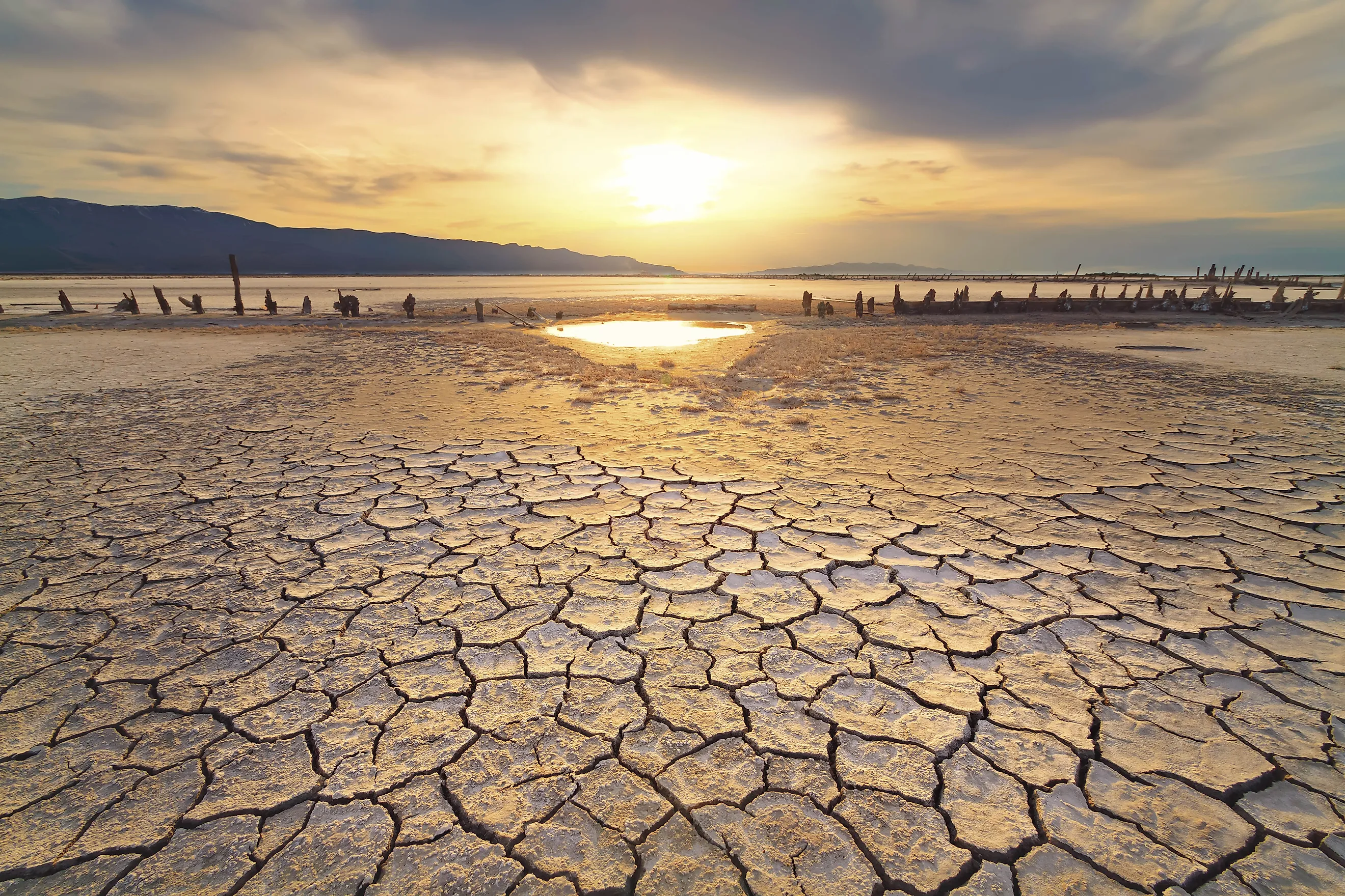
Great Salt Lake reached a record-low elevation in November 2022 after prolonged drought combined with decades of upstream water consumption. The lake had already fallen about 22 feet from its 1986 high, leaving broad stretches of exposed lakebed around northern Utah. Its importance reaches far beyond scenery. Brine shrimp support a commercial harvest, while migratory birds depend on the lake's wetlands and food-rich shallows. On Antelope Island, visitors find beaches, wildlife, and open views across the Wasatch Front. Wet years have produced partial rebounds, but they have not erased the long-term imbalance. Drought reduces inflow, while farms, cities, and industries claim water before it reaches the terminal lake.
Lake Mead, Arizona-Nevada

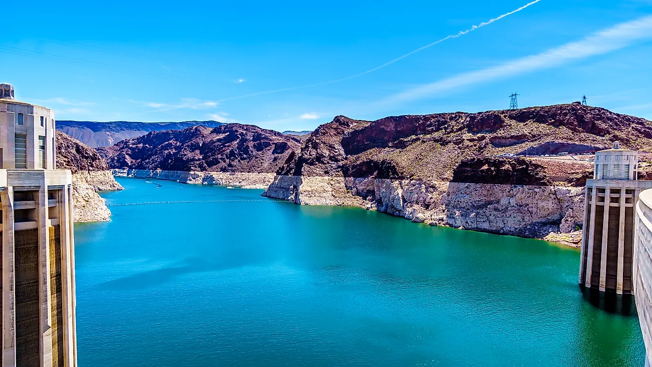
At 27 percent of capacity on July 26, 2026, Lake Mead held about 7.06 million acre-feet of water. Two decades of Colorado River drought, hotter conditions, and basin-wide demand have redrawn its shoreline and pushed marinas farther from former launch points. The reservoir remains indispensable because Hoover Dam stores water for farms and cities while generating electricity. It is also the centerpiece of the country's first national recreation area, where desert canyons meet a vast artificial lake. Boating, paddling, fishing, and trips below Hoover Dam continue despite changing access. Mead's losses cannot be blamed on rainfall alone. Releases and withdrawals are built into its operation, yet reduced river flow has made every demand harder to absorb.
Lake Powell, Arizona-Utah

Lake Powell entered late July 2026 with roughly 5.42 million acre-feet in storage, equal to about 23 percent of capacity. The forecast unregulated inflow for the water year was only 36 percent of normal, exposing how strongly the reservoir depends on Rocky Mountain snowpack. Glen Canyon Dam created Powell to store Upper Basin water and produce hydropower, but drought has repeatedly forced operational changes. Low levels have narrowed channels and stranded or shortened several boat ramps. Even so, the reservoir remains a striking recreation landscape of flooded sandstone canyons, houseboat routes, and remote coves. Its decline reflects poor runoff, evaporation, and releases downstream. Those overlapping pressures make Powell one of the clearest symbols of the Colorado River's shrinking margin.
Walker Lake, Nevada

Unlike a managed reservoir, Walker Lake has no outlet and loses water through evaporation. Its crisis begins upstream. Agricultural diversions from the Walker River helped lower the lake by more than 150 feet between the late nineteenth century and 2008. The decline removed about 7.4 million acre-feet of storage. Drought years intensify the damage because Sierra Nevada snowmelt supplies most river flow. As the lake contracts, salts remain behind and become more concentrated, undermining fish populations and the birds that feed on them. Walker Lake is still visually dramatic, set beneath Nevada's Wassuk Range, and it once supported an important Lahontan cutthroat trout fishery. Its story shows why drought cannot be separated from water allocation in closed desert basins.
Shasta Lake, California

California's largest reservoir fell to 24 percent full at the end of September 2021. Consecutive dry years had sharply reduced Sacramento River runoff. Shasta Lake stores water for the Central Valley Project, supports hydropower, and helps regulate river temperatures for salmon below the dam. That working role makes severe drawdowns consequential far beyond the exposed shoreline. The lake is also one of northern California's major recreation areas, known for houseboats, forested coves, fishing, and views of Mount Shasta. Its many branching arms create hundreds of miles of shoreline when storage is high. Wet winters can refill Shasta quickly, so the 2021 low was not permanent. It remains a powerful example of California's acute drought swings.
Lake Oroville, California

Few reservoirs illustrate California's weather volatility as clearly as Lake Oroville. It ended September 2021 at 22 percent of capacity, the lowest level recorded since filling, and the Hyatt Powerplant temporarily stopped operating. By May 2026, strong wet-season inflows had returned the reservoir to about 99 percent full. Oroville is the keystone of the State Water Project, supporting deliveries for 27 million Californians while providing flood control and water for Feather River ecosystems. Its recreation value is equally visible around the long shoreline, where visitors boat, fish, camp, and use trails above the reservoir. The dramatic recovery does not remove Oroville from a drought-loss list. Instead, it demonstrates how enormous volumes can disappear during a short dry sequence and return after favorable storms.
Elephant Butte Reservoir, New Mexico

By July 30, 2026, Elephant Butte Reservoir had fallen to about 1.4 percent of conservation capacity, holding roughly 26,800 acre-feet. Its water surface sat more than 130 feet below the conservation pool elevation. The reservoir is the principal storage feature of the Rio Grande Project, which delivers irrigation water to farmland in New Mexico and Texas. Releases for agriculture combine with weak river inflow, high evaporation, and persistent drought to drive the decline. What remains is still central to Elephant Butte Lake State Park, New Mexico's largest state park and a longstanding destination for boating and camping. Low water has sharply reduced usable lake area, however. Its near-empty condition makes Elephant Butte one of the nation's most severe proportional losses.
Salton Sea, California

The Salton Sea's retreat is measured across a shallow basin. By March 2026, its surface had dropped about 14.6 feet from the 2003 baseline, exposing lakebed around California's largest lake by surface area. The main cause is declining agricultural drainage from the Imperial Valley, not drought alone. Colorado River shortages and conservation measures can reduce those inflows further. The result is an ecological and public-health emergency because exposed sediments can become airborne dust. Wetlands along the Pacific Flyway shelter migrating birds, which keeps the sea important despite rising salinity and fish losses. Visitors encounter an otherworldly desert shoreline, geothermal landscapes, and communities shaped by the lake. Few places show more clearly how water efficiency elsewhere can create environmental costs downstream.
Trinity Lake, California

Trinity Lake did not rebound as quickly as other California reservoirs after the 2020 to 2022 drought. Storage stood at 31 percent of capacity in January 2022 and remained only 36 percent full in March 2023, despite snow elsewhere in the state. Its northern watershed missed much of the storm activity that restored Shasta and Oroville. The reservoir supplies the Central Valley Project, generates power, and releases water into the Trinity River for fish habitat. Around its forested shoreline, boaters and anglers find an alternative to Shasta Lake, with nearby campgrounds and mountain scenery. Trinity's slow recovery is what distinguishes it. A wet statewide average does not guarantee equal relief when storms bypass one headwater basin or releases must continue downstream.
Mono Lake, California

Mono Lake lost more than 40 feet of elevation and roughly half its volume after Los Angeles began diverting tributary streams in 1941. Court and regulatory decisions later limited those exports, yet drought has repeatedly delayed the lake's recovery toward the state's 6,392-foot management target. Because Mono has no outlet, falling water concentrates salt and changes habitat for brine shrimp, alkali flies, and nesting birds. Its exposed tufa towers make the eastern Sierra lake one of the most recognizable shorelines in the West. South Tufa draws visitors for walking and photography, while birdwatchers come for enormous seasonal gatherings. Mono belongs on this list with a warning: diversions produced the historic collapse, while drought now magnifies losses and obstructs restoration.
Amistad Reservoir, Texas-Mexico

International Amistad Reservoir was 38.6 percent full on July 31, 2026, after reaching record-low levels during the hot, dry summers of 2022 and 2024. Reduced rainfall, stronger evaporation, and growing demands have all affected storage. Its position on the Rio Grande adds another layer because water is divided between the United States and Mexico under treaty arrangements. Amistad remains valuable as a flood-control and water-supply reservoir, but its clearest public identity is recreational. Clear water fills limestone canyons near Del Rio, and visitors come to fish, boat, camp, and reach ancient rock-art sites. Falling levels expose hazards and can close ramps or displace tournaments. The reservoir shows how drought can affect tourism, cultural resources, and international water management at once.
Choke Canyon Reservoir, Texas

Choke Canyon Reservoir began July 2026 at only 8.5 percent full before heavy rainfall lifted it to 24.9 percent by July 31. That change reveals the depth of the preceding drought and the responsiveness of a South Texas reservoir to concentrated storms. Built on the Frio River, Choke Canyon supplies water to Corpus Christi and supports recreation across a shallow basin. Choke Canyon State Park protects access to the shoreline, where visitors fish, camp, watch birds, and search for alligators. Low water restricted ramps and reduced available fish habitat. July's rebound was welcome, but storage remained far below conservation capacity. The lake's recent history cautions against treating one rain event as the end of a prolonged regional shortage.
Reading the Shorelines
These lakes fall for two reasons that rarely act alone. Drought cuts the snowmelt and rain that feed them, and allocation sends much of the remaining water to farms, cities, and downstream users before it reaches the lakebed. Oroville and Choke Canyon show how fast the balance can swing back after a wet season, while Trinity and Great Salt Lake show how long recovery can lag when the storms miss a watershed or the demand never eases. The terminal lakes, Walker, Mono, and the Salton Sea, face an added problem: with no outlet, every foot lost concentrates salt and dust that reshapes habitat and public health. Reading these shorelines means tracking how the West chooses to share a shrinking supply.