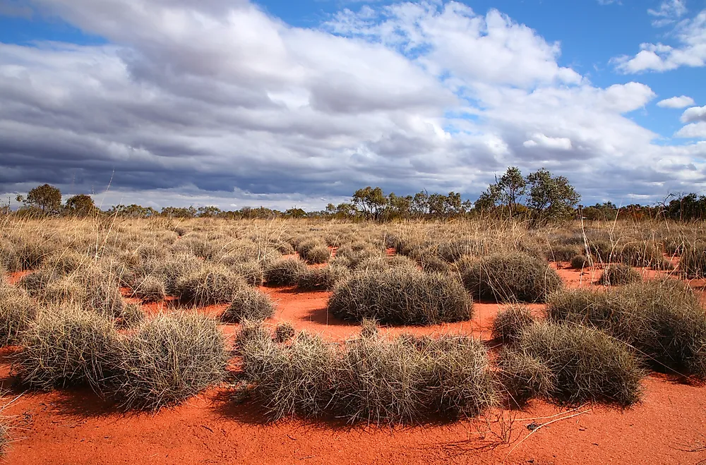
The Largest Deserts In Australia
Australia is the driest inhabited continent on Earth, with only Antarctica drier. Roughly 70 percent of the Australian mainland receives less than 500 mm of rain per year, and the ten officially named Australian deserts together cover approximately 1.37 million square kilometres, or about 18 percent of the mainland landmass. The list below ranks those ten deserts by area, largest first, with the Great Victoria Desert in Western Australia and South Australia at the top and the small Pedirka Desert in northern South Australia at the bottom. Each entry notes the desert's distinguishing features: dune fields, stony plains, salt lakes, mound springs, palaeontological sites, and the Indigenous peoples whose traditional lands the deserts span.
1. Great Victoria Desert
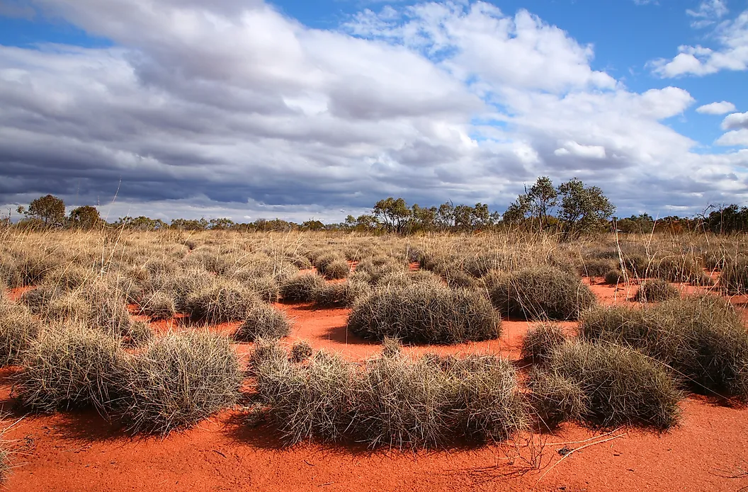
The Great Victoria Desert covers 348,750 km², roughly 4.5 percent of Australia's land area, making it the country's largest desert. It stretches more than 700 km east to west across the southern interior of Western Australia and the western half of South Australia, between the Eastern Goldfields and the Gawler Ranges. Average annual rainfall is between 150 and 250 mm. Summer daytime temperatures reach 32 to 40°C, dropping to 18 to 23°C in winter.
Ernest Giles, a British-born Australian explorer, was the first European to cross the desert, crossing on camels between May and November 1875. He named it for Queen Victoria. David Lindsay crossed it north to south in 1891, Frank Hann searched it for gold between 1903 and 1908, and Australian Army surveyor Len Beadell built the Anne Beadell Highway across it between 1953 and 1960. Anangu Pitjantjatjara Yankunytjatjara, Mirning, Spinifex (Pila Nguru), and other Aboriginal Australian peoples have lived in the region for tens of thousands of years.
The Tjuntjuntjara community in the Spinifex People's traditional lands documents continuous occupation of around 600 generations, or approximately 25,000 years. Sections of the desert near Maralinga and Emu Field were used by Britain for nuclear weapons tests between 1953 and 1963 and remain contaminated with plutonium residues. Most of the Spinifex People displaced by the tests returned to their lands in the 1980s. The Mamungari Conservation Park in South Australia is one of fourteen UNESCO Biosphere Reserves in Australia.
2. Great Sandy Desert

The Great Sandy Desert covers 267,250 km² across the northwest of Western Australia, making it the country's second-largest desert. It contains some of Australia's largest erg systems with parallel longitudinal sand dunes, alongside spinifex-dominated vegetation and patches of mulga woodland. The Wolfe Creek meteorite crater, on the desert's southern edge near the Tanami boundary, is one of the world's largest impact craters at roughly 880 metres across and 60 metres deep; the impact is estimated at around 300,000 years ago.
Two main Aboriginal Australian groups, the Martu and the Pintupi, have traditional connections to the country. The Canning Stock Route, surveyed by Alfred Canning between 1906 and 1910 to move cattle between the Kimberley and the southern goldfields, crosses the desert and is now one of the longest historic stock routes in the world. Significant mining operations, particularly for iron ore and gold, sit along the desert's edges.
3. Tanami Desert
The Tanami Desert covers 184,500 km² in the Northern Territory and the eastern edge of Western Australia. It is the country's third-largest desert and one of the last regions of mainland Australia to be mapped by non-Indigenous explorers. The central Tanami was not fully traversed by Europeans until the early 20th century. The Tanami Track, an unsealed road of just over 1,000 km, connects Alice Springs in the Northern Territory to Halls Creek in Western Australia and forms the principal route across the desert.
The Warlpiri and Kukatja peoples are among the traditional owners. The Tanami is one of Australia's most productive gold mining regions; the Tanami Gold Mine and the Granites Gold Mine, both in the Northern Territory section, have been operating since the 1980s. Notable fauna include the bilby, the long-tailed planigale, the freckled duck, and the grey falcon. Bilbies have been the focus of recent reintroduction programmes after population declines from feral cats and habitat loss.
4. Simpson Desert
The Simpson Desert covers 176,500 km² across the Northern Territory, Queensland, and South Australia. It is the country's fourth-largest desert by area but is often cited as the world's largest parallel sand dune desert. The desert contains more than 1,100 parallel longitudinal dunes oriented roughly north-northwest to south-southeast, some stretching up to 200 km in length. The largest single dune, Nappanerica (also called Big Red), stands 40 m tall near the desert's eastern edge close to Birdsville, Queensland.
The Wangkangurru Yarluyandi people, who have lived in and around the desert for thousands of years, know it as Munga-Thirri. The Simpson Desert sits atop the Great Artesian Basin, one of the largest groundwater basins in the world; water from the basin reaches the surface at natural springs including Dalhousie Springs in the desert's southwestern corner, which holds a warm-water pool used continuously by Aboriginal communities for thousands of years.
The Munga-Thirri / Simpson Desert National Park, established in South Australia in 2021, is the largest national park in Australia, covering more than 36,000 km². Public vehicle access through the desert is restricted between late November and mid-March each year because of extreme summer heat (regularly above 50°C).
5. Gibson Desert

The Gibson Desert covers 156,000 km² in central Western Australia, between the Great Sandy Desert to the north, the Little Sandy Desert to the west, and the Great Victoria Desert to the south. It is named after Alfred Gibson, a member of Ernest Giles's 1874 expedition who became separated from the party in waterless country and was never found. The desert reaches elevations of up to 500 m above sea level and contains gravel-covered terrains, rocky ridges, low ranges, and scattered salt lakes.
The Pintupi and Ngaanyatjarra peoples are among the traditional owners, with several small Aboriginal communities including Kiwirrkurra and Patjarr inside or on the desert's edges. The Gibson Desert Nature Reserve, covering 18,945 km², protects part of the western desert and is one of the largest single nature reserves in Western Australia. Notable wildlife includes the great desert skink, the rufous hare-wallaby (mala), and the desert mole.
6. Little Sandy Desert
The Little Sandy Desert covers 111,500 km² in central Western Australia, immediately west of the Gibson Desert and south of the Great Sandy Desert. The landscape resembles its larger northern neighbour, with longitudinal sand dunes and spinifex-dominated vegetation; the name reflects the close resemblance rather than any geological difference. The Canning Stock Route crosses both the Little Sandy and the Great Sandy on its southern run.
The Martu people are the traditional owners. Lake Disappointment, an ephemeral salt lake roughly 320 km² in size, sits in the desert's centre; the name comes from the surveyor Frank Hann, who reached it in 1897 expecting a freshwater lake and finding salt instead. The Karlamilyi (Rudall River) National Park, the second-largest national park in Western Australia, covers part of the desert's northern reaches.
7. Strzelecki Desert
The Strzelecki Desert covers 80,250 km² across northern South Australia, southwest Queensland, and the far west of New South Wales. It is named after Paweł Edmund Strzelecki, the Polish-born Australian explorer who passed through the region in the 1840s. The desert contains extensive longitudinal dune fields and three formally designated wilderness areas, including the Strzelecki Regional Reserve in South Australia.
Three watercourses cross the desert: the Strzelecki Creek, the Cooper Creek, and the Diamantina River; all are part of the Lake Eyre internal drainage basin and run only after major rain in their northern catchments. The Strzelecki Track, a remote unsealed road of about 470 km running from Lyndhurst in South Australia to Innamincka near the Queensland border, is one of the most-driven outback four-wheel-drive routes in the country.
8. Sturt Stony Desert
The Sturt Stony Desert covers 29,750 km² across northeastern South Australia, southwestern Queensland, and far western New South Wales, on the Gason Dome between the Strzelecki Desert to the southeast and the Simpson Desert to the west. It is named after the English explorer Charles Sturt, who passed through the area in 1844 while searching for an inland sea and recorded that the stony ground wore down his horses' hooves and made travel extremely difficult.
The desert surface is dominated by gibber, a dense pavement of small angular stones shaped over millennia by wind erosion and the alternating heat and cold of the desert climate (a surface known as desert pavement). Shallow ephemeral lakes called gilgai dot the surface. The desert is part of the Tirari-Sturt stony desert ecoregion. Notable native fauna include the kowari (Dasyuroides byrnei), a small carnivorous marsupial currently listed as vulnerable by the IUCN.
9. Tirari Desert
The Tirari Desert covers 15,250 km² in the eastern part of the Far North region of South Australia, east of Kati Thanda / Lake Eyre. Average annual rainfall is below 125 mm, among the lowest in Australia. The desert is characterised by a north-south sequence of salt lakes and longitudinal sand dunes, with Cooper Creek running through the middle on its way to Lake Eyre.
The Dieri (Diyari) people are the traditional owners. Part of the desert lies within the Kati Thanda / Lake Eyre National Park. The Tirari Desert is notable in palaeontology for the Lake Palankarinna fossil bed, which has produced significant Tertiary period (roughly 5 to 25 million years old) vertebrate fossils, including marsupial lions, giant kangaroos, and the extinct Diprotodon. The Diprotodon was the largest known marsupial ever to live, weighing up to roughly 2,800 kg.
10. Pedirka Desert
The Pedirka Desert covers 1,250 km² in northern South Australia, about 100 km northwest of Oodnadatta. It is the smallest of Australia's officially recognised deserts, accounting for roughly 0.016 percent of the country's land area. The desert is named after the abandoned railway siding of Pedirka on the old Central Australia Railway, which itself takes its name from a Lower Southern Aranda word.
The desert surface is dominated by deep red sand, with widely spaced low and weathered linear dunes and patches of dense mulga (Acacia aneura) woodland. The terrain is largely undeveloped, with current land use including pastoral leases and minor petroleum exploration.
The Ten Australian Deserts by Area
| Rank | Desert | Area (km²) | Share of Australia |
|---|---|---|---|
| 1 | Great Victoria Desert | 348,750 | 4.5% |
| 2 | Great Sandy Desert | 267,250 | 3.5% |
| 3 | Tanami Desert | 184,500 | 2.4% |
| 4 | Simpson Desert | 176,500 | 2.3% |
| 5 | Gibson Desert | 156,000 | 2.0% |
| 6 | Little Sandy Desert | 111,500 | 1.5% |
| 7 | Strzelecki Desert | 80,250 | 1.0% |
| 8 | Sturt Stony Desert | 29,750 | 0.3% |
| 9 | Tirari Desert | 15,250 | 0.2% |
| 10 | Pedirka Desert | 1,250 | 0.016% |
| Total | 1,371,000 | ~18% |
Sources: Geoscience Australia; Australian Bureau of Meteorology; Australian Geographic.
How Australia's Deserts Compare Globally
Combined, Australia's ten named deserts cover about 1.37 million km², an area roughly twice the size of Texas. The Great Victoria Desert alone is larger than the United Kingdom. None of the Australian deserts cracks the global top ten by area. At that scale they are dwarfed by the polar Antarctic and Arctic deserts (which together exceed 13 million km²), the Sahara (around 9.2 million km²), the Arabian Desert (around 2.3 million km²), and the Gobi (around 1.3 million km²). Australia's profile is unusual in that, despite the size of individual deserts, the country has no single very large desert system that dominates the continent in the way that the Sahara dominates North Africa.
Roughly three percent of Australia's population, fewer than 600,000 people, currently lives in the arid zone, which extends well beyond the formal desert boundaries. Most Australians live in coastal cities. Aboriginal Australian peoples, however, have continuously inhabited the desert interior for tens of thousands of years, and the desert regions hold some of the longest continuous human cultural lineages documented anywhere in the world.