The US Towns That Picked Up and Moved Themselves
Moving a house is hard enough. A few American towns moved everything. Faced with a flood or a mine or an earthquake, they decided the town was worth more than the ground under it. So they lifted the houses onto logs and rolled them down the road. They floated cottages across open water on barges. They hauled the church and the bank and the cemetery uphill and started over. It took years and cost fortunes, and it worked. Every town below is still standing today, and most are a pleasure to visit.
Hibbing, Minnesota

The best iron ore in Hibbing turned out to be sitting directly under people's houses. The Oliver Iron Mining Company wanted it, and the open pit had already crept up on three sides of town by the 1910s. So between 1919 and 1921, the people of Hibbing moved nearly 200 buildings two miles south. Crews slid logs under the structures, lashed them with steel cables, and rolled them along wooden rails toward the new site. Tall buildings lost their chimneys for the trip. When a house passed under a power line, workers climbed up and lifted the wires over it by hand.
Hibbing's mayor, a lawyer named Victor Power, refused to let the company move his town on the cheap. He held their feet to the fire until they agreed to build something worth moving to. The mining company paid for new sewer and electric lines, a hospital, a grand new high school, and the Androy Hotel. The old townsite is now the Hull-Rust-Mahoning open pit, one of the largest anywhere. You can stand at the mine view overlook today and see straight down into the canyon where the first Hibbing once had its streets.
American Falls, Idaho

Give American Falls credit for persistence, because this town moved itself twice. Settlers first built on the west bank of the Snake River in the 1880s. In 1888, the whole community shifted across the river to sit beside the new Oregon Short Line Railway. Then the real project arrived. By the 1920s the American Falls Dam needed the exact ground the town was standing on. Residents relocated 344 homes, 46 businesses, five churches, three hotels, a flour mill, and six grain elevators to higher ground.
The planners laid out the new streets parallel to the coming reservoir so every window would catch good sunlight. Locals worried the angle would confuse their kids about which way was north. One holdout stayed behind. The old Oneida Milling and Elevator Company grain elevator still stands in the water, and you can see it from the modern town across the reservoir. The dam went into service in 1927. These days people fish and boat right where the first American Falls used to be, and the Power County Museum keeps the whole strange story on the record.
Niobrara, Nebraska

Niobrara has the odd honor of being one of the oldest and one of the newest towns in Nebraska at the same time. That is what happens when you move twice. The first move came after the great flood of 1881, when an ice jam pushed water six feet deep through the streets. A crew of teamsters went to work with house jacks, block and tackle, and teams of horses, oxen, and mules. One building at a time, they hauled the town a mile and a half southwest.
The second move was a much slower heartbreak. Rising groundwater from the Gavins Point and Fort Randall dams began seeping up into the town from below. It took four and a half years to talk everyone into leaving, and the new Niobrara was dedicated in 1977 on ground about 1,225 feet above sea level. The town sits up above the river valley now. Its old home has become a wildlife area where the water finally won.
Kettle Falls, Washington
For generations the falls on the Columbia River were among the great salmon fishing grounds of the Northwest, gathering place for many tribes. The city of Kettle Falls grew up beside them in 1891 and did well on sawmills and ranching. Then came the Grand Coulee Dam. It would water the whole Columbia Basin and light up the region, and it would also drown Kettle Falls under the rising reservoir.
So Kettle Falls made a deal with its neighbor. The town annexed a strip of land running to nearby Meyers Falls, and more than 100 buildings, homes, stores, and churches were loaded onto flatbed trailers. Trucks hauled them up the valley slopes to the higher ground. Even the town cemetery was carefully moved to a new plot on the hill. When the dust settled the two communities had become one. The original townsite lies under about 100 feet of water today, part of the long blue reach of Lake Roosevelt, and modern Kettle Falls stands where Meyers Falls used to be. The lake now draws boaters and campers to a shoreline ringed by forested hills.
Shawneetown, Illinois

Shawneetown is one of the oldest towns in Illinois, and for a long time it was one of the most important. It opened the first bank in Illinois Territory back in 1816, and the grand State Bank building that still stands went up between 1839 and 1841. It even shares a rare distinction with Washington, D.C., as one of the only towns the federal government ever formally chartered. What Shawneetown could never shake was the Ohio River. The town flooded so often that residents kept raising the levee higher and higher.
In early 1937 the river crested at 65.64 feet and put the town under about 15 feet of water. Only a handful of the roughly 400 homes came through livable. This time the state and the federal government approved something never tried before, the removal of an entire town. Starting in 1938, Works Progress Administration crews trucked around 250 wooden houses about three miles inland to a sand ridge and set them on fresh concrete foundations. The heavy brick buildings had to be left behind. The move split the community for good. A few hundred people still live in Old Shawneetown by the levee, while New Shawneetown carries on as the county seat.
Boardman, Oregon

Boardman, the largest town in Morrow County, is named for Samuel Boardman, Oregon's first full-time state parks superintendent. Its first permanent resident arrived in 1915, a year before anyone bothered to lay out the streets, and the town incorporated in 1921. Sitting right on the Oregon bank of the Columbia River put it in the path of progress twice over. The first move came in 1952, when the town shifted half a mile inland to clear room for the widening of U.S. Highway 30.
The bigger upheaval followed the John Day Lock and Dam, which the Army Corps of Engineers began in 1958. The dam would create Lake Umatilla and flood the lower Columbia Basin, Boardman included. Residents planned an entirely new town on a sand ridge a quarter-mile inland. They moved the tourist-facing businesses first so travelers coming off the interstate would still have somewhere to stop. By 1967 the homes, the rail lines, the highway, and the new infrastructure were all in place. The next spring the reservoir began to rise over the old sites for the last time.
Valdez, Alaska

The most powerful earthquake ever recorded in North America hit Valdez on Good Friday in 1964. The old town had been built on a glacial moraine, and when the magnitude 9.2 quake struck, that ground turned to mush and slid into the bay. A wave tore through the waterfront and 32 people lost their lives. Engineers studied the wreckage and reached a hard conclusion. Valdez could never safely be rebuilt where it stood.
Then came a remarkable gift. The descendants of two of the town's founders revived an old family land partnership and donated more than 110 acres of solid ground about four miles away, near the mouth of Mineral Creek. That gift made a brand-new Valdez possible. Over the next three years crews relocated roughly 62 buildings to the new site, and homeowners paid $400 for their lots. The effort was so impressive that Valdez was named an All-America City in 1965. You can still walk the quiet foundations of Old Valdez today, marked with plaques that tell you what once stood there. The new town sits at the head of a deep fjord on Prince William Sound, closed in by snow-topped peaks and fed by waterfalls off the mountainsides.
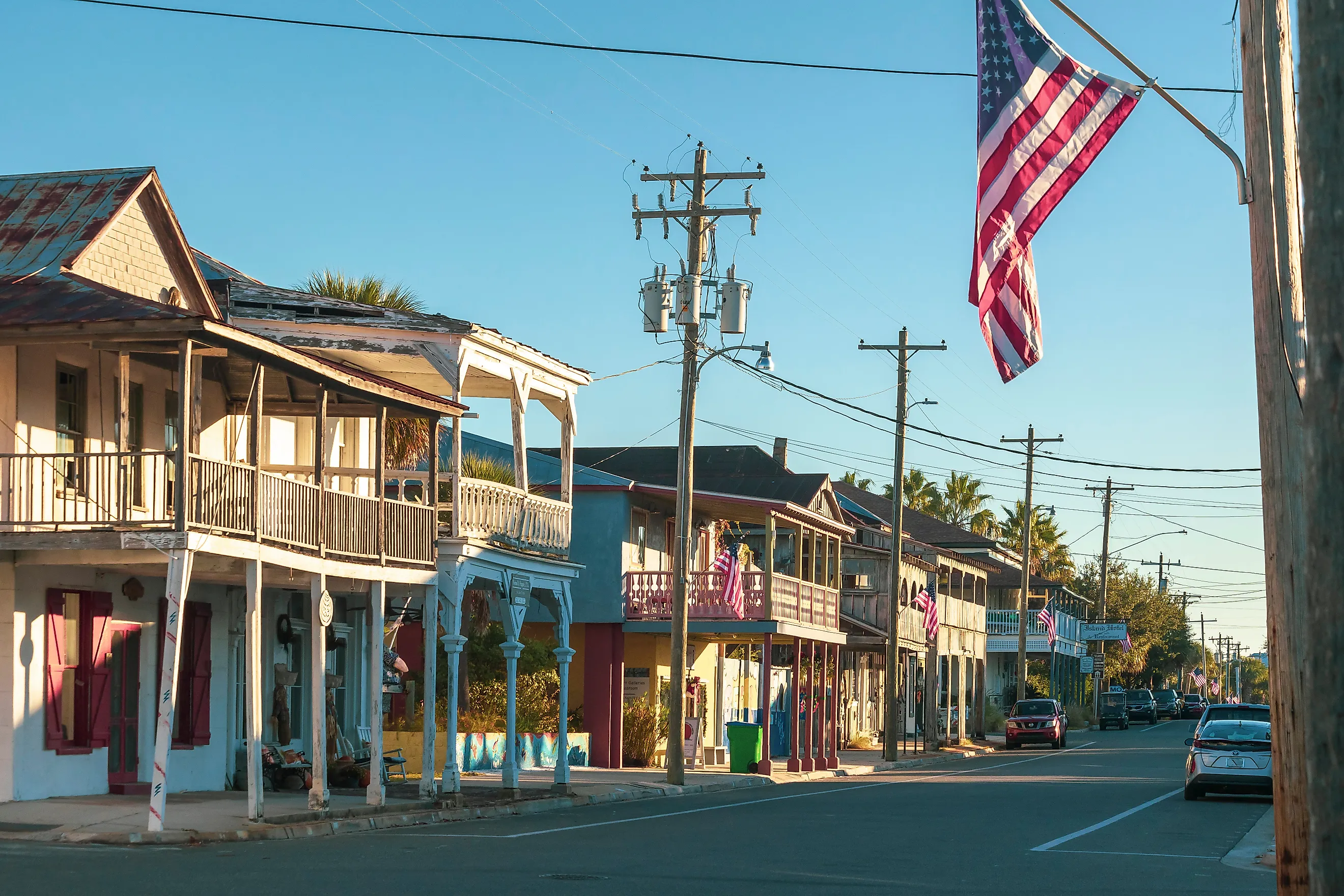
Cedar Key, Florida

Cedar Key sits on Way Key, a Gulf island reachable by a low bridge over the salt marsh, and it got its modern start with a barge convoy after a disaster. On the morning of September 28, 1896, a fisherman named Nicodemus Wilder noticed the sun looked wrong. It glowed through a thick haze in a heat that felt unnatural. None of the roughly 1,200 people around the Cedar Keys knew a major hurricane was bearing down on them. After a strange red sunset the winds arrived, peaking near 125 miles per hour. By dawn the storm had passed and people started making breakfast. Then the water came. A 10-foot surge swept clean over the little island of Atsena Otie, taking nearly all of its 50 buildings and the Faber pencil mill along with it. Across the Cedar Keys more than 30 people died.
The survivors on Atsena Otie made a quiet, practical decision. They would rebuild, just somewhere the sea could not reach so easily. Families loaded whatever cottages had held together onto wooden barges and floated them across the channel to Way Key, which had a rail link to the mainland. On the far shore they dragged the houses up, checked the damage, and settled them into new lots. That island became the Cedar Key of today, a small fishing and clamming town of weathered stilt houses, seafood docks, and artists' studios that draws visitors all year. The old island stands empty across the water as part of the Cedar Keys National Wildlife Refuge. Paddle out by kayak and you can still find the ruins of the pencil mill among the trees.
Hill, New Hampshire

The old village of Hill sat on a tree-lined main street beside the Pemigewasset River, and the river flooded it in 1875, 1916, 1936, and 1938. In February 1937 the residents got word that the whole place would sit inside the reservoir behind the new Franklin Falls dam. They could disband or they could move. So the town formed an association, bought higher ground a short distance away, and planned a brand-new village with help from the state. Crews saved 14 of the old buildings and hauled them uphill on railway tracks pulled by a horse-powered winch.
The speed of it still amazes. By June 1941 the new Hill had a town hall, a school, a water system, and 30 houses. That year's town meeting opened in the old hall, took a recess, and reconvened in the new one up the hill. The reborn town sits along Route 3A between Franklin and Bristol today, quiet and green in the New Hampshire woods. The old site became a flood-control area laced with trails, and you can walk, bike, or paddle out to the gridded streets where the first Hill once stood.
Soldiers Grove, Wisconsin

Soldiers Grove did something no American town had ever done on purpose. It chose to move out of the floodplain without waiting for a dam to force its hand. The Kickapoo River had swamped the little village again and again, in 1907, 1912, 1917, 1935, 1951, and on. The government's answer was always a bigger levee. Local leaders ran the numbers and decided the levee would only protect a downtown that was slowly dying anyway. In 1977 the village spent its own money to buy 100 acres of high ground and started laying pipe.
For years the federal help never came. Then the record flood of July 1978 changed everything, and a $900,000 grant finally arrived. The village moved its whole business district uphill between 1979 and 1983. Because the move landed during the energy crisis, planners made a bold call. Every new commercial building had to draw at least half its heat from the sun. Soldiers Grove became the first solar village in the country. When the big flood of 2007 came through and battered its neighbors, the town sat high and dry, its old downtown reborn as a riverside park. It rests in the green, unglaciated hills of Wisconsin's Driftless region, where the Kickapoo winds through some of the prettiest country in the state.
Carrying Home To Higher Ground
Look at these ten towns together and a pattern comes into focus. A place is never really the dirt it sits on. It is the people, the school, the bank, the fish fry, the neighbors who show up with a truck when the water rises. When staying became impossible, none of these communities simply scattered. They found higher ground and brought the whole town with them, board by board and house by house. Hibbing chose beauty over a payout. Valdez rose again beside its fjord on a neighbor's gift. Hill reconvened its town meeting in a hall that had just been hauled up the hill. Each move was an act of faith that home is worth the trouble of carrying.