The Most Beautiful Desert Towns In Nevada
Nevada is home to some of the most expansive desert landscapes in North America, and its modest collection of small towns often provides the best vantage points for experiencing them. From colorful hills and sagebrush valleys to towering mountain ranges and historic mining districts, communities like Caliente, Ely, and Tonopah showcase the remarkable variety found across the state's arid interior.
Some preserve railroad and frontier history, while others sit beside state parks, national monuments, or vast stretches of untouched public land. Regardless of where you head off to, these are among the most beautiful desert towns in Nevada, each offering a distinctive window into the state's best scenery and storied history.
Caliente

Set in southeastern Nevada along the Meadow Valley Wash, Caliente is a quintessential desert town, surrounded by rugged canyon country, volcanic formations, and expansive public lands as far as the eye can see. Founded as a railroad community in 1901, it still features the impressive Mission Revival-style Caliente Railroad Depot, now serving as the town's civic center.
Just outside town, Kershaw-Ryan State Park provides an unexpected contrast to the surrounding Great Basin Desert with its green gardens, towering cottonwoods, and natural springs flowing through a narrow canyon. Outdoor enthusiasts also come for the nearby Barnes Canyon mountain biking trails, while Rainbow Canyon similarly attracts photographers hoping to capture military aircraft flying low through the colorful cliffs. Exploring on the road instead? A handful of local scenic drives lead to formations such as the Oak Springs Trilobite Area and the striking landscapes of the Basin and Range National Monument.
Ely

Located at around 6,500 ft (1,981 m) in eastern Nevada, this lofty community sits within a broad high-desert basin framed by the Egan and Schell Creek mountain ranges. Its mountainous setting combines sagebrush-covered valleys with forested, sometimes snow-covered peaks, creating scenery that changes drastically with the seasons. Furthermore, Ely is notably remote, being found along the US Route 50, dubbed "the loneliest road in America."
A stroll down Ely's historic downtown may reveal its mining and railroad heritage, with numerous early 20th-century brick buildings and colorful outdoor murals depicting local history. The Nevada Northern Railway Museum, for example, preserves one of the nation's best collections of operating steam and diesel locomotives, offering excursions through outdoor exhibits through the surrounding desert landscape.
Just east of town, Great Basin National Park, one of the country's least visited federal parklands, features ancient bristlecone pine forests dating back thousands of years, alpine lakes, and the famed Lehman Caves, while the Success Loop Scenic Drive provides sweeping views of open rangeland and distant mountain ridges. The area is also recognized as a premier stargazing destination thanks to its exceptionally dark skies.
Rachel

Located in southern Nevada within the Great Basin and about a 2-hour drive from the Las Vegas Strip, Rachel is a surprisingly remote-feeling destination best known as the closest community to the mysterious landscapes around Area 51. The town also sits beneath the towering Worthington Mountains and near the Papoose Range, where rugged ridgelines, dry lake beds, and desert vistas create a stark yet captivating setting.
Fittingly, Rachel is the main stop along the famous Extraterrestrial Highway, a scenic route officially designated by the state of Nevada for its otherworldly roadside attractions and isolated scenery near the legendarily mysterious military base.
Beyond the alien folklore, however, the area contains significant natural features to look out for, including the nearby Basin and Range National Monument and the highly secluded Mount Irish and Worthington Mountains wildernesses. The surrounding deserts support some unique wildlife adapted to extreme conditions for you to peep as well, including desert bighorn sheep, kit foxes, and a variety of hardy reptiles, namely snakes and lizards.
Virginia City

Perched on the eastern slope of the Virginia Range, Virginia City rises above the high desert roughly between Reno and Carson City, with steep streets, exposed hillsides, and some seriously epic views across the Great Basin. The community developed rapidly after the 1859 discovery of the Comstock Lode, one of the richest silver deposits ever found in the United States; a finding that transformed Nevada's early economy greatly in some of its earliest days. Many of its original buildings, raised wooden sidewalks, and mining structures remain intact, giving modern visitors a glimpse into the boomtown era. Moreover, the nearby Virginia & Truckee Railroad follows historic mining routes through the region, while trails around Mount Davidson provide views of the Sierra Nevada and Carson Valley.
Aside from its architecture, though, Virginia City's landscape is defined by its heightened elevation and terrain, with the barren slopes of the adjacent mountains contrasting against distant valleys. Hikes up to spots like Flowey Peak, Mount Bullion, and Mount Davidson will give you some truly elevated, memorable views of the terrain, should you make the journey out.
Tonopah

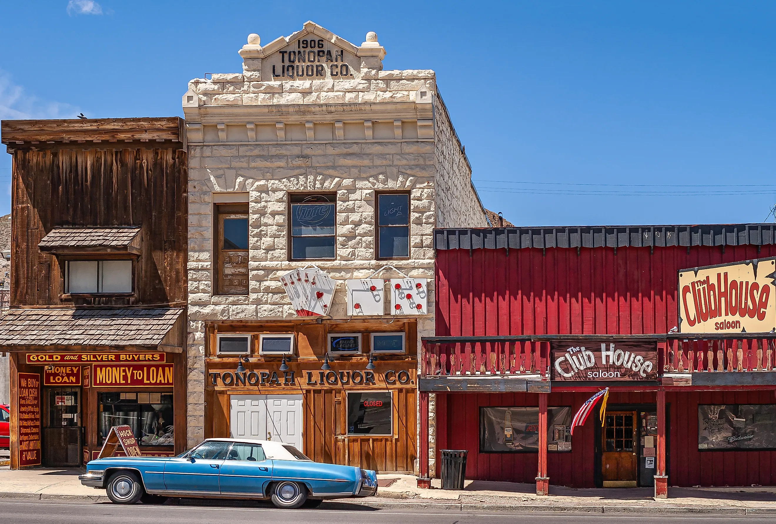
Positioned almost midway between Reno and Las Vegas, Tonopah is yet another Nevada town that was founded after a rich silver discovery. With that, its mining heritage remains visible at the Tonopah Historic Mining Park, where visitors can explore original equipment, shafts, and panoramic overlooks above the old workings dating back to 1900.
Its downtown retains an impressive collection of old-school buildings from the early 20th century as well, including the stately Mizpah Hotel. Like a few entries on this list, Tonopah is also internationally recognized for its exceptionally dark skies, earning designation as an International Dark Sky Community. On clear nights, the Milky Way stretches vividly across the horizon with minimal light pollution, and you don't have to stray very far out of the city limits to properly see it. Also just outside town, the unusual rock formations of the San Antonio Mountains and nearby desert provide plenty of open space for hiking, photography, and wildlife viewing, reinforcing Tonopah's reputation as one of Nevada's most visually striking high-desert communities.
Goldfield

In a very central portion of the state, Goldfield combines its arid landscapes with one of the richest mining histories in the American West. It rests at roughly 5,689 ft (1,734 m), surrounded by volcanic hills streaked with shades of brown, red, and gold that glow at sunrise and sunset.
During the early 1900s, Goldfield actually became Nevada's largest city for a time after an enormous gold discovery, and many substantial stone and brick buildings from that boom still stand today because of that. Landmarks such as the Goldfield Hotel, Esmeralda County Courthouse, and the former Goldfield High School now create a bit of a skyline against the barren yet scenic backdrop. The nearby International Car Forest of the Last Church also adds an unexpected splash of color, with dozens of graffiti-covered vehicles arranged as large-scale outdoor art. South of town, the broad Alkali Flat and local mountain ranges emphasize the immense scale of Nevada's interior desert, where long vistas stretch uninterrupted for miles in nearly every direction.
Searchlight

Located at the southern tip of Nevada, Searchlight sits deep within the Mojave Desert. It developed after gold discoveries in 1897 and quickly became one of many important mining centers in the state, a history that is still visible in the scattered mine remnants and historic buildings around the area.
Searchlight's scenery is defined by interesting desert contrasts, with dark volcanic hills rising above pale valley floors, while Joshua trees and other Mojave plants become more common as you get deeper into nearby wildernesses. The Wee Thump Joshua Tree Wilderness is worth an exploration, as it protects one of Nevada's largest Joshua tree forests. The eastern edge of Lake Mead National Recreation Area also lies a short drive away, giving you a rare chance in Nevada for a lakeside getaway. On the other hand, Spirit Mountain, considered sacred by several Indigenous tribes, dominates the southeastern horizon.
See the Wonders of Nevada in These Remote Destinations
These quiet desert communities reveal how Nevada's appeal extends far beyond the neon skylines and casino resorts of Las Vegas or Reno. Whether shaped by mining booms, railroads, eons of geological history, or all of the above, each destination mentioned here shows off a different side of the Great Basin and Mojave deserts that ought to be checked out by any curious traveler in the region.