The American Towns Surrounded Entirely By Water
A main street, a school, a church, and water in every direction. That is a town on an American island. A few of them get strange. On one, cars have been banned for more than a century, and horses still haul the UPS and Amazon boxes to the door. On another, winter freezes the lake hard enough that people drive out to the mainland on a road of ice. On a third, residents meet every ferry at the dock with golf carts, talking in an accent that sounds half-Elizabethan. Ten island towns follow, each a full community marooned on its own patch of land, and each worth the boat ride out.
Nantucket, Massachusetts

The town of Nantucket covers the entire island, plus two smaller ones, Tuckernuck and Muskeget, and Great Point Light sits about 7 miles up the sand from the Wauwinet gatehouse. The lighthouse is reached on foot or by driving the beach with an oversand permit from the Trustees, who manage 16 miles of sand routes and walking trails on the Coskata-Coatue Wildlife Refuge and turn away all-wheel-drive vehicles. Seals are common along the way.
The ride to the island is long. The traditional Steamship Authority ferry from Hyannis, on Cape Cod, takes 2 hours and 15 minutes. The island's spring event is the Daffodil Festival, on the last full weekend of April, when antique cars leave town at noon on the Saturday and drive out Milestone Road to 'Sconset, on the east shore, then park along the road for a tailgate picnic. In 'Sconset, the Bluff Walk follows a footpath along the top of the bluffs between the houses, about two miles round trip.
New Shoreham, Rhode Island

On Block Island, which makes up the whole town of New Shoreham off the Rhode Island coast, the walk to take is Clay Head Trail. It runs 3.5 miles out and back along the coast, with about 196 feet of climbing, through a 190-acre stretch with a nearly empty beach, bluffs that drop 120 feet to the ocean, and, at the top, a tangle of footpaths known as the Maze. Of the ferries from Point Judith, on the mainland, only the traditional boat carries cars. Bikes and mopeds rent near the ferry landing, the speed limit is 25 mph, and the island has no traffic lights.
On the south shore, Mohegan Bluffs rise about 200 feet above a rocky beach. The overlook and the top of the 141-step staircase are open, but the state closed the bottom of the stairs in June 2024 after the path to the beach washed out. Southeast Light, a National Historic Landmark near the bluffs, has a small museum with free admission, and Painted Rock, along Mohegan Trail, is covered in painted messages.
Tangier, Virginia

Farther south, in the Virginia waters of Chesapeake Bay, residents of Tangier are at the dock when the passenger boats come in, waiting with oversize golf carts for a 10-minute tour of the island. Few cars run here, and most people get around on golf carts, UTVs, bikes, and mopeds. The ferry from Onancock, on Virginia's Eastern Shore, leaves at 10 a.m. for a crossing of about an hour and starts back at 3:30 p.m., from the first weekend in May through September and again on the first weekend of October, so a day on Tangier fits between those two boats. Carts can also be rented through the Four Brothers Crab House & Ice Cream Deck, and the Tangier Island History Museum is a National Park Service partner site on Main Ridge Road. Across the harbor, crab shanties stand on stilts over the water, and watermen load packed soft-shell crabs onto the Crisfield mail boat each morning. Tangier also has its own accent, one that some residents describe as a mix of Southern and Elizabethan English.
Key West, Florida

A car can reach Key West. The island sits about 160 miles southwest of Miami, at the end of the 113-mile Overseas Highway and its 42 bridges, and it has its own international airport. Once there, the car matters less, since Old Town is easy to cover on foot or by bike and parking can be expensive. Free-roaming chickens share the streets. The Ernest Hemingway Home and Museum runs 30-minute guided tours of the house, where about 60 cats live, roughly half of them six-toed. Fort Zachary Taylor, an 87-acre state park, has a beach for swimming and snorkeling, and Dry Tortugas National Park, about 70 miles farther west, is reached by ferry, seaplane, or private boat.
The Sunset Celebration at Mallory Square, on the waterfront, takes place every night. It begins about two hours before sunset, with local musicians, artists, jugglers, stilt walkers, and food vendors, and it is free to attend.
Grand Isle, Louisiana

Louisiana Highway 1 ends on Grand Isle, the state's only inhabited barrier island. Unless you come by boat or floatplane, the elevated Highway 1 bridge between Leeville and Port Fourchon is the one way in and out. Fishing starts at the edge of the island. The free 960-foot Caminada Fishing Pier, which opened in December 2024, stands just before the road enters the island, and the 990-foot Grand Isle Fishing Pier opened in summer 2023. Dozens of charter fishing companies work out of the island's marinas.
The highway crosses the island and ends on its eastern side, near Grand Isle State Park, where surf fishing from the beach is a popular pastime and a valid Louisiana fishing license is required. The island lies on the Mississippi Flyway, a route migrating birds follow, and the Grand Isle Migratory Bird Celebration is held there every April. In July, the Grand Isle Tarpon Rodeo, first held in 1928 and billed as America's oldest fishing tournament, brings tarpon, redfish, and trout to the scales at the Tarpon Rodeo Pavilion.
Put-in-Bay, Ohio

Put-in-Bay is the village on South Bass Island, in Lake Erie, and the Jet Express from Port Clinton lands passengers right downtown. Perry's Victory and International Peace Memorial, a 352-foot column run by the National Park Service, stands within the village. Its rotunda is free, and a ticket from the visitor center covers the observation deck. Drivers come over on the Miller Ferry, the only boat line that carries vehicles, which lands at the Lime Kiln Dock.
The Butterfly House and Perry's Cave are both on the island. About a mile from downtown, Heineman's Winery sits on top of a second cave, Crystal Cave, where celestine crystals up to 3 feet wide line the walls. A visit to the cave comes with a tour of the winery above it.
Mackinac Island, Michigan

Every June, Mackinac Island holds a 10-day Lilac Festival that ends with a Grand Parade of horse-drawn floats. Ferries from Mackinaw City and St. Ignace, on either side of the Straits of Mackinac, land on streets that have been car-free for more than 100 years, and horses have the right of way. Freight is loaded onto horse-drawn drays at the ferry dock, horses deliver UPS, FedEx, and Amazon boxes door to door, and hotel luggage often rides from the boat on a bike.
M-185, the road that circles the island, runs 8.2 miles along the shoreline. On a bike, the loop takes about an hour at a leisurely pace, and biking, running, or walking the full distance is a popular activity. The Grand Hotel's 660-foot front porch is visible from the ferry, and a narrated carriage tour covers the island in about 1 hour and 45 minutes.
La Pointe, Wisconsin

By mid-January in most winters, the ice on Lake Superior gets too thick for the Madeline Island Ferry, which crosses from Bayfield to La Pointe, the village at Madeline Island's ferry dock. A passenger-only windsled takes over on a limited schedule, and passengers stepping off it should expect a cold walk or ask a local for a ride. In winters cold enough for the ice to be judged safe for cars and light trucks, an ice road opens across the lake.
When spring makes the road unsafe, the windsled runs again until the boats can. The ferries return in March or April and keep running until the lake freezes over.
The Madeline Island Museum is near the ferry dock, with art galleries and bike rentals close by. Big Bay State Park and Big Bay Town Park sit at opposite ends of Big Bay, on the island's east side, and both have campgrounds.
Avalon, California

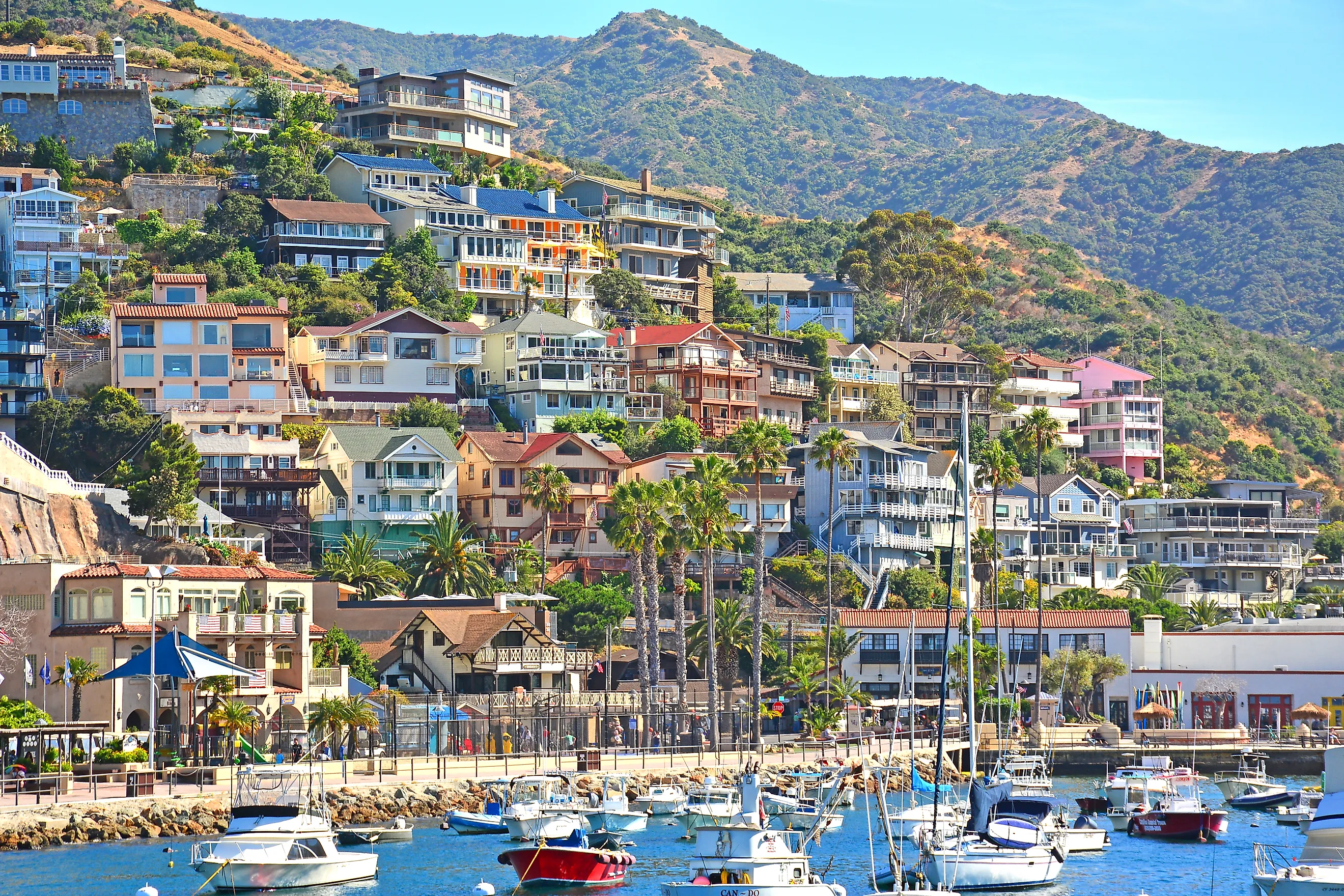
A zip line on Santa Catalina Island, off the Southern California coast, starts in the hills above Avalon and ends 60 feet above sea level at Descanso Beach. The Zip Line Eco Tour has five lines between the hilltops and the beach. The Casino building in Avalon offers tours daily, and the Garden to Sky Hike starts at the Wrigley Memorial & Botanical Garden. Longer hikes into the island's interior need a free permit.
The Catalina Express sails most often from Long Beach, and no car ferries make the trip. Visitors are not allowed to drive cars on the island, vehicle permits go only to full-time residents, and golf carts rent by the hour, for two hours at most.
Ketchikan, Alaska

Airline passengers bound for Ketchikan land on Gravina Island, across the half-mile-wide Tongass Narrows from town, and finish the trip by ferry, since no bridge crosses the channel. The ferry carries cars and foot passengers, leaving the airport on the hour and half hour and leaving town at quarter past and quarter to, between 6:15 a.m. and 9:30 p.m. A taxi to the airport gets expensive, because the meter keeps running while the cab waits for the boat and rides across.
The town itself is on Revillagigedo Island. Creek Street, a boardwalk that counts as an actual city street, allows no vehicles and holds art galleries and restaurants. Totem Bight State Historical Park, about 10 miles northwest along North Tongass Highway, displays 14 totem poles and can be reached on the Blue Line city bus. Misty Fjords National Monument, east of town, is reached only by floatplane or boat.
In several of these towns, the crossing itself has changed in the past few years. Silt building up in the channel to Tangier pushed back the start of the 2026 cruise season from Crisfield, Maryland. Both of Grand Isle's new fishing piers were completed as part of the town's work after Hurricane Ida, the second one opening in December 2024.
On Lake Superior, the road to Madeline Island depends on the winter. In 2023, the ice road never formed. In 2026, it opened across the lake, and on February 6 it closed again because of cracks in the ice, while crews looked for another route.