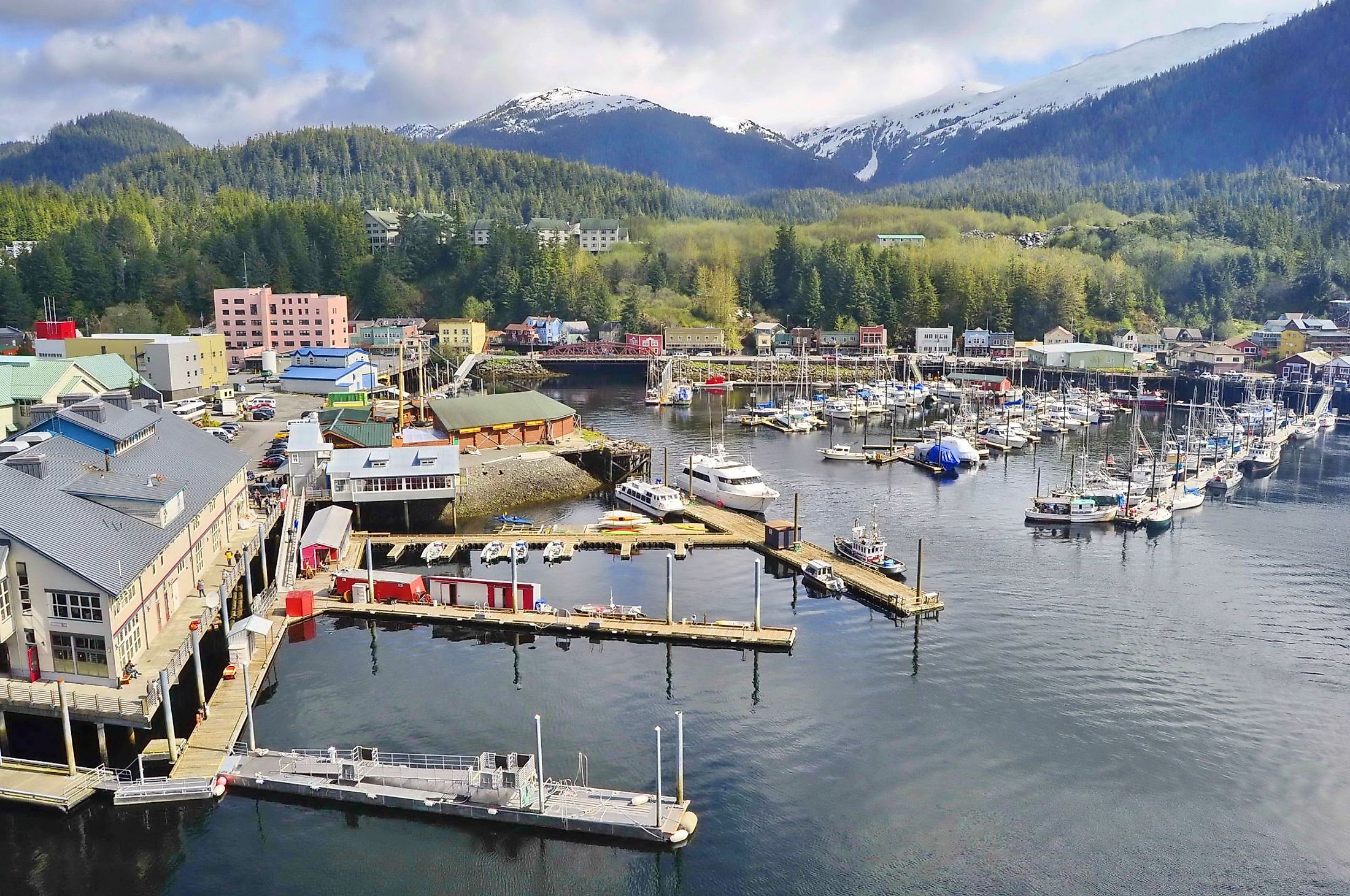
Ketchikan, Alaska
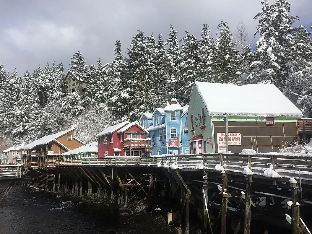
Found on the southeastern coast of Revillagigedo Island, Ketchikan is the southernmost southeastern city in the US State of Alaska. It is referred to as "Alaska's first city" due to its crucial position off the southern tip of Inside Passage that links the Puget Sound with the Gulf of Alaska. This area is found within the Alexander Archipelago, a 480km chain of 1,100 islands stretching from Alaska to British Columbia, Canada. Once a fishing settlement on the Ketchikan River, populated by the Tongass and Cape Fox Tlingit Indians, Ketchikan currently serves as a popular northbound cruise port on the Inside Passage. The city is well known for its spectacular natural scenery, colorful buildings, Native American totem poles, and salmon fishing. Because of its rich fishing heritage dating back hundreds of years, Ketchikan is known as the "Salmon Capital of the World." Thus, a salmon is found at the center of the Ketchikan's flag upon a green and white background.
Geography Of Ketchikan

Alaska is part of the United States in the Northwest corner of the continent of North America. It neighbors Russia to the west and Canada to the east and south. Ketchikan is located about 378km south of Juneau and 1,100km northwest of Seattle, Washington. The city has been named after Ketchikan Creek, the body of the water that runs through the heart of Ketchikan on Revillagigedo Island and empties into the Tongass Narrows. Ketchikan is a Tlingit Indian word for "Thundering Wings of an Eagle," although its true meaning is uncertain. It is thought to be a nod to the formation of the glacial rivers that appear like an eagle's spread wingtip. Ketchikan covers an area of 15.27 sq. km and sits at an elevation of 0m, whereas areas outside the borough have an elevation of upwards of 91.4m.
Climate Of Ketchikan
Historically, Ketchikan sees 229 days of precipitation a year, totaling up to 153.24 inches. This is due to its oceanic climate, similar to that of Scotland or Northern Ireland. Ketchikan is often referred to as the “Rain Capital of Alaska” as it receives much more rain compared to the national average. The average temperature in January is 0.9°C, while the average temperature in August is 14.7°C.
History Of Ketchikan

For centuries, the Tlingit Indians have relied on the salmon that call the Pacific waters of the Ketchikan River home from May to August. It wasn’t until the late 1880s that an Oregon-based canning company set up a salmon cannery in what is known as modern-day Ketchikan. The cannery burned down two years later and was replaced with a saltery and general store. This led to the beginning of a settlement that would become the present-day Ketchikan. By 1890, news of gold-rich pay dirt brought miners from all over the United States to the state in high hopes of striking it rich in the Gold Rush. Alas, gold, silver, and copper mines popped up in the mountains around Ketchikan. On August 25, 1900, Ketchikan was incorporated and given the nickname “Alaska’s first city.” Its geographical position allowed it to be a prime location for a port of entry, bringing shipping traffic to the waterways. Unlike Fairbanks or Juneau, Ketchikan did not have a mineral-rich geological sample of gold. Subsequently, the Gold Rush didn’t last long in Ketchikan and began to dwindle around 1910. By the 1930s, its main industry was fishing and canning, with 13 canneries operating and shipping over 1.5 million cases of fish a year.
Demographics Of Ketchikan
Being the county seat of Ketchikan Gateway Boroughs, Ketchikan is the fifth most populous city in Alaska, with a population of approximately 8,192 inhabitants with a population density of 829.19 inhabitants per sq. km. Nationally, it is placed 3,517th on the list of the largest cities in the United States. It is the last major city, both north, and south, on the Tongass Highway, with small towns also considered part of Ketchikan.
Economy Of Ketchikan

The economy of Ketchikan is made up of 3 main industries: fishing which consists of the processing and shipping of seafood such as salmon, halibut, trout and snapper, and cod. Seafood processing makes up 70% of Alaska’s manufacturing sector. Alternatively, fishing tourism makes up a part of Ketchikan’s fishing industry with boats, guides, and equipment for hire. Southeast Alaska (where Ketchikan is located) makes up one-third of all fishing vessels in the state. Whether industrially processing seafood or packaging fish to bring home after a derby, this perishable good can be shipped overnight through the Ketchikan International Airport on Gravina Island. Overall, Alaska’s seafood sector makes up for two-thirds of the total imports in the United States and is a 3 billion dollar industry annually.
Another economic driver in Ketchikan is its tourism sector, in which 1 million visitors are welcomed annually from Mid-May to Mid-September. During the peak summer months, the cruise ports located at Ketchikan Harbor house 4 Panamax ports. Thus, four large cruise ships can be stationed in Ketchikan at a given time and allow 13,000 visitors into the town in a single day.
Timber has long been a prevalent industry in Ketchikan. However, this industry is currently ongoing a major shift. Along the Ketchikan river, hemlock, spruce, and cedar trees grow. Henceforth, due to environmental, legislative, and conservation views changing, many logging camps and pulp mills have seized operations since the late 1990s.
Attractions Of Ketchikan
Misty Fjords National Monument and Tongass National Forest

Located about 64km east of Ketchikan is Misty Fjords National Monument. It is a designated wilderness area and part of the Tongass National Forest, maintained by the U.S. Forest Service. The Tongass National Forest is considered a temperate rainforest that stretches 68,000 sq. km, covering the islands of the Alexander Archipelago, peaks of the Coast Mountains, and several fjords and glaciers. The name Misty Fjord is a recognition of the oceanic climate and constant precipitation. This stunning sea cliff protrudes 914.4 meters straight out of the water. If one visits after a large rainfall, waterfalls can be seen cascading around the fjord. It is suggested, for best viewing, to take a seaplane and see it from the air. However, this is weather permitting, and one of the daily day cruises may be an alternative option.
Shaped by a rich Tlingit Indian heritage, whose century-old traditions of living and relying on the life cycle of the salmon have influenced Ketchikan, Alaska. Thus, making it what it is today. With a thriving seafood fishery, Native American totem poles, and a spectacular landscape, it's no wonder why Ketchikan went from a 20th-century gold rush town evolving into a must-see tourist destination on Alaska's Inside Passage putting it at the center stage for the world to discover.