Block Island, Rhode Island
Block Island is a small pear-shaped island situated between the Block Island Sound and the Atlantic Ocean that forms a part of the Washington County of the US State of Rhode Island. Block Island is located approximately 14km south of the Rhode Island mainland and about 23km east of Long Island’s Montauk Point. This popular summer tourist destination also forms a part of the Outer Lands archipelagic region and is coterminous with the town of New Shoreham.
Geography Of Block Island

Block Island covers an area of 25.211 sq. km. The island has a length of about 10km and a maximum width of 5.5km. The northernmost point of Block Island is made up of Cow Cove, Sandy Point, and Settler’s Rock. There are two historic lighthouses on the island: the 17m tall Block Island North Light is located on Sandy Point in the island's northern extremity, and the 16m tall Block Island Southeast Light is located in the island’s southeastern corner on the Mohegan Trail.

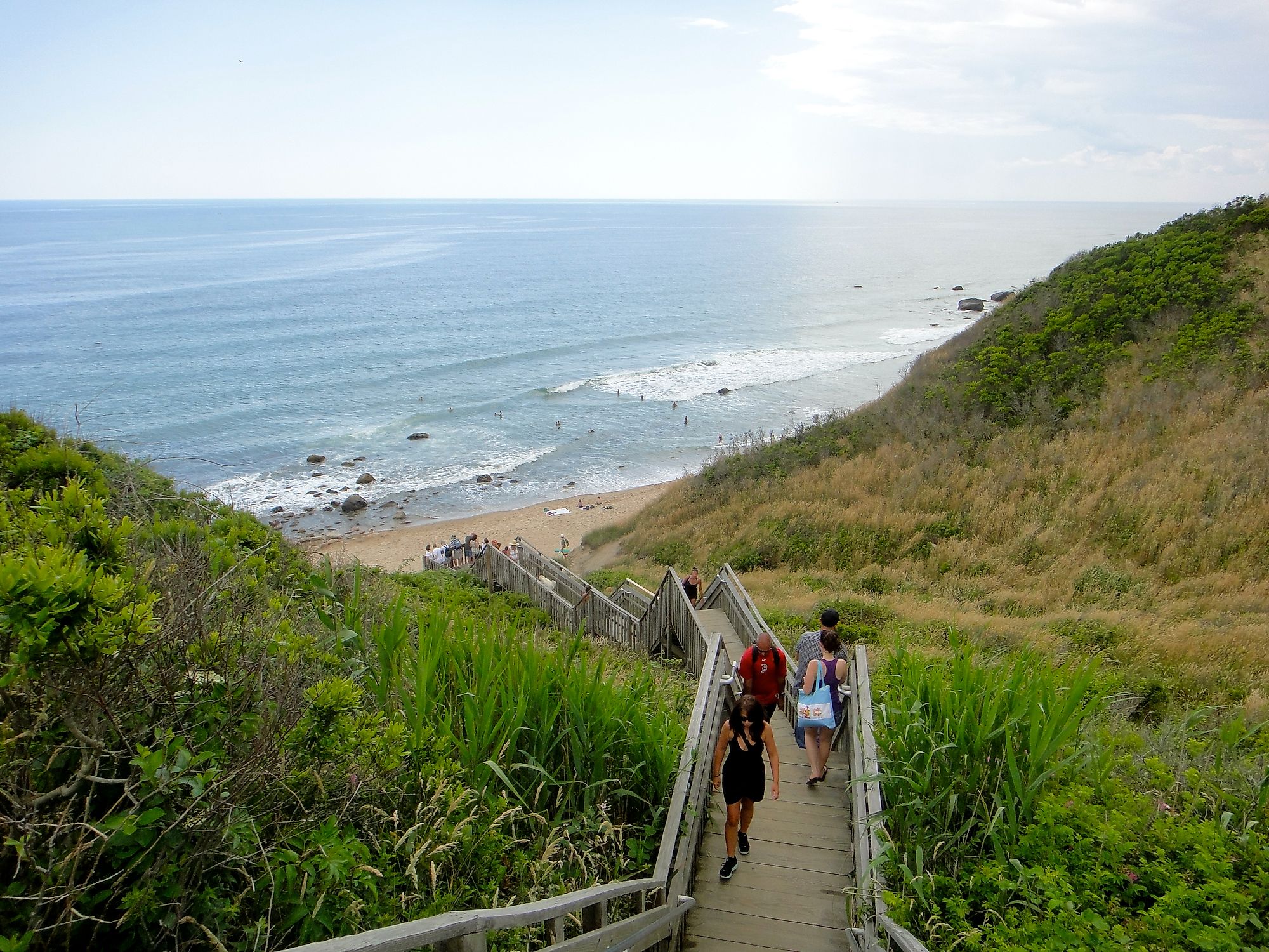
Also situated on the island’s southern shores are the Mohegan Bluffs, which are 46m high spectacular clay cliffs. In addition to this, Block Island features more than 300 freshwater ponds, over 27.35km of pristine coastal beaches, around 48.2km of walking trails, and attractive artificial stone walls. The island’s large Crescent Beach contains five smaller beaches, including Fred Benson Town Beach, Mansion Beach, Rouse’s Beach, Scotch Beach, and Surf Beach. Located to the north of the Mansion Beach are the Clayhead and Pots & Kettles area that contains iron-rich clay deposits and is well known for shell and rock hunting. Some of the other beaches on the island include Ballard’s Beach, Bluffs Beach, and Coastguard Beach.

The construction of a breakwater led to the creation of the Old Harbor on the eastern side of the island, whereas the construction of a channel from the Great Salt Pond to the Block Island Sound led to the formation of New Harbor on the island’s western side. Currently, Old Harbor serves as the island's main settlement, with all the Victorian-style buildings located along its waterfront street. A significant portion of Block Island’s northwestern part is an undeveloped natural area that hosts the Block Island National Wildlife Refuge. Due to its location along the Atlantic Flyway, the refuge area serves as a stopover point for many migratory birds. The Block Island National Wildlife Refuge is home to many species, including American Burying Beetle, Grasshopper Sparrow, Fiddler Crab, piping plover, etc.
Population And Economy Of Block Island

As per the 2020 census, Block Island has a population of 1,410 inhabitants, which increases about three times during the warmer months due to the high number of visitors that visit this popular summer tourist destination. Block Island offers several outdoor recreational activities such as sailing, fishing, hiking, parasailing, kayaking, bicycling, sunbathing, shopping, horseback riding, etc., for its visitors. Situated about 4.8km southeast of Block Island in the vast Atlantic Ocean is the Block Island Wind Farm, which is United States’ first commercial offshore wind farm. Developed by Deepwater Wind, this five-turbine 30-Megawatt project produces more than 125,000-megawatt-hours of electricity per year.
Climate

According to the Köppen climate classification, Block Island experiences an oceanic climate that is quite rare for an east coast island situated in the Northern Hemisphere. The surrounding Atlantic Ocean and the offshore blowing winds greatly influence the weather of Block Island. As the ocean becomes cold during the spring and summer months, Block Island remains cooler than the Rhode Island mainland. However, as the ocean remains quite warm during the fall and winter months, Block Island also becomes warm. The annual average high temperature in Block Island is about 14.9°C, whereas the annual average low temperature in Block Island is about 6.5°C. Block Island receives about 1,229mm of rainfall in a year.
Brief History Of Block Island

Geologists believe that Block Island was formed by receding glaciers during the end of the last Ice Age. The island was initially referred to as “Manisses” by the indigenous Niantic people. Archaeological excavations have revealed that these indigenous people lived on the island mainly by growing crops like beans, corn, and squash, hunting deer, and fishing and catching shellfish. In 1524, the Italian explorer Giovanni da Verrazzano first sighted the island and referred to it as “Claudia” in honor of Claude of France. Almost a century later, in 1614, the island was rediscovered by the famous Dutch explorer Adriaen Block, who named the island for himself. During this time, the indigenous Niantics split into two groups: the Eastern Niantics, who joined with the Narragansetts, and the Western Niantics, who joined with the Pequots and Mohegans. In due course, Block Island was conquered by the Massachusetts Bay Colony, who sold the island in 1658 to the Endicott group. In 1661, the Endicott group sold the island to a party of sixteen settlers led by John Alcock.
In 1672, the Rhode Island General Assembly incorporated Block Island, and the island’s government adopted a new name, “New Shoreham.” The Town of New Shoreham was invaded several times by pirates from 1690 to 1704. Block Island was also briefly occupied by the British Navy during the War of 1812. The two lighthouses, including the Block Island North Light and the Block Island Southeast Light, were constructed in 1829 and 1873 to prevent further shipwrecks from the dangerous shoals and ledges surrounding the Block Island. The island’s two artificial harbors: Old harbor was constructed in 1870, and New Harbor was built in 1895. In 1875, Block Island’s only public library – the Island Free Library was established. In 1972, the Block Island Conservancy was established, which helps to protect approximately 40% of the Block Island for people and nature. Block Island was named one of the 12 “Last Great Places” in the Western Hemisphere by the Nature Conservancy in 1991.