8 Of The Quietest Rhode Island Towns
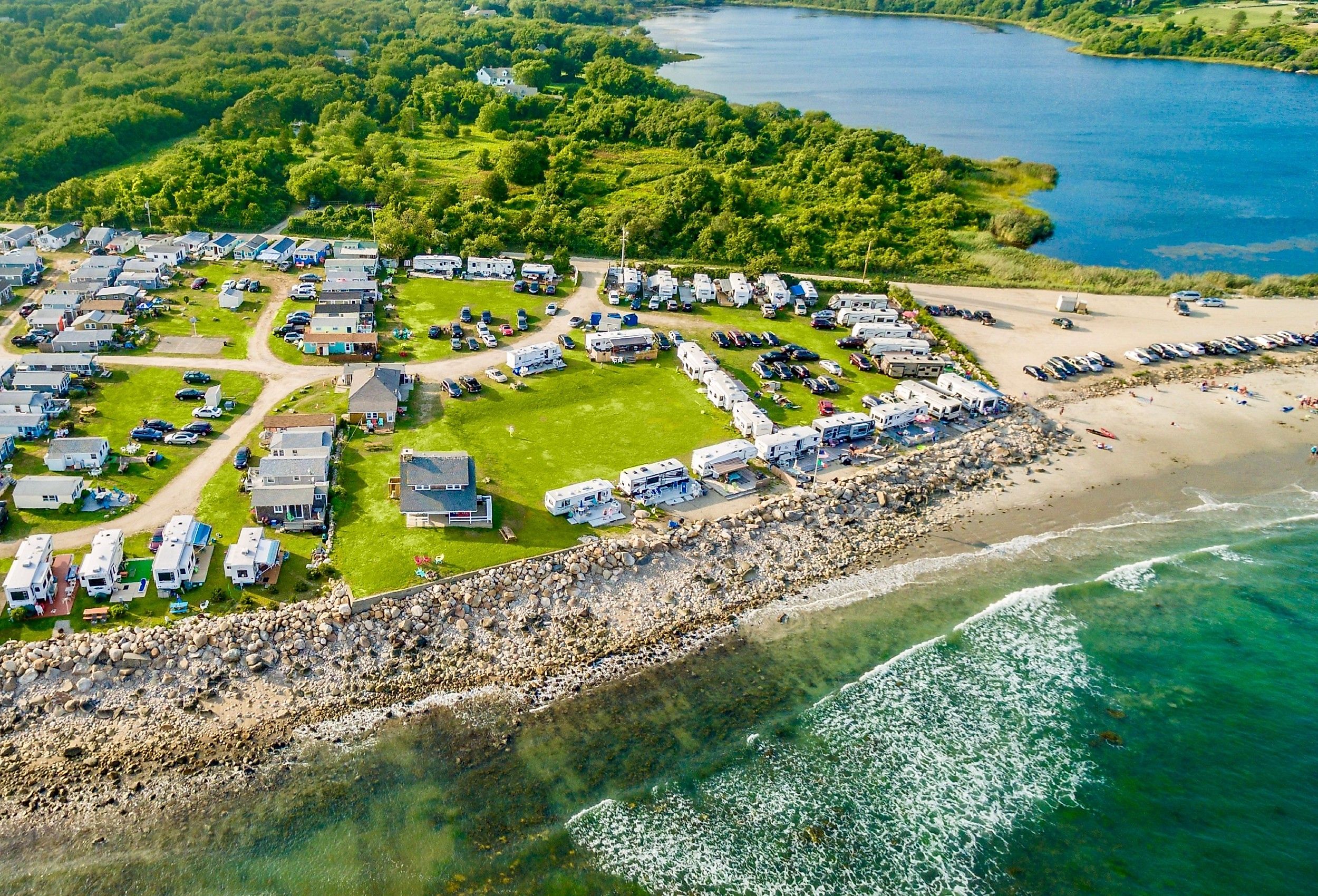
Cue the ocean views and forest trails because Rhode Island is ready for its close-up. Jamestown brings the coastal drama at Beavertail, while Green Animals Topiary Garden gives Portsmouth a playful twist. Across Tiverton, the footbridges of Fort Barton Woods lead hikers beside Sin and Flesh Brook. Sakonnet Lighthouse commands the view from Little Compton. Narragansett is home to Point Judith and the stately Towers. Across Rhode Island, these towns keep the pace easy with preserved woodlands, uncrowded shores, and historic village streets. The result is a quieter side of the state, perfect for a slow, scenic getaway.
Portsmouth

Portsmouth covers the northern third of Aquidneck Island. Sandy Point Beach sits at the end of Sandy Point Avenue, and the river water stays shallow well offshore, which is why families with small children frequent it. A few miles west, Green Animals Topiary Garden has more than 80 topiary animals and figures trimmed across seven acres of lawn above Narragansett Bay, backed by flower beds that stay in bloom from May into October. Beside Portsmouth High School, Butts Hill Fort's 250-year-old earthworks include a restored southern half that was cleared and connected by walking paths during a multiyear project, with continued grounds maintenance and grass cultivation in 2025. Greenvale Vineyards has been a working farm in the same family since 1863, and the outdoor tables look downhill across the vine rows to the river.
Tiverton

Route 24 crosses the Sakonnet River Bridge from Portsmouth into Tiverton. Fort Barton rises above the village on Highland Road, with an observation tower overlooking a long view across the Sakonnet River to the Aquidneck Island shoreline. Steep steps drop from the redoubt into Fort Barton Woods, where marked trails cross Sin and Flesh Brook on rustic footbridges through woods and wetlands. Weetamoo Woods protects more than 750 acres, with over five miles of trails passing part of the original Pocasset Purchase roadway, dating to about 1685, and the remains of a village sawmill. On Seapowet Avenue, the Emilie Ruecker Wildlife Refuge has 1.6 miles of easy trail across 50 acres of salt marsh and red maple swamp, where glossy ibis, snowy egrets, and ospreys work the shallows and harbor seals play offshore in the cold months.
Little Compton

Main Road heads south from Four Corners into Little Compton and doesn't stop until it reaches saltwater, with open fields on both sides most of the way. A private land trust founded here in 1972, the first of its kind in Rhode Island, has conserved more than 467 acres of that ground. Halfway down the road, the village common is home to a white steepled church, a green, and the Old Burial Ground that the town's proprietors laid out in 1678. Here, the oldest legible headstone belongs to Mary Rouse Price, who died in 1698. The Little Compton Historical Society opens the Wilbor House across the road for tours Thursday through Sunday in July and August. South of the common, the Nature Conservancy has protected Goosewing Beach Preserve since 1989, a barrier beach a mile long that separates Quicksand Pond from the Atlantic and shelters nesting piping plovers and least terns. The road runs out at Sakonnet Point, where the Sakonnet Lighthouse stands 800 yards offshore on Little Cormorant Rock, first lit in 1884. Back up the road, Sakonnet Vineyard has more than 20 acres of vines across a 169-acre farm, with shaded outdoor seating open Wednesday through Monday.
Jamestown

Jamestown is located on Conanicut Island. Beavertail State Park covers its southern tip with four overlooks and a rocky coastline, and the 1856 lighthouse there marks the entrance to Narragansett Bay. A seasonal museum and the Beavertail Aquarium sit at its base, and the park is home to accessible tide pools. Fort Wetherill State Park occupies 61.5 acres atop 100-foot granite cliffs above Newport Harbor and Narragansett Bay, a popular vantage point for tall ship events and America's Cup racing. Watson Farm grazes about 100 Red Devon cattle and a flock of sheep across 265 acres, with more than two miles of farm trails through pastures and hayfields and along the Narragansett Bay shoreline. The Jamestown Windmill of 1787 on North Road, three stories and octagonal under a domed bonnet, still raises its sails and turns that bonnet to the wind on Windmill Day in late July.
Narragansett

Route 138 continues west over the Jamestown Verrazzano Bridge and the West Passage, with Narragansett running south from there along the ocean. The Towers spans Ocean Road at the Pier, the granite portion of the Narragansett Pier Casino that McKim, Mead & White built between 1883 and 1886. It alone survived the fire of 1900. Restorers have since brought it back, and the building now operates as a venue for public events, theater, and dancing, among them. South along Ocean Road, the Black Point Trail runs about 1.5 miles over more than 40 acres of Narragansett Pier granite. It passes a split glacial erratic, the boulder called Quahog Rock, and the ruins of the Windswept estate carriage house. The walk ends at a seawall where Scarborough North State Beach takes over. Inland, Canonchet Farm encompasses 174 acres of wetland, forest, brooks, and ponds along Pettaquamscutt Cove on the Narrow River, with a 1.3-mile History Trail past stone walls, ruins, glacial boulders, and a quarry. The South County Museum shares the property, its eight-acre campus running a blacksmith forge, print shop, carpentry barn, and a fiber shed. Ocean Road ends at Point Judith Lighthouse, an octagonal granite tower built in 1857 that stands 51 feet tall, with its light 65 feet above sea level.
Richmond

Richmond lies inland to the northwest, with the Pawcatuck River along its southern border and the Wood River along its western border. Congress designated both, along with five other rivers in the watershed, as Wild and Scenic in March 2019. At Shannock, the Pawcatuck drops over the Horseshoe Falls Dam, curves into a U, and is fitted with a fish ladder. The Carolina Management Area covers more than 2,300 acres of forest, swamp, and wetland in Richmond, with hiking, biking, fishing, canoeing, and a trout hatchery on the grounds. Beaver River Park is a 28-acre town property with a short, level trail system, access to the Beaver River, and a children's playground. Every August, the Washington County Fair fills the grounds on Richmond Townhouse Road with vegetable, flower, and dahlia exhibits, youth livestock shows, quilts, needlework, photography, and baking contests.
Hopkinton

The Wood River draws the line between Richmond and Hopkinton. The town is home to four villages: Ashaway, Bradford, Hope Valley, and Rockville. The Audubon Society of Rhode Island manages Long Pond Woods Wildlife Refuge, 220 acres of rocky, steep ground. Two miles of challenging trail climb through dense groves of mountain laurel and rhododendron to a rock outcrop above Long Pond. Barred owls, mink, and otter live there. Next to it, the Nature Conservancy's Ell Pond Preserve surrounds a kettle pond shaped like an L, which the Interior Department named a National Natural Landmark in 1974, still the only one in Rhode Island. Hemlocks, Atlantic white cedars, and giant rhododendrons grow around it. The rhododendrons bloom in July, two months behind the cultivated kind. The Tomaquag Trail runs through the Pelloni Preserve past a 25-foot granite cliff, complete with small caves, and over a traditional stone slab bridge. Crown Farm Preserve has 124 acres of hayfield and former pastureland around a wetland complex that once grew cranberries.
Glocester

Glocester sits at the opposite end of the state, in the northwest corner along Route 44. Chepachet village fills about half a mile of that road with buildings put up between roughly 1800 and the 1870s. Among them stands the Job Armstrong Store of 1814, restored in 1974 and now the Glocester Heritage Society headquarters. Brown & Hopkins Country Store has traded on Putnam Pike since 1809, with two floors of lighting, textiles, candles, primitive furniture, and penny candy. About four and a half miles west of the village, the George Washington Management Area covers more than 4,000 acres around Bowdish Reservoir. Australian sailors waiting on the commissioning of the HMAS Perth cut the Walkabout Trail there in 1965. Its blue, red, and orange loops run about two, six, and eight miles through white cedar swamp, hemlock groves, upland forest, and wetland, crossed on log bridges. Pulaski State Park and Recreational Area adjoins it.
Where Rhode Island Goes Quiet
Rhode Island’s quieter side stretches from Beavertail’s rocky shoreline to the hemlock groves of Hopkinton and Glocester. Visitors can follow Sin and Flesh Brook through Fort Barton Woods, watch the Pawcatuck River spill over Horseshoe Falls Dam, or relax beside the vines at Greenvale. Whether the day leads to a museum, lighthouse, or woodland trail, these towns leave plenty of room to slow down and take in the view.