8 Best Small Towns To Retire In Victoria
Victoria packs more variety into 87,000 square miles than any other Australian state. Retirement outside Melbourne can mean alpine skiing one weekend and a Murray River paddle steamer the next. These eight towns listed below are small enough to know your neighbors yet large enough to keep a hospital, a golf club, and a weekly market within walking distance. Each city anchors a different recreation territory across Victoria, from the Great Ocean Road to the Australian Alps, and each rewards retirees who want to stay active outdoors year-round.
Bright

Bright sits in the southeastern Ovens Valley at the foot of the alpine ranges in northeastern Victoria, with a 2021 Census population of 2,620. Active retirees gravitate here for year-round access to the outdoors. The sealed Murray to Mountains Rail Trail, more than 100 kilometers in total length (about 62 miles), runs gentle-graded directly through Bright. The route is one of the most accessible cycling options in Victoria's High Country for retirees on regular or e-bikes. The Canyon Walk traces the Ovens River through old gold-mining diversions, with suspension-bridge crossings and pools where platypus surface at dawn.
Mount Buffalo National Park rises directly west of town, opening into a granite plateau, with alpine wildflowers in summer and snow at the higher elevations in winter. Mount Buffalo is one of the oldest national parks in the Australian Alps, gazetted in 1898. Back in town, the Bright Brewery stands on the riverbank and serves locally produced craft beer with a deck overlooking the water. The Bright Autumn Festival turns the town into a draw of its own each April. European elms, oaks, and poplars planted by 19th-century settlers blaze red and gold against the surrounding eucalypts. So for retirees who want skiing nearby in winter, river swims in summer, and a walkable main street year-round, Bright runs a hard bargain for spending all four seasons here.
Mansfield

Mansfield anchors the southern entrance to Victoria's High Country, in the foothills of the Great Dividing Range, making it a spot that runs on outdoor recreation. The town population was 5,541 at the 2021 Census, with thousands in the surrounding rural community. Lake Eildon lies west of Mansfield with 515 kilometers (320 miles) of shoreline, and remains the only inland waterway in Victoria where licensed houseboats are permitted. Today, over 700 of them call the lake home.
The Great Victorian Rail Trail begins in Mansfield and runs 134 kilometers toward Tallarook through wetlands and rolling pastoral country, gentle enough for daily morning rides. Mount Buller Alpine Resort lies 48 kilometers (29 miles) east of town and gives Mansfield its winter character, while the same access road becomes a scenic alpine drive once the snow clears. Mount Buller sits within the broader Australian Alps ski region. Mansfield Botanic Park sits beside Ford Creek for slower mornings. The historic Mansfield Cemetery holds the graves of the three policemen killed by Ned Kelly's gang at Stringybark Creek in 1878. The site draws history-minded retirees who walk the grounds each year.
Yarrawonga

Yarrawonga sits on the Victorian side of the Murray River at the foot of Lake Mulwala. The 2021 Census population was 8,661, with steady growth from sea-change and tree-change migration into northeast Victoria. The lake itself was created in 1939 when the Yarrawonga Weir dammed the Murray. The resulting lake covers about 5,000 hectares (12,355 acres), which is partly why Yarrawonga is where Australian water skiing took off in the 1950s. Retirees can still take lessons at the Mulwala Water Ski Club across the bridge, but the daily rhythm tends toward calmer pursuits.
The Yarrawonga Mulwala Golf Club Resort runs Australia's largest public-access golf complex at 45 holes, with the Murray Course tracing the river itself. The Black Bull Golf Course adds another championship 18-hole layout a short drive away, and golf alone draws many retirees out of southern coastal towns. Lake Mulwala Foreshore carries a level walking and cycling path with views of the partially submerged red-gum forest, an unusual sight where dead-tree silhouettes rise straight from the water. The paddle steamer PS Cumberoona runs scenic cruises out of Yarrawonga Foreshore, an unhurried morning out on the river that suits the local pace.
Rutherglen, Victoria

Rutherglen lies 10 kilometers (about 6 miles) south of the Murray River on the rolling country between Wangaratta and Wodonga in northeastern Victoria. The 2021 Census population for the town locality was 2,579. Around 20 wineries operate within a short drive of the town center, producing the muscats and topaques the region is internationally known for. All Saints Estate, established in 1864 outside neighboring Wahgunyah, remains the largest of them. The estate runs landscaped gardens, a heritage-listed castellated cellar door, and a fine-dining restaurant.
The Murray to Mountains Rail Trail enters Rutherglen via the 9-kilometer Wahgunyah branch, the shortest and flattest section in Victoria's rail-trail network, good for a vineyard ride between cellar doors. The town center keeps its 19th-century shopfronts. The wine-bottle-shaped Rutherglen Water Tower in Campbell Street is a standing local landmark. And Lake King, ringed by Apex Park and Rutherglen Park, gives walkers and birdwatchers a mid-town green belt.
Mildura

Mildura stands at the western end of Victoria on a great bend of the Murray River. The 2021 Census population was 34,565, a regional center small enough to feel like a town and large enough to offer specialty health care. The Mediterranean climate brings mostly sunny days, and the warm, dry weather draws retirees out of Melbourne's gray winters. The Mildura Wharf frequently sends paddle steamers downstream through Lock 11. Mildura Paddle Steamers has run the same family-owned cruises since 1955 aboard the 1881-built PV Rothbury and the 1987-built PB Mundoo.
The Australian Inland Botanic Gardens at nearby Mourquong holds a 152-hectare (375 acres) arid-zone botanical collection just across the Murray in southern New South Wales. Murray-Sunset National Park sits southwest of town and contains the Pink Lakes. Four salt lakes turn pink in late summer when beta-carotene from the resident Dunaliella salina algae saturates the water. The 2.5-kilometer Pink Lakes Trail loops past all four basins. The Mildura Arts Center on Cureton Avenue holds a regional gallery, theater, and the heritage Rio Vista Historic House. And the Mildura International Balloon Fiesta lifts hot-air balloons aloft each July when still air settles over the citrus groves. The morning launches draw retirees from across northeastern Victoria.
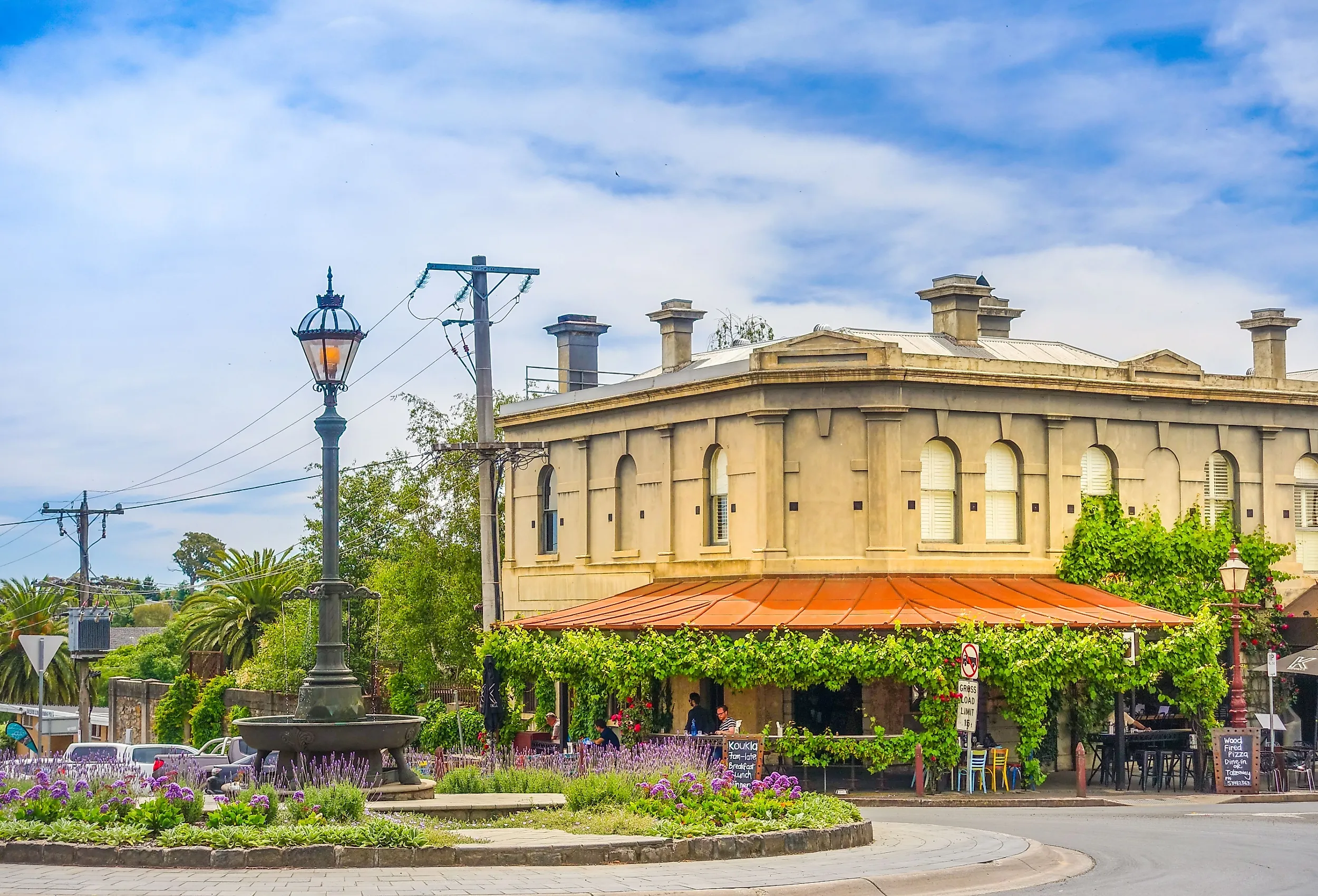
Daylesford, Victoria

Daylesford fills a high pocket of the Central Highlands, roughly 115 kilometers northwest of Melbourne. The 2021 Census population was 2,781, with a median age of 55, well above the Victorian median of 38. The Daylesford-Hepburn Springs region holds 65 mineral springs, more than 80% of all known mineral springs in Australia. The town has built its modern identity on that geology. The Hepburn Bathhouse and Spa, in the adjacent village of Hepburn Springs, draws directly from the Hepburn Mineral Spring Reserve. The reserve was gazetted in 1865 to protect the springs from disturbance caused by gold mining.
Lake Daylesford sits in the heart of town with a 1.5-kilometer shoreline walking path, paddle-boats for hire, and waterside cafes. The Convent Gallery, a sandstone former convent on Wombat Hill, holds rotating contemporary exhibitions and a restaurant terrace with views over the surrounding forest. Wombat Hill Botanic Gardens, established in 1863, runs walking paths through specimen oaks and redwoods. A heritage-listed pioneer memorial tower stands at the highest point. The Daylesford Sunday Market at the historic railway station has run continuously since 1981. The market is an enduring weekly anchor for retirees who came for the spa-country lifestyle and stayed for the community. Daylesford rounds out as one of the most established lifestyle towns in central Victoria.
Apollo Bay, Victoria

Apollo Bay overlooks a sheltered crescent on the eastern shoulder of Cape Otway along Victoria's Great Ocean Road. The 2021 Census population was 1,790 in a town that swells to 15,000 in summer. The retiree appeal runs on permanent access to terrain most travelers see only on a coach tour. The Great Otway National Park wraps inland from town through cool-temperate rainforest, fern gullies, and waterfalls, including nearby Stevenson Falls. The Great Ocean Walk, a marked coastal track of more than 100 kilometers (62 miles), begins right in Apollo Bay and runs west to the Twelve Apostles. Day-walk sections are short enough for morning use.
Apollo Bay Harbour still works as a small commercial fishing port, and the Apollo Bay Fishermen's Co-op sells the day's catch directly off the boats most afternoons. Southern right whales return to the bay each year between May and October to calve in the warmer waters. Viewing platforms above the harbor give retirees a free seasonal show. The Apollo Bay Golf Club runs a 9-hole course that rises into the foothills. The foreshore reserve carries a level walking path along the beach for daily morning loops. The town faces directly onto Bass Strait, giving the air a clean sea breeze that retirees credit with helping them sleep and their overall health.
Inverloch, Victoria

Inverloch wraps the northern shore of Anderson Inlet at the eastern end of the Bunurong Coast, 143 kilometers southeast of Melbourne in southern Victoria. The 2021 Census population of 6,526 has grown nearly 20% since 2016. The growth reflects retiree migration into Victoria's coastal communities. Anderson Inlet itself is a 2,400-hectare (5,930 acres) protected estuary where the Tarwin River meets Bass Strait. The calm waters are kayak-friendly year-round and shallow enough for safe wading at low tide. Bunurong Marine and Coastal Park runs 17 kilometers of cliffs and rock platforms west of town. Snorkeling waters lie around Eagles Nest, with walking access from car parks along the Cape Paterson-Inverloch Road.
Geologist William Ferguson found Australia's first dinosaur bone here in 1903, the Cape Paterson Claw. The annual Dinosaur Dreaming dig at Flat Rocks has surfaced more than 6,000 fossils since 1991. The Inverloch Surf Beach carries patrolled flags through summer. The 14-kilometer Bunurong Coastal Drive between Inverloch and Cape Paterson stitches together the cliffs, beaches, and rock-pool platforms of the eastern Bass Coast. The Inverloch Community Hub runs U3A classes, a library, and a year-round events calendar that retirees weave into the weekly rhythm. The town stands alongside Victoria's best-known coastal communities as a destination for active retirement.
A Quieter Pace Across Victoria
These eight towns trade traffic and tower blocks for daily access to mountains, rivers, lakes, and coast. Each runs under the 50,000-resident mark. Each is sized for the kind of life where the local market knows your name. The recreation runs the full Victorian range, from alpine cycling at Bright to paddle-steamer afternoons at Mildura. Pick the one that matches the rhythm you want to wake up to.