Bass Strait
A strait is defined as a narrow water passage bordered by landmasses that connects two large bodies of water. Straits can be formed naturally due to tectonic plate movements or formed by human activity. The Bass Strait is a water channel between the island of Tasmania and the State of Victoria on the mainland of Australia. The strait links the Indian Ocean with the Tasman Sea (part of the South Pacific Ocean).
However, there are differing views regarding the location of the Bass Strait. According to the International Hydrographic Organization, the Bass Strait forms a part of the Indian Ocean, but some authorities believe the strait to be a portion of the Pacific Ocean. As per the Australian Hydrographic Service, the Strait is a part of Australia and is situated close to the Tasman Sea.
Geography

The Bass Strait has a length of about 500 km and an average depth of 60m. The strait has a width of 250 km, with the widest part being situated at about 350 km between Point Hicks on the mainland of Australia and Cape Portland on the north-eastern edge of Tasmania Island. Located at the center of the Bass Strait is a shallow depression known as the Bass Basin which covers an area of more than 65,000 km2 with a length of about 400 km and a maximum width of 120 km. As per the navigational charts, the maximum depth of the Bass Basin is about 155 m, between Flinders and Inner Sister. The Bass Strait is surrounded by the Bassian Rise plateau on its eastern side and the King Island Rise plateau on its western side. The basement of these two plateaus is composed of Paleozoic granite and these plateaus, in turn, form sills that help to separate the Bass Basin from the adjoining ocean basins.

The Bassian Rise reaches a depth of fewer than 50 m and is associated with the Furneaux Islands of which Flinders Island is the largest. The King Island Rise also reaches a depth of fewer than 50 m and includes the King Island and the 40 m deep Tail Bank at its northern edge. It is estimated that about 6,000 km2 of the strait’s seabed is covered by submerged dunes and sand waves as well as tidal current ridges.
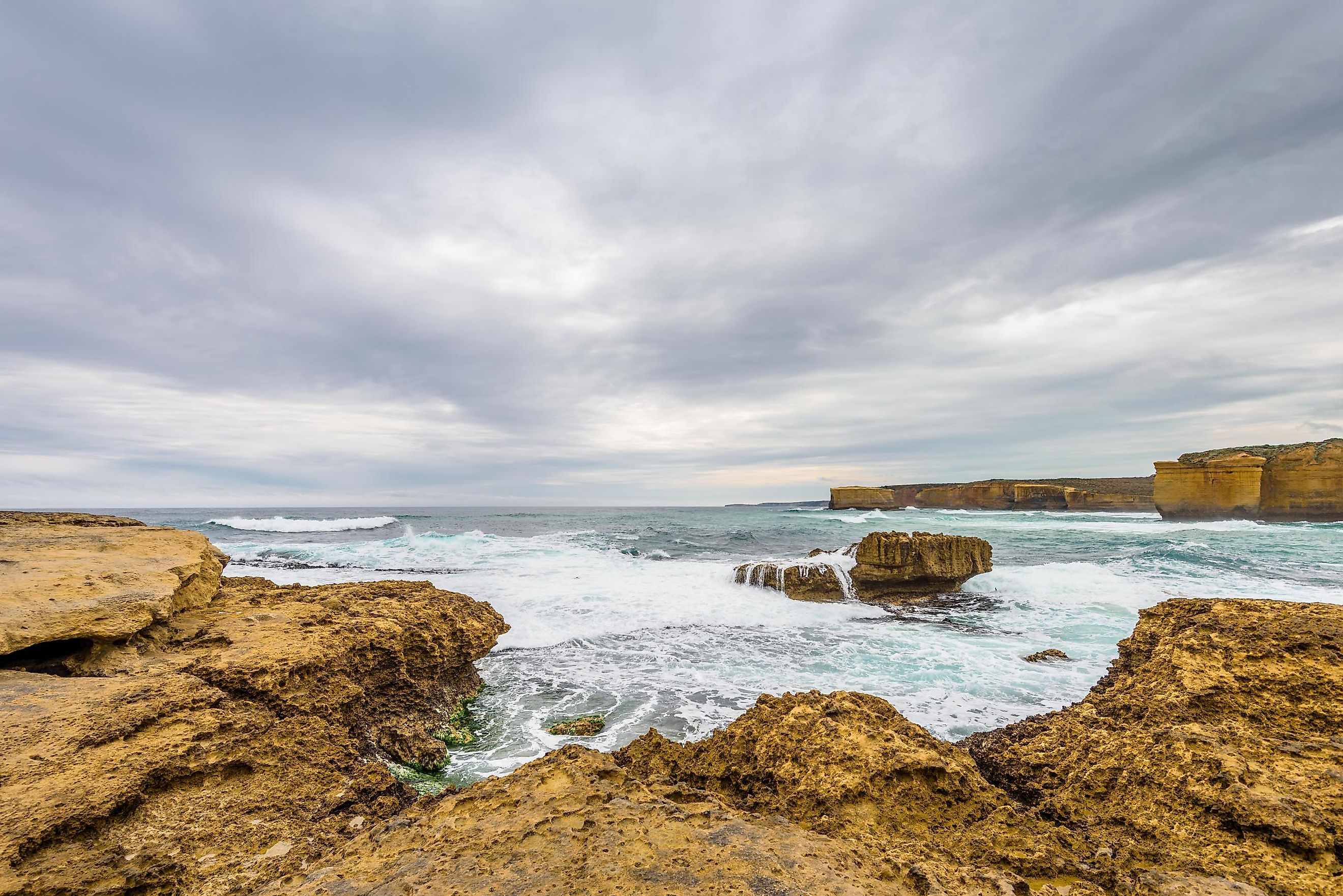
The Bass Strait comprises more than 50 islands. Some of the major islands include the King Island, Robbins Island, and Hunter Island in the western part; the Furneaux Islands group including the Flinders Island, Clark Island, the Sisters Islands group, and numerous other islands in the southeastern part; and the Hogan Island, the Kent Island Group and the Curtis Island in the north-eastern part. Several Commonwealth Marine Reserves are located in the Bass Strait including Flinders, Zeehan, Apollo, East Gippsland, and Beagle. The Kent Group National Park covers the Tasmanian Kent Group of Islands. The entire National Park forms a part of the Beagle Commonwealth Marine Reserve. Several protected marine national parks of the Australian State of Victoria are located in the Bass Strait. These include Twelve Apostles, Port Philip Heads, and Bunurong.
Natural Resources
The eastern part of the Bass Strait, known as the Gippsland Basin, contains many oil and gas fields. From 1960 to the 1970s, most of the large fields including Halibut, Kingfish, Cobia, Fortescue, and Mackerel were discovered approximately 65 km from the coast of the Victorian rural region of Gippsland at a depth of 70 m. The oil refineries and gas processing plants located at Western Port, Longford, Geelong, and Altona receive the oil and gas via a pipeline, whereas a tanker is used to transfer the resources to the Australian State of New South Wales. In early 2017, the Hazelwood Power Station was closed and in June 2017, the Victorian government announced a project to set up an offshore wind farm spread over an area of 574 km2 containing more than 250 wind turbines that would generate about 8,000 GWh of electricity for the State of Victoria.
Brief History

It is believed that about 40,000 years ago, the Aboriginal Tasmanians arrived in Tasmania by crossing a land bridge known as the Bassian Plain. About 8,000 years ago, the rise in sea levels led to the formation of the Bass Strait and the subsequent isolation of these Aboriginal Tasmanians from the Australian mainland. The Dutch explorer Abel Tasman was likely the first European to detect the strait in 1642. The British explorer James Cook was the next European to reach the strait in April 1770. The British surgeon-explorer George Bass along with the English navigator Matthew Flinders circumnavigated the strait from 1788 to 1789. In 1798, the strait was named “Bass Strait” in the honor of George Bass.
The Bass Strait faces strong currents from both the waters of the Indian and the Pacific Oceans, which result in the creation of powerful storm waves. The strong winds and the sea conditions along with several semi-submerged reefs and rocks have led to the disappearance of many vessels in the Strait. However, despite the difficulty in navigating the strait’s waters, in the early 19th century, the Bass Strait served as a safe passage to Sydney from Europe and India, saving about 1,300 km of the journey.
Air transport serves as the cheapest and fastest method that is used in crossing the Bass Strait. Virgin Airlines and Jetstar Airways function as the leading airlines from Tasmania’s Hobart and Launceston Airports. Two passenger ferries serve the domestic sea routes daily between Tasmania’s Devonport and Melbourne’s Station Pier. Some Telstra-operated optic cables connect Tasmania with the Australian mainland and help in communication.


