2026's 8 Most Scenic The Rockies Towns
The geology of the Rocky Mountains transforms as they range across the western half of North America. Colorado's San Juans have narrow canyons and high waterfalls. Idaho's Sawtooths rise in sharp rows above lakes and the Salmon River. In Wyoming, the Tetons shoot almost directly from the valley floor. Alberta brings turquoise lakes and limestone peaks into the picture. Some of the best places to see these landscapes are towns where the mountains are visible from downtown, and the eight below are primed for a 2026 Rockies itinerary.
Telluride, Colorado

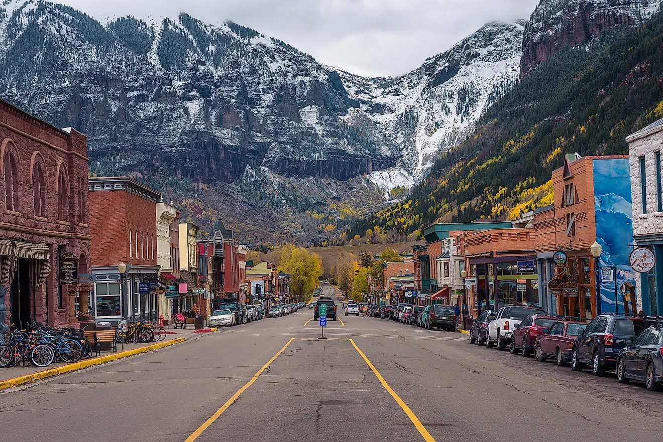
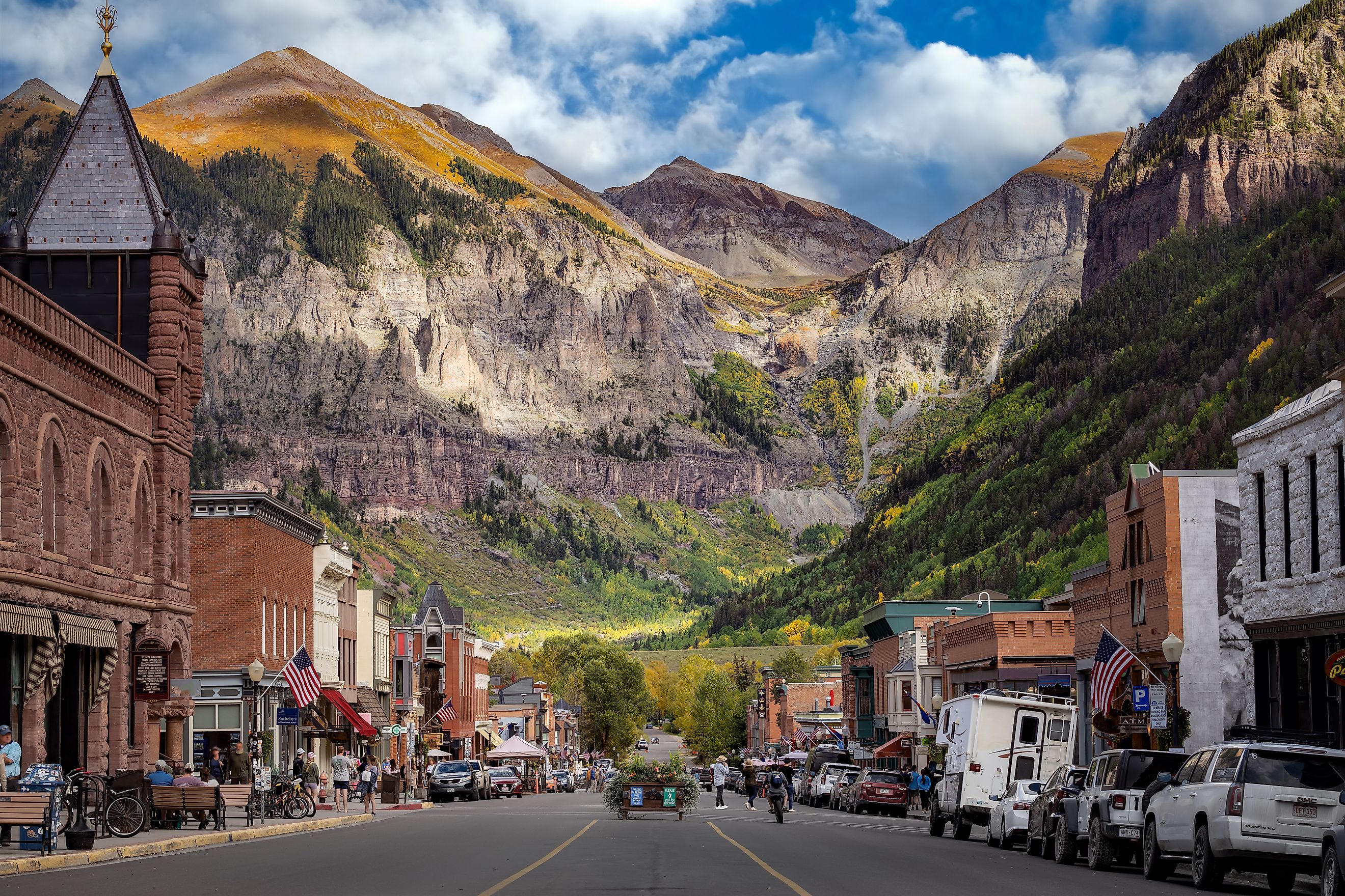
Walk east on Colorado Avenue in Telluride and the road eventually runs toward the wall of mountains closing off the box canyon. Keep going and Bridal Veil Falls comes into view. The 365-foot waterfall is the tallest free-falling waterfall in Colorado, with a historic power plant standing at the top. Hikers can use the Bridal Veil Trail to reach the base rather than walking along the four-wheel-drive road.
Another view requires considerably less work. Telluride's free gondola climbs 1,750 feet between town and San Sophia Station before continuing to Mountain Village. The full ride between Telluride and Mountain Village takes about 12 minutes, and the gondola operates until midnight during its 2026 summer season.
For something closer to street level, take the San Miguel River Trail. The relatively flat path runs beside the river from the Valley Floor through Telluride and east to the Idarado Legacy Trail. It is an easy way to see another side of the canyon without committing to one of the steeper trails above town.
Ouray, Colorado

Ouray has a waterfall inside a narrow gorge only a short distance from Main Street. At Box Cañon Falls Park, Canyon Creek rushes through quartzite before joining the Uncompahgre River. A 500-foot walk reaches the falls, so this one does not require an all-day hike. The High Bridge Trail climbs above the gorge and connects with the trail system surrounding town.
That trail system includes the Ouray Perimeter Trail, which circles the slopes above Ouray and passes waterfalls, bridges, forests, and viewpoints over the valley. There is no requirement to hike the entire route. Access points around town make shorter sections possible.
Cascade Falls is even easier to work into an afternoon. The trail begins at the east end of 8th Avenue and heads toward the waterfall above town. Afterward, the Ouray Hot Springs Pool gives visitors a chance to sit in geothermal water with the San Juan Mountains rising on nearly every side. Drivers have another option. US 550 leaves Ouray heading south toward Red Mountain Pass and Silverton. This stretch of road is known as the Million Dollar Highway, and the route quickly climbs above the valley that holds Ouray.
Stanley, Idaho

Coming into Stanley from the south is part of the experience. Idaho 75 drops from Galena Summit into the Sawtooth Valley, where the Sawtooth Mountains line the western side of the basin. The road forms part of the 116-mile Sawtooth Scenic Byway, which runs from Shoshone to Stanley.
Before reaching Stanley, turn west for Redfish Lake. It is the largest and most visited of three easily accessible alpine lakes along this section of Idaho 75. Public beaches sit along the shore, while the marina runs boat rentals and a seasonal shuttle across the lake for hikers heading toward the Sawtooth Wilderness.
Pettit Lake and Alturas Lake are farther south and see less traffic than Redfish. Both can be reached by vehicle and have day-use areas, boat ramps, and access to hiking trails. Save Pioneer Park for the end of the day. The park faces the Sawtooths across the valley, and Idaho Tourism recommends it as a final stop on a drive along the scenic byway.
Jackson, Wyoming

The Teton Range climbs abruptly from Jackson Hole, with no foothills separating much of the range from the valley below. To see them up close, take US 26/89/191 north from Jackson toward Grand Teton National Park. Moose Junction is about 20 miles from town. Turn west there, pass through the Moose Entrance Station, and continue another eight miles to Jenny Lake. The lake sits directly beneath the Tetons and has trails around its shoreline and into the surrounding mountains.
Wildlife can be much closer to Jackson. The National Elk Refuge borders town and protects more than 24,000 acres. Elk generally move onto the refuge as snow accumulates at higher elevations and are commonly present from mid-December through early April.
Jackson's easiest high-angle view comes from Snow King Mountain, which rises directly above downtown. At its base, streets lead toward Town Square, where four arches constructed from shed elk antlers mark the corners of the park. The antlers are replaced periodically as weather takes its toll on them.
Canmore, Alberta

The Three Sisters are hard to lose sight of in Canmore. The three peaks rise along the southwest side of the Bow Valley, appearing above streets, trails, and stretches of the Bow River. For an uncomplicated walk, head to the Policeman's Creek Boardwalk. The route follows the creek for about four kilometers through town, and benches along the way face the Three Sisters, Ha Ling Peak, and Mount Rundle. There are several entry points, so visitors can walk a short portion rather than covering the full route.
The Bow River gives Canmore another easy trail option. The West Bow River Pathway runs for about six kilometers round trip from downtown, with an extension continuing toward the Three Sisters neighborhood. For more elevation, head toward Grassi Lakes in the Canmore Nordic Centre Provincial Park area. The trail climbs above the valley to two clear lakes beneath limestone cliffs. From the higher sections, the view opens back toward Canmore and the Bow Valley.
Fernie, British Columbia

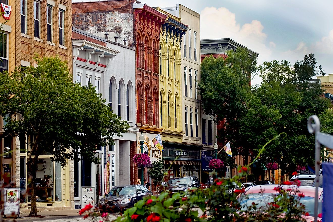
Stand on 2nd Avenue in downtown Fernie and the Lizard Range appears behind rows of brick buildings dating to the community's early mining years. It is one of the easiest places in town to get architecture and mountains into the same photograph. For a few hours on foot, head toward Fairy Creek Falls on the lower slopes of Mount Proctor. The trail leaves from the area near the Fernie Visitor Information Centre and passes through forest before reaching the waterfall.
On the other side of town, Mount Fernie Provincial Park has trails around Lizard Creek and the lower slopes of Mount Fernie. Its forested routes are a good alternative to the exposed terrain found higher in the mountains. The Lizard Range looks very different from Fernie Alpine Resort, southwest of downtown. Ski runs spread across the slopes during winter. When summer arrives, mountain biking and hiking take over parts of the resort.
Estes Park, Colorado

Bear Lake is one of the busiest places in Rocky Mountain National Park for good reason. The lake sits beneath Hallett Peak, and a short trail circles the shoreline. Hikers who want to continue can use the same trailhead for routes toward Nymph Lake, Dream Lake, and Emerald Lake.
A completely different view comes from behind the windshield. Trail Ridge Road crosses Rocky Mountain National Park between Estes Park and Grand Lake, climbing to 12,183 feet. Eleven miles of the route are above the tree line. Snow closes the high section for part of the year, so a 2026 trip requires checking current road conditions.
Back in Estes Park, Lake Estes has a trail around the water without the elevation or crowds associated with some national park hikes. Then there is the Stanley Hotel. F.O. Stanley opened the hotel in 1909, and its white exterior and red roof stand on higher ground above town. Stephen King stayed there in the 1970s, an experience that helped inspire The Shining. Even visitors uninterested in the literary connection get a broad look across Estes Park and the surrounding mountains from the property.
Banff, Alberta

One of Banff's best-known views requires nothing more than standing downtown. Look north along Banff Avenue and Cascade Mountain rises beyond the buildings at the end of the street. For a wider look at the area, the Banff Gondola climbs Sulphur Mountain. At the top, the Sulphur Mountain Boardwalk follows the ridge toward Sanson's Peak, with Banff, the Bow River, and surrounding mountains below. Bow Falls is close enough to downtown for a shorter stop. The Bow River drops over a broad section of rock below the Fairmont Banff Springs area before continuing through the valley.
There is more water northeast of town at Lake Minnewanka. The long lake reaches into the mountains and has shoreline trails and seasonal boat cruises. In the opposite direction, Cave and Basin National Historic Site preserves the thermal springs tied to the creation of Canada's first national park.Before leaving, walk Banff Avenue once more. Cascade Mountain looks different as the light changes, and there is no lookout railing or trailhead between the town and the view.
Seeing The Rockies From Town
Every Rockies town offers a different facet of mountain terrain for your viewing pleasure. Telluride has a waterfall at the end of its box canyon, while Stanley faces the Sawtooths across a broad Idaho valley. Jackson puts the Tetons within driving distance and the National Elk Refuge beside town. Farther north, the Three Sisters rise above Canmore and Cascade Mountain fills the end of Banff Avenue. The roads connecting these places are part of the scenery too, particularly the Sawtooth Scenic Byway outside Stanley and Trail Ridge Road above Estes Park.