Maps of Uzbekistan

Uzbekistan occupies an area of 447,000 sq. km in Central Asia. It is only one of the two countries in the world that is doubly-landlocked. The other one is Liechtenstein.
As can be observed on the physical map above, the topography of Uzbekistan is about 80% sandy, scrubby desert, including the massive Kyzyl Kum.
The mountains of the southeast and northeast are foothills and lower mountains of the Tian Shan Range, an extension of the Himalayas. As marked on the map by a yellow upright triangle, the highest point in the country, the 4,301 m tall Adelunga Toghi is located to the extreme northeast of the country.
The Fergana Valley, between the northeast and southeast mountain ranges, is reportedly home to the most desirable agricultural land and climate in all of western Asia.
In the far west, Uzbekistan is dominated by vast lowlands, the Amu Darya River valley, the Ustyurt Plateau, and the southern half of the Aral Sea.
The Aral Sea, located in both Kazakhstan and Uzbekistan, is disappearing. Mismanagement of this valuable sea by the overuse of its tributary rivers is now recognized as one of the world's worst environmental disasters.
Some of the country's major rivers and lakes have been marked on the map. The most significant rivers of Uzbekistan include the Amu Darya and the Syr Darya; major lakes include Lake Ayddrkul and Lake Sarykamish.
The lowest point of the country is at -12 m below sea level in Lake Sarykamish.
Regions of Uzbekistan Map

Uzbekistan (Republic of Uzbekistan) is divided into 12 administrative regions, 1 autonomous republic, and 1 independent city. In alphabetical order, these regions are: Andijan, Buxoro, Fergana, Jizzax, Namangan, Navoiy, Qashqadaryo, Samarkand, Sirdaryo, Surxondaryo, Tashkent, and Xorazm; along with the autonomous republic of Karakalpakstan and the independent city of Tashkent. These regions and the Republic are further subdivided into districts and cities. The districts in turn form smaller subdivisions – cities, urban-type settlements, and citizen assemblies of villages.
With an area of 161,358 sq. km, Karakalpakstan is the largest subdivision of the country by area and Samarkand Region is the most populous one.
Tashkent located in the north-eastern part is the national capital.
Where is Uzbekistan?

Uzbekistan is a landlocked Central Asian country located in the Northern and Eastern hemispheres of the Earth. It is bordered by 5 Asian nations; Kazakhstan borders it to the north; Kyrgyzstan to the north-east and Tajikistan to the south-east. Uzbekistan is also bounded by Afghanistan and Turkmenistan to the south and south-west respectively.
Uzbekistan Bordering Countries: Kazakhstan, Turkmenistan, Afghanistan, Kyrgyzstan, Tajikistan.
Regional Maps: Map of Asia
Outline Map of Uzbekistan

The above blank outline map represents Uzbekistan. It is a landlocked country in Central Asia. The map can be downloaded, printed, and used for educational purpose or coloring.

The above outline map represents the Central Asian country of Uzbekistan. It is a landlocked country.
Key Facts
| Legal Name | Republic of Uzbekistan |
|---|---|
| Flag |
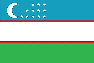
|
| Capital City | Tashkent (Toshkent) |
| 41 19 N, 69 15 E | |
| Total Area | 447,400.00 km2 |
| Land Area | 425,400.00 km2 |
| Water Area | 22,000.00 km2 |
| Population | 33,580,650 |
| Major Cities |
|
| Currency | Uzbekistani soum (UZS) |
| GDP | $57.92 Billion |
| GDP Per Capita | $1,724.84 |
This page was last updated on March 7, 2023