Amu Darya River
Historically known by its Latin name 'Oxus' during classical antiquity, Amu Darya is one of Central Asia's longest rivers. Originating from the Pamir Mountains, this 1,500 miles long transboundary river is shared by the countries of Afghanistan, Tajikistan, Uzbekistan, and Turkmenistan and finally drains into the southern remnants of the Aral Sea. The Amu Darya River plays a critical role in supporting the livelihood of millions of people residing in the Aral Sea Basin.
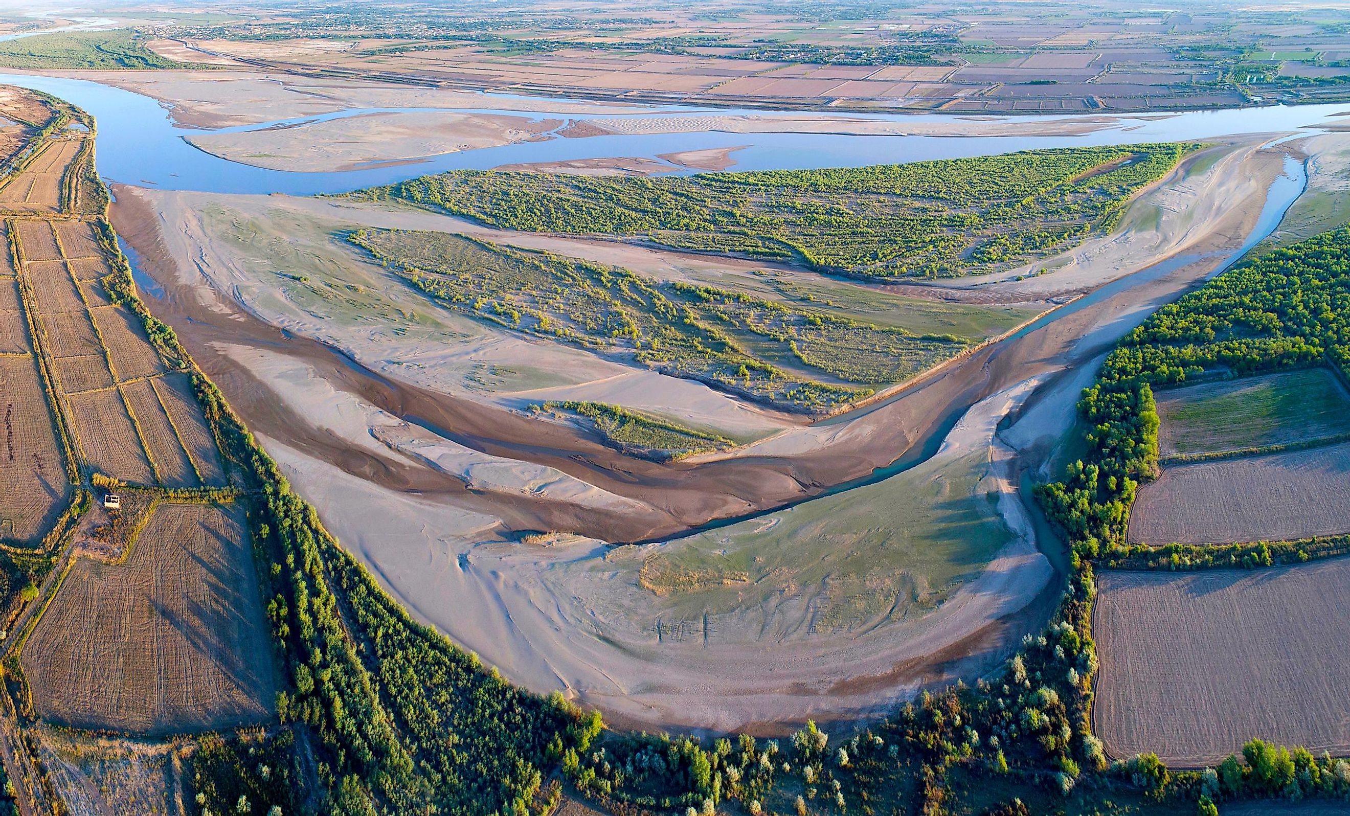
Course Of The Amu Darya River

The primary source of the Amu Darya River is the Pamir River, which begins at an elevation of 13,550 ft in the Zorkul Lake in the Pamir Mountains. Near the village of Qal'eh-ye Panjeh in northeastern Afghanistan, the Pamir River joins the Wakhan River to form the 572-mile-long Panj River. At the boundary between Afghanistan and Tajikistan, in the Tigrovaya Balka Nature Reserve, the Panj River meets the Vakhsh River giving rise to the mighty Amu Darya River.
Close to the meeting point of the Panj and Vakhsh Rivers, the Amu Darya River is joined by its three tributaries: the Qonduz River on the south and the Kofarnihon and Surkhandarya rivers on the north. In its upper course, the Amu Darya River forms portions of Afghanistan's northern boundary with three countries: Tajikistan, Turkmenistan, and Uzbekistan. The river then flows across a desert in eastern Turkmenistan and, in its lower course, forms portions of the border between Turkmenistan in the southwest and Uzbekistan in the northeast.

After passing through the highland zone, the river continues in the northwest direction and crosses the dry Turan Plain. Here, the river also forms a boundary between the Kyzylkum Desert in the northeast and the Karakum Desert in the southwest. In this region, the majority of the water of the river is lost by three main factors: evaporation, seepage, and irrigation.
The Amu Darya drainage basin covers an area of 206,475 square miles and extends for about 600 miles from north to south and over 900 miles from east to west. This drainage basin is bordered by the Tarim Basin in the east, Syr Darya Basin in the north, and in the south by the Indus and Helmand River Basins. A significant portion of the Amu Darya drainage basin is in Tajikistan, followed by Kyrgyzstan's southwestern corner, Afghanistan's northeastern corner, Uzbekistan's western half, and a narrow eastern portion of Turkmenistan. Tajikistan, Turkmenistan, and Uzbekistan occupy about 61% of the river's drainage basin, whereas Afghanistan occupies 39%.
The source of the Amu Darya River's abundant flowing water comes mainly from the glaciers of the Pamir and the Tian Shan Mountains. The mountains, which stand high above the adjacent arid plains, collect atmospheric moisture from the area with a yearly precipitation of more than 39 inches. Without these mountains and the glaciers, the Amu Darya River would not exist, as it rarely precipitates in the lowland areas through which the river flows. Navigable for more than 900 miles, the river has an average discharge of 89,200 cubic feet per second and a maximum discharge of 210,000 cubic feet per second.
Climate Of Amu Darya River Basin
The principal source of precipitation in the Amu Darya River Basin is the mid-latitude westerlies. During winters, the precipitation is mainly in the form of snow, which helps to feed the glaciers in the high Pamir and Hindu Kush Mountains. The yearly precipitation here exceeds 40 inches, while the average temperatures remain below freezing during winter. At lower elevations, the precipitation decreases with an increase in mean monthly temperatures. Here the annual precipitation is less than 4 inches, while the average temperature is above 77°F in July and varies between 32°F and 50°F in January. From March to May, with the melting of snow and increased rainfall, the flow of the Amu Darya River is augmented significantly. The river flow gradually decreases from September to February, and during winter, the lower sections of the river remain completely frozen for over two months.
History Of Amu Darya River

During classical antiquity, the ancient Greeks referred to the Amu Darya River as 'Oxus.' Historically, the river was believed to form a border between Greater Iran and Turan - the present-day Central Asia region. The drainage basin of the river lies in an area that was occupied by the empires of Genghis Khan and Alexander the Great at different periods. Called "Jayhun" by the Arabs, the Amu Darya River derives its current name from the former city of Amul, which is believed to have occupied the site of Turkmenistan's second-largest city Turkmenabat, while Darya is the Persian term for "river." From the 13th to the late 16th century, the Amu Darya River drained into both Aral and Caspian Seas, reaching the Caspian Sea via a large distributary named the Uzboy River. A massive dam was built in AD 985 at the Uzboy River's bifurcation. In 1221, the dam was destroyed by the troops of Genghis Khan. In the later years, the river turned northwards and started flowing into the Aral Sea. However, the diversion of the Amu Darya River waters for irrigation subsequently reduced the amount of water entering the Aral Sea, leading to its shrinkage. By the beginning of the 21st century, the Aral Sea's southern shores receded several miles from the previous delta of the Amu Darya River.
Ecology Of Amu Darya River

Tugais, dense thickets of reeds, and several swamps and lakes dominate the floodplain of the Amu Darya River. Plants like junipers, blackberries, sweetbriers, and poplars grow along the river's edges, whereas willows, glassworts, oleasters, licorice, and buckthorn cover the lower elevations. Many faunal species like jackals, badgers, long-eared hedgehogs, foxes, wild boars, Bukhara deer, lizard steppe agama, and Central Asian tortoise are found along the river banks. The middle Amu Darya River supports endemic fish species, such as Amu Darya sturgeon, Zeravshan dace, and Starostin's loach. Some other notable fishes include Eastern crested loach, Bukhara loach, pike asp, Capoeta capoeta, etc.
The Amu Darya River is vital in supporting the livelihoods of millions of people residing in the Aral Sea Basin. The river's waters are mainly used for agriculture, domestic, drinking, and industrial purposes, as well as for hydroelectric power generation. Agriculture is the mainstay of the economy for riparian nations, and approximately 80% of the population of these nations depend on agriculture for their livelihoods. Through various interstate organizations like The Interstate Commission For Water Coordination and International Fund For Saving The Aral Sea, the countries in the Amu Darya River Basin are currently trying to strike a balance between the management of water and energy resources.


