The State Parks Where Flash Floods Are A Real Risk
The scenery that draws you into a canyon is the same terrain that can trap you in one. At Palo Duro, you get Grand Canyon crowds without the entrance lines. At Snow Canyon, you get red rock, half an hour from Zion, at a fraction of the traffic. In those same narrow gorges and slot canyons, water moves fast once a storm hits upstream. In July 2025, flooding in the Texas Hill Country killed at least 135 people over a Fourth of July weekend, most of them along the Guadalupe River. The seven parks below are split into two groups by hazard: acute slot-canyon flash floods in some, slower rain-driven river flooding in others. One rule holds for both. Never cross flowing water, on foot or in a vehicle.
Palo Duro Canyon State Park, Texas

Ten inches of rain fell west of the town of Canyon in about 90 minutes in May 1978, sending a 12-foot wall of water through Palo Duro Canyon State Park. Four people drowned. Locals still call it the park's "100-year flood," and it remains the worst on record here. The place is dry most of the year, averaging about 20 inches of rain, but the arithmetic changes in a hurry: one June 2024 morning dropped nearly 7 inches in under 12 hours. About 25 minutes south of Amarillo, this is the second-largest canyon in the country, roughly 120 miles long, up to 20 miles wide, and around 800 feet deep. The danger sits on the canyon-floor road and its low-water crossings. Late spring through summer runs highest, when Panhandle thunderstorms fire most often, and December through February stays driest. The Texas Parks and Wildlife Department tells visitors to watch the depth gauges at each crossing and to stop once the water passes six inches.
Snow Canyon State Park, Utah

A dry wash turned into a river in about five minutes. In March 2023, a bystander spotted a Florida family with three young children, ages 2, 4, and 6, heading out on the Johnson Canyon trail before the water started to move, and called for help. Washington County Search and Rescue reached them, rigged a makeshift zipline across the flooded wash, and pulled all five out cold but unhurt. The suddenness is the whole lesson here. Water can rise downstream even when the storm producing it sits miles away. The park's summer monsoon typically runs July through September, when afternoon thunderstorms hit hardest, though flooding can come any month. The risk lives in the dry washes that cross the hiking trails, bone-dry one minute and impassable the next. This compact park sits about 30 minutes from Zion's south entrance, known for red Navajo sandstone cliffs, lava tubes, and dunes. Check the National Weather Service flash-flood forecast before you set foot in any streambed or drainage.
Goblin Valley State Park, Utah

In April 2026, rangers pulled a group of hikers out of a slot canyon after a flash flood caught them mid-hike, and over the following week they answered search-and-rescue calls nearly every day, including a technical rope rescue in Goblin's Lair. The scenery is striking, but that rescue pace is the part worth remembering. Goblin Valley State Park sits in the San Rafael Swell between Arches and Capitol Reef, about 35 minutes from Hanksville, and its thousands of mushroom-shaped sandstone hoodoos are often compared to the surface of Mars. The higher-risk ground includes Little Wild Horse Canyon just outside the park, plus the park's own slot canyons and washes. Goblin's Lair is a technical route, a single rope-assisted rappel into the Chamber of the Basilisk, a cavern whose towering walls hikers liken to a Gothic cathedral. The worst day came in May 2020, when an isolated thunderstorm over the San Rafael Swell flooded Little Wild Horse Canyon and drowned two sisters, ages 7 and 3.
Anza-Borrego Desert State Park, California

Running water carved every canyon here, and it still does. At more than 650,000 acres across three counties, Anza-Borrego is California's largest state park, a spread of badlands, desert washes, spring wildflowers, and slot canyons near Borrego Springs. Catastrophic erosion shaped the Henderson, Borrego-Palm, and Hellhole canyons, as floodwater stripped rock from high ground and spread it across the flats below. The Slot, one of the park's signature hikes, runs between siltstone walls that stand about 40 feet high and narrow to a few feet apart in places. Late-summer monsoonal storms in August and September can push sudden flash floods through washes that look bone-dry. The record backs it up: Hurricane Kathleen brought devastating flooding in September 1976, and a major 2004 flood pushed boulders, debris, and sediment through Borrego Palm Canyon. Winter through early spring is the comfortable season, and a wet winter can set up spectacular February and March wildflower displays.
Watkins Glen State Park, New York
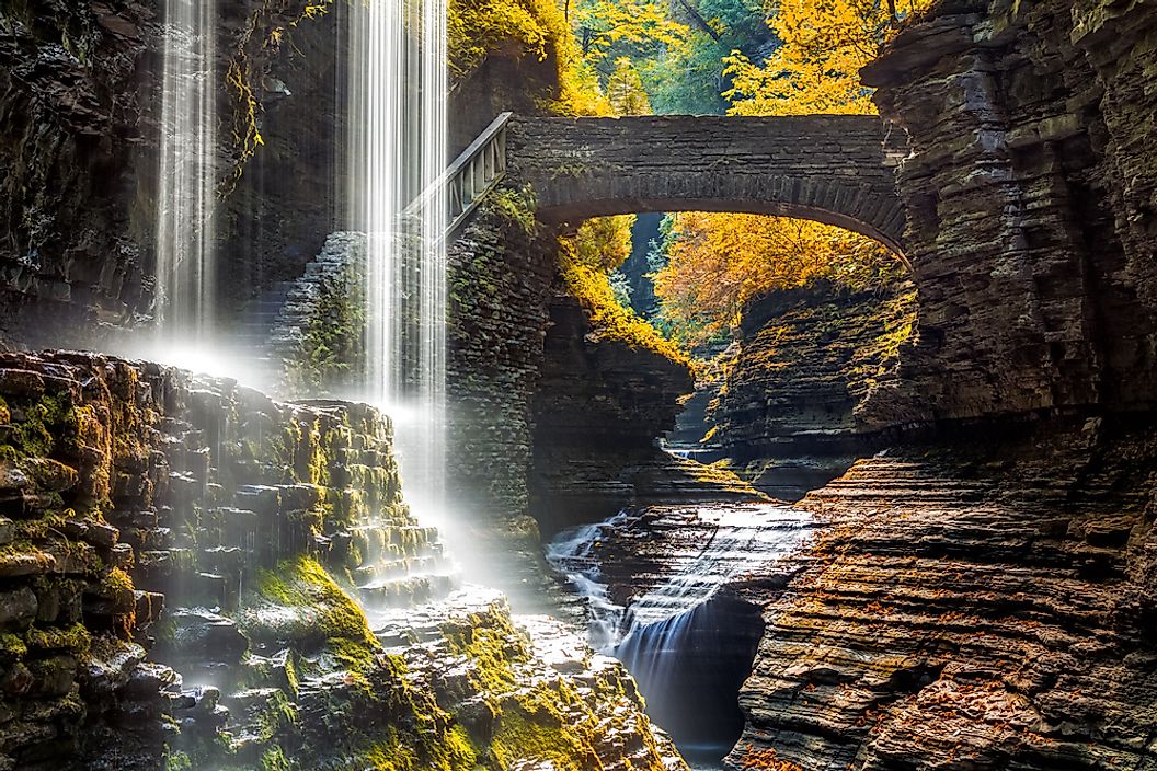
A single 1935 flood washed away nearly all of the park's trail infrastructure, and the fix still shapes how the place runs today. Crews built two dams afterward to regulate the flow of the glen. Watkins Glen is the crown jewel of the Finger Lakes, known for cavernous pathways and strange stone formations, but its draw is also its hazard. The Gorge Trail runs alongside Glen Creek past 19 waterfalls through a narrow, steep-sided gorge, and a confined channel like that turns intense rainfall into fast-rising streamflow. New York State Parks lists no official "flash-flood season" for the park, but it does tie the Gorge Trail's opening and closing to weather. Serious flash floods are rare here. The bigger recent scare came from the sky: in July 2019, a thunderstorm sent a lightning strike into the Cayuga Loop at the park campground, leaving two campers with minor injuries.
Starved Rock State Park, Illinois

The Illinois River is the clock everyone here watches. When it reaches 22 feet, the low-lying visitor-center parking area goes under, and heavy rain can swell the watercourses in the canyons on its own. Along the river near Utica, about 90 miles southwest of Chicago, Starved Rock is the second state park Illinois ever established, in 1911, and its most visited, drawing more than two million people a year. Glacial meltwater cut its 18 sandstone canyons more than 14,000 years ago. Flooding shuts the lower park down on a recurring basis: the main lot and boat ramp by the visitor center close whenever the river rises, most recently in June 2026. In 2019, the main lower lots stayed closed through Memorial Day after spring flooding, and October rains that year forced the closure of the main lot and the Tonti Canyon bridge. The safest move is to check the Illinois Department of Natural Resources closures before you go, and to stay out of a canyon during or right after heavy rain.
Matthiessen State Park, Illinois

The Lower Dells around Cascade Falls are the part to respect: a narrow canyon with the trail running right along the watercourse through a confined gorge. Heavy rain in December 2019 raised the water in the Lower Dells past the point where normally passable sections stayed walkable, and the state closed the area. During heavy rains that October, the Illinois Department of Natural Resources had already closed the Strawberry Rock and Upper Dells trail, the Lower Dells, and the equestrian trails and campgrounds. Matthiessen sits in central LaSalle County, about four miles south of Utica and three miles east of Oglesby, best known for its sandstone dells cut by water erosion. The park covers nearly 2,000 acres, but its defining feature is the roughly one-mile canyon system running from Deer Park Lake to the Vermilion River. The Upper Dell runs from Deer Park Lake to Cascade Falls, where the canyon drops about 45 feet before the Lower Dell begins.
Reading the Water Before It Reads You
Seven parks, one habit worth building. Before any trip, look up the watershed above your trail rather than just the patch of sky over your head, because a clear morning means nothing if rain is falling miles upstream. Call the park or check its state agency site the day you plan to hike, since closures land with little notice. On the trail, the warning signs are physical: water going muddy, a fast rise, a distant rumble down the canyon. Any one of them is your cue to get to higher ground and stay there. The margin between a good day out and a rescue call is often just the few minutes it takes to check a forecast and believe it.